Category:Images of a site of community importance with code ES4160109 from Wiki Loves Earth in Spain
Jump to navigation
Jump to search
Site of Community Importance: Sierra de Guadarrama (ES4160109)
Subcategories
This category has only the following subcategory.
Media in category "Images of a site of community importance with code ES4160109 from Wiki Loves Earth in Spain"
The following 80 files are in this category, out of 80 total.
-

-
-
-

-
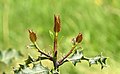
 Antirrhinum meonanthum 20130621 a.jpg 2,255 × 3,200; 1.62 MB
-
 Antirrhinum meonanthum 20130621 b.jpg 2,772 × 4,032; 2.81 MB
-
 Arbol nevado en la Sierra de Guadarrama.jpg 2,448 × 3,264; 2.56 MB
-
 Arboles nevados en la Sierra de Guadarrama 1.jpg 2,448 × 3,264; 2.82 MB
-
 Arboles nevados en la Sierra de Guadarrama 2.jpg 2,448 × 3,264; 2.71 MB
-
 Arboles nevados en la Sierra de Guadarrama 3.jpg 2,448 × 3,264; 2.57 MB
-
 Arboles nevados en la Sierra de Guadarrama 4.jpg 2,448 × 3,264; 2.87 MB
-
 Arboles nevados en la Sierra de Guadarrama.jpg 2,592 × 1,944; 1.45 MB
-
 Boca del Asno (2 de mayo de 2015, parque natural Sierra Norte de Guadarrama) 01.jpg 2,592 × 3,888; 6.78 MB
-
 Boca del Asno (2 de mayo de 2015, parque natural Sierra Norte de Guadarrama) 02.jpg 2,592 × 3,888; 5.79 MB
-
 Boca del Asno (2 de mayo de 2015, parque natural Sierra Norte de Guadarrama) 03.jpg 3,888 × 2,592; 5.65 MB
-
 Boca del Asno (2 de mayo de 2015, parque natural Sierra Norte de Guadarrama) 04.jpg 3,888 × 2,592; 6.27 MB
-
 Boca del Asno, Valsaín.jpg 4,160 × 3,120; 7.33 MB
-
 Bosque nevado en la Sierra de Guadarrama.jpg 1,944 × 2,592; 1.61 MB
-
 Bosque Nevado en la Sierra de Guadarrama.jpg 2,448 × 3,264; 2.67 MB
-
 Bosque y arboles nevados en la Sierra de Guadarrama.jpg 3,264 × 2,448; 2.39 MB
-

-

-
 Cerro Minguete - 01.jpg 4,352 × 2,901; 10.04 MB
-
 Cerro Minguete - 02.jpg 4,444 × 2,963; 10.02 MB
-
 Cerro Minguete y Montón de Trigo - 01.jpg 4,575 × 3,050; 10.31 MB
-
 Cerro Minguete y Montón de Trigo - 02.jpg 4,573 × 3,049; 10.6 MB
-
 Cresta de los Claveles.jpg 3,264 × 2,448; 1.14 MB
-
 ES4160109-Arroyo de El Chorro- AGA5423.jpg 4,000 × 6,000; 2.92 MB
-
 ES4160109-El Chorro de Navafria.jpg 3,855 × 5,782; 18.9 MB
-
 ES4160109-Sierra de Guadarrama-Boca de Asno-San Ildefonso AGA4849.jpg 4,000 × 6,000; 3.23 MB
-
 Indicador de ruta (2 de mayo de 2015, parque natural Sierra Norte de Guadarrama) 01.jpg 2,592 × 3,888; 4.17 MB
-
 Indicador de ruta (2 de mayo de 2015, parque natural Sierra Norte de Guadarrama) 02.jpg 3,888 × 2,592; 5.15 MB
-
 Indicador de ruta (2 de mayo de 2015, parque natural Sierra Norte de Guadarrama) 03.jpg 2,592 × 3,888; 4.64 MB
-
 Indicador de ruta (2 de mayo de 2015, parque natural Sierra Norte de Guadarrama) 04.jpg 2,592 × 3,888; 4.43 MB
-
 La Bola del Mundo desde Peñalara.jpg 3,264 × 2,448; 1.53 MB
-
 La Granja, camino del Club del Tiro.jpg 1,632 × 1,224; 1.26 MB
-
 La Sauca, La Granja de San Ildefonso.jpg 1,224 × 1,632; 998 KB
-
 Montón de Trigo - 01.jpg 4,225 × 2,817; 8.44 MB
-
 Montón de Trigo - 02.jpg 4,402 × 2,935; 10.62 MB
-
 Montón de Trigo - 03.jpg 4,317 × 2,590; 7.99 MB
-
 Montón de Trigo - 04.jpg 4,624 × 2,774; 9.82 MB
-
 Montón de Trigo - 05.jpg 4,762 × 2,857; 10.41 MB
-
 Pico del Nevero.jpg 2,560 × 1,536; 1.31 MB
-
 Pinar de Valsaín.jpg 4,000 × 3,000; 19.8 MB
-

-

-
 Pinos nevados en las faldas del Peñalara.jpg 2,048 × 1,536; 1.22 MB
-
 Portos en Boca del Asno, Valsaín.jpg 3,184 × 2,844; 9.4 MB
-
 Puente de Navalacarreta (2 de mayo de 2015, Boca del Asno, Segovia) 01.JPG 2,592 × 3,888; 5.64 MB
-
 Puente de Navalacarreta (2 de mayo de 2015, Boca del Asno, Segovia) 02.JPG 2,592 × 3,888; 6.41 MB
-
 Puente de Navalacarreta (2 de mayo de 2015, Boca del Asno, Segovia) 03.JPG 3,888 × 2,592; 6.58 MB
-
 Puente de Navalacarreta (2 de mayo de 2015, Boca del Asno, Segovia) 04.JPG 3,888 × 2,592; 6.39 MB
-
 Puente de Navalacarreta (2 de mayo de 2015, Boca del Asno, Segovia) 05.JPG 3,888 × 2,592; 6.27 MB
-
 Puente de Navalacarreta (2 de mayo de 2015, Boca del Asno, Segovia) 06.JPG 3,888 × 2,592; 6.49 MB
-
 Puente de Navalacarreta (2 de mayo de 2015, Boca del Asno, Segovia) 07.JPG 3,888 × 2,592; 6.41 MB
-
 Puente de Navalacarreta (2 de mayo de 2015, Boca del Asno, Segovia) 08.JPG 3,888 × 2,592; 6.18 MB
-
 Puente de Navalacarreta (2 de mayo de 2015, Boca del Asno, Segovia) 09.JPG 3,888 × 2,592; 6.47 MB
-

-

-

-

-
-
 Río Cambrones 2.jpg 4,000 × 3,000; 6.85 MB
-
 Río Cambrones 3.jpg 4,000 × 3,000; 4.04 MB
-
 Río Cambrones.jpg 4,000 × 3,000; 5.64 MB
-
 Río Eresma (2 de mayo de 2015, parque natural Sierra Norte de Guadarrama) 01.jpg 2,592 × 3,888; 5.84 MB
-
 Río Eresma (2 de mayo de 2015, parque natural Sierra Norte de Guadarrama) 02.jpg 2,592 × 3,888; 6.36 MB
-
 Río Eresma (2 de mayo de 2015, parque natural Sierra Norte de Guadarrama) 03.jpg 3,888 × 2,592; 6.34 MB
-
 Río Eresma (2 de mayo de 2015, parque natural Sierra Norte de Guadarrama) 04.jpg 3,888 × 2,592; 6.38 MB
-
 Río Eresma (2 de mayo de 2015, parque natural Sierra Norte de Guadarrama) 05.jpg 2,592 × 3,888; 5.88 MB
-
 Río Eresma (2 de mayo de 2015, parque natural Sierra Norte de Guadarrama) 06.jpg 2,592 × 3,888; 6.67 MB
-
 Río Eresma (2 de mayo de 2015, parque natural Sierra Norte de Guadarrama) 07.jpg 2,592 × 3,888; 6.07 MB
-
 Río Eresma (2 de mayo de 2015, parque natural Sierra Norte de Guadarrama) 08.jpg 3,888 × 2,592; 5.96 MB
-
 Río Eresma (2 de mayo de 2015, parque natural Sierra Norte de Guadarrama) 09.jpg 2,592 × 3,888; 6.64 MB
-
 Río Eresma (2 de mayo de 2015, parque natural Sierra Norte de Guadarrama) 10.jpg 2,592 × 3,888; 6.75 MB
-

-

-
 Sierra de Guadarrama desde Peñalara.jpg 3,264 × 2,448; 1.52 MB
-
 Sierra de Guadarrama y bosque nevado.jpg 2,592 × 1,944; 1.59 MB
-
 Sierra-de-guadarrama.jpg 778 × 1,162; 1.21 MB
_01.jpg)
_02.jpg)
_03.jpg)
_04.jpg)


_01.jpg)
_02.jpg)
_03.jpg)
_04.jpg)


_01.jpg)
_02.jpg)


_01.jpg)
_02.jpg)
_03.jpg)
_04.jpg)


_01.jpg)
_02.jpg)


_01.JPG)
_02.JPG)
_03.JPG)
_04.JPG)
_05.JPG)
_06.JPG)
_07.JPG)
_08.JPG)
_09.JPG)
_01.jpg)
_02.jpg)
_03.jpg)
_04.jpg)
_05.jpg)


_01.jpg)
_02.jpg)
_03.jpg)
_04.jpg)
_05.jpg)
_06.jpg)
_07.jpg)
_08.jpg)
_09.jpg)
_10.jpg)
_01.jpg)
_02.jpg)


