Category:Images in Stedenatlas Venlo
Jump to navigation
Jump to search
Wikimedia category | |||||
| Upload media | |||||
| Instance of | |||||
|---|---|---|---|---|---|
| Category combines topics | |||||
| Historische stedenatlas van Nederland. Venlo (1999) | |||||
Historical work on Venlo  | |||||
| Instance of | |||||
| Main subject | |||||
| Country of origin | |||||
| Author | |||||
| Publisher | |||||
| Language of work or name | |||||
| Full work available at URL | |||||
| Publication date |
| ||||
| Part of the series | |||||
| |||||
Media in category "Images in Stedenatlas Venlo"
The following 18 files are in this category, out of 18 total.
-
 1560 Kaart van Venlo door Jacob van Deventer.jpg 3,672 × 3,904; 3.87 MB
-
 1650 Gezicht op Venlo vanuit het westen door Bonaventura Peeters.jpg 1,122 × 680; 182 KB
-
 1654 Gezicht op Venlo van buiten de stad over de Maas gezien.jpg 6,185 × 1,100; 2.47 MB
-
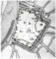
 1729 G.J.E. Marlet - Plan de la ville de Venlo et du fort Sint-Michiel.jpg 1,214 × 1,435; 450 KB
-
 Tekening van J. de Beyer, 1741 - Venlo - 20241032 - RCE.jpg 818 × 1,200; 221 KB
-
 1741 Gezicht op Venlo, gezien vanaf de Maas, Hendrik Spilman, naar Jan de Beijer.jpg 4,116 × 1,796; 1.15 MB
-
 1751 Plan van Venlo en het Fort St. Michiel.jpg 6,884 × 4,901; 10.21 MB
-

-

-
 1872 Uitbreidingplan voor de binnenstad van Van Gendt.jpg 1,637 × 1,414; 442 KB
-

-
 1916 Plan voor uitbreiding van de Gemeente Venlo met aanleg van Rosariumwijk.jpg 1,406 × 924; 226 KB
-
 1920 01 Hoogwater. Overstroming van de Maas in de Oude Markt.jpg 895 × 611; 117 KB
-
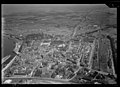 NIMH - 2011 - 0551 - Aerial photograph of Venlo, The Netherlands - 1920 - 1940.jpg 3,500 × 2,536; 2.52 MB
-
 NIMH - 2011 - 0549 - Aerial photograph of Venlo, The Netherlands - 1920 - 1940.jpg 3,500 × 2,531; 1.74 MB
-

-
 1999 Ligging van torens in de stadsmuur van Venlo volgens Hermans (1999).jpg 1,684 × 1,784; 2.83 MB
-
 NIMH - 2011 - 0546 - Aerial photograph of Venlo, The Netherlands - 1920 - 1940.jpg 3,500 × 2,529; 2.97 MB


.jpg)
.jpg)
