Category:Images from the World and Regional Maps Collection
Jump to navigation
Jump to search
Images from the World and Regional Maps Collection.
Subcategories
This category has only the following subcategory.
Media in category "Images from the World and Regional Maps Collection"
The following 67 files are in this category, out of 67 total.
-
 1708 map of Congo by Guillaume Delisle (detail of larger Africa map).jpg 2,711 × 1,651; 1.01 MB
-
 1708 map of Madagascar by Guillaume Delisle (detail of larger Africa map).jpg 2,481 × 2,291; 1.16 MB
-
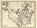
 Amérique Septentrionale (MAPS 107).jpg 8,067 × 5,512; 10.61 MB
-

-

-
 Bird's Eye View of Walla Walla, Washington Territory, 1876 (MAPS 127).jpg 7,882 × 5,061; 10.64 MB
-
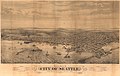
 Bird's Eye View, City of Seattle and vicinity, 1904 (MAPS 63).jpg 8,397 × 5,292; 15.4 MB
-
-

-

-

-
 Carte De L'Egypte De La Nubie De L'Abissinie etc (MAPS 89).jpg 7,605 × 5,926; 9.16 MB
-
 Carte de L'Isle de Ceylan (MAPS 82).jpg 6,910 × 5,163; 7.05 MB
-
 Carte de la Barbarie de la Nigritie et de la Guinée (MAPS 88).jpg 7,583 × 5,918; 8.79 MB
-
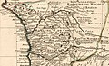
 Carte de la Californie et des pays nord-ouest (MAPS 96).jpg 7,058 × 5,955; 9.75 MB
-

-

-

-

-

-
 Carte de Moscovie (MAPS 135).jpg 7,446 × 5,623; 13.16 MB
-

-
 Carte de Provence et des Terres Adjacentes (MAPS 123).jpg 7,308 × 5,798; 12.6 MB
-

-

-
 Carte des Côtes de Malabar et de Coromandel (MAPS 81).jpg 7,140 × 5,596; 7.97 MB
-
-

-
-

-

-

-
 Carte du Congo et du Pays des Cafres (MAPS 87).jpg 7,583 × 5,888; 8.56 MB
-
 Carte Du Royaume De Danemarc (MAPS 134).jpg 7,425 × 5,634; 10.58 MB
-

-

-

-
-

-
-
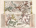
 Floral cartouche in a Ceylon map by Delisle.jpg 1,742 × 1,773; 642 KB
-
 Grennan & Cranney's Saw Mills, Utsalady, Camano Island, Puget Sound, W T, 1862 (MAPS 71).jpg 8,179 × 5,057; 8.89 MB
-

-
 Hungaria (MAPS 176).jpg 3,103 × 2,577; 2.01 MB
-

-
-

-
 L'Amerique divisée Par Grands Etats Par le Sr Janvier Géographe A Paris (MAPS 31).jpg 7,254 × 4,980; 6.95 MB
-

-

-

-

-

-

-

-

-
-

-
-

-
 Plan du port et de la Ville de Nangasaki (MAPS 177).jpg 7,800 × 4,756; 8.39 MB
-
 Port Ludlow, Puget Sound, W T (MAPS 69).jpg 7,463 × 5,655; 9.1 MB
-
 S.C.&T.Co's Wharf, Seattle, 1878.jpg 838 × 360; 112 KB
-
 Scithia intra imavm (MAPS 77).jpg 7,746 × 5,179; 6.78 MB
-
 Tacoma (MAPS 65).jpg 7,394 × 4,590; 14.13 MB
-
 Tacoma Western Terminus of the Northern Pacific Railroad (MAPS 67).jpg 8,864 × 6,221; 29.99 MB
-
 View Of New Tacoma and Mount Tacoma, Puget Sound, Washington Territory (MAPS 72).jpg 7,982 × 5,324; 8.79 MB
.jpg)
.jpg)
.jpg)
.jpg)
.jpg)
.jpg)
.jpg)
.jpg)
.jpg)
.jpg)
.jpg)
.jpg)
.jpg)
.jpg)
.jpg)
.jpg)
.jpg)
.jpg)
.jpg)
.jpg)
.jpg)
.jpg)
.jpg)
.jpg)
.jpg)
.jpg)
.jpg)
.jpg)
.jpg)
_(cropped).jpg)
.jpg)
.jpg)
.jpg)
.jpg)
.jpg)
.jpg)
.jpg)
.jpg)
.jpg)
.jpg)

.jpg)
.jpg)
.jpg)
.jpg)
.jpg)
.jpg)
.jpg)
.jpg)
.jpg)
.jpg)
.jpg)
.jpg)
.jpg)
.jpg)
.jpg)
.jpg)
.jpg)
.jpg)
.jpg)
.jpg)
.jpg)

.jpg)
.jpg)
.jpg)
.jpg)