Category:Images from the Museum of Lands, Mapping and Surveying
Jump to navigation
Jump to search
English: Museum of Lands, Mapping and Surveying is a museum in Brisbane, Queensland, Australia, which collects artefacts and information about the development of land, mapping and surveying within Queensland
Media in category "Images from the Museum of Lands, Mapping and Surveying"
The following 20 files are in this category, out of 20 total.
-
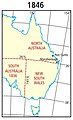 1846 Eastern Australia state boundaries.jpg 300 × 495; 28 KB
-

-
 1862 change to Queensland's western border.jpg 200 × 329; 21 KB
-
 Alec Barr Yeates, Surveyor General of Queensland.jpg 181 × 258; 34 KB
-
 Allan Alfred Spowers, Surveyor General of Queensland.jpg 181 × 258; 31 KB
-
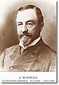 Archibald McDowall, Surveyor General of Queensland.jpg 181 × 258; 36 KB
-
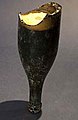
 Compass theodolite.jpg 321 × 450; 18 KB
-
 Eric Douglas Mellor, Surveyor General of Queensland.jpg 181 × 258; 34 KB
-
 Frank Beresford Campbell-Ford, Surveyor General of Queensland.jpg 181 × 258; 32 KB
-
 John Macquarie Serisier, Surveyor General of Queensland.jpg 181 × 258; 33 KB
-
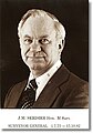
 John Percival Harvey, Surveyor General of Queensland.jpg 181 × 258; 33 KB
-
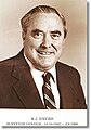 Kevin John Davies, Surveyor General of Queensland.jpg 181 × 258; 33 KB
-

-
 Neil Graham Divett, Surveyor General of Queensland.jpg 181 × 258; 38 KB
-
 Queensland boundaries as proclaimed in 1859.jpg 200 × 322; 19 KB
-
-
 Torleif Hein, Surveyor General of Queensland.jpg 181 × 258; 32 KB
-
 William Barcham, Surveyor General of Queensland.jpg 181 × 258; 34 KB
-

-