Category:Images from Wiki Loves Earth 2019, DE-HE
Jump to navigation
Jump to search

Deutsch: Wettbewerbsbeiträge für Wiki Loves Earth 2019 aus Hessen. – Bitte die Bilder zusätzlich noch mit inhaltlichen/räumlichen Kategorien versehen, siehe v.a. Category:Protected areas of Hesse.
Media in category "Images from Wiki Loves Earth 2019, DE-HE"
The following 200 files are in this category, out of 1,232 total.
(previous page) (next page)-
 2016 Edersee 01.jpg 4,978 × 3,319; 2.38 MB
-
 20170509 194639 HDR.jpg 3,840 × 2,160; 1.58 MB
-
 950 m über Hessen.jpg 1,920 × 2,560; 1.18 MB
-
Adela reaumurella - 2019-04-30.webm 3 min 22 s, 3,840 × 2,160; 487.92 MB
-
 Affelderchen im August.jpg 4,608 × 2,592; 4.94 MB
-
 Affelderchen-Bach.jpg 3,264 × 2,448; 3.26 MB
-
 Ahorn auf dem Ermschwerder Heegen.jpg 3,888 × 5,184; 13.22 MB
-
 Alte Eiche im Naturschutzgebiet Hegbachaue im Naturraum Messeler Hügelland.jpg 1,932 × 2,576; 1.92 MB
-
 Alte Kastanie Naturschutzgebiet Hegbachaue Messeler Hügelland.jpg 2,576 × 1,932; 830 KB
-
 Alte Kopfweide.jpg 3,072 × 4,096; 5.97 MB
-
 Altenburschlaer Angerlinde.jpg 4,896 × 2,752; 5.93 MB
-
 Alter Flugplatz Frankfurt runway 01.jpg 5,184 × 3,888; 6.99 MB
-
 Alter Flugplatz Frankfurt runway 02.jpg 5,184 × 3,888; 6.86 MB
-
 Alter Flugplatz Frankfurt runway 03.jpg 5,184 × 3,888; 8.89 MB
-
 Alter Flugplatz Frankfurt runway 04.jpg 5,184 × 3,888; 8.33 MB
-
 Alter Flugplatz Frankfurt runway 05.jpg 5,184 × 3,888; 8.9 MB
-
 Alter Flugplatz Frankfurt runway 06.jpg 5,184 × 3,888; 7.68 MB
-
 Alter Flugplatz Frankfurt runway 07.jpg 5,184 × 3,888; 7.5 MB
-
 Alter Flugplatz Frankfurt runway 08.jpg 5,184 × 3,888; 8.95 MB
-
 Alter Flugplatz Frankfurt runway 09.jpg 5,184 × 3,888; 9.35 MB
-
 Alter Flugplatz Frankfurt runway 10.jpg 5,184 × 3,888; 9.04 MB
-
 Although the water is not clear it still mirrors the sky - even flying birds can be seen.jpg 3,456 × 5,184; 1.69 MB
-
 Altrhein in der Knoblauchsaue.jpg 3,000 × 4,000; 6.05 MB
-
 Am Berger Hang 01.jpg 5,184 × 3,888; 10.14 MB
-
 Am Berger Hang 02.jpg 5,184 × 3,888; 9.26 MB
-
 Am Berger Hang 03.jpg 5,184 × 3,888; 6.43 MB
-
 Am Berger Hang 04.jpg 5,184 × 3,888; 10.02 MB
-
 Am Berger Hang 05.jpg 5,184 × 3,888; 10.33 MB
-
 Am Berger Hang 06.jpg 5,184 × 3,888; 10.19 MB
-
 Am Berger Hang 07.jpg 5,184 × 3,888; 10.32 MB
-
 Am Berger Hang 08.jpg 5,184 × 3,888; 9.33 MB
-
 Am Berger Hang 09.jpg 5,184 × 3,888; 9.88 MB
-
 Am Berger Hang 10.jpg 5,184 × 3,888; 9.86 MB
-
 Am Berger Hang 11.jpg 5,184 × 3,888; 10.28 MB
-
 Am Berger Hang 12.jpg 5,184 × 3,888; 9.77 MB
-
 Am Berger Hang 13.jpg 5,184 × 3,888; 10.07 MB
-
 Am Bilstein bei Breungeshain und Busenborn - Alter Sitzbank.jpg 5,984 × 3,376; 11.35 MB
-
 Am Bilstein bei Breungeshain und Busenborn - Am Bilstein.jpg 5,984 × 3,376; 9.06 MB
-
 Am Bilstein bei Breungeshain und Busenborn - Am Geotop Bilstein.jpg 5,984 × 3,376; 10.61 MB
-
 Am Bilstein bei Breungeshain und Busenborn - Aussicht vom Berg Bilstein.jpg 5,984 × 3,376; 9.42 MB
-
 Am Bilstein bei Breungeshain und Busenborn - Aussicht vom Bilstein.jpg 5,984 × 3,376; 12.24 MB
-
 Am Bilstein bei Breungeshain und Busenborn - Bilstein (Vogelsberg).jpg 5,984 × 3,376; 10.13 MB
-
 Am Bilstein bei Breungeshain und Busenborn - Blick zwischen den Bäumen.jpg 3,376 × 5,984; 10.6 MB
-
 Am Bilstein bei Breungeshain und Busenborn - Blumen am Feldweg.jpg 5,984 × 3,376; 7.72 MB
-
 Am Bilstein bei Breungeshain und Busenborn - Blumen auf der Weide.jpg 5,984 × 3,376; 7.29 MB
-
 Am Bilstein bei Breungeshain und Busenborn - Blumen.jpg 5,984 × 3,376; 9.03 MB
-
 Am Bilstein bei Breungeshain und Busenborn - Durchgang zwischen den Bäumen.jpg 3,376 × 5,984; 11.12 MB
-
 Am Bilstein bei Breungeshain und Busenborn - Ein Felsen im Wald.jpg 5,984 × 3,376; 14.1 MB
-
 Am Bilstein bei Breungeshain und Busenborn - Felsen.jpg 5,984 × 3,376; 9.81 MB
-
 Am Bilstein bei Breungeshain und Busenborn - Geotop Bilstein in Vogelsberg.jpg 5,984 × 3,376; 8.36 MB
-
 Am Bilstein bei Breungeshain und Busenborn - Geotop Bilstein.jpg 5,984 × 3,376; 10.42 MB
-
 Am Bilstein bei Breungeshain und Busenborn - Gestein am Berg.jpg 5,984 × 3,376; 11.42 MB
-
 Am Bilstein bei Breungeshain und Busenborn - Gestein im Wald.jpg 5,984 × 3,376; 9.16 MB
-
 Am Bilstein bei Breungeshain und Busenborn - Große Steine im Wald.jpg 5,984 × 3,376; 9.51 MB
-
 Am Bilstein bei Breungeshain und Busenborn - Großer Stein am Feldweg.jpg 5,984 × 3,376; 12.23 MB
-
 Am Bilstein bei Breungeshain und Busenborn - Hütte.jpg 5,984 × 3,376; 10.49 MB
-
 Am Bilstein bei Breungeshain und Busenborn - Sitzbank.jpg 5,984 × 3,376; 12.34 MB
-
 Am Bilstein bei Breungeshain und Busenborn - Waldblick vom Bilstein.jpg 5,984 × 3,376; 11.06 MB
-
 Am Bilstein bei Breungeshain und Busenborn - Waldblick.jpg 5,984 × 3,376; 9.69 MB
-
 Am Bubenrain bei Waldensberg 1.jpg 5,984 × 3,376; 7.62 MB
-
 Am Bubenrain bei Waldensberg 2.jpg 5,984 × 3,376; 7.79 MB
-
 Am Bubenrain bei Waldensberg 3.jpg 5,984 × 3,376; 10.46 MB
-
 Am Bubenrain bei Waldensberg 4.jpg 3,376 × 5,984; 11.3 MB
-
 Am Bubenrain bei Waldensberg 5.jpg 5,984 × 3,376; 9.33 MB
-
 Am Bubenrain bei Waldensberg, Kirchenbäume.jpg 5,984 × 3,376; 11.12 MB
-
 Am Bubenrain bei Waldensberg, Teich. 2.jpg 5,984 × 3,376; 11.62 MB
-
 Am Bubenrain bei Waldensberg, Teich. 3.jpg 5,984 × 3,376; 11.14 MB
-
 Am Bubenrain bei Waldensberg, Teich.jpg 5,984 × 3,376; 11.9 MB
-
 Am Bubenrain bei Waldensberg, Weiher. 1.jpg 5,984 × 3,376; 8.2 MB
-
 Am Bubenrain bei Waldensberg, Weiher. 2.jpg 5,984 × 3,376; 10.52 MB
-
 Am Bubenrain bei Waldensberg, Weiher. 3.jpg 5,984 × 3,376; 9.23 MB
-
 Am Bubenrain bei Waldensberg, Weiher. 4.jpg 5,984 × 3,376; 9.22 MB
-
 Am Bubenrain bei Waldensberg, Weiher. 5.jpg 5,984 × 3,376; 10.06 MB
-
 Am Bubenrain bei Waldensberg, Weiher. 6.jpg 5,984 × 3,376; 10.3 MB
-
 Am Bubenrain bei Waldensberg, Weiher. 7.jpg 5,984 × 3,376; 7.46 MB
-
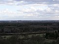
 Am Hohen Meißner in Nordhessen.jpg 4,032 × 3,024; 4.18 MB
-
 Amoeneburg Pfad zur Wenigenburg.jpg 3,000 × 2,000; 4.48 MB
-
 Amoeneburg Richtung Norden.jpg 3,000 × 2,000; 4.67 MB
-
 Amoeneburg Wanderpfad.jpg 3,000 × 2,000; 3.74 MB
-
 Amoeneburg Westhang.jpg 2,978 × 1,861; 3.11 MB
-
 Amöneburg Panorama Westseite 02.jpg 10,000 × 2,817; 8.08 MB
-
 Amöneburg-Pfad zur Wenigenburg 01.jpg 2,998 × 1,999; 5.1 MB
-
 Amöneburg-Pfad zur Wenigenburg 02.jpg 3,000 × 2,000; 2.62 MB
-
 Amöneburg-Wenigenburg-Blick nach Rossdorf.jpg 2,998 × 1,998; 4 MB
-
 Amöneburger Becken bei Sonnenuntergang.jpg 6,000 × 4,000; 9.78 MB
-
 Amöneburger Becken.jpg 6,000 × 4,000; 14.51 MB
-
 Anfang des Naturschutzgebietes in Calden (Hessen).jpg 6,024 × 4,024; 7.49 MB
-
 Anoplotrupes stercorosus.jpg 4,896 × 3,264; 1.32 MB
-
 Apfelblüte im Kirdorfer Feld.jpg 3,024 × 4,032; 2.59 MB
-
 Ast mit Blättern1.jpg 6,000 × 4,000; 10.24 MB
-
 Ast mit Blättern2.jpg 6,000 × 4,000; 9.89 MB
-
 Auf dem Beilstein.jpg 5,984 × 3,376; 9.51 MB
-
 Auf der Gründauaue bei Niedergründau.jpg 5,984 × 3,376; 8.98 MB
-
 Auf der Weide von Talauen von Nidder und Hillersbach bei Gedern und Burkhards.jpg 5,984 × 3,376; 10.41 MB
-
 Auf der Weideswiesen-Oberwald bei Erlensee.jpg 5,984 × 3,376; 9.03 MB
-
 Ausblick vom Großen Nallenberg.jpg 11,756 × 3,200; 30.06 MB
-

-
 Aussicht vom Bilstein.jpg 5,984 × 3,376; 9.53 MB
-
 Autal bei Bad Orb.jpg 1,078 × 599; 323 KB
-
 Backlit of European Nature Reserve Kühkopf-Knoblochsaue from Rhine.jpg 3,837 × 2,879; 2.16 MB
-
 Baggersee Südwest Niederwald.jpg 5,539 × 3,462; 2.81 MB
-
 Basalstein - Naturstein.jpg 5,984 × 3,376; 11.93 MB
-
 Basalt Formation Beilstein.jpg 5,984 × 3,376; 8.19 MB
-
 Basalt Formation.jpg 5,984 × 3,376; 9.03 MB
-
 Basaltmagerrasen am Rand der Wetterau.jpg 4,922 × 2,876; 4.52 MB
-
 Basaltsein Formation und Pflanzen.jpg 5,984 × 3,376; 11.72 MB
-
 Basaltstein - Basalt Formation und Pflanzen.jpg 5,984 × 3,376; 12.93 MB
-
 Basaltstein Jossgrund Lettgenbrunn.jpg 5,984 × 3,376; 11.26 MB
-
 Baum auf dem Beilstein.jpg 5,984 × 3,376; 10.33 MB
-
 Baum auf einer Wiese.jpg 6,000 × 4,000; 11.96 MB
-
 Baum auf einer Wiese2.jpg 6,000 × 4,000; 11.86 MB
-
 Baum mit Blättern.jpg 6,000 × 4,000; 13.31 MB
-
 Baum verdeckt die Sonne.jpg 6,000 × 4,000; 10.35 MB
-
 Baum vor einem See.jpg 6,000 × 4,000; 13.05 MB
-
 Baumkrohne.jpg 6,000 × 4,000; 12.19 MB
-
 Baumnachwuchs.jpg 7,906 × 5,584; 57.16 MB
-
 Baunrinde mit Blättern.jpg 6,000 × 4,000; 11.33 MB
-
 Beilstein (Hessischer Spessart) Felsen.jpg 5,984 × 3,376; 10.17 MB
-
 Beilstein (Hessischer Spessart) Felsenberg.jpg 5,984 × 3,376; 9.13 MB
-
 Beilstein (Hessisches Spessart) Felsen und Grün.jpg 5,984 × 3,376; 11.65 MB
-
 Beilstein - Basalt.jpg 5,984 × 3,376; 10.06 MB
-
 Beilstein - Basaltformation.jpg 5,984 × 3,376; 9 MB
-
 Beilstein - Basaltkegel.jpg 5,984 × 3,376; 11.5 MB
-
 Beilstein - Felsen und Grün.jpg 5,984 × 3,376; 11.62 MB
-
 Beilstein - Felsen.jpg 5,984 × 3,376; 11.74 MB
-
 Beilstein - Mauerreste Burgruine Beilstein.jpg 5,984 × 3,376; 9.41 MB
-
 Beilstein - Pflanzen am Basaltstein Formation.jpg 5,984 × 3,376; 9.58 MB
-
 Beilstein - Pflanzen am Mauerrest.jpg 5,984 × 3,376; 11.12 MB
-
 Beilstein Hessischer Spessart - Basaltformation.jpg 5,984 × 3,376; 9.88 MB
-
 Beilstein Hessischer Spessart.jpg 5,984 × 3,376; 12.44 MB
-
 Beilstein Jossgrund.jpg 5,984 × 3,376; 8.97 MB
-
 Beilsteiner Felsen.jpg 5,984 × 3,376; 10.01 MB
-
 BergKlee.jpg 3,163 × 3,282; 686 KB
-
 Biene beim Pollensammeln im Quittenbaum.jpg 3,024 × 4,032; 2.06 MB
-
 Bienenstöcke auf dem Ermschwerder Heegen.jpg 3,815 × 2,504; 10.21 MB
-
 Bienwiese - Teilstück - in Richtung Nord-Ost geschaut.jpg 4,000 × 2,248; 4.24 MB
-
 Bienwiesen - östliches Teilstück.jpg 4,000 × 2,248; 4.23 MB
-
 Bilder aus dem Dietzhölztal.png 2,040 × 1,080; 2.86 MB
-
 Bilstein Geotop.jpg 5,984 × 3,376; 8.94 MB
-
 Bingenheimer Ried.001.jpg 4,817 × 1,776; 1.67 MB
-
 Bingenheimer Ried.011.jpg 4,843 × 3,125; 2.74 MB
-
 Biotop an der ehemaligen Raketenstation Ockstadt, FFH Gebiet.jpg 4,032 × 3,024; 7.28 MB
-
 Biotop mit Wasserlinien, FFH Gebiet Ockstadt, ehemalige Raketen Station.jpg 3,024 × 4,032; 8.05 MB
-
 Birchtrees are starters to bring back nature in the old kaolin carving ground.jpg 3,456 × 5,184; 3.48 MB
-
 Bird Digging in the Dirt.jpg 1,280 × 863; 367 KB
-
 Bird in the Tree.jpg 1,280 × 853; 413 KB
-
 Blick vom Beilstein.jpg 5,984 × 3,376; 11.56 MB
-
 Blick vom Kahlen Hardt, Naturschutzgebiet am Edersee im Landkreis Waldeck-Frankenberg.jpg 4,928 × 3,264; 5.11 MB
-
 Blick vom Prinzenberg, Totholz im NSG Streuobstwiesen von Darmstadt-Eberstadt.jpg 5,184 × 3,456; 6.42 MB
-
 Blick vom Simmelsberg.jpg 3,968 × 2,976; 1.07 MB
-
 Blick von Burg Brandenstein aus.jpg 4,624 × 2,608; 5.14 MB
-
 Blick von der Spitze des Bilstein.jpg 5,984 × 3,376; 11.51 MB
-

-
 Blockhalde auf der Milseburg.jpg 4,837 × 3,000; 12.57 MB
-
 Blumen auf der Feuchtwiesen bei Ahl.jpg 5,941 × 3,373; 5.73 MB
-
 Blumen auf der Lange Wiese bei Weilers.jpg 5,984 × 3,376; 7.47 MB
-
 Blätter am Felsen der Beilstein.jpg 5,984 × 3,376; 8.7 MB
-
 Blühende Kirschbaum bei der Schwanheimer Düne.jpg 4,032 × 3,024; 8.06 MB
-
 Blühender Bärlauch unter neuem Baumgrün.jpg 2,448 × 3,264; 3.97 MB
-
 Blühender Hohlweg an der Hohen Straße bei Bensheim-Gronau.jpg 4,160 × 3,120; 3.81 MB
-
 Blühendes Knabenkraut.2.jpg 3,024 × 4,032; 4.43 MB
-
 Blühendes Knabenkraut.jpg 3,024 × 4,032; 4.34 MB
-
 Blüten der gemeinen Akelei.jpg 6,000 × 4,000; 1.83 MB
-
 Bracket Fungi grow on a tree in Altkönig.jpg 2,760 × 4,896; 1.82 MB
-
 Braune Randwanze (Gonocerus acuteangulatus) im Pfungstaedter Moor.jpg 1,366 × 768; 1.02 MB
-
 Brießelserlen im Winter.jpg 5,494 × 2,922; 7.39 MB
-
 Bruchwiesen bei Büttelborn DSC 0177 Waldrand.jpg 4,608 × 3,072; 7.44 MB
-
 Bruchwiesen bei Büttelborn DSC 0189 Reh.jpg 1,796 × 1,158; 961 KB
-
 Bruchwiesen bei Büttelborn DSC 0238 Graben.jpg 3,072 × 4,608; 7.91 MB
-
 Bruchwiesen bei Büttelborn DSC 0267 01.jpg 4,608 × 3,072; 6.65 MB
-
 Bruchwiesen bei Büttelborn DSC 0267 02.jpg 4,608 × 3,072; 8.16 MB
-
 Bruchwiesen bei Büttelborn DSC 0267 03.jpg 4,608 × 3,072; 7.44 MB
-
 Bruchwiesen bei Büttelborn DSC 0267 04.jpg 4,608 × 3,072; 6.3 MB
-
 Bruchwiesen bei Büttelborn DSC 0267 05.jpg 4,608 × 3,072; 3.52 MB
-
 Bruchwiesen bei Büttelborn DSC 0267 06.jpg 4,608 × 3,072; 3.93 MB
-
 Bruchwiesen bei Büttelborn DSC 0272 Storch Anflug Nistmaterial.jpg 1,132 × 1,972; 786 KB
-
 Bruchwiesen bei Büttelborn DSC 0300 Vogel.jpg 1,746 × 1,456; 1.28 MB
-
 Bruchwiesen bei Büttelborn DSC 0305 Storch mit Nestbaumaterial.jpg 4,608 × 3,072; 3.67 MB
-
 Buchen im Nationalpark Kellerwald-Edersee im Frühling.jpg 4,928 × 3,264; 9.38 MB
-
 Buchenurwald im Nationalpark Kellerwald-Edersee.jpg 4,928 × 3,264; 6.63 MB
-
 Burgruine Beilstein Mauerrest.jpg 5,984 × 3,376; 10.96 MB
-
 Bäume am Heidberg Sickendorf in der Nähe zur Kapelle 1.jpg 4,000 × 2,248; 4.1 MB
-
-
 Clay Pit.jpg 1,280 × 853; 449 KB
-
 Close up of field near Frankfurter Berg 01.jpg 5,184 × 3,888; 5.06 MB
-
 Close up of field near Frankfurter Berg 02.jpg 5,184 × 3,888; 5.03 MB
-
 Close up of field near Frankfurter Berg 03.jpg 5,184 × 3,888; 5.03 MB
-
 Close up of field near Frankfurter Berg 04.jpg 5,184 × 3,888; 5.41 MB
-
 Close up of field near Frankfurter Berg 05.jpg 5,184 × 3,888; 6.38 MB
-
 Close up of field near Frankfurter Berg 06.jpg 5,184 × 3,888; 6.62 MB
-
 Close up of field near Frankfurter Berg 07.jpg 5,184 × 3,888; 6.62 MB
-
 Close up of field near Frankfurter Berg 08.jpg 5,184 × 3,888; 6.41 MB
-
 Close up of field near Frankfurter Berg 09.jpg 5,184 × 3,888; 6.44 MB
-
 Close up of field near Frankfurter Berg 10.jpg 5,184 × 3,888; 6.2 MB
-
 Close up of field near Frankfurter Berg 11.jpg 5,184 × 3,888; 9.41 MB
-
 Close up of field near Frankfurter Berg 12.jpg 5,184 × 3,888; 9.84 MB
-
 Close up of field near Frankfurter Berg 13.jpg 5,184 × 3,888; 5.04 MB
-
 Close up of field near Frankfurter Berg 14.jpg 5,184 × 3,888; 9.6 MB
-
 Close up of field near Frankfurter Berg 15.jpg 5,184 × 3,888; 9.34 MB
-
 Close up of field near Frankfurter Berg 16.jpg 5,184 × 3,888; 8.76 MB


.jpg)


.jpg)


_Felsen.jpg)
_Felsenberg.jpg)
_Felsen_und_Gr%C3%BCn.jpg)


_Gebiet,_Nummer_4624-306,_in_dem_europ%C3%A4isch_vernetzten_Schutzgebietssystem.jpg)


_im_Pfungstaedter_Moor.jpg)


