Category:Images by Vincent Jones
Jump to navigation
Jump to search

Media in category "Images by Vincent Jones"
The following 106 files are in this category, out of 106 total.
-
 A riverside house in Framilode - geograph.org.uk - 120974.jpg 640 × 480; 111 KB
-
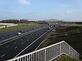
 A38 Frampton on Severn turnoff - geograph.org.uk - 167624.jpg 640 × 480; 69 KB
-
 Allium ursinum in Standish woods - geograph.org.uk - 162080.jpg 640 × 480; 157 KB
-
 Bank of the river Severn - geograph.org.uk - 164540.jpg 640 × 480; 79 KB
-
 Beached boat by the Severn - geograph.org.uk - 123620.jpg 640 × 480; 158 KB
-
 Blakeney Church - geograph.org.uk - 164443.jpg 640 × 480; 92 KB
-

-
 Cliff Well - geograph.org.uk - 160008.jpg 640 × 480; 138 KB
-
 Cliff Well on the Cotswold Way path - geograph.org.uk - 145390.jpg 640 × 480; 131 KB
-
 Cotswold Way path at Haresfield Beacon - geograph.org.uk - 160027.jpg 640 × 480; 104 KB
-
 Cotswold Way path at Ring Hill - geograph.org.uk - 145930.jpg 640 × 480; 119 KB
-
 Cotswold Way path woodland - geograph.org.uk - 145935.jpg 640 × 480; 147 KB
-
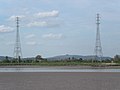 Electric pylons by the river Severn - geograph.org.uk - 165010.jpg 640 × 480; 50 KB
-

-
 Frampton on Severn church - geograph.org.uk - 146624.jpg 640 × 480; 95 KB
-
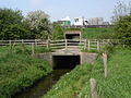
 Fromebridge mill - geograph.org.uk - 146661.jpg 640 × 480; 111 KB
-
 Gloucester Cathedral entrance - geograph.org.uk - 117094.jpg 640 × 480; 132 KB
-
 Gloucester docks dry dock - geograph.org.uk - 117104.jpg 640 × 480; 105 KB
-
 Great War memorial in Elmore - geograph.org.uk - 119319.jpg 640 × 480; 127 KB
-
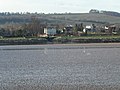
 Hempsted from the river Severn - geograph.org.uk - 125333.jpg 640 × 480; 132 KB
-
-
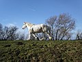 Horse on the Severn Way footpath - geograph.org.uk - 123631.jpg 640 × 480; 110 KB
-
-
 Little Haresfield - geograph.org.uk - 147586.jpg 640 × 480; 90 KB
-
 Lock Entrance to Gloucester Docks - geograph.org.uk - 117114.jpg 640 × 480; 79 KB
-
 Longney Sands on the river Severn - geograph.org.uk - 120990.jpg 640 × 480; 81 KB
-
 M5 Underpass - geograph.org.uk - 167622.jpg 640 × 480; 114 KB
-
 Minsterworth Church - geograph.org.uk - 118827.jpg 640 × 480; 99 KB
-
 Narrow boat at Parkend bridge - geograph.org.uk - 119912.jpg 640 × 480; 75 KB
-
 Narrow boats moored on Stroudwater canal - geograph.org.uk - 121597.jpg 640 × 480; 104 KB
-
 Newnham on Severn A48 - geograph.org.uk - 124474.jpg 640 × 480; 107 KB
-
 Newnham on Severn church - geograph.org.uk - 119921.jpg 640 × 480; 82 KB
-
 Ocker Hill phone box - geograph.org.uk - 162488.jpg 640 × 480; 115 KB
-
 Painswick Stream - geograph.org.uk - 162094.jpg 640 × 480; 147 KB
-
 Parish church Elmore - geograph.org.uk - 119334.jpg 640 × 480; 107 KB
-

-
 Pill Box on the Severn - geograph.org.uk - 121102.jpg 640 × 480; 95 KB
-

-
 Randwick church - geograph.org.uk - 162070.jpg 640 × 480; 120 KB
-

-
 River Severn - geograph.org.uk - 164534.jpg 640 × 480; 61 KB
-

-
 Seagulls and sheep on landfill site - geograph.org.uk - 123655.jpg 640 × 480; 99 KB
-

-
 Seagulls on the Severn - geograph.org.uk - 123735.jpg 640 × 480; 103 KB
-
 Severn railway bridge base - geograph.org.uk - 194267.jpg 640 × 480; 97 KB
-
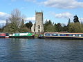
 Ship Inn at Upper Framilode - geograph.org.uk - 121093.jpg 640 × 480; 102 KB
-

-
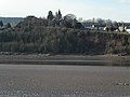
 St. Mary's church tower at Arlingham - geograph.org.uk - 124470.jpg 640 × 480; 86 KB
-

-
 Strolling by the river Severn - geograph.org.uk - 141737.jpg 640 × 480; 89 KB
-
 Stroudwater canal at Saul bridge - geograph.org.uk - 124460.jpg 640 × 480; 151 KB
-

-
 Stroudwater canal filled in section. - geograph.org.uk - 146654.jpg 640 × 480; 98 KB
-
 Stroudwater canal in February - geograph.org.uk - 124466.jpg 640 × 480; 89 KB
-
 Stroudwater canal south from Saul bridge - geograph.org.uk - 124462.jpg 640 × 480; 132 KB
-
 The Apple Tree on the A48 - geograph.org.uk - 141722.jpg 640 × 480; 72 KB
-
 The Noose - geograph.org.uk - 163996.jpg 640 × 480; 63 KB
-
 The Noose on the river Severn - geograph.org.uk - 146641.jpg 640 × 480; 90 KB
-
 The Old Passage inn at Arlingham - geograph.org.uk - 120304.jpg 640 × 480; 103 KB
-
 The river Cam in Gloucestershire - geograph.org.uk - 146519.jpg 640 × 480; 87 KB
-
 Tythe Barn Frampton - geograph.org.uk - 147733.jpg 640 × 480; 106 KB
-
 Victorian postbox - geograph.org.uk - 164968.jpg 640 × 480; 114 KB
-
 Village postbox Little Haresfield - geograph.org.uk - 147705.jpg 640 × 480; 142 KB
-
 Whiteshill Church - geograph.org.uk - 160743.jpg 640 × 480; 79 KB
-
 Abandoned cottage by the river Severn - geograph.org.uk - 139501.jpg 640 × 480; 86 KB
-
 Abandoned stone wheel and trough. - geograph.org.uk - 141751.jpg 640 × 480; 111 KB
-
 Ancient craft of hedgelaying - geograph.org.uk - 164974.jpg 640 × 480; 152 KB
-
 Beacon Inn Hotel - geograph.org.uk - 147623.jpg 640 × 480; 118 KB
-
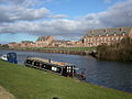
 Boats at Bullo Pill - geograph.org.uk - 165034.jpg 640 × 480; 103 KB
-

-

-
 Bridleway at Manor farm - geograph.org.uk - 147602.jpg 640 × 480; 76 KB
-
 Farleys End Gloucestershire - geograph.org.uk - 140049.jpg 640 × 480; 94 KB
-
 Farmland - geograph.org.uk - 164524.jpg 640 × 480; 111 KB
-
 Farmland above the river Severn - geograph.org.uk - 164083.jpg 640 × 480; 98 KB
-

-
 Farmland at Wick Street - geograph.org.uk - 162188.jpg 640 × 480; 102 KB
-
 Farmland below Standish Woods - geograph.org.uk - 147614.jpg 640 × 480; 115 KB
-
 Farmland below Whiteshill - geograph.org.uk - 162038.jpg 640 × 480; 81 KB
-
 Frampton on Severn lake - geograph.org.uk - 146496.jpg 640 × 480; 77 KB
-
 Frampton on Severn sailing lake - geograph.org.uk - 146500.jpg 640 × 480; 97 KB
-
 Gloucester and Sharpness canal path - geograph.org.uk - 146670.jpg 640 × 480; 81 KB
-
-
 Groundless Pool by the river Severn - geograph.org.uk - 139494.jpg 640 × 480; 103 KB
-
 Highway Agency depot - geograph.org.uk - 167628.jpg 640 × 480; 101 KB
-
 Hockley Hill - geograph.org.uk - 122794.jpg 640 × 480; 138 KB
-
 Hockley wood - geograph.org.uk - 123794.jpg 640 × 480; 107 KB
-
 Ice pockets on Severn estuary - geograph.org.uk - 120280.jpg 640 × 480; 125 KB
-
 Lane between Ayleford and A48 - geograph.org.uk - 164429.jpg 640 × 480; 152 KB
-
 Longney Crib on the river Severn - geograph.org.uk - 121008.jpg 640 × 480; 71 KB
-
 Longridge Village - geograph.org.uk - 162116.jpg 640 × 480; 91 KB
-
 Lower parting Gloucester - geograph.org.uk - 123668.jpg 640 × 480; 88 KB
-

-
 Passage road Arlingham - geograph.org.uk - 120324.jpg 640 × 480; 101 KB
-
 Railway bridge close to Colethrop village - geograph.org.uk - 122786.jpg 640 × 480; 104 KB
-
 Road to Haresfield Beacon - geograph.org.uk - 145942.jpg 640 × 480; 100 KB
-
 Severn valley farm - geograph.org.uk - 147594.jpg 640 × 480; 68 KB
-
 Severn Way footpath at Placket Pool - geograph.org.uk - 118846.jpg 640 × 480; 87 KB
-
 Severn Way footpath at Weir Green - geograph.org.uk - 120977.jpg 640 × 480; 86 KB
-
 Small pond - geograph.org.uk - 147608.jpg 640 × 480; 115 KB
-
 The Haie - geograph.org.uk - 164072.jpg 640 × 480; 104 KB
-
 The Pilot Inn at Sellars Bridge - geograph.org.uk - 118809.jpg 640 × 480; 94 KB
-
 Train from Gloucester at Black Bridge - geograph.org.uk - 147609.jpg 640 × 480; 80 KB
-
 Vinegar Hill - geograph.org.uk - 147616.jpg 640 × 480; 100 KB
-
 Whiteshill village - geograph.org.uk - 162048.jpg 640 × 480; 130 KB


