Category:Images by Terry Hughes
Jump to navigation
Jump to search

Media in category "Images by Terry Hughes"
The following 200 files are in this category, out of 585 total.
(previous page) (next page)-

-

-
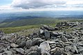
 Adam and Eve stones on Tryfan summit - geograph.org.uk - 205486.jpg 640 × 427; 80 KB
-
 Afon Conwy shore near Glan Conwy - geograph.org.uk - 209104.jpg 640 × 427; 64 KB
-
 Afon Crafnant near Gelli Lydan - geograph.org.uk - 223634.jpg 640 × 427; 149 KB
-
 Afon Machno - geograph.org.uk - 223131.jpg 640 × 427; 129 KB
-
 Afon Porth-llwyd from Pont Newydd - geograph.org.uk - 204141.jpg 640 × 427; 131 KB
-
 Afon Ystumiau - geograph.org.uk - 207419.jpg 640 × 427; 108 KB
-
 Afon Ystumiau Crossing Place - geograph.org.uk - 207818.jpg 640 × 427; 125 KB
-
 Ardda and Tyddyn Wilym Road Junction - geograph.org.uk - 208029.jpg 640 × 427; 98 KB
-
 Beaver Grove Ruin - geograph.org.uk - 220865.jpg 640 × 427; 132 KB
-
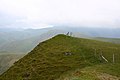
 Bera Bach summit - geograph.org.uk - 205450.jpg 640 × 427; 88 KB
-
 Blaen y Nant and Llyn Crafnant - geograph.org.uk - 223731.jpg 640 × 427; 64 KB
-
 Blaen-y-buarth farmhouse - geograph.org.uk - 204161.jpg 640 × 427; 121 KB
-
 Bodunig Farm near Llangernyw - geograph.org.uk - 218464.jpg 640 × 427; 73 KB
-

-
 Bridge at the end of the Road - geograph.org.uk - 222118.jpg 640 × 427; 109 KB
-

-
 Brwynog Uchaf Ruins - geograph.org.uk - 222157.jpg 640 × 427; 100 KB
-
 Bryn Euryn Trig Pillar - geograph.org.uk - 822687.jpg 640 × 427; 75 KB
-
 Bryn Glo Car Park near Capel Curig - geograph.org.uk - 207976.jpg 640 × 427; 75 KB
-
 Bryn Llech Summit View - geograph.org.uk - 221619.jpg 640 × 427; 56 KB
-
 Bryn Locyn Mast near Gyffin - geograph.org.uk - 209102.jpg 640 × 427; 53 KB
-
 Bwlch Cwm Brwynog and Moel Cynghorion - geograph.org.uk - 837360.jpg 640 × 427; 60 KB
-

-
 Bwlch Eryl farchog from Pen yr Helgi Du - geograph.org.uk - 213833.jpg 640 × 427; 100 KB
-
 Bwlch Tryfan - geograph.org.uk - 222918.jpg 640 × 427; 70 KB
-

-

-
 Cae Coch standing stone - geograph.org.uk - 196627.jpg 640 × 427; 73 KB
-
 Cae Crwn Farm near Llyn Crafnant - geograph.org.uk - 222313.jpg 640 × 427; 115 KB
-
 Cairn above Craig Cwmbychan - geograph.org.uk - 825809.jpg 640 × 427; 93 KB
-

-
 Cairn in the Mist - geograph.org.uk - 221637.jpg 640 × 427; 75 KB
-
 Cairn near Carnedd Llewelyn - geograph.org.uk - 197111.jpg 640 × 427; 78 KB
-
 Cairn near Carreg y Big - geograph.org.uk - 223969.jpg 640 × 427; 138 KB
-
 Cairn on Cefn Cyfarwydd - geograph.org.uk - 210814.jpg 640 × 427; 72 KB
-
 Capel Curig Track near Llyn Crafnant - geograph.org.uk - 223727.jpg 640 × 427; 64 KB
-
 Car park area in Coed Bryndansi - geograph.org.uk - 217922.jpg 640 × 427; 121 KB
-

-
 Carnedd Dafydd Summit Cairn - geograph.org.uk - 205548.jpg 640 × 427; 71 KB
-
 Carnedd Llewelyn from Cefn Cyfarwydd - geograph.org.uk - 223650.jpg 640 × 427; 62 KB
-

-
 Carnedd Llewelyn main summit cairn - geograph.org.uk - 205453.jpg 640 × 427; 81 KB
-
 Carnedd Llewelyn summit stone shelter - geograph.org.uk - 205452.jpg 640 × 427; 78 KB
-
 Carnedd y Ddelw summit shelter - geograph.org.uk - 646974.jpg 640 × 427; 67 KB
-
 Carnedd Y Filiast Summit - geograph.org.uk - 580777.jpg 640 × 427; 91 KB
-
 Carreg Mianog - geograph.org.uk - 198827.jpg 640 × 427; 56 KB
-
 Castell Dinas Bran - geograph.org.uk - 837597.jpg 640 × 427; 73 KB
-

-

-
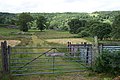
 Cattle Grid near Garthmyn - geograph.org.uk - 222125.jpg 640 × 427; 109 KB
-
 Cefn Cyfarwydd Moorland with a View - geograph.org.uk - 223648.jpg 640 × 427; 73 KB
-
 Cefn Cyfarwydd O.S. triangulation pillar - geograph.org.uk - 197099.jpg 640 × 427; 103 KB
-
 Chapel near Bryn y maen - geograph.org.uk - 206265.jpg 640 × 427; 86 KB
-
 Chapel near Rhiw - geograph.org.uk - 220903.jpg 640 × 427; 68 KB
-
 Chapelhouse at Maenan - geograph.org.uk - 201898.jpg 640 × 427; 124 KB
-
 Clogwyn Du'r Arddu - geograph.org.uk - 837339.jpg 640 × 427; 89 KB
-
 Clogwyn Du'r Arddu Reflections - geograph.org.uk - 837333.jpg 640 × 427; 89 KB
-
 Clogwyn Mawr - geograph.org.uk - 198686.jpg 640 × 427; 79 KB
-
 Clogwyn Yr Eryr summit - geograph.org.uk - 196632.jpg 640 × 427; 87 KB
-

-
 Clogwynyreryr from Cwm Eigiau Track - geograph.org.uk - 223833.jpg 640 × 427; 61 KB
-
 Clogwynyreryr Summit - geograph.org.uk - 218187.jpg 640 × 427; 76 KB
-
 Cors Bodgynydd Reservoir - geograph.org.uk - 221635.jpg 640 × 427; 86 KB
-
 Craig Eigiau ridge - geograph.org.uk - 198815.jpg 640 × 427; 74 KB
-
 Craig Eigiau Summit Peak - geograph.org.uk - 208016.jpg 640 × 427; 77 KB
-
 Craig Wen - geograph.org.uk - 223725.jpg 640 × 427; 70 KB
-
 Craig Wen - geograph.org.uk - 223767.jpg 640 × 427; 79 KB
-
-
 Craig Wen from Crimpiau Summit - geograph.org.uk - 223762.jpg 640 × 427; 90 KB
-
 Craig y Bera Gulley - geograph.org.uk - 823141.jpg 640 × 427; 111 KB
-

-
-
 Creigiau Gleision Mountain Range - geograph.org.uk - 223758.jpg 640 × 427; 81 KB
-
 Creigiau Gleision north top summit cairn - geograph.org.uk - 204163.jpg 640 × 427; 104 KB
-
 Creigiau Gleision summit - geograph.org.uk - 205473.jpg 640 × 427; 99 KB
-

-
 Crimpiau from Craig Wen - geograph.org.uk - 223771.jpg 640 × 427; 75 KB
-
 Crimpiau from near Blaen y Nant - geograph.org.uk - 223721.jpg 640 × 427; 68 KB
-
 Crimpiau Summit - geograph.org.uk - 198689.jpg 640 × 427; 96 KB
-
 Crossing Tracks above Capel Curig - geograph.org.uk - 212042.jpg 640 × 427; 88 KB
-
 Crossroads North of Llanddoged - geograph.org.uk - 206252.jpg 640 × 427; 71 KB
-
 Cwm Brwynog - geograph.org.uk - 837347.jpg 640 × 427; 85 KB
-
 Cwm Eigiau car park - geograph.org.uk - 205471.jpg 640 × 427; 71 KB
-
 Cwm Eigiau to Melynllyn Track - geograph.org.uk - 223840.jpg 640 × 427; 81 KB
-
 Cwm Planwydd Valley - geograph.org.uk - 827720.jpg 640 × 427; 73 KB
-
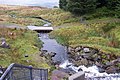
 Dam across Afon Dulyn - geograph.org.uk - 197166.jpg 640 × 427; 122 KB
-
 Danger Keep Out - geograph.org.uk - 223642.jpg 640 × 427; 124 KB
-
 Derelict Oerfa near Nant Y Rhiw - geograph.org.uk - 211218.jpg 640 × 427; 78 KB
-
 Derelict Remains of Bryn-y-Gwynt - geograph.org.uk - 211183.jpg 640 × 427; 94 KB
-
 Disused chapel near Bod Hyfryd - geograph.org.uk - 222140.jpg 640 × 427; 129 KB
-
 Disused Quarry above Maes Mawr - geograph.org.uk - 223709.jpg 640 × 427; 59 KB
-
 Disused Reservoir near Llyn Y Parc - geograph.org.uk - 197108.jpg 640 × 427; 99 KB
-
 Dried out pools on Pen y Graig Gron - geograph.org.uk - 210803.jpg 640 × 427; 82 KB
-
 Drosgl summit cairn - geograph.org.uk - 205444.jpg 640 × 427; 64 KB
-
 Drws y Coed from Craig y Bera - geograph.org.uk - 823123.jpg 640 × 427; 108 KB
-
 Dry Stone Wall near Llyn Cwellyn - geograph.org.uk - 223233.jpg 640 × 427; 61 KB
-
 Dry Stone Wall on Tal y Fan Summit - geograph.org.uk - 220314.jpg 640 × 427; 79 KB
-
 Dry Stone Walls near Bwlch Goleuni - geograph.org.uk - 221593.jpg 640 × 427; 60 KB
-
 Dry Stone Walls near Ffynnon Lloer - geograph.org.uk - 222431.jpg 640 × 427; 52 KB
-
 Dry Stone Walls near Hwylfa - geograph.org.uk - 222192.jpg 640 × 427; 84 KB
-
-
 Dual Footpaths near Hafod Gau - geograph.org.uk - 221178.jpg 640 × 427; 71 KB
-
-
 Ducks on eastern shore of Llyn Syberi - geograph.org.uk - 201706.jpg 640 × 427; 122 KB
-

-
 Eastern Moorland near Llyn y Coryn - geograph.org.uk - 223751.jpg 640 × 427; 76 KB
-
-
-
 Eastern Side of Glyder Fach - geograph.org.uk - 222914.jpg 640 × 427; 57 KB
-
 Eastern side of Y Foel Goch - geograph.org.uk - 222893.jpg 640 × 427; 59 KB
-
 Elidir Fawr summit Cairn shelter - geograph.org.uk - 648339.jpg 640 × 427; 55 KB
-

-
 End of the Road - geograph.org.uk - 220867.jpg 640 × 427; 75 KB
-
 False Summit Cairn of Pen yr Helgi Du - geograph.org.uk - 208000.jpg 640 × 427; 101 KB
-
 Farm Buildings and Machinery at Gymmanog - geograph.org.uk - 223633.jpg 640 × 427; 103 KB
-
 Farmland near Penmachno - geograph.org.uk - 199904.jpg 640 × 427; 86 KB
-
 Ffridd Wen ruins - geograph.org.uk - 202727.jpg 640 × 427; 125 KB
-
 Ffynnon Lloer - geograph.org.uk - 222442.jpg 640 × 427; 99 KB
-
 Ffynnon Lloer from above - geograph.org.uk - 222460.jpg 640 × 427; 107 KB
-
 Ffynnon Llugwy reservoir - geograph.org.uk - 199380.jpg 640 × 427; 85 KB
-

-
 Ffynnon Llyffant - geograph.org.uk - 205523.jpg 640 × 427; 105 KB
-
 Foel Fras from Clogwynyreryr Summit - geograph.org.uk - 223851.jpg 640 × 427; 49 KB
-
 Foel Fras from Garnedd Uchaf Summit - geograph.org.uk - 223074.jpg 640 × 427; 73 KB
-
 Foel Fras from Waen Bryn Gwenith - geograph.org.uk - 223691.jpg 640 × 427; 80 KB
-
 Foel Fras summit Trig pillar - geograph.org.uk - 205536.jpg 640 × 427; 93 KB
-
 Foel Fras Trig Pillar - geograph.org.uk - 222403.jpg 640 × 427; 77 KB
-
 Foel Goch Summit Cairn - geograph.org.uk - 837430.jpg 640 × 427; 47 KB
-
 Foel Grach summit cairn - geograph.org.uk - 205528.jpg 640 × 427; 87 KB
-
 Foel Gron Summit - geograph.org.uk - 837439.jpg 640 × 427; 46 KB
-
 Foel Rudd Summit Cairn - geograph.org.uk - 822699.jpg 640 × 427; 84 KB
-
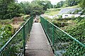 Footbridge across Afon Roe in Rowen - geograph.org.uk - 209015.jpg 640 × 427; 140 KB
-
 Footbridge at Helyg - geograph.org.uk - 204175.jpg 640 × 427; 123 KB
-
 Footbridge near Llyn Cowlyd - geograph.org.uk - 198222.jpg 640 × 427; 96 KB
-

-
 Footbridge over Ceunant y Garnedd - geograph.org.uk - 208458.jpg 640 × 427; 102 KB
-
 Footbridge over leat on Y Braich - geograph.org.uk - 205504.jpg 640 × 427; 115 KB
-
 Footpath above Cae-cwmpas - geograph.org.uk - 202716.jpg 640 × 427; 113 KB
-
 Footpath between Gors Wen and Rhos Farm - geograph.org.uk - 211227.jpg 640 × 427; 109 KB
-
 Footpath near Gelli Lydan - geograph.org.uk - 210792.jpg 640 × 427; 121 KB
-
 Footpath North of Llanddoged - geograph.org.uk - 206240.jpg 640 × 427; 141 KB
-
 Footpath over Footbridge - geograph.org.uk - 212649.jpg 640 × 427; 133 KB
-
 Footpath Southeast of Eglwysbach - geograph.org.uk - 201896.jpg 640 × 427; 122 KB
-
 Footpath through Heather Moorland - geograph.org.uk - 213808.jpg 640 × 427; 79 KB
-
 Forestry road - geograph.org.uk - 199915.jpg 640 × 427; 116 KB
-
 Forestry road junction - geograph.org.uk - 197110.jpg 640 × 427; 99 KB
-
 Forestry Road Junction - geograph.org.uk - 207421.jpg 640 × 427; 113 KB
-

-
 Gallt Yr Ogof from Y Foel Goch Summit - geograph.org.uk - 222906.jpg 640 × 427; 65 KB
-
 Gallt Yr Ogof summit cairn - geograph.org.uk - 196636.jpg 640 × 427; 77 KB
-
 Gallt-yr-Ogof Northeast Summit Cairn - geograph.org.uk - 209470.jpg 640 × 427; 77 KB
-

-
 Garnedd Uchaf summit - geograph.org.uk - 205529.jpg 640 × 427; 95 KB
-
 Gate and Leat near Rowlyn Isa - geograph.org.uk - 221748.jpg 640 × 427; 100 KB
-

-
 Gate and Stile near Bryn Llech - geograph.org.uk - 221623.jpg 640 × 427; 101 KB
-
 Gate and Stile near Capel Tan-y-garth - geograph.org.uk - 207988.jpg 640 × 427; 130 KB
-
 Gate and Stile near Clogwynyreryr - geograph.org.uk - 222358.jpg 640 × 427; 93 KB
-

-
-
 Gate entrance to Dolbryn Goch ruin - geograph.org.uk - 207426.jpg 640 × 427; 92 KB
-
 Gate Entrance to Glyn Parc near Roewen - geograph.org.uk - 209066.jpg 640 × 427; 101 KB
-
 Gate Entrance to Parc Mawr - geograph.org.uk - 209025.jpg 640 × 427; 116 KB
-
 Gate Entrance to Trefriw Cemetery - geograph.org.uk - 213651.jpg 640 × 427; 106 KB
-
 Gate near Blaen-y-buarth above Penmachno - geograph.org.uk - 222185.jpg 640 × 427; 124 KB
-
 Gate near Llugallt Cottage - geograph.org.uk - 224879.jpg 640 × 427; 126 KB
-
 Gate near Parc farm - geograph.org.uk - 202729.jpg 640 × 427; 124 KB
-
 Gate to Field near Coed Baclaw - geograph.org.uk - 209106.jpg 640 × 427; 104 KB
-
 Gate to Field near Pant-glas - geograph.org.uk - 211219.jpg 640 × 427; 75 KB
-
 Gate to Field near Tyddyn Rhobin - geograph.org.uk - 212670.jpg 640 × 427; 85 KB
-
 Gledrffordd plateau - geograph.org.uk - 198808.jpg 640 × 427; 42 KB
-
 Glyder Fach from Llyn Caseg Fraith - geograph.org.uk - 222910.jpg 640 × 427; 66 KB
-
 Glyder Fach from Y Foel Goch Summit - geograph.org.uk - 222899.jpg 640 × 427; 53 KB
-
 Glyder Fach Summit - geograph.org.uk - 205483.jpg 640 × 427; 51 KB
-
 Glyn Isa Fisheries main Fishing Pool - geograph.org.uk - 220324.jpg 640 × 427; 90 KB
-
 Goats at Llyn Caseg-Fraith - geograph.org.uk - 205489.jpg 640 × 427; 72 KB
-

-
 Grassy Moorland near Rhiw Lwyd - geograph.org.uk - 223964.jpg 640 × 427; 72 KB
-

-
 Grassy Plateau with a View - geograph.org.uk - 223056.jpg 640 × 427; 60 KB
-
 Grinllwm View - geograph.org.uk - 222176.jpg 640 × 427; 47 KB
-
 Gwaun y Garnedd Plateau - geograph.org.uk - 222383.jpg 640 × 427; 52 KB
-
 Gymmanog Farm Roadbridge above Trefriw - geograph.org.uk - 213652.jpg 640 × 427; 124 KB
-
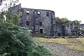
 Hafna Lead Mine Ruins - geograph.org.uk - 217548.jpg 640 × 427; 99 KB
-
 Hafoty Gwyn Ruin above Rowen - geograph.org.uk - 220259.jpg 640 × 427; 79 KB
-

-
 Horses in field near Gymannog Farm - geograph.org.uk - 223631.jpg 640 × 427; 97 KB
-
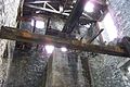 Inside the Klondyke Lead Mine Mill - geograph.org.uk - 223643.jpg 640 × 427; 103 KB
-

-
 Island in the Lake - geograph.org.uk - 221632.jpg 640 × 427; 71 KB
-
 Iwerddon O.S. triangulation pillar - geograph.org.uk - 197105.jpg 640 × 427; 134 KB
-
 Klondyke Lead Mine Ruins - geograph.org.uk - 207826.jpg 640 × 427; 107 KB
-
 Klondyke Lead Mine Slag Heaps - geograph.org.uk - 223644.jpg 640 × 427; 94 KB
-
 Lake - geograph.org.uk - 198696.jpg 640 × 427; 91 KB
-
 Lane near Cefn Madoc farm - geograph.org.uk - 218427.jpg 640 × 427; 73 KB
-
 Large Blue House - geograph.org.uk - 220936.jpg 640 × 427; 70 KB
-
 Lay-By near Cae Cwmpas - geograph.org.uk - 222190.jpg 640 × 427; 101 KB
-
 Lay-by off the A470 - geograph.org.uk - 206260.jpg 640 × 427; 87 KB


