Category:Images by Tabl-trai/2011
Jump to navigation
Jump to search
| By camera - Par appareil photo | Vivitar ViviCam 55 (2004) • Olympus Camedia C-370 Zoom (2005-2010) • Fujifilm FinePix AV130 (2011-2021) • Samsung Galaxy A3 2015 (2015-) • Samsung Galaxy A40 2019 (2019-) • Nikon D5200 (2021-2024) • Canon EOS 2000D (2024-) | GALLERY |
| Other data - Autres données | Maps - Cartes | |
| Year - Année | 2004 • 2005 • 2006 • 2007 • 2008 • 2009 • 2010 • 2011 • 2012 • 2013 • 2014 • 2015 • 2016 • 2017 • 2018 • 2019 • 2020 • 2021 • 2022 • 2023 • 2024 |
Media in category "Images by Tabl-trai/2011"
The following 137 files are in this category, out of 137 total.
-
A71 - NS Franchissement du col de Naves.jpg 1,920 × 1,080; 472 KB
-
A71 - NS Virage à droite.jpg 1,920 × 1,080; 531 KB
-
A71 - Signal complémentaire de sortie.jpg 1,920 × 1,080; 382 KB
-
A71 - SN, Échangeur A714.jpg 1,920 × 1,080; 533 KB
-
A71 - SN, Échangeur de Montmarault.jpg 1,920 × 1,080; 520 KB
-
Abrest - Rue du Groumenier, interdite aux plus de 7,5 tonnes.JPG 1,920 × 1,080; 678 KB
-
Ancien panneau A8 pour la ligne Saint-Germain - Darsac.jpg 850 × 850; 208 KB
-
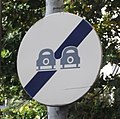
Ancien panneau interdiction de dépasser (Bellerive-sur-Allier) 2011-06-29.JPG 1,080 × 1,080; 162 KB
-
Ancien Stade Nautique de Bellerive-sur-Allier.jpg 1,920 × 1,080; 730 KB
-
Arrêt interdit sauf GIG-GIC, avec abaissé.jpg 1,920 × 1,080; 554 KB
-
Autoroute distance de sécurité SR2a.jpg 1,920 × 1,080; 550 KB
-
Autoroute distance de sécurité SR2b.jpg 1,920 × 1,080; 572 KB
-
Autoroute distance de sécurité SR2c.jpg 1,920 × 1,080; 529 KB
-
Avenue de Gramont sens inverse b55 c114 finespacepartage.jpg 1,920 × 1,080; 496 KB
-
Bellerive-sur-Allier - Départementale 2209 PR16 Stade Aquatique.JPG 1,920 × 1,080; 582 KB
-
Bellerive-sur-Allier - Entrée d'un espace partagé.JPG 1,440 × 1,080; 417 KB
-
Bellerive-sur-Allier - Largeur limitée à deux mètres.jpg 1,920 × 1,080; 664 KB
-
Bellerive-sur-Allier - Panneau directionnel cyclistes.JPG 1,920 × 384; 155 KB
-
Bellerive-sur-Allier - Parking du Centre Omnisports, hauteur limitée sur portique.JPG 1,920 × 1,080; 738 KB
-
Bellerive-sur-Allier - Parking Tour des Juges, arrêt interdit sauf GIG-GIC.JPG 1,920 × 1,080; 604 KB
-
Bellerive-sur-Allier - Parking Tour des Juges, rampe UFR.JPG 1,920 × 1,080; 581 KB
-
Bellerive-sur-Allier - Rue des Petits Prés.JPG 1,920 × 1,080; 537 KB
-
Borne RN 9 Pérignat Riom.jpg 1,920 × 1,080; 583 KB
-
Boulevard Hôpital Vichy Limitation 50 km par heure.jpg 1,800 × 1,080; 507 KB
-
Chamalières - Ancien panneau de fin d'interdiction de dépasser.jpg 895 × 885; 161 KB
-
Champeix D 996 vers Issoire.jpg 1,920 × 1,080; 554 KB
-
Chemin d'un parc de Vichy interdit autos-motos sauf cyclo.jpg 1,920 × 1,080; 564 KB
-
Col de la Ventouse vers Clermont-Ferrand.JPG 1,800 × 1,000; 342 KB
-
Cournon-d'Auvergne depuis le plateau de Gergovie 20110303.JPG 2,800 × 1,200; 650 KB
-
Creuzier-le-Neuf - Rue interdite à tous les véhicules à moteur.jpg 1,920 × 1,080; 836 KB
-
Creuzier-le-Vieux - Monument aux morts.JPG 1,920 × 1,080; 647 KB
-
Creuzier-le-Vieux - Église.JPG 1,920 × 1,080; 641 KB
-
Cusset - Avenue Gilbert Roux, STOP en pleine voie.JPG 1,920 × 1,080; 769 KB
-
Cusset - D 186 Rue Jean-Baptiste Bru.JPG 1,920 × 1,080; 478 KB
-
Cusset - Emplacement désormais interdit à l'arrêt des véhicules.jpg 1,920 × 1,080; 495 KB
-
Cusset - Fin voie cyclable obligatoire et début conseillée.JPG 1,440 × 1,080; 365 KB
-
Cusset - Halte Routière de la Cité Scolaire AL.jpg 1,920 × 1,080; 527 KB
-
Cusset - Nouveau parking de la Cité Scolaire AL.jpg 1,920 × 1,080; 442 KB
-
Cusset - Stationnement interdit sauf taxis.jpg 1,920 × 1,080; 583 KB
-
Cusset - Traversées piétonne et cyclable.JPG 1,920 × 1,080; 707 KB
-
Cusset - Voie de service interdite sauf bus.jpg 1,920 × 1,080; 713 KB
-
D2209 03 - sortie de Creuzier-le-Neuf vers Vichy.jpg 1,680 × 1,050; 531 KB
-
D2209 03 2 voies dans un sens 1 dans l'autre.jpg 1,920 × 1,080; 495 KB
-
D2209 03 Créneau de dépassement à 500 m.jpg 1,920 × 1,080; 691 KB
-
D2209 03 Fin de créneau de dépassement à 200 m.jpg 1,920 × 1,080; 672 KB
-
D2209 03 Fin de créneau de dépassement.jpg 1,920 × 1,080; 459 KB
-
D221 03 - Pente à dix pour cent et dos-d'âne.jpg 1,920 × 1,080; 587 KB
-
D258 03 - Route de Bourzat en direction de Saint-Germain-des-Fossés centre.jpg 1,920 × 1,080; 714 KB
-
D258 03 - Route de Bourzat en direction de Vichy.jpg 1,920 × 1,080; 553 KB
-
D52 03 - Direction Saint-Germain-des-Fossés.jpg 1,600 × 1,000; 535 KB
-
D67 03 - En direction de Creuzier-le-Neuf.JPG 1,920 × 1,080; 778 KB
-
D67 03 - En direction de Saint-Rémy-en-Rollat.JPG 1,920 × 1,080; 754 KB
-
D67 03 - Raccordement D 67A.jpg 1,920 × 1,080; 524 KB
-
D67 03 - Échangeur D 67A.jpg 1,920 × 1,080; 742 KB
-
D983 63 - Station du Sancy.JPG 1,080 × 900; 236 KB
-
D984 03 - Début de limitation à 30 km par heure.jpg 1,920 × 1,080; 504 KB
-
D984 03 - Fin de limitation à 30 km par heure.jpg 1,920 × 1,080; 493 KB
-
Gare routière de Vichy - Station de taxis.jpg 1,920 × 1,080; 609 KB
-
Gare routière de Vichy Vue générale.jpg 1,920 × 1,080; 668 KB
-
Hauterive - Rue des Vignes interdit PL.JPG 1,920 × 1,080; 365 KB
-
Hauterive 03 - Rue de la Mairie.jpg 1,920 × 1,080; 708 KB
-
Hauterive 03 - Église.jpg 1,920 × 1,080; 673 KB
-
Heuliez GX 107 625 T2C vers Aulnat.jpg 1,920 × 1,080; 514 KB
-
Interdit aux PL plus 7,5 t sauf livraisons 20110416.JPG 1,080 × 1,920; 505 KB
-
La Bourboule - Départementales 996 et 130.JPG 2,000 × 1,200; 581 KB
-
Le Cendre depuis le plateau de Gergovie 20110303.JPG 2,000 × 1,200; 406 KB
-
Le Mont-Dore D 36 vers Besse autre danger.jpg 1,920 × 1,080; 739 KB
-
Le Mont-Dore D 36 vers Besse col ouvert.jpg 1,920 × 1,080; 495 KB
-
Le Mont-Dore D 983 vers Centre.jpg 1,920 × 1,080; 546 KB
-
Le Mont-Dore D 983 vers Station du Sancy.jpg 1,920 × 1,080; 541 KB
-
Le Mont-Dore Exemple de Parking.jpg 1,920 × 1,080; 560 KB
-
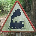
Ligne Saint-Germain Darsac PN 12B.JPG 1,920 × 1,080; 768 KB
-
Ligne Saint-Germain Darsac PN 12C.JPG 1,920 × 1,080; 600 KB
-
Ligne Vichy Riom, N depuis pont D 275.JPG 1,920 × 1,080; 798 KB
-
Ligne Vichy Riom, S depuis pont D 275.JPG 1,920 × 1,080; 686 KB
-
Mairie de Seuillet.jpg 1,920 × 1,080; 713 KB
-
Mehun D 2076 vers Bourges.jpg 1,920 × 1,080; 695 KB
-
Mehun D 2076 vers Centre.jpg 1,920 × 1,080; 685 KB
-
Menetou-Salon - D 11 vers Bourges.jpg 1,920 × 1,080; 495 KB
-
Menetou-Salon - D 11 vers Henrichemont.jpg 1,920 × 1,080; 330 KB
-
Menetou-Salon - D 25 Rue de Paradis.jpg 1,920 × 1,080; 438 KB
-
Menetou-Salon - D 25 vers Parassy.jpg 1,920 × 1,080; 438 KB
-
Menetou-Salon - D 59 vers Quantilly.jpg 1,920 × 1,080; 466 KB
-
Menetou-Salon - Monument aux Morts.jpg 1,920 × 1,080; 688 KB
-
Menetou-Salon - Église.jpg 2,112 × 2,816; 1 MB
-
Nationale 209 de Champs Rosier vers Varennes-sur-Allier.jpg 1,920 × 1,080; 690 KB
-
Nationale 209 de Champs Rosier vers Vichy.jpg 1,920 × 1,080; 454 KB
-
Orcet depuis le plateau de Gergovie 20110303.JPG 1,500 × 900; 257 KB
-
Orcines - D 942, vers Clermont-Ferrand, animal domestique.jpg 1,920 × 1,080; 641 KB
-
Orcines - La Font de l'Arbre, D 68 direction Ceyssat.jpg 1,920 × 1,080; 670 KB
-
Orcines - La Font de l'Arbre, D 68 direction Chamalières Royat.jpg 1,920 × 1,080; 633 KB
-
Orcines - La Font de l'Arbre, D 942 direction Clermont-Ferrand.jpg 1,920 × 1,080; 690 KB
-
Orcines - La Font de l'Arbre, D 942 direction Tulle.jpg 1,920 × 1,080; 658 KB
-
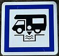
Panneau CE24 station de vidange à 800 m.jpg 820 × 1,040; 242 KB
-
Panneau CE24 station de vidange.jpg 810 × 768; 209 KB
-
Panneau D258 03 interdit plus 18 tonnes.jpg 1,620 × 560; 245 KB
-
Panneau Jalonnement cyclable flèche NO pos N 20110402.JPG 1,080 × 1,920; 779 KB
-
Panneau Risque de verglas.JPG 1,080 × 1,920; 265 KB
-
Panneaux avec symbole indication pl 7,5 t Vichy D 434.jpg 1,174 × 840; 224 KB
-
Quai d'Allier à contresens - Piste cyclable sur trottoir.jpg 1,920 × 1,080; 546 KB
-
Rond-Point de Creuzier-le-Neuf.jpg 1,920 × 1,080; 611 KB
-
Royat - D 68, entrée et radar pédagogique.jpg 1,920 × 1,080; 644 KB
-
Rue Claude Decloître à Bellerive-sur-Allier.jpg 1,920 × 1,080; 760 KB
-
Rue du Golf en sens interdit à Bellerive-sur-Allier.jpg 1,700 × 900; 358 KB
-
Rue Laprugne à Vichy 2.jpg 1,920 × 1,080; 704 KB
-
Rue Laprugne à Vichy 3.jpg 1,920 × 1,080; 670 KB
-
Rue Laprugne à Vichy 4.jpg 1,920 × 1,080; 660 KB
-
Rue Laprugne à Vichy.jpg 1,500 × 1,080; 393 KB
-
Saint-Germain-des-Fossés - Nouvelle place de la Libération.JPG 1,920 × 1,080; 495 KB
-
Saint-Priest-Bramefant - D 433, Virage à droite sur route et panneau.JPG 1,920 × 1,080; 642 KB
-
Saint-Priest-Bramefant - D 433, Virage à gauche sur route et panneau.JPG 1,920 × 1,080; 635 KB
-
Saint-Priest-Bramefant - Église.JPG 1,920 × 1,080; 666 KB
-
Saint-Yorre - Départementale 906 direction Thiers.JPG 2,048 × 1,536; 889 KB
-
Saint-Yorre - Départementale 906 PR6 direction Vichy.JPG 2,048 × 1,536; 1.3 MB
-
Sens interdit à 25 mètres près mairie Bellerive-sur-Allier.jpg 1,920 × 1,080; 567 KB
-
Seuillet - Départementale 52.jpg 1,920 × 1,080; 609 KB
-
T2C ligne 10 Aulnat - GX 327 731 20110305.JPG 1,800 × 900; 397 KB
-
T2C ligne 6 Cournon - GX 417 71 20110305.JPG 1,920 × 840; 408 KB
-
T2C ligne 6 Durtol - GX 427 42 20110305.JPG 2,000 × 1,000; 433 KB
-
T2C ligne 9 Brézet - GX 317 130 20110305.JPG 1,750 × 900; 361 KB
-
T2C ligne B - Agora L 96 20110305.JPG 1,800 × 800; 379 KB
-
Vichy - Avenue de Gramont annexe.jpg 1,800 × 1,080; 544 KB
-
Vichy - Avenue du Pt Doumer vers gare SNCF.jpg 1,920 × 1,080; 579 KB
-
Vichy - Avenue Durin, cassis.JPG 1,920 × 1,080; 376 KB
-
Vichy - Avenue Lyon en direction Avenue de Gramont limite 3m.jpg 1,920 × 1,080; 544 KB
-
Vichy - Bd Résistance - Anciens B1 et B21a1.JPG 1,920 × 1,080; 546 KB
-
Vichy - Boulevard de l'Hôpital - Feux de circulation routière.jpg 1,920 × 1,080; 579 KB
-
Vichy - Débouché Avenue Doumer sur Rue Clemenceau.jpg 1,920 × 1,080; 476 KB
-
Vichy - Nouvelle Avenue de Gramont avec traversée cyclable.jpg 1,920 × 1,080; 562 KB
-
Vichy - Nouvelle avenue de Gramont.jpg 1,920 × 1,080; 733 KB
-
Vichy - Place CDG interdit sauf vélos bus et taxis.jpg 1,920 × 1,080; 488 KB
-
Vichy - Place CDG, indication et avertissement cyclistes.jpg 1,920 × 1,080; 569 KB
-
Vichy - Rue Drichon depuis l'avenue de Gramont.jpg 1,280 × 960; 391 KB
-
Vichy,fin bande conseillée,début voie partagée.jpg 1,395 × 1,032; 395 KB
-
Voie service Pl Lasteyras b54 c113 espacepartage.jpg 1,920 × 1,080; 512 KB
-
Vue générale de Menetou-Salon depuis la route de Quantilly.jpg 1,920 × 1,080; 725 KB


