Category:Images by Stephen Williams
Jump to navigation
Jump to search

Media in category "Images by Stephen Williams"
The following 200 files are in this category, out of 432 total.
(previous page) (next page)-

-

-

-
 A35 near Morcombelake - geograph.org.uk - 390237.jpg 640 × 480; 94 KB
-
 A35 near Morcombelake looking east - geograph.org.uk - 390257.jpg 640 × 480; 71 KB
-
 Abbotsbury at sunrise - geograph.org.uk - 351832.jpg 640 × 579; 69 KB
-
 Abbotsbury Castle trig point - geograph.org.uk - 539456.jpg 640 × 480; 76 KB
-
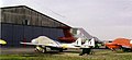
 Aircraft and hangar at Goodwood - geograph.org.uk - 354291.jpg 640 × 343; 53 KB
-

-
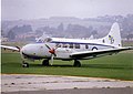 Aircraft at Shoreham, 1986 - geograph.org.uk - 348832.jpg 640 × 451; 57 KB
-
 Aircraft at Sywell, July 1975 - geograph.org.uk - 348854.jpg 640 × 371; 44 KB
-

-
 Aircraft landing at Denham, 1978 - geograph.org.uk - 354264.jpg 640 × 359; 39 KB
-
-
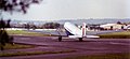 Airliner at Staverton, 1978 - geograph.org.uk - 348840.jpg 640 × 296; 38 KB
-
 All the comforts of home... - geograph.org.uk - 539418.jpg 640 × 480; 114 KB
-
 Allotments at Max Gate, Dorchester - geograph.org.uk - 435877.jpg 640 × 480; 80 KB
-
 Approaching the mouth of the Axe - geograph.org.uk - 341303.jpg 640 × 480; 91 KB
-
 Army Air Corps Station Middle Wallop.jpg 640 × 381; 44 KB
-

-
-
 B3157 near Rodden - geograph.org.uk - 351825.jpg 640 × 431; 72 KB
-
 Back of MandS, Weymouth seafront - geograph.org.uk - 539407.jpg 640 × 480; 87 KB
-
 Back street off Weymouth seafront - geograph.org.uk - 539440.jpg 640 × 584; 70 KB
-

-
 Baiter slipway, Poole Harbour - geograph.org.uk - 388852.jpg 640 × 480; 68 KB
-
-
 Barge under Walton Bridge in 1991. - geograph.org.uk - 376609.jpg 640 × 376; 69 KB
-
 Beach and beach huts at Branscombe - geograph.org.uk - 418533.jpg 640 × 480; 60 KB
-
 Beach and cliffs at Highcliffe - geograph.org.uk - 469082.jpg 640 × 480; 68 KB
-
 Beach at Barton-on-Sea - geograph.org.uk - 477868.jpg 495 × 640; 64 KB
-
 Beach at Highcliffe - geograph.org.uk - 469089.jpg 640 × 480; 70 KB
-
 Beach at Highcliffe - geograph.org.uk - 477841.jpg 640 × 480; 76 KB
-
 Beach at Sandy Bay - geograph.org.uk - 389103.jpg 640 × 480; 95 KB
-
 Beverley - RAF Museum - 1989 - geograph.org.uk - 354966.jpg 640 × 322; 51 KB
-
 Bidlake Farm and more pylons - geograph.org.uk - 377968.jpg 640 × 480; 83 KB
-
 Bincleaves Coastguard Station - geograph.org.uk - 459304.jpg 640 × 404; 61 KB
-

-
 Blackpool South Pier from the air - geograph.org.uk - 354448.jpg 640 × 389; 47 KB
-
 Blackpool Tower from the air - geograph.org.uk - 354437.jpg 417 × 577; 57 KB
-
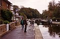
 Boats at Teddington Lock - geograph.org.uk - 363841.jpg 640 × 413; 68 KB
-
-
 Boot's chemists in Bridport - geograph.org.uk - 347271.jpg 532 × 640; 71 KB
-

-
-
 Branscombe Mouth - geograph.org.uk - 366758.jpg 640 × 418; 82 KB
-

-
 Bridge over the Asker, Loders - geograph.org.uk - 532477.jpg 640 × 480; 157 KB
-
 Bridges over the Grand Union Canal - geograph.org.uk - 374220.jpg 640 × 416; 66 KB
-
 Bridport's new Health Centre - geograph.org.uk - 364429.jpg 640 × 480; 89 KB
-
 Brinsworth House, Twickenham - geograph.org.uk - 373844.jpg 640 × 480; 93 KB
-
 Brooklands aerodrome from the air - geograph.org.uk - 365631.jpg 640 × 393; 44 KB
-
 Burton Mere - geograph.org.uk - 356834.jpg 640 × 480; 80 KB
-
 Bushy House, Bushy Park - geograph.org.uk - 362754.jpg 640 × 403; 74 KB
-
 By the Thames at Lower Ham Road - geograph.org.uk - 376558.jpg 640 × 374; 57 KB
-
 Canal bridge near Iver - geograph.org.uk - 374218.jpg 640 × 416; 60 KB
-
 Canbury Gardens, Kingston - geograph.org.uk - 376565.jpg 640 × 443; 109 KB
-
 Caravan site above Eype - geograph.org.uk - 364492.jpg 640 × 433; 82 KB
-
 Cascade, Pool and Oceanides - geograph.org.uk - 373903.jpg 640 × 527; 91 KB
-
 Castle Drogo - geograph.org.uk - 355080.jpg 640 × 397; 53 KB
-
 Cessna aircraft at Blackbushe, 1985 - geograph.org.uk - 348762.jpg 640 × 374; 54 KB
-
 Chewton Bunny - geograph.org.uk - 477856.jpg 480 × 640; 84 KB
-
 Chewton Bunny - geograph.org.uk - 477861.jpg 640 × 480; 124 KB
-
 Cliff training wall at Highcliffe - geograph.org.uk - 469087.jpg 640 × 487; 90 KB
-
 Cliffs at Hengistbury Head - geograph.org.uk - 389146.jpg 640 × 480; 67 KB
-
 Cliffs East of Beer - geograph.org.uk - 341069.jpg 640 × 480; 86 KB
-
 Cliffs west of Barton-on-Sea - geograph.org.uk - 477866.jpg 640 × 480; 58 KB
-
-

-
 Colne at Wivenhoe, 1989 - geograph.org.uk - 351105.jpg 640 × 403; 77 KB
-
 Colne at Wivenhoe, 1989 - geograph.org.uk - 351107.jpg 640 × 403; 64 KB
-
 Compton Abbas airfield - geograph.org.uk - 342607.jpg 640 × 370; 58 KB
-
-
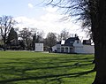 Cricket pavilion on Twickenham Green - geograph.org.uk - 373851.jpg 640 × 507; 97 KB
-

-
 Cropredy Festival 2007 - geograph.org.uk - 532473.jpg 640 × 480; 97 KB
-
 Cropredy Festival flags, 2007 - geograph.org.uk - 532475.jpg 640 × 480; 75 KB
-
 Cropredy Festival, 1985 - geograph.org.uk - 345434.jpg 640 × 493; 93 KB
-
 Brasenose Arms, Cropredy - geograph.org.uk - 351125.jpg 640 × 400; 69 KB
-
 Damaged aircraft at Popham - geograph.org.uk - 389031.jpg 640 × 480; 83 KB
-
 Deer in Bushy Park - geograph.org.uk - 469072.jpg 640 × 501; 129 KB
-
 Derelict building on Wears Hill - geograph.org.uk - 539452.jpg 640 × 480; 95 KB
-
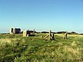
 Derelict site on Askerswell Down - geograph.org.uk - 435867.jpg 640 × 480; 55 KB
-
 Derelict site on Askerswell Down - geograph.org.uk - 435870.jpg 640 × 480; 64 KB
-

-
 Dismantled railway line near Mappercombe - geograph.org.uk - 532505.jpg 640 × 480; 105 KB
-
 Dismantled railway track near Loders - geograph.org.uk - 532515.jpg 480 × 640; 134 KB
-
 Disused railway bridge near Loders - geograph.org.uk - 469065.jpg 640 × 480; 155 KB
-
 Disused railway bridge near Loders - geograph.org.uk - 469067.jpg 554 × 640; 167 KB
-
 Dorchester bypass - geograph.org.uk - 435875.jpg 640 × 480; 90 KB
-
 Dorset Martyrs statue - geograph.org.uk - 532468.jpg 640 × 480; 128 KB
-
 Down House Farm and some sheep. - geograph.org.uk - 365142.jpg 640 × 479; 89 KB
-
 Durdle Door from seaward - geograph.org.uk - 388775.jpg 640 × 480; 63 KB
-
 Duxford airfield, 1987 - geograph.org.uk - 348777.jpg 640 × 393; 53 KB
-
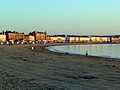 Early morning on Weymouth beach - geograph.org.uk - 539402.jpg 640 × 480; 74 KB
-

-
 East Cliff, West Bay - geograph.org.uk - 354426.jpg 640 × 439; 67 KB
-

-
 Eastern end of Burton Mere - geograph.org.uk - 356845.jpg 640 × 480; 71 KB
-
 Eel Pie Island footbridge - geograph.org.uk - 363866.jpg 640 × 403; 81 KB
-
 Elm Tree Road, Teddington. - geograph.org.uk - 362795.jpg 640 × 370; 57 KB
-
 End of the canal - geograph.org.uk - 374197.jpg 640 × 416; 63 KB
-
 Entrance to Clover Farm - geograph.org.uk - 539493.jpg 640 × 480; 68 KB
-
 Entrance to fields near Rodden - geograph.org.uk - 351829.jpg 480 × 640; 98 KB
-
 Entrance to Higher Ford Farm - geograph.org.uk - 348593.jpg 640 × 444; 103 KB
-
 Entrance to Poole Park - geograph.org.uk - 388788.jpg 640 × 480; 63 KB
-
 Eyot House, D'Oyly Carte Island - geograph.org.uk - 376622.jpg 640 × 439; 107 KB
-

-

-
 Final approach to Wycombe Air Park - geograph.org.uk - 345468.jpg 640 × 343; 27 KB
-

-
 Fishing boat at Branscombe Mouth - geograph.org.uk - 366760.jpg 640 × 409; 52 KB
-
 Flats near Weymouth Harbour - geograph.org.uk - 539476.jpg 640 × 480; 82 KB
-

-

-
-

-
 Footpath at Bradpole - geograph.org.uk - 388724.jpg 640 × 480; 166 KB
-
 Footpath at Teddington Lock - geograph.org.uk - 376550.jpg 640 × 428; 110 KB
-

-
 Footpath near Bincleaves, Weymouth - geograph.org.uk - 459327.jpg 480 × 640; 118 KB
-
 Footpath near Fleet village - geograph.org.uk - 539486.jpg 640 × 474; 71 KB
-
 Ford and footbridge at Upton Manor Farm - geograph.org.uk - 532490.jpg 480 × 640; 136 KB
-

-
-

-

-
 Fuller's Griffin Brewery, Chiswick - geograph.org.uk - 351145.jpg 640 × 361; 72 KB
-
 Fulwell Railway depot - geograph.org.uk - 362782.jpg 640 × 359; 60 KB
-
 Gate guard at RAF Kemble, 1986 - geograph.org.uk - 344814.jpg 640 × 438; 64 KB
-

-
 Gatwick Airport in 1970 - geograph.org.uk - 354976.jpg 640 × 456; 55 KB
-

-
 Gazebo in the grounds of Bushy House - geograph.org.uk - 362766.jpg 640 × 464; 104 KB
-
 General Roy monument, Hampton Hill. - geograph.org.uk - 362666.jpg 530 × 640; 129 KB
-
 General Roy monument, Hampton Hill. - geograph.org.uk - 373787.jpg 640 × 480; 99 KB
-
 General Roy monument, Hampton Hill. - geograph.org.uk - 373804.jpg 509 × 640; 161 KB
-
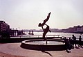 Girl with a dolphin near Tower Bridge - geograph.org.uk - 370876.jpg 640 × 439; 52 KB
-
 Grand Union Canal near Iver - geograph.org.uk - 374213.jpg 640 × 416; 74 KB
-
 Grand Union Canal, Slough arm. - geograph.org.uk - 374225.jpg 640 × 416; 58 KB
-
 Grand Union Canal, Slough arm. - geograph.org.uk - 374231.jpg 640 × 416; 52 KB
-
 Belvedere at Great Bourton - geograph.org.uk - 354412.jpg 400 × 640; 58 KB
-
 The Bell Inn at Great Bourton - geograph.org.uk - 354405.jpg 640 × 389; 76 KB
-
 Green Lane, near Bridport - geograph.org.uk - 388677.jpg 480 × 640; 151 KB
-
 Greenwich Foot Tunnel, looking NNE - geograph.org.uk - 346799.jpg 640 × 374; 59 KB
-
 Hampton Court Bridge - geograph.org.uk - 376583.jpg 640 × 368; 51 KB
-
 Hampton in 1974 - geograph.org.uk - 362690.jpg 640 × 477; 59 KB
-
 Hampton riverside - geograph.org.uk - 376588.jpg 640 × 389; 60 KB
-
 Hampton School - geograph.org.uk - 373778.jpg 640 × 430; 79 KB
-
 Harbour light, South Shields - geograph.org.uk - 359656.jpg 640 × 319; 37 KB
-
 Hardown Hill from the road to Ryall - geograph.org.uk - 390270.jpg 640 × 397; 70 KB
-
 Harvard at RAF Brize Norton - geograph.org.uk - 342225.jpg 640 × 431; 68 KB
-
 Haven Hotel, Sandbanks. - geograph.org.uk - 366773.jpg 640 × 417; 48 KB
-
 Haven Hotel, Sandbanks. - geograph.org.uk - 388768.jpg 640 × 480; 88 KB
-

-
 Hayling Island from the air, 1976 - geograph.org.uk - 345376.jpg 640 × 625; 63 KB
-
 Heathrow Airport, Hangar 1 in 1990 - geograph.org.uk - 351113.jpg 640 × 402; 80 KB
-

-
 Helicopter pad, North Pier Blackpool - geograph.org.uk - 354432.jpg 640 × 526; 58 KB
-
 Swiss Farm campsite, Henley, 1985. - geograph.org.uk - 345472.jpg 640 × 451; 96 KB
-
 High Cliff, at Highcliffe. - geograph.org.uk - 477836.jpg 640 × 387; 60 KB
-
 Highcliffe Castle 6.jpg 640 × 480; 95 KB
-
 Highcliffe Castle and lawns - geograph.org.uk - 389153.jpg 640 × 480; 88 KB
-

-
 Jetty at Hamworthy beach - geograph.org.uk - 388899.jpg 640 × 480; 54 KB
-
 Jodel DR100 at Brooklands, 1993 - 344817.jpg 640 × 351; 55 KB
-
 Jurassic Coast Dinosaur^ - geograph.org.uk - 341329.jpg 640 × 487; 68 KB
-
 Kingston Bridge - geograph.org.uk - 376571.jpg 640 × 416; 81 KB
-
 Lanehouse Vauxhall - geograph.org.uk - 539484.jpg 640 × 480; 60 KB
-
 Langton Cross on the B3157 - geograph.org.uk - 351819.jpg 640 × 480; 105 KB
-
 Lay-by off the A35 near Tolpuddle - geograph.org.uk - 459296.jpg 640 × 412; 48 KB
-

-
 Loders Hill - geograph.org.uk - 388701.jpg 640 × 480; 117 KB
-
 Longford River aqueduct - geograph.org.uk - 373812.jpg 640 × 466; 119 KB
-
 Longford River in Bushy Park - geograph.org.uk - 373825.jpg 640 × 451; 118 KB
-

-
 Lower Eype - geograph.org.uk - 365139.jpg 640 × 480; 78 KB
-
 Lulworth Range - geograph.org.uk - 345501.jpg 640 × 423; 51 KB
-
 Lyme Regis harbour and lifeboat - geograph.org.uk - 389097.jpg 640 × 480; 65 KB
-
 Lyme Regis harbour from seaward. - geograph.org.uk - 389072.jpg 640 × 480; 78 KB
-

-

-
 Mappercombe Manor from the south - geograph.org.uk - 532509.jpg 480 × 640; 132 KB
-
 Marble Hill House - geograph.org.uk - 373908.jpg 640 × 480; 62 KB
-
 Marsh Barn Farm, East of Bridport - geograph.org.uk - 459336.jpg 640 × 480; 73 KB
-
 Max Gate roundabout - geograph.org.uk - 435880.jpg 640 × 409; 72 KB
-
 Milestone at Miles Cross on the A35 - geograph.org.uk - 365124.jpg 640 × 575; 148 KB
-
 Minor road near Bradpole - geograph.org.uk - 388720.jpg 558 × 640; 120 KB
-

-

-
 Mysterious tumulus near Broad Stone - geograph.org.uk - 361045.jpg 640 × 420; 58 KB
-
 NCI lookout, St. Alban's Head - geograph.org.uk - 388877.jpg 640 × 480; 72 KB
-
 Newton's Cove towards Nothe Fort - geograph.org.uk - 459316.jpg 640 × 480; 69 KB
-
 Newton's Cove, Weymouth - geograph.org.uk - 459320.jpg 640 × 411; 79 KB
-
 Nothe Fort, Weymouth - geograph.org.uk - 388932.jpg 640 × 480; 67 KB
-

-
 Old radar site at Highcliffe - geograph.org.uk - 469084.jpg 640 × 480; 74 KB
-

-
 Old railway track-bed near Bridport - geograph.org.uk - 388728.jpg 605 × 640; 129 KB
-
 Old schoolhouse at Loders - geograph.org.uk - 469063.jpg 640 × 480; 83 KB


