Category:Images by Stephen Richards
Jump to navigation
Jump to search

Subcategories
This category has only the following subcategory.
N
Media in category "Images by Stephen Richards"
The following 200 files are in this category, out of 1,801 total.
(previous page) (next page)-
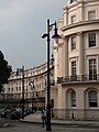
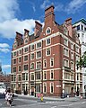
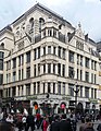
 1 Aldwych (geograph 5380231).jpg 467 × 640; 179 KB
-
 1 and 2 Pilgrim Hill - geograph.org.uk - 1751404.jpg 640 × 480; 124 KB
-
 1 Bootham, York - geograph.org.uk - 4893895.jpg 640 × 530; 234 KB
-
 1 Cavendish Crescent South, Nottingham (geograph 4117083).jpg 640 × 437; 174 KB
-
 1 Charing Cross Road (geograph 5659583).jpg 402 × 640; 144 KB
-
 1 Great Scotland Yard (geograph 5340376).jpg 560 × 640; 221 KB
-
 1 Grosvenor Crescent and Wilton Crescent - geograph.org.uk - 1513523.jpg 480 × 640; 103 KB
-
 1 Kemble Street (geograph 2778228).jpg 413 × 640; 196 KB
-
 1 Minster Gates, York - geograph.org.uk - 4893840.jpg 444 × 640; 209 KB
-
 1 Palace Road - geograph.org.uk - 1411897.jpg 480 × 640; 420 KB
-
 1 St Helen's Square, York - geograph.org.uk - 4904272.jpg 640 × 577; 245 KB
-
 1-10 Holborn Viaduct (geograph 2503376).jpg 486 × 640; 215 KB
-
 1-11 Dunbar Street - geograph.org.uk - 1744642.jpg 640 × 462; 131 KB
-
 1-12 Park Terrace, Nottingham (geograph 4117034).jpg 640 × 506; 144 KB
-
 1-12 William Street (geograph 4722641).jpg 640 × 547; 196 KB
-
 1-13 Chester Square (geograph 4752954).jpg 640 × 531; 182 KB
-
 1-13 South Eaton Place (geograph 4752411).jpg 640 × 551; 176 KB
-
 1-15 Wilton Street (geograph 4767996).jpg 640 × 561; 198 KB
-
 1-16 York Place, Bristol - geograph.org.uk - 3771237.jpg 443 × 640; 180 KB
-
 1-17 Grosvenor Gardens (geograph 2637776).jpg 640 × 429; 183 KB
-
 1-19 Bartholomew Street (geograph 4831864).jpg 640 × 535; 179 KB
-
 1-2 Lower John Street (geograph 5848924).jpg 513 × 640; 244 KB
-
 1-2 St James's Street - geograph.org.uk - 2660769.jpg 472 × 640; 225 KB
-
 1-2 Upper Belgrave Street (geograph 5650831).jpg 640 × 499; 165 KB
-
 1-2 York Place, Leeds - geograph.org.uk - 2742986.jpg 383 × 640; 151 KB
-
 1-25 Chester Row (geograph 4752867).jpg 505 × 640; 153 KB
-
 1-25 Gillingham Street (geograph 4695093).jpg 640 × 513; 209 KB
-
 1-3 Effra Road, Brixton, London.jpg 640 × 453; 194 KB
-
 1-3 Nessgate, York - geograph.org.uk - 4904298.jpg 547 × 640; 204 KB
-
 1-3 Parliament Street, York - geograph.org.uk - 4913830.jpg 640 × 506; 223 KB
-
 1-3 Robert Street (geograph 5351128).jpg 576 × 640; 218 KB
-
 1-3 West Halkin Street (geograph 4722316).jpg 640 × 517; 152 KB
-
 1-31 Eaton Place (geograph 4740189).jpg 640 × 464; 172 KB
-
 1-33 Alderney Street (geograph 4693592).jpg 640 × 536; 208 KB
-
 1-4 Halkin Street (geograph 4768952).jpg 640 × 625; 288 KB
-
 1-4 Lyall Street (geograph 4739529).jpg 529 × 640; 179 KB
-
 1-5 Bermondsey Square (geograph 4985857).jpg 640 × 541; 180 KB
-
 1-5 Grosvenor Place, London.jpg 640 × 509; 159 KB
-
 1-5 Lister Gate, Nottingham - geograph.org.uk - 4055449.jpg 640 × 522; 189 KB
-
 1-6 Coventry Street (geograph 5721622).jpg 640 × 514; 200 KB
-
 1-6 Cumberland Gardens, London-geograph-4515715.jpg 553 × 640; 174 KB
-
 1-6 Portland Square, Bristol (geograph 3779338).jpg 640 × 571; 191 KB
-
 1-7 Endsleigh Place, London-geograph-2656616.jpg 640 × 475; 177 KB
-
 1-7 Peckitt Street, York - geograph.org.uk - 4910677.jpg 640 × 512; 189 KB
-
 1-7 Stamford Street (geograph 4806911).jpg 640 × 504; 173 KB
-
 1-7 Warwick Square (geograph 4577633).jpg 486 × 640; 196 KB
-
 1-7 West Eaton Place (geograph 4740551).jpg 494 × 640; 168 KB
-
 1-8 Fawcett Street, York - geograph.org.uk - 4917035.jpg 640 × 493; 167 KB
-
 1-9 Eaton Gate (geograph 4740638).jpg 640 × 476; 173 KB
-
 1-9 St Leonards Place, York (geograph 4894347).jpg 640 × 489; 157 KB
-
 10 and 11 Long Street, Devizes (geograph 2279580).jpg 640 × 498; 195 KB
-
 10 Duke Street St James's - geograph.org.uk - 2660754.jpg 476 × 640; 189 KB
-
 10 Market Place, Warwick (geograph 3475540).jpg 640 × 441; 215 KB
-
 10 Pelham Street, Nottingham (geograph 4065322).jpg 640 × 537; 210 KB
-
 10 Precentor's Court, York - geograph.org.uk - 4895096.jpg 640 × 561; 201 KB
-
 10 Spring Gardens (geograph 5371785).jpg 640 × 530; 189 KB
-
 10-11 Wyle Cop, Shrewsbury.jpg 640 × 484; 171 KB
-
 10-14 Church Street, Ross-on-Wye (geograph 5491553).jpg 483 × 640; 184 KB
-
 101-111 Wandsworth Road (geograph 2241480).jpg 640 × 473; 190 KB
-
 103 Cannon Street (geograph 2556238).jpg 431 × 640; 166 KB
-
 103-118 Eaton Square (geograph 4751908).jpg 640 × 493; 178 KB
-
 104 Stokes Croft, Bristol (geograph 3787227).jpg 541 × 640; 246 KB
-
 109 Clive Road - geograph.org.uk - 1770597.jpg 640 × 497; 92 KB
-
 109-112 Eaton Square (geograph 4751915).jpg 474 × 640; 204 KB
-
 11 and 14 Cavendish Square - geograph.org.uk - 2659730.jpg 640 × 485; 177 KB
-
 11 Essex Street (geograph 5380735).jpg 402 × 640; 177 KB
-
 11 Golden Square (geograph 5848795).jpg 481 × 640; 188 KB
-
 11 Great George Street (geograph 5347546).jpg 547 × 640; 256 KB
-
 11 High Petergate, York - geograph.org.uk - 4904705.jpg 439 × 640; 141 KB
-
 11 West Halkin Street (geograph 4722308).jpg 451 × 640; 161 KB
-
 11-13 Craven Street (geograph 5579328).jpg 369 × 640; 163 KB
-
 11-13 Low Pavement, Nottingham (geograph 4058259).jpg 497 × 640; 120 KB
-
 11-13 Micklegate, York - geograph.org.uk - 4906864.jpg 532 × 640; 197 KB
-
 11-15 Grosvenor Crescent (geograph 4768971).jpg 512 × 640; 228 KB
-
 11-15 Lower Grosvenor Place (geograph 4767632).jpg 565 × 640; 170 KB
-
 111 Carrington Street, Nottingham (geograph 4121102).jpg 482 × 640; 196 KB
-
 111-135 Ebury Street (geograph 4759246).jpg 514 × 640; 211 KB
-
 113-119 Portland Street, Manchester (geograph 2753899).jpg 640 × 499; 226 KB
-
 114 and 116 Church Road - geograph.org.uk - 1775138.jpg 640 × 443; 311 KB
-
 116 High Street Boston Geograph-2277060-by-Stephen-Richards.jpg 640 × 457; 183 KB
-
 116-123 Long Acre (geograph 5548681).jpg 640 × 628; 242 KB
-
 116-140 Ebury Street (geograph 4759108).jpg 640 × 512; 183 KB
-
 118 Micklegate, York - geograph.org.uk - 4908475.jpg 495 × 640; 208 KB
-
 118-118A London Wall and 83 Moorgate (geograph 2557502).jpg 640 × 467; 196 KB
-
 119-125 Warwick Way (geograph 4693587).jpg 584 × 640; 191 KB
-
 11b-16 West Halkin Street (geograph 4720586).jpg 532 × 640; 169 KB
-
 12 Belgrave Square - geograph.org.uk - 1513535.jpg 640 × 479; 83 KB
-
 12 Floral Street (geograph 5548657).jpg 442 × 640; 128 KB
-
 12 York Street, Liverpool - geograph.org.uk - 2860931.jpg 427 × 640; 201 KB
-
 12-14 Lowndes Street (geograph 4722335).jpg 640 × 500; 165 KB
-
 12-16 Castlegate, York - geograph.org.uk - 4910626.jpg 640 × 523; 196 KB
-
 12-16 Low Pavement, Nottingham (geograph 4086372).jpg 477 × 640; 185 KB
-
 120 High Street Boston Geograph-2277073-by-Stephen-Richards.jpg 640 × 484; 225 KB
-
 120-124 Pall Mall (geograph 5360586).jpg 516 × 640; 181 KB
-
 123 Knight's Hill - geograph.org.uk - 1711775.jpg 640 × 487; 130 KB
-
 123a Grosvenor Road (geograph 4694491).jpg 640 × 491; 209 KB
-
 124 Victoria Street - geograph.org.uk - 2305126.jpg 456 × 640; 203 KB
-
 124-132 Bermondsey Street (geograph 4985463).jpg 547 × 640; 217 KB
-
 13-14 Archer Street (geograph 5658506).jpg 445 × 640; 207 KB
-
 13-14 Basinghall Street (geograph 2541721).jpg 378 × 640; 179 KB
-
 13-14 New Row (geograph 5549705).jpg 426 × 640; 167 KB
-
 13-15 Arundel Street - geograph.org.uk - 5392703.jpg 510 × 640; 230 KB
-
 13-15 Soho Square (geograph 5657302).jpg 541 × 640; 226 KB
-
 130-132 Wardour Street (geograph 5722103).jpg 476 × 640; 217 KB
-
 130-142 Church Road - geograph.org.uk - 1775109.jpg 640 × 400; 327 KB
-
 139-147 Leadenhall Street (geograph 2557537).jpg 432 × 640; 147 KB
-
 14 Essex Street (geograph 5380715).jpg 412 × 640; 220 KB
-
 14 Garrick Street (geograph 5353438).jpg 640 × 597; 245 KB
-
 14 Greek Street (geograph 5657935).jpg 470 × 640; 164 KB
-
 14 Manette Street (geograph 5657515).jpg 477 × 640; 113 KB
-
 14-16 Cockspur Street (geograph 5360567).jpg 471 × 640; 173 KB
-
 14-16 Rupert Street (geograph 5702575).jpg 481 × 640; 182 KB
-
 14-23 Chester Square (geograph 4752936).jpg 565 × 640; 235 KB
-
 14-27 Lisle Street (geograph 5755405).jpg 456 × 640; 180 KB
-
 14-46 Lower Belgrave Street (geograph 4753162).jpg 640 × 523; 178 KB
-
 140-152 Walworth Road (geograph 4829275).jpg 640 × 505; 219 KB
-
 143-151 Wardour Street (geograph 5722096).jpg 551 × 640; 201 KB
-
 15 Bishopsgate (geograph 2541490).jpg 640 × 460; 206 KB
-
 15 College Green, Worcester (geograph 3386104).jpg 640 × 423; 216 KB
-
 15 Poland Street (geograph 5722372).jpg 443 × 640; 176 KB
-
 15 Stonegate, York - geograph.org.uk - 4899406.jpg 437 × 640; 178 KB
-
 15-21 Harleyford Road (geograph 4785678).jpg 517 × 640; 196 KB
-
 15-23 Hope Street, Liverpool (geograph 5028408).jpg 640 × 556; 197 KB
-
 15-29 Caroline Terrace (geograph 4752136).jpg 640 × 519; 169 KB
-
 15-31 George Street, York - geograph.org.uk - 4917020.jpg 640 × 484; 183 KB
-
 152-153 Strand (geograph 5389719).jpg 492 × 640; 192 KB
-
 154-170 New Kent Road (geograph 4832435).jpg 640 × 450; 198 KB
-
 155 Old Kent Road (geograph 4831854).jpg 640 × 520; 182 KB
-
 157-165 Wardour Street (geograph 5722111).jpg 504 × 640; 198 KB
-
 157-167 Buckingham Palace Road (geograph 4753186).jpg 436 × 640; 139 KB
-
 16 Gerrard Street (geograph 5789701).jpg 480 × 640; 192 KB
-
 16 Great College Street (geograph 5347684).jpg 511 × 640; 215 KB
-
 16 St Marys Gate, Derby (geograph 4178072).jpg 640 × 524; 204 KB
-
 16-17 Maiden Lane (geograph 5549829).jpg 494 × 640; 190 KB
-
 16-17 Old Bailey (geograph 2503414).jpg 503 × 640; 206 KB
-
 16-18 New Row (geograph 5549382).jpg 640 × 612; 280 KB
-
 16-18 Victoria Street, Nottingham (geograph 4067588).jpg 480 × 640; 164 KB
-
 16-18 Whitehall (geograph 5340369).jpg 468 × 640; 202 KB
-
 16-22 St Saviourgate, York - geograph.org.uk - 4893341.jpg 640 × 556; 221 KB
-
 16-22 Upper Brook Street, Oswestry (geograph 2444004).jpg 640 × 441; 174 KB
-
 16-23 Wilton Street (geograph 4768001).jpg 640 × 484; 181 KB
-
 16-30 Wilton Crescent (geograph 4720528).jpg 640 × 553; 184 KB
-
 160 Wardour Street (geograph 5722121).jpg 640 × 477; 186 KB
-
 162 Buckingham Palace Road (geograph 4753180).jpg 640 × 504; 176 KB
-
 162-170 Ebury Street (geograph 4759169).jpg 640 × 527; 211 KB
-
 17 Barker Gate, Nottingham - geograph.org.uk - 4090710.jpg 640 × 480; 202 KB
-
 17 Carlisle Street.jpg 478 × 640; 236 KB
-
 17 Market Place, Devizes (geograph 2279722).jpg 640 × 453; 160 KB
-
 17-19 Wellington Street Leeds geograph-2743017-by-Stephen-Richards.jpg 585 × 640; 212 KB
-
 17-20 Cockspur Street (geograph 5360558).jpg 546 × 640; 203 KB
-
 17-22 Buckingham Street (geograph 5351277).jpg 640 × 591; 278 KB
-
 17-25 Tooley Street (geograph 4951311).jpg 640 × 509; 198 KB
-
 171-173 Bermondsey Street (geograph 4985146).jpg 476 × 640; 185 KB
-
 173 Clapham Road - geograph.org.uk - 1557052.jpg 640 × 475; 128 KB
-
 174 Derby Road, Nottingham - geograph.org.uk - 4145767.jpg 640 × 484; 191 KB
-
 175-179 Wardour Street (geograph 5722174).jpg 570 × 640; 215 KB
-
 18 Blake Street, York - geograph.org.uk - 4913863.jpg 519 × 640; 219 KB
-
 18 Low Pavement, Nottingham (geograph 4111043).jpg 437 × 640; 183 KB
-
 18 Wellington Street (geograph 5372144).jpg 640 × 534; 216 KB
-
 18-20 Coventry Street (geograph 5658523).jpg 494 × 640; 202 KB
-
 18-22 Fletcher Gate, Nottingham (geograph 4067346).jpg 640 × 509; 221 KB
-
 18-22 Pavement, York - geograph.org.uk - 4915420.jpg 640 × 513; 179 KB
-
 18-22 St Peters Churchyard, Derby (geograph 4178229).jpg 485 × 640; 219 KB
-
 18-30 Chester Street (geograph 4768029).jpg 542 × 640; 196 KB
-
 180 New Bond Street (geograph 2660816).jpg 484 × 640; 197 KB
-
 180-188 Ebury Street (geograph 4759174).jpg 640 × 497; 247 KB
-
 187 Church Road - geograph.org.uk - 1770701.jpg 640 × 517; 142 KB
-
 187 Wardour Street (geograph 5722186).jpg 505 × 640; 221 KB
-
 19 Essex Street (geograph 5388199).jpg 357 × 640; 200 KB
-
 19 Low Pavement, Nottingham (geograph 4058284).jpg 640 × 543; 169 KB
-
 19-21 Clifford Street, York - geograph.org.uk - 4910685.jpg 489 × 640; 196 KB
-
 19-29 Blossom Street, York - geograph.org.uk - 4908487.jpg 640 × 462; 181 KB
-
 19-35 Cliveden Place (geograph 4752112).jpg 640 × 460; 168 KB
-
 190-192 Sloane Street (geograph 2678107).jpg 443 × 640; 165 KB
-
 191 Bermondsey Street (geograph 4985141).jpg 627 × 640; 225 KB
-
 1–4 and 23 Suffolk Place and 3 Haymarket.jpg 640 × 482; 190 KB
-
 2 and 4 Chestnut Road - geograph.org.uk - 1751257.jpg 640 × 446; 92 KB
-
 2 Bessborough Street (geograph 4577960).jpg 640 × 518; 199 KB
-
 2 Elizabeth Street (geograph 4753210).jpg 583 × 640; 204 KB
-
 2 Rougier Street, York - geograph.org.uk - 4906647.jpg 640 × 507; 169 KB
-
 2 Savoy Place (geograph 5392691).jpg 524 × 640; 194 KB
-
 2 Temple Place (geograph 5392715).jpg 640 × 499; 193 KB
-
 2 Walmgate, York - geograph.org.uk - 4870933.jpg 521 × 640; 175 KB
-
 2, 3 and 4 D'Arblay Street.jpg 474 × 640; 204 KB
-
 2-10 Eaton Gate (geograph 4740625).jpg 640 × 478; 176 KB
-
 2-10 Tavistock Street (geograph 5371645).jpg 480 × 640; 204 KB
-
 2-12 Chesham Street (geograph 4739532).jpg 640 × 523; 163 KB
-
 2-12 West Eaton Place (geograph 4740565).jpg 507 × 640; 161 KB
-
 2-20 Bedford Square, London Geograph-3610834-by-Stephen-Richards.jpg 566 × 640; 198 KB
-
 2-24 Gerald Road (geograph 4752431).jpg 512 × 640; 166 KB
-
 2-24 South Eaton Place (geograph 4752420).jpg 555 × 640; 188 KB
-
 2-24 West Eaton Place (geograph 4740614).jpg 640 × 505; 196 KB
-
 2-34 Eaton Place (geograph 4740195).jpg 568 × 640; 189 KB
-
 2-4 Leathermarket Street (geograph 4984980).jpg 640 × 491; 215 KB
-
 2-6 John Adam Street (geograph 5351125).jpg 640 × 526; 229 KB
-
 2-6 Meard Street (geograph 5651604).jpg 421 × 640; 172 KB
-
 2-8 Ganton Street (geograph 5743793).jpg 489 × 640; 205 KB
-
 20 Abchurch Lane - geograph.org.uk - 2541992.jpg 428 × 640; 176 KB
-
 20 St Andrewgate, York - geograph.org.uk - 4893363.jpg 640 × 625; 263 KB
-
 20 Tavistock Street (geograph 5371658).jpg 640 × 510; 197 KB
.jpg)


.jpg)
.jpg)
.jpg)

.jpg)


.jpg)

.jpg)
.jpg)
.jpg)
.jpg)
.jpg)

.jpg)
.jpg)
.jpg)

.jpg)

.jpg)
.jpg)


.jpg)
.jpg)
.jpg)
.jpg)
.jpg)
.jpg)
.jpg)


.jpg)

.jpg)


.jpg)
.jpg)
.jpg)

.jpg)
.jpg)
.jpg)

.jpg)
.jpg)

.jpg)

.jpg)
.jpg)
.jpg)
.jpg)
.jpg)

.jpg)

.jpg)
.jpg)
.jpg)

.jpg)
.jpg)
.jpg)

.jpg)
.jpg)
.jpg)
.jpg)
.jpg)


.jpg)
.jpg)

.jpg)
.jpg)
.jpg)

.jpg)

.jpg)

.jpg)

.jpg)

.jpg)

.jpg)
.jpg)
.jpg)
.jpg)

.jpg)
.jpg)

.jpg)
.jpg)
.jpg)
.jpg)
.jpg)
.jpg)
.jpg)
.jpg)
.jpg)
.jpg)
.jpg)
.jpg)
.jpg)
.jpg)
.jpg)

.jpg)
.jpg)
.jpg)

.jpg)
.jpg)
.jpg)
.jpg)
.jpg)
.jpg)
.jpg)
.jpg)
.jpg)
.jpg)
.jpg)
.jpg)
.jpg)

.jpg)
.jpg)
.jpg)
.jpg)
.jpg)
.jpg)


.jpg)

.jpg)
.jpg)
.jpg)
.jpg)


.jpg)

.jpg)
.jpg)
.jpg)
.jpg)

.jpg)
.jpg)
.jpg)
.jpg)

.jpg)
.jpg)
.jpg)


.jpg)
.jpg)
.jpg)


.jpg)
.jpg)

.jpg)
.jpg)


.jpg)
.jpg)
.jpg)
.jpg)

.jpg)
.jpg)
.jpg)
.jpg)
.jpg)
.jpg)
.jpg)
.jpg)


.jpg)