Category:Images by Stephen McCulloch
Jump to navigation
Jump to search

Media in category "Images by Stephen McCulloch"
The following 200 files are in this category, out of 952 total.
(previous page) (next page)-
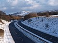
 A174 near Staithes - geograph.org.uk - 515014.jpg 640 × 480; 105 KB
-
 A174 Parkway - geograph.org.uk - 1650782.jpg 640 × 480; 212 KB
-
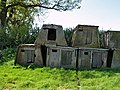
 Abandoned sheds near Hambleton Hill - geograph.org.uk - 1269223.jpg 640 × 480; 206 KB
-
 Advertising hoardings by the A66 - geograph.org.uk - 628706.jpg 640 × 480; 103 KB
-
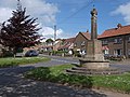 Aislaby war memorial - geograph.org.uk - 810322.jpg 640 × 480; 149 KB
-
 Allotments at Lingdale - geograph.org.uk - 679950.jpg 640 × 480; 126 KB
-
 Allotments at Saltburn - geograph.org.uk - 560199.jpg 640 × 480; 94 KB
-
 Animal Shelters - geograph.org.uk - 419762.jpg 640 × 480; 139 KB
-
 Animal trap - geograph.org.uk - 518364.jpg 640 × 480; 115 KB
-
 Another fine mess... - geograph.org.uk - 1371746.jpg 480 × 640; 127 KB
-
 Another load of Springhill Water - geograph.org.uk - 382456.jpg 640 × 502; 94 KB
-

-
 Another view from Roseberry Topping - geograph.org.uk - 874233.jpg 640 × 480; 118 KB
-
 Approaching Grosmont Farm - geograph.org.uk - 810349.jpg 640 × 480; 139 KB
-
 Approaching Middlehaven Interchange - geograph.org.uk - 658058.jpg 640 × 480; 87 KB
-
 Approaching Skinningrove along Grove Road - geograph.org.uk - 970471.jpg 640 × 480; 162 KB
-
 Approaching the Grand Hotel - geograph.org.uk - 593052.jpg 640 × 480; 128 KB
-
 Approaching Thirsley Cottage - geograph.org.uk - 403595.jpg 640 × 480; 77 KB
-
 Arnold Palmer Putting Course - geograph.org.uk - 451512.jpg 526 × 640; 116 KB
-
 Arriva bus depot in Loftus, North Yorkshire 16 October 2007.jpg 640 × 480; 81 KB
-
 Ayresome Park estate - geograph.org.uk - 427762.jpg 640 × 480; 81 KB
-
 Ayresome Park main entrance - geograph-427787.jpg 640 × 465; 114 KB
-
 B1266 road Ellerby Moor - geograph.org.uk - 622259.jpg 640 × 480; 70 KB
-
 Backlane at Staithes - geograph.org.uk - 849520.jpg 480 × 640; 150 KB
-
 Barley field by The Lea - geograph.org.uk - 914945.jpg 640 × 480; 144 KB
-
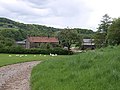
 Barn at Newbiggin Hall Farm - geograph.org.uk - 810340.jpg 640 × 480; 151 KB
-
 Barns and bales - geograph.org.uk - 633182.jpg 640 × 480; 129 KB
-
 Baxtergate - geograph.org.uk - 722531.jpg 640 × 480; 147 KB
-
 Beach Huts - geograph.org.uk - 499358.jpg 640 × 480; 92 KB
-
 Beach huts and boats at The Point - geograph.org.uk - 910769.jpg 640 × 480; 256 KB
-
 Bench at Raw - geograph.org.uk - 633424.jpg 640 × 480; 142 KB
-
 Bench on hillside at Castleton - geograph.org.uk - 576623.jpg 640 × 480; 89 KB
-
 Beresford Buildings - geograph.org.uk - 622894.jpg 640 × 480; 159 KB
-
 Beverley Road Nunthorpe - geograph.org.uk - 477691.jpg 640 × 480; 121 KB
-
 Birchdale House - geograph.org.uk - 1023980.jpg 640 × 480; 221 KB
-
 Birdlife on Coatham Sands - geograph.org.uk - 591996.jpg 640 × 519; 104 KB
-
 Blind bend, Shaldon Road - geograph.org.uk - 914580.jpg 640 × 480; 198 KB
-
 Blocks and dunes - geograph.org.uk - 1387903.jpg 640 × 480; 227 KB
-
 Blue Bank Farm - geograph.org.uk - 810463.jpg 640 × 480; 130 KB
-
 Boggle Hole - geograph.org.uk - 421540.jpg 640 × 480; 98 KB
-
 Boletus mushroom in Danby Park - geograph.org.uk - 576486.jpg 640 × 480; 130 KB
-
 Bow section of the MV Creteblock - geograph.org.uk - 722556.jpg 640 × 480; 168 KB
-
 Boxes on Baxtergate - geograph.org.uk - 722517.jpg 480 × 640; 162 KB
-
 Bran Sands - geograph.org.uk - 1318456.jpg 640 × 480; 217 KB
-
 Breakwater at Port Mulgrave - geograph.org.uk - 948283.jpg 640 × 480; 203 KB
-
 Bricked-up bridge - geograph.org.uk - 616339.jpg 640 × 486; 105 KB
-
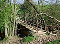
 Bridge at Iburndale - geograph.org.uk - 804756.jpg 640 × 480; 191 KB
-

-
 Bridleway approaching Hecks Wood - geograph.org.uk - 810337.jpg 640 × 480; 156 KB
-
 Bridleway between Aislaby and Briggswath - geograph.org.uk - 804711.jpg 480 × 640; 153 KB
-
 Bridleway climbing Brown Dod - geograph.org.uk - 453693.jpg 640 × 480; 122 KB
-
 Bridleway down to Gribdale - geograph.org.uk - 718931.jpg 640 × 480; 122 KB
-
 Bridleway south of Lodge Farm - geograph.org.uk - 810330.jpg 640 × 480; 156 KB
-
 Bridleway through Newton Mulgrave Woods - geograph.org.uk - 622256.jpg 480 × 640; 127 KB
-
 Bridleway to Aireyholme Farm - geograph.org.uk - 1151333.jpg 640 × 480; 150 KB
-
 Bridleway to Holwick - geograph.org.uk - 518426.jpg 640 × 480; 88 KB
-
 Burrow system - geograph.org.uk - 756748.jpg 640 × 480; 173 KB
-

-
 Bus shelters on the A174 - geograph.org.uk - 690109.jpg 640 × 480; 131 KB
-
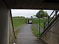
 Bus stop under the bridge - geograph.org.uk - 1280329.jpg 480 × 640; 227 KB
-

-
 Buskey House Farm - geograph.org.uk - 810488.jpg 640 × 480; 143 KB
-
 Bydale Howle - geograph.org.uk - 795352.jpg 640 × 480; 133 KB
-
 Caedmon's Cross - geograph.org.uk - 671168.jpg 640 × 480; 110 KB
-
 Calais House and the A171 - geograph.org.uk - 700082.jpg 640 × 480; 101 KB
-
 Caravan site at Highgate Howe - geograph.org.uk - 671176.jpg 640 × 480; 94 KB
-
 Carlton Methodist Church - geograph.org.uk - 594608.jpg 640 × 426; 83 KB
-
 Carr Pond - geograph.org.uk - 588073.jpg 640 × 480; 100 KB
-
 Castle Chamber - geograph.org.uk - 457285.jpg 640 × 408; 86 KB
-
 Castleton High Street and post office - geograph.org.uk - 576350.jpg 640 × 480; 95 KB
-
 Castleton waste water pumping station - geograph.org.uk - 576341.jpg 640 × 476; 133 KB
-
 Cattle grid, Fair Head Lane - geograph.org.uk - 810433.jpg 640 × 480; 123 KB
-
 Cattle near Newton under Roseberry - geograph.org.uk - 874205.jpg 640 × 480; 130 KB
-
 Caves below Cowbar Lane - geograph.org.uk - 515114.jpg 640 × 480; 104 KB
-
 Cemetery off Larpool Lane - geograph.org.uk - 451459.jpg 640 × 480; 102 KB
-
 Chair Lift and Promenade Cafe - geograph.org.uk - 499380.jpg 640 × 480; 95 KB
-
 Charlbury Road community centre - geograph.org.uk - 616337.jpg 640 × 460; 92 KB
-
 Church of St Mary the Virgin - geograph.org.uk - 870662.jpg 480 × 640; 137 KB
-
 Church on Loxley Road - geograph.org.uk - 628713.jpg 640 × 460; 92 KB
-
 Church Street - geograph.org.uk - 545568.jpg 640 × 480; 125 KB
-
 Cleveland Ironstone - geograph.org.uk - 437885.jpg 480 × 640; 122 KB
-
 Cleveland Road - geograph.org.uk - 583042.jpg 640 × 480; 82 KB
-
 Cleveland Way - geograph.org.uk - 421576.jpg 480 × 640; 133 KB
-
 Cleveland Way at Clock Case Nab - geograph.org.uk - 838623.jpg 640 × 480; 122 KB
-

-

-
 Cliff top, Hummersea Point - geograph.org.uk - 970496.jpg 640 × 480; 152 KB
-
 Cliffs at Far Jetticks - geograph.org.uk - 838609.jpg 640 × 480; 124 KB
-
 Cliffs east of Redcar - geograph.org.uk - 795354.jpg 640 × 480; 121 KB
-
 Clock Case Nab - geograph.org.uk - 838668.jpg 640 × 480; 94 KB
-
 Closed-off gateway on Newton Moor - geograph.org.uk - 1151305.jpg 640 × 480; 186 KB
-
 Clubhouse at Hunley Hill Golf Club - geograph.org.uk - 611019.jpg 640 × 480; 83 KB
-
 Clump of trees - geograph.org.uk - 1650788.jpg 480 × 640; 189 KB
-
 Coatham Marsh nature reserve - geograph.org.uk - 622901.jpg 640 × 480; 107 KB
-
 Colonnade, Stewart Park - geograph.org.uk - 392678.jpg 640 × 465; 105 KB
-
 Combeinteignhead - geograph.org.uk - 914546.jpg 640 × 480; 212 KB
-
 Contrasting land-use - geograph.org.uk - 699965.jpg 640 × 480; 134 KB
-
 Cornelian Bay - geograph.org.uk - 756069.jpg 640 × 480; 144 KB
-
 Cornelian bay from White Nab - geograph.org.uk - 756751.jpg 640 × 480; 129 KB
-
 Corrugated storage shed - geograph.org.uk - 680058.jpg 640 × 480; 136 KB
-
 Cowpen Bewley Landfill Site - geograph.org.uk - 427662.jpg 640 × 480; 95 KB
-
 Crop spraying near Aireyholme Farm - geograph.org.uk - 587303.jpg 640 × 480; 102 KB
-
 Cross on Church Lane - geograph.org.uk - 1650794.jpg 480 × 640; 191 KB
-
 Crow Wood - geograph.org.uk - 1390722.jpg 640 × 413; 212 KB
-
 Cut-off channel, Greatham Creek - geograph.org.uk - 410324.jpg 640 × 480; 90 KB
-
 Cute sign by the B1266 - geograph.org.uk - 1024520.jpg 640 × 480; 217 KB
-
 Dale Head - geograph.org.uk - 725336.jpg 640 × 480; 164 KB
-
 Dalehouse - geograph.org.uk - 515018.jpg 640 × 480; 121 KB
-
 Damaged fence at Redcar steelworks - geograph.org.uk - 1318461.jpg 480 × 640; 206 KB
-
 Damaged wall, Easby Moor - geograph.org.uk - 718907.jpg 640 × 480; 137 KB
-
 Danby Rigg - geograph.org.uk - 725369.jpg 640 × 480; 139 KB
-
 Dean Hall Farm - geograph.org.uk - 804796.jpg 640 × 480; 169 KB
-
 Decorations - geograph.org.uk - 515058.jpg 480 × 601; 98 KB
-
 Derelict Barn at High Farm - geograph.org.uk - 484071.jpg 640 × 480; 97 KB
-
-
 Dismantled Railway - geograph.org.uk - 484079.jpg 640 × 480; 120 KB
-
 Disused church at Dunsley - geograph.org.uk - 459036.jpg 474 × 640; 145 KB
-
 Disused workings - geograph.org.uk - 725428.jpg 640 × 480; 126 KB
-
 Dixon's Bank - geograph.org.uk - 1061098.jpg 640 × 480; 204 KB
-
 Dog Loup - geograph.org.uk - 849515.jpg 473 × 640; 65 KB
-
 Dorman Museum - geograph.org.uk - 764314.jpg 640 × 480; 166 KB
-
 Dry stone wall, Newton Moor - geograph.org.uk - 1151295.jpg 640 × 480; 154 KB
-
 Dunes and lagoon, Teesmouth - geograph.org.uk - 1387953.jpg 640 × 480; 174 KB
-
 Earthworks, Eston Nab - geograph.org.uk - 588079.jpg 640 × 480; 85 KB
-
 Easington post office - geograph.org.uk - 586349.jpg 640 × 480; 128 KB
-
 East Stand, Ayresome Park.jpg 640 × 466; 85 KB
-
 Eating alfresco at The Spa - geograph.org.uk - 593061.jpg 640 × 480; 111 KB
-
 Edge of Easby Moor - geograph.org.uk - 718959.jpg 640 × 480; 145 KB
-
 Edge of Hutton Lowcross Woods - geograph.org.uk - 1151311.jpg 640 × 480; 168 KB
-
 Edge of Teignmouth - geograph.org.uk - 914916.jpg 640 × 480; 207 KB
-
 Egton Road - geograph.org.uk - 1177965.jpg 640 × 480; 239 KB
-
 Empty flats, Cottingham Drive - geograph.org.uk - 622895.jpg 640 × 480; 93 KB
-
 Empty house, Redcar Road - geograph.org.uk - 658004.jpg 480 × 640; 117 KB
-
 Empty plot of land - geograph.org.uk - 1075714.jpg 640 × 480; 194 KB
-
 End of Ripley's Road - geograph.org.uk - 403618.jpg 640 × 480; 88 KB
-
 End of Saltwick Nab - geograph.org.uk - 722588.jpg 640 × 480; 144 KB
-
 End of track near Fair Plain quarries - geograph.org.uk - 810454.jpg 640 × 480; 160 KB
-
 Entering Little Beck Nature Reserve - geograph.org.uk - 804803.jpg 640 × 480; 175 KB
-
 Entering Ugglebarnby - geograph.org.uk - 810479.jpg 640 × 480; 170 KB
-
 Entrance to Haltermann chemical works - geograph.org.uk - 657984.jpg 640 × 480; 84 KB
-
 Entrance to Knowles Farm - geograph.org.uk - 671172.jpg 640 × 480; 98 KB
-
 Entrance to Old Walls Vineyard - geograph.org.uk - 914937.jpg 640 × 480; 214 KB
-
 Entrance to Watergate Farm - geograph.org.uk - 1177933.jpg 640 × 485; 184 KB
-
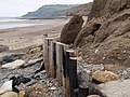 Erosion barrier - geograph.org.uk - 421568.jpg 640 × 480; 117 KB
-
 Escape Lane, Blue Bank - geograph.org.uk - 810457.jpg 480 × 640; 154 KB
-
 Eskdale views from Lowther's Crag - geograph.org.uk - 810441.jpg 640 × 480; 179 KB
-
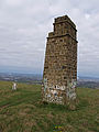 Eston Nab Monument-by-Stephen-McCulloch.jpg 480 × 640; 84 KB
-
 Ever felt you were being watched^ - geograph.org.uk - 553240.jpg 640 × 480; 85 KB
-
 Ewe Cote - geograph.org.uk - 722514.jpg 640 × 480; 145 KB
-
 Exchange Square - geograph.org.uk - 764330.jpg 640 × 480; 152 KB
-
 Fair Head Lane - geograph.org.uk - 810405.jpg 640 × 480; 169 KB
-
 Falling Foss waterfall - geograph.org.uk - 804816.jpg 480 × 640; 198 KB
-
 Fardeanside Farm - geograph.org.uk - 401491.jpg 640 × 458; 84 KB
-
 Fardeneside Farm - geograph.org.uk - 401664.jpg 640 × 488; 75 KB
-
 Farm at Kilton - geograph.org.uk - 679813.jpg 640 × 480; 99 KB
-
 Farm Lane - geograph.org.uk - 450056.jpg 640 × 480; 125 KB
-
 Farm track near Morton Carr - geograph.org.uk - 870684.jpg 640 × 480; 123 KB
-
 Farmland above Overdale Wyke - geograph.org.uk - 786255.jpg 640 × 480; 141 KB
-
 Farmland by Ridge Lane - geograph.org.uk - 802667.jpg 640 × 480; 102 KB
-
 Farmland east of Soulsgrave Farm - geograph.org.uk - 838526.jpg 640 × 480; 170 KB
-
 Farmland near Borrowby Dale - geograph.org.uk - 622189.jpg 640 × 480; 96 KB
-
 Farmland near South Lackenby - geograph.org.uk - 1280351.jpg 640 × 480; 187 KB
-
 Farmland near Spring Clump - geograph.org.uk - 1390725.jpg 640 × 427; 253 KB
-
 Farmland near Wynyard Woodland Park - geograph.org.uk - 449795.jpg 640 × 480; 117 KB
-
 Farmland north of Church Lane - geograph.org.uk - 870670.jpg 640 × 480; 128 KB
-
 Farmland west of Ellerby - geograph.org.uk - 1024531.jpg 640 × 480; 218 KB
-
 Farmland west of Newton Brow Farm - geograph.org.uk - 1024041.jpg 640 × 480; 198 KB
-
 Farmland west of Teignharvey Road - geograph.org.uk - 917489.jpg 640 × 480; 191 KB
-
 Fault in Jet Wyke - geograph.org.uk - 437890.jpg 640 × 480; 125 KB
-
 Fence and wall, Newton Moor - geograph.org.uk - 996063.jpg 640 × 480; 220 KB
-
 Field east of Ellerby Lane - geograph.org.uk - 1024521.jpg 640 × 480; 175 KB
-

-
 Fields south of High Lane - geograph.org.uk - 746472.jpg 640 × 480; 122 KB
-
 Five benches, Runswick Bay - geograph.org.uk - 689590.jpg 640 × 480; 102 KB
-
 Flank of Roseberry Topping - geograph.org.uk - 874228.jpg 640 × 480; 118 KB
-
 Fleet House - geograph.org.uk - 880023.jpg 640 × 543; 157 KB
-
 Footbridge - geograph.org.uk - 427727.jpg 640 × 496; 104 KB
-
 Footbridge in the woods - geograph.org.uk - 803128.jpg 640 × 480; 185 KB
-
 Footbridge over Normanby Road - geograph.org.uk - 477669.jpg 640 × 480; 123 KB
-
 Footbridge over Ormesby Road, Normanby - geograph.org.uk - 1075772.jpg 640 × 480; 191 KB
-
 Footbridge over Staindale Beck - geograph.org.uk - 401476.jpg 640 × 475; 190 KB
-
 Footbridge over Stoupe Beck - geograph.org.uk - 421634.jpg 640 × 472; 112 KB
-
 Footbridge over The Parkway - geograph.org.uk - 392773.jpg 640 × 452; 79 KB
-
 Footbridge over the River Esk - geograph.org.uk - 804715.jpg 640 × 475; 177 KB
-
 Footbridge over Worsall Gill - geograph.org.uk - 401652.jpg 640 × 480; 148 KB
-
 Footpath across moorland at Fair Plain - geograph.org.uk - 810451.jpg 640 × 480; 151 KB
-

-
 Footpath across the dunes - geograph.org.uk - 1318466.jpg 480 × 640; 230 KB
-
 Footpath descending Little Roseberry - geograph.org.uk - 996033.jpg 640 × 480; 225 KB
-
 Footpath heading west from Snow Hall Farm - geograph.org.uk - 874208.jpg 480 × 640; 194 KB
-
 Footpath leading to New Gardens farm - geograph.org.uk - 671173.jpg 640 × 480; 108 KB
-
 Footpath leading to New May Beck - geograph.org.uk - 804822.jpg 640 × 480; 157 KB
-
 Footpath through Greystones Roundabout - geograph.org.uk - 1280370.jpg 640 × 480; 124 KB
-

-
 Footpath to Fulthorpe - geograph.org.uk - 449788.jpg 640 × 480; 161 KB
-
 Footpath to Highfields Farm - geograph.org.uk - 802586.jpg 480 × 640; 116 KB
-
 Footpath to the south of Ormesby Hall - geograph.org.uk - 1269156.jpg 640 × 480; 189 KB
-
 Footpath up beck at Hob Holes - geograph.org.uk - 439365.jpg 480 × 640; 120 KB
-
 Footpath, Newton Moor - geograph.org.uk - 1151334.jpg 640 × 480; 163 KB
-
 Footpath, Quarry Hill - geograph.org.uk - 874260.jpg 640 × 480; 171 KB


