Category:Images by Stephen Elwyn Roddick
Jump to navigation
Jump to search

Media in category "Images by Stephen Elwyn Roddick"
The following 200 files are in this category, out of 378 total.
(previous page) (next page)-
 A Black Shaggy Cow - geograph.org.uk - 773380.jpg 640 × 439; 133 KB
-

-
 A Derbyshire Dew Pond, Near Hartington. - geograph.org.uk - 110454.jpg 640 × 480; 103 KB
-

-

-
 A Farm Road, on Mynydd Cefnamwlch. - geograph.org.uk - 139586.jpg 480 × 640; 109 KB
-

-

-

-

-
 A Snowscene near Deiniolen - geograph.org.uk - 132551.jpg 640 × 445; 81 KB
-

-

-

-

-

-
 Aberaeron Harbour - geograph.org.uk - 668620.jpg 640 × 180; 33 KB
-
 Aberllefenni Slate Quarry - geograph.org.uk - 96242.jpg 640 × 480; 114 KB
-
 Afon Cefni, Llangefni - geograph.org.uk - 796244.jpg 640 × 477; 109 KB
-
 Afon Ffraw and Cellar Mill. - geograph.org.uk - 100725.jpg 640 × 480; 102 KB
-
 Albert Bridge, Old Windsor. - geograph.org.uk - 99868.jpg 640 × 480; 87 KB
-
 Albert Lodge, Windsor. - geograph.org.uk - 99952.jpg 529 × 318; 57 KB
-
-

-

-
 April Clouds over Bron Meirion, Rhyd - geograph.org.uk - 771565.jpg 640 × 516; 111 KB
-

-
 Beaumaris Castle at Night - geograph.org.uk - 109229.jpg 640 × 480; 96 KB
-
 Beddgelert from Bedd-y-bryn - geograph.org.uk - 97460.jpg 640 × 483; 77 KB
-
 Blue Door - geograph.org.uk - 773526.jpg 427 × 640; 82 KB
-
 Boarded-up Building, in Deiniolen. - geograph.org.uk - 1571613.jpg 640 × 426; 50 KB
-
 Bodennog, Capel Gwyn, Anglesey. - geograph.org.uk - 115955.jpg 640 × 480; 88 KB
-

-
 Britons Mills, Nant Meigan, Beaumaris. - geograph.org.uk - 106757.jpg 640 × 480; 137 KB
-
 Bryn Bachau Chapel - geograph.org.uk - 212388.jpg 640 × 479; 93 KB
-
 Bryniau, Boduan. - geograph.org.uk - 97973.jpg 636 × 426; 53 KB
-
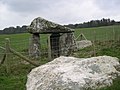 Burial Chamber, Cefnamwlch. - geograph.org.uk - 139496.jpg 640 × 480; 119 KB
-
 Burnham Abbey Wall - geograph.org.uk - 99878.jpg 640 × 486; 111 KB
-
 Bwa Gwyn Natural Arch. - geograph.org.uk - 100498.jpg 480 × 640; 89 KB
-
 Caban, Glynrhonwy - geograph.org.uk - 1605151.jpg 640 × 500; 110 KB
-
 Caeau-gwynion, Newborough, Anglesey. - geograph.org.uk - 146433.jpg 640 × 480; 91 KB
-
 Caergeiliog, Anglesey. - geograph.org.uk - 212815.jpg 640 × 349; 80 KB
-

-
 Caernarfon Castle on a February Evening - geograph.org.uk - 689139.jpg 628 × 265; 147 KB
-
 Capel Gwyn from Meidref. - geograph.org.uk - 115969.jpg 640 × 390; 68 KB
-
 Capel Mawr, Bodorgan. - geograph.org.uk - 177509.jpg 640 × 218; 37 KB
-
 Capelulo in the Snow - geograph.org.uk - 97985.jpg 640 × 432; 86 KB
-
 Caravans and Aircraft, Rhosneigr. - geograph.org.uk - 122657.jpg 640 × 445; 65 KB
-
 Carreglefn, Anglesey. - geograph.org.uk - 154630.jpg 640 × 487; 63 KB
-
 Castell Aberlleiniog - geograph.org.uk - 1141115.jpg 640 × 640; 156 KB
-
 Castellaberlleiniog.jpg 640 × 462; 137 KB
-
 Cefn Leisiog and Mynydd Y Garn - geograph.org.uk - 102700.jpg 640 × 441; 56 KB
-
 Celtic Gateway, Holyhead. - geograph.org.uk - 321724.jpg 640 × 231; 36 KB
-

-
 City hall, Cathays Park. - geograph.org.uk - 98011.jpg 640 × 331; 40 KB
-
 Clogwyn Cyrau, Betws-y-coed. - geograph.org.uk - 104732.jpg 440 × 640; 81 KB
-
 Coddington Farm, Crich. - geograph.org.uk - 105579.jpg 480 × 640; 101 KB
-
 Colwyn Bay at Night - geograph.org.uk - 99902.jpg 640 × 480; 58 KB
-
 Colwyn Bay Civic Centre - geograph.org.uk - 1261633.jpg 640 × 480; 73 KB
-
 Country Road - geograph.org.uk - 1215975.jpg 640 × 481; 74 KB
-

-

-
 Cruick Cottage, Torthorwald - geograph.org.uk - 1720085.jpg 929 × 654; 335 KB
-

-
 Cwm Hetiau - geograph.org.uk - 98188.jpg 640 × 430; 45 KB
-
 Cwm Penmachno - geograph.org.uk - 147746.jpg 640 × 480; 82 KB
-
 Dinorwig Quarry Slate Tips - geograph.org.uk - 104887.jpg 640 × 430; 84 KB
-
 Dipper (Cinclus cinclus) - geograph.org.uk - 765508.jpg 640 × 427; 90 KB
-

-
 Dorney Lake at Dawn in January. - geograph.org.uk - 99884.jpg 640 × 480; 65 KB
-
 Draining Pontcysyllte, Aqueduct - geograph.org.uk - 1579222.jpg 427 × 640; 84 KB
-

-
 Dwygyfylchi from above Capel Horeb - geograph.org.uk - 97983.jpg 640 × 436; 97 KB
-
 Eel Catching Spear - geograph.org.uk - 114629.jpg 452 × 640; 87 KB
-
 Efail Y Gof - Blacksmith Forges - geograph.org.uk - 1036678.jpg 640 × 477; 100 KB
-
 Eglwys St Mihangel's Church crop.jpg 497 × 313; 83 KB
-
 Eglwys St Mihangel's Church.jpg 640 × 471; 90 KB
-
 Eglwys St. Ceinwen, Cerrigceinwen. - geograph.org.uk - 107212.jpg 640 × 480; 103 KB
-
 Ellen's Tower, South Stack, Anglesey. - geograph.org.uk - 179247.jpg 640 × 326; 59 KB
-
 Ffynnon Gybi - geograph.org.uk - 102127.jpg 640 × 480; 270 KB
-
 Ffynnon Y Wrach, Holyhead, Anglesey. - geograph.org.uk - 123308.jpg 640 × 480; 92 KB
-

-
 Flower and water - geograph.org.uk - 903806.jpg 640 × 477; 114 KB
-

-
 Glan Llyn Farm, Llanaelhaearn. - geograph.org.uk - 116579.jpg 640 × 443; 74 KB
-

-
 Gun Dog Trials - geograph.org.uk - 220125.jpg 640 × 480; 585 KB
-
-
 Hair Pin Bend - geograph.org.uk - 1276667.jpg 640 × 278; 48 KB
-
 Hampstead Road Lock, Camden Town. - geograph.org.uk - 703686.jpg 640 × 475; 129 KB
-

-
 Hermon Windmill - geograph.org.uk - 101336.jpg 640 × 480; 105 KB
-
 Hoddam Church of Scotland. - geograph.org.uk - 97730.jpg 640 × 429; 71 KB
-

-
 Hollywood visits Llanddwyn Island - geograph.org.uk - 96486.jpg 640 × 480; 84 KB
-
 Holyhead Fish Dock - geograph.org.uk - 108901.jpg 640 × 480; 71 KB
-

-
 Houses for Sale - geograph.org.uk - 99915.jpg 640 × 480; 74 KB
-

-

-

-

-
 John Smedley Clock, Lea Mills. - geograph.org.uk - 105594.jpg 640 × 480; 88 KB
-
 Lime Street, Trefor. - geograph.org.uk - 116650.jpg 480 × 640; 71 KB
-

-
 Llanfihangel Din Sylwy Church - geograph.org.uk - 799979.jpg 640 × 481; 107 KB
-
 Llyn Alaw Wind Farm - geograph.org.uk - 102122.jpg 640 × 480; 134 KB
-
 Llyn Lockwood, Pen-y-gwryd. - geograph.org.uk - 97181.jpg 640 × 283; 80 KB
-
 Llyn Maelog - geograph.org.uk - 1131796.jpg 640 × 422; 133 KB
-
 Llyn Padarn and Snowdonia - geograph.org.uk - 765568.jpg 640 × 476; 273 KB
-
 Llyn Pen-y-gwryd, Snowdonia - geograph.org.uk - 765535.jpg 640 × 432; 48 KB
-
 Llynnon Mill (pre restoration).jpg 432 × 640; 43 KB
-
 Lon Bodlondeb, Morfa Nefyn - geograph.org.uk - 689143.jpg 640 × 481; 122 KB
-
 Lon Pant, Llanfairpwllgwyngyll. - geograph.org.uk - 114626.jpg 640 × 437; 63 KB
-
 Lon Tudur, Llangefni, Anglesey. - geograph.org.uk - 183690.jpg 640 × 233; 67 KB
-
 Looking towards Bodowyr - geograph.org.uk - 823911.jpg 640 × 477; 56 KB
-
-

-

-
 Machine shed, Australia - geograph.org.uk - 1605154.jpg 640 × 418; 105 KB
-

-

-

-

-
 Maisie the Highland Cow - geograph.org.uk - 101647.jpg 640 × 480; 88 KB
-
 Malltraeth, Post Office. - geograph.org.uk - 146385.jpg 640 × 480; 78 KB
-
 Mallwyd Church Porch - geograph.org.uk - 104594.jpg 480 × 640; 99 KB
-
 Meinbank - geograph.org.uk - 98227.jpg 640 × 429; 56 KB
-
-

-
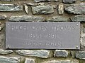
 Memorial Written in Riddle. - geograph.org.uk - 97699.jpg 417 × 640; 70 KB
-
 MiddleMouse.jpg 640 × 480; 114 KB
-

-
 Modern Sculpture - geograph.org.uk - 1276495.jpg 640 × 475; 98 KB
-
 Montgomery Town Hall - geograph.org.uk - 98025.jpg 640 × 430; 71 KB
-
 Mozzarella Cheese Factory, Llangefni. - geograph.org.uk - 107213.jpg 640 × 373; 68 KB
-
 New Inn Farm, Glyndyfrdwy - geograph.org.uk - 1208403.jpg 640 × 427; 101 KB
-
 Newgate, Penmachno. - geograph.org.uk - 147772.jpg 640 × 480; 91 KB
-
 Newton Church Tower - geograph.org.uk - 815700.jpg 624 × 462; 139 KB
-

-

-

-

-
 Old Bothy Window - geograph.org.uk - 1720122.jpg 984 × 638; 352 KB
-
 Old Green Hall, Llanyre - geograph.org.uk - 1736315.jpg 2,998 × 1,990; 5.04 MB
-

-
 Orsedd Goch, Llanfairynghornwy. - geograph.org.uk - 111659.jpg 640 × 382; 62 KB
-
 Parys Mine Shaft - geograph.org.uk - 101626.jpg 480 × 640; 95 KB
-
 Pen Garrett Mess Room - geograph.org.uk - 676799.jpg 564 × 403; 199 KB
-
 Pen Y Gaer - geograph.org.uk - 101495.jpg 640 × 451; 101 KB
-

-
 Penarth Fawr, near Chwilog, Pwllheli - geograph.org.uk - 172951.jpg 640 × 480; 121 KB
-
 Penmaenmawr Golf Course and Alltwen - geograph.org.uk - 97982.jpg 640 × 436; 46 KB
-
 Pheasant Rearing Country, Pentrefoelas - geograph.org.uk - 125847.jpg 480 × 640; 107 KB
-
 Pont Aberffraw, Aberffraw, Anglesey. - geograph.org.uk - 183723.jpg 640 × 231; 25 KB
-
 Pont Ar Gonwy - geograph.org.uk - 244827.jpg 640 × 480; 162 KB
-

-
 Pont-rhyd-y-groes-by-Stephen-Elwyn-RODDICK.jpg 640 × 480; 341 KB
-
 Poole's cavern stalagmites.jpg 480 × 640; 68 KB
-
 Porth Colmon, near Llangwnnadl. - geograph.org.uk - 244860.jpg 639 × 339; 73 KB
-
 Porth Cwyfan - geograph.org.uk - 1093103.jpg 640 × 481; 50 KB
-
 Porth Dynion, Amlwch - geograph.org.uk - 1560677.jpg 640 × 427; 81 KB
-
 Porth Penrhyn - geograph.org.uk - 104638.jpg 640 × 480; 83 KB
-
 Porth-y-nant - geograph.org.uk - 96203.jpg 640 × 480; 124 KB
-

-
 Rail Repairs - geograph.org.uk - 335295.jpg 640 × 480; 43 KB
-
 Reach for the Sky - geograph.org.uk - 100510.jpg 480 × 640; 79 KB
-
 Reflections, at Portmeirion. - geograph.org.uk - 105187.jpg 429 × 640; 94 KB
-
-

-

-
 River Nadder Harnham Mill.jpg 640 × 436; 87 KB
-
 Road To Tai'n-y-foel, Cerrigydrudion. - geograph.org.uk - 125889.jpg 640 × 480; 104 KB
-
 Rock of Cashel, Ireland. - geograph.org.uk - 111029.jpg 640 × 435; 31 KB
-

-
-
 Romsey Corn Exchange and Abbey Tower - geograph.org.uk - 98002.jpg 640 × 437; 80 KB
-

-
 Ruins, Gwaen-ydog, Nr Mynydd Mechell. - geograph.org.uk - 154647.jpg 640 × 480; 69 KB
-
 Rural Crime - geograph.org.uk - 769726.jpg 640 × 478; 59 KB
-

-
 Santes Fair, Llangwyfan, Anglesey. - geograph.org.uk - 115975.jpg 640 × 480; 100 KB
-

-
 Scale of charges at Llanfair toll gate. - geograph.org.uk - 114407.jpg 575 × 640; 104 KB
-

-
 Sea Pinks - geograph.org.uk - 1311459.jpg 640 × 422; 117 KB
-
 Seagulls having a feast^ - geograph.org.uk - 115979.jpg 640 × 480; 66 KB
-

-
 Sheltering from the Cold North Wind - geograph.org.uk - 100717.jpg 640 × 480; 118 KB
-

-
 Snowdon from near Ceunant Ifan. - geograph.org.uk - 97248.jpg 640 × 480; 127 KB
-
 Southampton Civic Centre. - geograph.org.uk - 101805.jpg 433 × 640; 42 KB
-
 St Andrew's Church, Presteigne. - geograph.org.uk - 98030.jpg 608 × 414; 56 KB
-
 St Andrew's Church, Tarvin.jpg 482 × 510; 95 KB
-
 St Caian's Church, Tregaian.jpg 640 × 480; 70 KB
-
 St Cybi's Church, Holyhead - geograph.org.uk - 799137.jpg 640 × 364; 83 KB
-
 St Georges Mill, Kingsland (geograph 4619905).jpg 2,448 × 3,264; 2.9 MB
-
 St Petrox Church - geograph.org.uk - 844946.jpg 480 × 640; 97 KB
-
 St. Aelhaearn's Well, Llanaelhaearn. - geograph.org.uk - 116590.jpg 640 × 480; 100 KB
-
 St. Andrew's Parish Church. - geograph.org.uk - 97725.jpg 482 × 640; 70 KB


,_Llanfaelog,_Anglesey._-_geograph.org.uk_-_123070.jpg)


_at_Sunset._-_geograph.org.uk_-_132562.jpg)


_-_geograph.org.uk_-_765508.jpg)


.jpg)


,_Cwm_Penmachno._-_geograph.org.uk_-_147752.jpg)


.jpg)


