Category:Images by Simon Ledingham
Jump to navigation
Jump to search

Media in category "Images by Simon Ledingham"
The following 76 files are in this category, out of 76 total.
-
 Aerial view Sellafield, Cumbria - geograph.org.uk - 50827.jpg 640 × 404; 104 KB
-

-
 Another view of Shap Abbey, Cumbria - geograph.org.uk - 74088.jpg 640 × 480; 105 KB
-
 Appleby Castle from above.jpg 640 × 529; 143 KB
-
 Askerton Castle.jpg 640 × 554; 139 KB
-
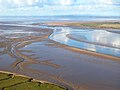
 Blackshaw Bank, Solway Estuary - geograph.org.uk - 612800.jpg 640 × 435; 55 KB
-
 Ninekirks 2.JPG 640 × 556; 127 KB
-
 Caerlaverock Castle from the air 1.jpeg 640 × 550; 121 KB
-
 Caerlaverock Castle from the air.jpg 1,100 × 840; 166 KB
-
 Calder Abbey, Cumbria - geograph.org.uk - 54489.jpg 640 × 554; 159 KB
-
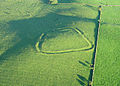
 Castlefolds, Great Asby Scar - geograph.org.uk - 612587.jpg 640 × 487; 142 KB
-
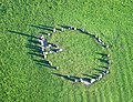 CastleriggStoneCircle(SimonLedingham)Jul2005.jpg 640 × 490; 231 KB
-
-
 Clifton Hall.jpg 640 × 550; 176 KB
-
 Close-up of Penrith Beacon, Cumbria - geograph.org.uk - 73964.jpg 630 × 640; 155 KB
-
 Cumberland Infirmary Hospital.jpg 640 × 480; 94 KB
-
 Cumberland Infirmary, Carlisle - geograph.org.uk - 74610.jpg 640 × 480; 230 KB
-

-
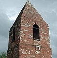
 Fox Tower, Helbeck Wood, Brough, Cumbria - geograph.org.uk - 50513.jpg 640 × 576; 224 KB
-
 Gleneagles Hotel and grounds.jpg 640 × 402; 173 KB
-
 Greatmellfell.jpg 640 × 480; 181 KB
-
 Greystoke Castle.jpg 640 × 480; 118 KB
-
 Haaf Net Fishermen, Solway Estuary - geograph.org.uk - 612827.jpg 640 × 498; 131 KB
-
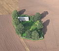
 Hay Close Farm Maize Maze.jpg 640 × 398; 85 KB
-

-
 High Cup Gill, Cumbria - geograph.org.uk - 72725.jpg 640 × 487; 105 KB
-
 High Head Castle from above.jpg 640 × 470; 137 KB
-
 JCB factory Rocester by-Simon-Ledingham.jpg 640 × 480; 175 KB
-
 Kilnholme - geograph.org.uk - 280116.jpg 640 × 555; 154 KB
-
 King Edward I Monument, Solway, Cumbria - geograph.org.uk - 60486.jpg 640 × 535; 196 KB
-
 KirkbyThoreGypsumPlant(SimonLedingham)May2005.jpg 640 × 445; 124 KB
-
 Lanercost Priory remains and Church - geograph.org.uk - 74035.jpg 640 × 480; 129 KB
-
 Lime House School - geograph.org.uk - 279353.jpg 640 × 469; 119 KB
-
 LongMegAndHerDaughters(SimonLedingham)May2005.jpg 640 × 584; 252 KB
-
 Lowther Castle 02.jpg 640 × 442; 131 KB
-
 Lowther Castle today.jpg 1,800 × 941; 368 KB
-
 Milburn, Cumbria - geograph.org.uk - 74119.jpg 640 × 480; 117 KB
-
 MilburnVillageCumbria(SimonLedingham)Oct2003.jpg 640 × 480; 175 KB
-
 Moricambe Bay.jpg 640 × 415; 67 KB
-
 Naworth Castle air 1.jpg 640 × 631; 144 KB
-
 Naworth Castle air 2.jpg 640 × 508; 126 KB
-
 Netherby Hall - geograph.org.uk - 280055.jpg 640 × 515; 132 KB
-
 Old Harbour Wall, Port Carlisle, Cumbria - geograph.org.uk - 72848.jpg 640 × 453; 144 KB
-
 Penrith Beacon, Cumbria - geograph.org.uk - 73863.jpg 640 × 614; 259 KB
-
 Princess Diana's Island, Althorp - geograph.org.uk - 50660.jpg 640 × 443; 163 KB
-
 Remains of Hudson Bomber AM 771 - geograph.org.uk - 269085.jpg 640 × 554; 113 KB
-
 RiverEamontAtBroughamCastle(SimonLedingham)Jun2004.jpg 640 × 534; 194 KB
-
 RiverWampool(SimonLedingham)Sep2004.jpg 640 × 468; 116 KB
-

-
 Sands of the Solway at Sunset - geograph.org.uk - 73954.jpg 640 × 480; 88 KB
-
 Scaleby Castle, Cumbria - geograph.org.uk - 50853.jpg 640 × 459; 178 KB
-
 ShapAbbey(SimonLedingham)Aug2004.jpg 640 × 480; 135 KB
-
-
 Spring day at Grune Point, Cumbria - geograph.org.uk - 74081.jpg 640 × 471; 108 KB
-
 St Luke's, Ousby Townhead, Westmorland - geograph.org.uk - 159237.jpg 640 × 471; 109 KB
-
 St Luke's, Ousby Townhead, Westmorland - geograph.org.uk - 159252.jpg 640 × 527; 171 KB
-
 Stonegarthside Hall - geograph.org.uk - 280068.jpg 640 × 484; 127 KB
-
 TempleSowerby(SimonLedingham)Jul2003.jpg 640 × 471; 193 KB
-

-
 The Nine Standards, Cumbria - geograph.org.uk - 53635.jpg 640 × 398; 173 KB
-

-
 Viaduct over River Liddel - geograph.org.uk - 280061.jpg 640 × 428; 106 KB
-
 View of Gleneagles - a corner - geograph.org.uk - 76288.jpg 640 × 394; 110 KB
-
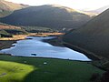 Cogra Moss, Cumbria - geograph.org.uk - 72796.jpg 640 × 480; 106 KB
-
 Crofthead - geograph.org.uk - 280054.jpg 640 × 515; 152 KB
-
 Cross Fell, Pennines, Cumbria - geograph.org.uk - 60504.jpg 640 × 480; 170 KB
-
 Field with crop pattern, Eden Valley - geograph.org.uk - 280132.jpg 640 × 477; 125 KB
-
 Meadley Reservoir - geograph.org.uk - 72809.jpg 640 × 480; 234 KB
-
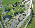 Rheged - 'The Village in The Hill' - geograph.org.uk - 75787.jpg 640 × 502; 199 KB
-

-
 Runway 07 Carlisle Airport - geograph.org.uk - 74464.jpg 640 × 469; 124 KB
-
 Sands of the Solway Estuary, Cumbria - geograph.org.uk - 72867.jpg 640 × 480; 88 KB
-
-
 Sunset on the Sands of the Solway - geograph.org.uk - 73957.jpg 640 × 480; 92 KB
-
 Temple Sowerby village green, Cumbria - geograph.org.uk - 60936.jpg 640 × 480; 149 KB
-


Jul2005.jpg)


May2005.jpg)


May2005.jpg)


Oct2003.jpg)


Jun2004.jpg)
Sep2004.jpg)


Aug2004.jpg)


Jul2003.jpg)


