Category:Images by Sharon Leedell
Jump to navigation
Jump to search

Media in category "Images by Sharon Leedell"
The following 111 files are in this category, out of 111 total.
-
 Air ambulance at Patterdale - geograph.org.uk - 1736959.jpg 640 × 480; 45 KB
-
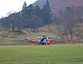 Air Sea Rescue helicopter - geograph.org.uk - 1736966.jpg 640 × 491; 66 KB
-
 Approach to Gelt Woods from Brampton - geograph.org.uk - 1519427.jpg 640 × 480; 61 KB
-
 Ben Nevis from Stob Ban - geograph.org.uk - 1523123.jpg 640 × 480; 87 KB
-

-
 Campsite at Ingleton - geograph.org.uk - 1523041.jpg 640 × 480; 81 KB
-
 Carlisle at 7am^ - geograph.org.uk - 1519482.jpg 480 × 640; 104 KB
-
 Carlisle Tourist Information Office - geograph.org.uk - 1519485.jpg 640 × 480; 76 KB
-
 Christmas tree^^ - geograph.org.uk - 1639347.jpg 640 × 480; 143 KB
-
 Cold morning near Cold Fell^ - geograph.org.uk - 1736893.jpg 640 × 480; 82 KB
-
 Coming down from Whinstone Lee Tor - geograph.org.uk - 1528582.jpg 640 × 480; 87 KB
-
 December snow, near Brampton - geograph.org.uk - 1639270.jpg 640 × 480; 127 KB
-
 Derwent-Ladybower Dam overflowing - geograph.org.uk - 1515664.jpg 425 × 640; 42 KB
-
 Dovestone Tor - geograph.org.uk - 1528267.jpg 640 × 480; 59 KB
-
 Early autumn evening, Brampton - geograph.org.uk - 1511056.jpg 480 × 640; 54 KB
-
 Early autumn sunset, Brampton - geograph.org.uk - 1511075.jpg 640 × 480; 27 KB
-
 Eilean Donan Castle - geograph.org.uk - 1523024.jpg 640 × 480; 89 KB
-
 Eilean Donan Castle - geograph.org.uk - 1523027.jpg 640 × 480; 83 KB
-

-

-
 Ferry to Largs - geograph.org.uk - 1523259.jpg 640 × 480; 78 KB
-
 First launch of the day - geograph.org.uk - 1519451.jpg 640 × 480; 88 KB
-
 Flood hit pier, Ullswater - geograph.org.uk - 1639406.jpg 453 × 604; 113 KB
-

-

-
 Footpath with view towards Tarnmonath Fell - geograph.org.uk - 1733841.jpg 1,024 × 768; 164 KB
-
 Frosty morning over Ullswater - geograph.org.uk - 1639401.jpg 640 × 480; 45 KB
-
 Frosty walls - geograph.org.uk - 1639421.jpg 640 × 480; 138 KB
-
 Gairs - geograph.org.uk - 1736908.jpg 640 × 480; 123 KB
-

-

-

-
 Hynam and Tarnmonath Fell - geograph.org.uk - 1733822.jpg 1,024 × 768; 192 KB
-
 Icy footpath near Gairs - geograph.org.uk - 1736913.jpg 640 × 480; 115 KB
-

-
 Inside White Scar Caves - geograph.org.uk - 1522997.jpg 640 × 473; 70 KB
-
 Inside White Scar Caves - geograph.org.uk - 1523002.jpg 640 × 480; 122 KB
-
 Inside White Scar Caves - geograph.org.uk - 1523006.jpg 640 × 480; 96 KB
-
 Inside White Scar Caves - geograph.org.uk - 1523010.jpg 640 × 480; 77 KB
-
 Interesting Icicles^ - geograph.org.uk - 1639320.jpg 480 × 640; 145 KB
-

-
 Ladybower Dam - geograph.org.uk - 1515641.jpg 440 × 640; 72 KB
-
 Ladybower-Derwent Dam - geograph.org.uk - 1515656.jpg 640 × 430; 64 KB
-
 Limestone walling and features - geograph.org.uk - 1523109.jpg 640 × 480; 97 KB
-
 Loch an Ruathair - geograph.org.uk - 1528616.jpg 640 × 480; 88 KB
-
 Loch Maree towards Slioch - geograph.org.uk - 1528709.jpg 640 × 480; 62 KB
-
 Millport Bay, Great Cumbrae - geograph.org.uk - 1523283.jpg 640 × 480; 30 KB
-
 Millport Town and Bay - geograph.org.uk - 1528079.jpg 640 × 480; 54 KB
-
 Mini house on Little Loch Shin - geograph.org.uk - 1528681.jpg 640 × 480; 50 KB
-
 Mist over Ullswater - geograph.org.uk - 1513079.jpg 640 × 425; 48 KB
-
 Mullach an Rathain - geograph.org.uk - 1511232.jpg 640 × 422; 77 KB
-

-
-
 Overlooking Am-ploc - geograph.org.uk - 1511175.jpg 640 × 417; 53 KB
-

-
 Rainbow over Ullswater - geograph.org.uk - 1513053.jpg 640 × 424; 33 KB
-
 Sharp frost at Glenridding - geograph.org.uk - 1639414.jpg 640 × 480; 123 KB
-

-
 Snowy trees - geograph.org.uk - 1639332.jpg 480 × 640; 149 KB
-
 Storm damage near Unity, Brampton - geograph.org.uk - 1519414.jpg 640 × 480; 131 KB
-
 Storm damaged tree near Unity - geograph.org.uk - 1519416.jpg 480 × 640; 137 KB
-

-
 The Derwent Moors from Win Hill - geograph.org.uk - 1528156.jpg 640 × 480; 48 KB
-

-

-
 The Greens - geograph.org.uk - 1736883.jpg 640 × 480; 60 KB
-
 The Mamores from Stob Ban - geograph.org.uk - 1523118.jpg 640 × 480; 82 KB
-
 The path through Gelt Wood - geograph.org.uk - 1519431.jpg 640 × 480; 125 KB
-
 The River Twiss - geograph.org.uk - 1523052.jpg 640 × 480; 129 KB
-

-
 Truckfest 2003 - geograph.org.uk - 1522957.jpg 640 × 480; 65 KB
-
 Truckfest 2003 - geograph.org.uk - 1522961.jpg 640 × 480; 67 KB
-
 Truckfest 2003 - geograph.org.uk - 1522965.jpg 640 × 480; 101 KB
-
 Truckfest 2003 - geograph.org.uk - 1522968.jpg 640 × 480; 86 KB
-
 Truckfest 2003 - geograph.org.uk - 1522972.jpg 480 × 640; 104 KB
-
 Truckfest 2003 - geograph.org.uk - 1522978.jpg 640 × 480; 62 KB
-
 View around NW from Eyam Moor - geograph.org.uk - 1528223.jpg 640 × 480; 71 KB
-

-
 View from The Ridge, Brampton - geograph.org.uk - 1511115.jpg 640 × 480; 80 KB
-

-

-
 View NW from Eyam Moor - geograph.org.uk - 1528229.jpg 640 × 480; 84 KB
-
 View NW from Win Hill - geograph.org.uk - 1528159.jpg 640 × 480; 53 KB
-

-
 View over How Gill near Gairs - geograph.org.uk - 1736919.jpg 640 × 480; 94 KB
-

-

-

-
 View South near Loch Lucy - geograph.org.uk - 1528606.jpg 640 × 480; 76 KB
-
 View to Bretton Brook - geograph.org.uk - 1528233.jpg 640 × 480; 83 KB
-
 View to Derwent Valley from Win Hill - geograph.org.uk - 1528150.jpg 640 × 480; 73 KB
-
 View to Faochag from the River Shiel - geograph.org.uk - 1523019.jpg 640 × 480; 90 KB
-

-

-
 View to High Stile - geograph.org.uk - 1513129.jpg 640 × 448; 85 KB
-
 View to Largs from the Ferry - geograph.org.uk - 1528073.jpg 480 × 640; 70 KB
-
 View to Mam Tor from Win Hill - geograph.org.uk - 1528165.jpg 640 × 480; 79 KB
-
-
 View to Skiddaw from the Ferry - geograph.org.uk - 1519465.jpg 640 × 480; 68 KB
-
 View to Talkin-Kelky Fell from Hynam - geograph.org.uk - 1733829.jpg 1,024 × 768; 159 KB
-

-

-

-
-
 Washed up tree stump by Ullswater - geograph.org.uk - 1639411.jpg 640 × 480; 103 KB
-
 Windy day over Ullswater - geograph.org.uk - 1515705.jpg 640 × 435; 54 KB
-
 Winter reflections on lake Ullswater - geograph.org.uk - 1639396.jpg 640 × 480; 94 KB
-
 Wintry scene, Brampton - geograph.org.uk - 1639309.jpg 640 × 480; 100 KB
-
 Wintry scene, Brampton - geograph.org.uk - 1639339.jpg 640 × 480; 132 KB
-

-
 Below Gasgale Crags, Grasmoor - geograph.org.uk - 1513114.jpg 640 × 446; 110 KB


