Category:Images by Robert Ashby
Jump to navigation
Jump to search

Media in category "Images by Robert Ashby"
The following 43 files are in this category, out of 43 total.
-
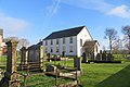 Ballylinney Presbyterian Church, County Antrim - geograph-3840851.jpg 4,000 × 2,664; 2.44 MB
-
 Ballywindelland Road (geograph 3637661).jpg 3,648 × 2,736; 6.58 MB
-
 Balnamore village - geograph-5328247.jpg 3,200 × 2,400; 4.95 MB
-
 Beaghmore stone circles - geograph-3455003.jpg 3,629 × 1,999; 2.28 MB
-
 Bendooragh crossroads, County Antrim - geograph-5328225.jpg 3,200 × 2,400; 4.82 MB
-
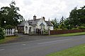
 Berwick Hall (2) (geograph 5181989).jpg 3,216 × 2,144; 3.37 MB
-
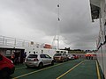 Carlingford ferry (geograph 5530622).jpg 4,608 × 3,456; 6.7 MB
-
 Carragh village (geograph 4662360).jpg 4,000 × 2,664; 6.59 MB
-
 Charleville station (geograph 4166551).jpg 4,000 × 2,664; 2.59 MB
-
 Church at Carnacon (geograph 4965893).jpg 4,000 × 2,664; 2.12 MB
-
 Curraghbinny Woods (geograph 4657047).jpg 2,000 × 1,332; 2.75 MB
-
 Drogheda station.jpg 4,000 × 3,000; 4.79 MB
-
 Ebrington Barracks and parade ground, Londonderry (geograph 3328421).jpg 3,648 × 2,736; 4.35 MB
-
 Farming country by Donegore Hill, Co Antrim - geograph-4258600.jpg 4,000 × 2,664; 4.15 MB
-
 Fenit station (geograph 5126907).jpg 3,216 × 2,144; 2.7 MB
-
 Fenit station (geograph 5126908).jpg 3,216 × 2,144; 3.04 MB
-
 Fenit station (geograph 5126910).jpg 3,216 × 2,144; 3.57 MB
-
 Fenit station (geograph 5126911).jpg 2,144 × 3,216; 3.41 MB
-
 Gatehouse on Fenaghy Road, Galgorm - geograph-4023361.jpg 4,000 × 2,664; 2.7 MB
-
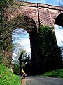 Glendun Viaduct, Co Antrim (geograph 3285723).jpg 1,200 × 1,600; 2.46 MB
-
 Glounthaune village (geograph 4170808).jpg 4,000 × 2,664; 4.34 MB
-
 Housing development (geograph 4171701).jpg 4,000 × 2,664; 3.68 MB
-
 In Carrigtohill (geograph 4170875).jpg 4,000 × 2,664; 3.85 MB
-
 Manulla Junction, Co Mayo (geograph 3464997).jpg 4,000 × 3,000; 4.82 MB
-
 Millstreet, Co Cork (geograph 3654563).jpg 3,504 × 2,538; 6.13 MB
-
 Mogeely Road (geograph 4171710).jpg 3,876 × 2,490; 6.05 MB
-
 New ferry service on Carlingford Lough (geograph 5530604).jpg 4,608 × 3,456; 7.18 MB
-
 Parkgate Village - geograph-3708418.jpg 4,000 × 2,664; 2.3 MB
-
 Picture Perfect (geograph 4661901).jpg 4,000 × 2,664; 4.13 MB
-
 Rathmore rail station (geograph 3654599).jpg 3,294 × 2,328; 5.91 MB
-
 Rochestown station (geograph 3675638).jpg 2,500 × 1,875; 3.64 MB
-
 Sandyknowes roundabout (geograph 4410594).jpg 4,000 × 2,664; 2.23 MB
-
 Service station (geograph 4171754).jpg 4,000 × 2,664; 2.11 MB
-
 St Brendans Church, Co Mayo (geograph 3473430).jpg 4,000 × 3,000; 4.41 MB
-
 Tardree Forest, on Tobernaveen Hill - geograph-3796097.jpg 4,000 × 2,664; 5.93 MB
-
 The castle (geograph 4661995).jpg 4,000 × 2,664; 2.69 MB
-
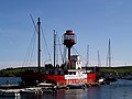 The former lightship Ballydorn, Whiterock, Strangford Lough (geograph 3285753).jpg 3,283 × 2,462; 2.14 MB
-
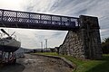
 The Old Deerpark Bridge, Antrim (geograph 3343368).jpg 4,000 × 3,000; 6.64 MB
-
 The Rue Point lighthouse, Rathlin Island (geograph 3291672).jpg 3,000 × 4,000; 6.89 MB
-
 The Temple Inn (geograph 3654181).jpg 3,648 × 2,736; 5.49 MB
-
 Traffic calming (geograph 3989309).jpg 4,000 × 2,664; 2.29 MB
-
 Tullamore station (geograph 4961217).jpg 3,576 × 2,298; 4.34 MB
-
 View from Ballycotton (geograph 4171849).jpg 1,927 × 3,000; 5.5 MB

.jpg)


_(geograph_5181989).jpg)
.jpg)
.jpg)
.jpg)
.jpg)
.jpg)

.jpg)

.jpg)
.jpg)
.jpg)
.jpg)

.jpg)
.jpg)
.jpg)
.jpg)
.jpg)
.jpg)
.jpg)
.jpg)

.jpg)
.jpg)
.jpg)
.jpg)
.jpg)
.jpg)

.jpg)
.jpg)
.jpg)
.jpg)
.jpg)
.jpg)
.jpg)
.jpg)