Category:Images by Rob Bradford
Jump to navigation
Jump to search

Media in category "Images by Rob Bradford"
The following 89 files are in this category, out of 89 total.
-
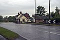
 A609, Horsley, Road Junction, Kilburn - geograph.org.uk - 13624.jpg 640 × 427; 62 KB
-
 Allestree Hall golf.jpg 640 × 427; 91 KB
-
 Alport height.jpg 640 × 427; 65 KB
-
 Arbour Low - geograph.org.uk - 11357.jpg 640 × 427; 58 KB
-

-
 Bar Brook flowing over stepping stones - geograph.org.uk - 723702.jpg 427 × 640; 103 KB
-
 St John's Church Interior, Berkswell - geograph.org.uk - 29745.jpg 427 × 640; 59 KB
-
 Bird Watching Hide. - geograph.org.uk - 825345.jpg 427 × 640; 69 KB
-
 Blowing Stone, Kingston Lisle - geograph.org.uk - 17542.jpg 640 × 427; 103 KB
-
 Bottle Brook Houses - geograph.org.uk - 13537.jpg 640 × 427; 73 KB
-
 Church of St James, Taxal - geograph.org.uk - 746402.jpg 427 × 640; 88 KB
-

-
 Church At Cross Hill, Derbyshire (geograph 11655).jpg 640 × 427; 80 KB
-

-
 Coxbench Station and level crossing (geograph 13627).jpg 640 × 427; 84 KB
-
 St Mary's Church , Cromford, Derbyshire - geograph.org.uk - 11264.jpg 640 × 427; 123 KB
-
 Cromford Bridge - geograph.org.uk - 11273.jpg 640 × 427; 95 KB
-
 Donna Nook Seals and Warning Sign - geograph.org.uk - 761157.jpg 640 × 427; 64 KB
-

-
-

-
 Footbridge over the River Dove (1) - geograph.org.uk - 1374885.jpg 427 × 640; 136 KB
-
 Footbridge over the River Dove (2) - geograph.org.uk - 1374900.jpg 427 × 640; 110 KB
-
 Footbridge over the River Goyt - geograph.org.uk - 746414.jpg 640 × 427; 117 KB
-
 Footbridge to Taxal over the River Goyt - geograph.org.uk - 746394.jpg 427 × 640; 130 KB
-
 G R Wall Post Box - geograph.org.uk - 29749.jpg 427 × 640; 122 KB
-
 Halter Devils Chapel - geograph.org.uk - 11358.jpg 640 × 427; 86 KB
-
 Heage Hall - geograph.org.uk - 11352.jpg 640 × 427; 131 KB
-
 Heage Windmill - geograph.org.uk - 11351.jpg 427 × 640; 68 KB
-

-
 High Peak Junction - geograph.org.uk - 17305.jpg 640 × 427; 116 KB
-
 Horsley Woodhouse Church.jpg 640 × 427; 74 KB
-
 Horsley Woodhouse Post Office - geograph.org.uk - 13644.jpg 640 × 427; 73 KB
-
 Ingleby caves.jpg 427 × 640; 103 KB
-
 Island with tree in Coneries Pond. - geograph.org.uk - 822618.jpg 426 × 640; 43 KB
-
 Isolated Cottage - geograph.org.uk - 746444.jpg 640 × 427; 61 KB
-
 Kilburn War Memorial - geograph.org.uk - 13623.jpg 640 × 427; 101 KB
-
 Knipe Farm - geograph.org.uk - 746437.jpg 640 × 427; 59 KB
-
 Ladder Hill TV Mast - geograph.org.uk - 746422.jpg 427 × 640; 63 KB
-
 Leawood Pump - geograph.org.uk - 717597.jpg 427 × 640; 65 KB
-
 Leawood Pumphouse In Steam - geograph.org.uk - 17554.jpg 457 × 640; 127 KB
-
 Madscar Farm - geograph.org.uk - 746431.jpg 640 × 427; 62 KB
-
 Magpie Mine - geograph.org.uk - 11353.jpg 640 × 427; 64 KB
-
 Magpie Mine Pit Head (Disused) - geograph.org.uk - 726254.jpg 635 × 640; 128 KB
-
 Matlock Cable Cars - geograph.org.uk - 21515.jpg 427 × 640; 111 KB
-
 Moor St Station, post-refurbishment - geograph.org.uk - 11639.jpg 640 × 480; 113 KB
-
 Moravian Church - geograph.org.uk - 11365.jpg 427 × 640; 112 KB
-

-
 Nottingham Castle - geograph.org.uk - 17560.jpg 522 × 640; 200 KB
-
 Nottingham Castle's Gatehouse - geograph.org.uk - 17562.jpg 640 × 427; 108 KB
-
 Octagonal Cottage - geograph.org.uk - 1374841.jpg 640 × 509; 73 KB
-
 Overton Hall Farm - geograph.org.uk - 761140.jpg 640 × 427; 46 KB
-
 Remains of a Farm Building - geograph.org.uk - 761126.jpg 427 × 640; 94 KB
-
 Riverside Home On Stilts - geograph.org.uk - 822613.jpg 426 × 640; 95 KB
-
 Roadside Shrine, Goyt's Lane - geograph.org.uk - 1430782.jpg 640 × 427; 71 KB
-
 Seahouses By Night - geograph.org.uk - 834411.jpg 640 × 427; 42 KB
-
 Shottesbrooke Church - geograph.org.uk - 11297.jpg 427 × 640; 67 KB
-
 St Mary's Church, Denby - geograph.org.uk - 13539.jpg 640 × 427; 102 KB
-
 Stocks on Village Green, Berkswell - geograph.org.uk - 29743.jpg 640 × 427; 90 KB
-
 Stream over rocks in woody glade - geograph.org.uk - 1374924.jpg 427 × 640; 113 KB
-
 Swarkestone Bridge - geograph.org.uk - 11356.jpg 640 × 427; 142 KB
-
 The Chapel of St Mary on the Bridge - geograph.org.uk - 845010.jpg 640 × 427; 91 KB
-

-

-

-

-
 Weir On The Leam - geograph.org.uk - 11638.jpg 640 × 480; 153 KB
-
 Wigwell Aqueduct Over The River Derwent - geograph.org.uk - 717565.jpg 640 × 497; 122 KB
-
 Wollaton Hall - geograph.org.uk - 11366.jpg 480 × 640; 164 KB
-
 Wollaton Hall - geograph.org.uk - 11651.jpg 640 × 427; 126 KB
-
 Wollaton Hall, Post Renovation - geograph.org.uk - 723692.jpg 559 × 640; 57 KB
-
 Coach and Horses, Horsley - geograph.org.uk - 13641.jpg 640 × 427; 73 KB
-
 Denby Pottery - geograph.org.uk - 11649.jpg 640 × 427; 113 KB
-
 Derelict Junction Keepers Cottage - geograph.org.uk - 306428.jpg 429 × 640; 189 KB
-
 Drum Hill Reservoir - geograph.org.uk - 13629.jpg 640 × 427; 55 KB
-
 Galsnakille, Rowan Cottage - geograph.org.uk - 641305.jpg 640 × 464; 54 KB
-
 Hill Farm - geograph.org.uk - 11653.jpg 427 × 640; 69 KB
-

-
 John Flamsteed Memorial Garden - geograph.org.uk - 11660.jpg 427 × 640; 106 KB
-
 Kilburn Baptist Church - geograph.org.uk - 13620.jpg 427 × 640; 62 KB
-
 Kilburn Residential Care Home - geograph.org.uk - 13621.jpg 640 × 427; 61 KB
-
 Mermaid Inn and Beacon - geograph.org.uk - 11354.jpg 427 × 640; 80 KB
-
 Morley Smithy - geograph.org.uk - 13631.jpg 640 × 427; 78 KB
-
 Notice In Berkswell's Well - geograph.org.uk - 29746.jpg 640 × 427; 107 KB
-
 Radio Mast at Toadmoor - geograph.org.uk - 17547.jpg 427 × 640; 59 KB
-
 Rubna Dearg from Sealife Centre - geograph.org.uk - 655931.jpg 640 × 427; 55 KB
-
 Sitwell Arms - geograph.org.uk - 11701.jpg 640 × 427; 75 KB
-
 Street Lane Methodists Church - geograph.org.uk - 11645.jpg 640 × 427; 90 KB
-
 The Well at Berkswell, Warwickshire - geograph.org.uk - 29742.jpg 640 × 427; 121 KB


.jpg)
_Bus_Stop_-_geograph.org.uk_-_822600.jpg)
.jpg)


_-_geograph.org.uk_-_1374885.jpg)
_-_geograph.org.uk_-_1374900.jpg)


_-_geograph.org.uk_-_726254.jpg)


_Fernilee_reservoir_-_geograph.org.uk_-_777263.jpg)


