Category:Images by Richard Sutcliffe
Jump to navigation
Jump to search

Media in category "Images by Richard Sutcliffe"
The following 81 files are in this category, out of 81 total.
-
 1051 Great Western Road (geograph 7389786).jpg 1,600 × 1,271; 385 KB
-
 1051 Great Western Road (geograph 7389791).jpg 1,600 × 1,172; 402 KB
-
 1051 Great Western Road (geograph 7389795).jpg 1,600 × 1,199; 429 KB
-
 1051 Great Western Road (geograph 7558178).jpg 1,600 × 1,200; 481 KB
-
 1051 GWR (geograph 5949863).jpg 1,600 × 971; 489 KB
-
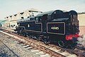 42085 at Lakeside Station - geograph.org.uk - 4733993.jpg 1,747 × 1,177; 371 KB
-
 Allander Water in spate - geograph.org.uk - 4758399.jpg 3,432 × 2,227; 3.19 MB
-
 Archway, Culzean Castle - geograph.org.uk - 4458117.jpg 3,504 × 2,336; 5.15 MB
-
 Argyle Street and York Street junction - geograph.org.uk - 5077111.jpg 3,432 × 2,183; 2.13 MB
-
 Bears Way, A81 - geograph.org.uk - 4758447.jpg 3,504 × 2,336; 4.22 MB
-
 Big Wood and new ponds - geograph.org.uk - 4460821.jpg 2,048 × 1,536; 1.01 MB
-
 Booking Hall, former station (geograph 7078002).jpg 1,155 × 1,600; 317 KB
-
 Canal House, Spier's Wharf (geograph 6548677).jpg 1,600 × 1,170; 332 KB
-
 Cardiff Queen Street station and HM Prison Cardiff (geograph 4989990).jpg 3,350 × 1,953; 2.14 MB
-
 Carved stonework (geograph 7078012).jpg 1,600 × 1,007; 280 KB
-
 Central Manchester University Hospitals - geograph.org.uk - 4533749.jpg 2,048 × 1,536; 750 KB
-
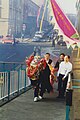 Chinese New Year celebrations, Glasgow - geograph.org.uk - 4743663.jpg 1,184 × 1,770; 362 KB
-
 Colquhoun Park Flood Alleviation Scheme - geograph.org.uk - 4563427.jpg 2,048 × 1,536; 699 KB
-
 Cross-country jumps, Smeaton - geograph.org.uk - 4749977.jpg 3,504 × 2,336; 4.08 MB
-
 Dundee Drive - geograph.org.uk - 4632614.jpg 3,504 × 2,336; 3.91 MB
-
 East Lodge, Dunira - geograph.org.uk - 4437494.jpg 3,504 × 2,336; 4.66 MB
-
 Feeding the swans - geograph.org.uk - 4758111.jpg 3,440 × 2,256; 2.57 MB
-
 Fish Ladder, Milngavie - geograph.org.uk - 4758393.jpg 2,252 × 3,274; 3.36 MB
-
 Fish Ladder, Milngavie - geograph.org.uk - 4758396.jpg 3,137 × 2,233; 3.54 MB
-
 Fish ladder, Milngavie - geograph.org.uk - 4758402.jpg 2,336 × 3,504; 3.85 MB
-
 Flooded field, Bearsden - geograph.org.uk - 4758407.jpg 3,428 × 2,223; 3.8 MB
-
 Flooded fields, Bearsden - geograph.org.uk - 4758410.jpg 3,440 × 2,162; 3.26 MB
-
 Footpath from York Drive to Grange Road - geograph.org.uk - 4535913.jpg 640 × 480; 129 KB
-
 Footpath to Glasgow Road, Kirkintilloch - geograph.org.uk - 4592161.jpg 1,247 × 1,528; 534 KB
-
 Footpaths and trees, Kilmardinny Loch - geograph.org.uk - 4758546.jpg 3,504 × 2,336; 5.87 MB
-
 Footpaths behind Glen Esk Drive - geograph.org.uk - 4758074.jpg 2,048 × 1,536; 1.04 MB
-
 Footpaths, Kilmardinny Loch - geograph.org.uk - 4758541.jpg 3,504 × 2,336; 4.47 MB
-
 Former railway station, Troutbeck (geograph 6884771).jpg 1,600 × 1,035; 413 KB
-
 Former station building (geograph 7077997).jpg 1,600 × 1,155; 262 KB
-
 Former station building (geograph 7078008).jpg 1,215 × 1,600; 378 KB
-
 Gardens behind the Treasurer's House, York - geograph.org.uk - 5635932.jpg 1,038 × 1,600; 321 KB
-
 Glen Ogle - geograph.org.uk - 4614387.jpg 3,504 × 2,336; 3.08 MB
-
 Grotto, Dunkeld House Hotel - geograph.org.uk - 4613707.jpg 2,336 × 3,504; 5.16 MB
-
 High flats on Wyndfiord Road (geograph 5948610).jpg 1,600 × 1,034; 417 KB
-
 Jorvik Viking Centre - geograph.org.uk - 5635945.jpg 1,600 × 973; 330 KB
-
 Kilmarnock Road, Shawlands (geograph 4713797).jpg 3,504 × 2,336; 2.88 MB
-
 King Street, Castle Douglas - geograph.org.uk - 4692860.jpg 3,504 × 2,336; 3.34 MB
-
 Kirkhouse, Kirkgunzeon - geograph.org.uk - 4742716.jpg 1,743 × 1,160; 323 KB
-
 Life goes on (geograph 6552145).jpg 1,600 × 1,200; 427 KB
-
 Loch Lomond Shores - geograph.org.uk - 4479496.jpg 3,452 × 2,239; 2.44 MB
-
 Low tide at Kippford - geograph.org.uk - 4758103.jpg 3,504 × 2,336; 3.11 MB
-
 Main entrance, The Burrell Collection - geograph.org.uk - 4750502.jpg 1,986 × 1,461; 722 KB
-
 Millichen Flood - geograph.org.uk - 4456161.jpg 3,504 × 2,336; 5.18 MB
-
 National Railway Museum, York - geograph.org.uk - 4798359.jpg 1,536 × 2,048; 1.09 MB
-
 National Railway Museum, York - geograph.org.uk - 4798375.jpg 2,048 × 1,536; 1.1 MB
-
 New Abbey Parish Hall plaque - geograph.org.uk - 4739522.jpg 1,016 × 773; 211 KB
-
 New buildings beside the Clyde (geograph 7161605).jpg 1,600 × 1,188; 250 KB
-
 New York Cottage, Bridge Street, St Andrews - geograph.org.uk - 6168335.jpg 1,242 × 1,600; 360 KB
-
 Newtown, Inverarary - geograph.org.uk - 4504230.jpg 3,393 × 2,208; 3.36 MB
-
 Old bridge, Kinglas Glen - geograph.org.uk - 4444632.jpg 3,504 × 2,336; 4.07 MB
-
 Owl sculpture, Kilmardinny Loch - geograph.org.uk - 4758457.jpg 2,336 × 3,504; 4.84 MB
-
 Parkhouse (geograph 5259753).jpg 1,600 × 1,067; 474 KB
-
 Path to Dunkeld and Cally Car Park - geograph.org.uk - 4618445.jpg 3,504 × 2,336; 5.97 MB
-
 Path, Victoria Park (geograph 6901067).jpg 1,600 × 1,200; 571 KB
-
 Prestonkirk Church, East Linton - geograph.org.uk - 4749988.jpg 3,504 × 2,336; 2.75 MB
-
 Raith Avenue (geograph 5826203).jpg 1,600 × 990; 337 KB
-
 Signalling model, National Railway Museum, York - geograph.org.uk - 4798449.jpg 2,048 × 1,536; 1.1 MB
-
 St Peter's Church, Lower Heswall - geograph.org.uk - 4758149.jpg 1,175 × 1,732; 535 KB
-
 Statue of Minerva - geograph.org.uk - 5635925.jpg 1,033 × 1,600; 310 KB
-
 Steps to Whithope Road - geograph.org.uk - 4563599.jpg 2,048 × 1,536; 977 KB
-
 SUDS pond, Muirshiel Crescent (geograph 4995013).jpg 3,504 × 2,336; 3.92 MB
-
 Tall ships at Greenock, 1999 - geograph.org.uk - 4739185.jpg 1,757 × 1,174; 462 KB
-
 Telfords (geograph 7168670).jpg 1,600 × 1,078; 354 KB
-
 The River Ouse and Lendal Bridge, York - geograph.org.uk - 4441673.jpg 2,048 × 1,536; 815 KB
-
 The Shambles, York - geograph.org.uk - 4748156.jpg 1,155 × 1,715; 362 KB
-
 The Warehouse, National Railway Museum, York - geograph.org.uk - 4798416.jpg 1,983 × 1,443; 793 KB
-
 Three bridges, Motherwell station (geograph 5091350).jpg 3,296 × 2,191; 2.52 MB
-
 Train approaching Hyndland Station - geograph.org.uk - 4629637.jpg 1,536 × 2,048; 793 KB
-
 Tweedsmuir Road (geograph 5322600).jpg 1,600 × 1,048; 266 KB
-
 Wild flowers at Glasgow Museums Resource Centre - geograph.org.uk - 4430879.jpg 2,336 × 3,504; 1.39 MB
-
 York Drive - geograph.org.uk - 5325791.jpg 1,600 × 1,200; 362 KB
-
 York Minster - geograph.org.uk - 4662487.jpg 1,168 × 1,733; 356 KB
-
 York Minster - geograph.org.uk - 4662499.jpg 1,742 × 1,168; 305 KB
-
 York Minster - geograph.org.uk - 5635936.jpg 1,600 × 1,030; 300 KB
-
 York sunset - geograph.org.uk - 4798512.jpg 2,048 × 1,536; 456 KB
-
 Yorkshire Museum - geograph.org.uk - 4797164.jpg 1,992 × 1,421; 693 KB
.jpg)
.jpg)
.jpg)
.jpg)
.jpg)


.jpg)
.jpg)
.jpg)
.jpg)


.jpg)
.jpg)
.jpg)


.jpg)

.jpg)


.jpg)


.jpg)


.jpg)

.jpg)

.jpg)


.jpg)

.jpg)


.jpg)

.jpg)


