Category:Images by Philip Platt
Jump to navigation
Jump to search

Media in category "Images by Philip Platt"
The following 34 files are in this category, out of 34 total.
-
 -2021-06-23 Bolton Cenotaph, Victoria Square, Bolton.jpg 1,600 × 1,020; 357 KB
-
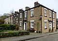
 9-11, Playfair St, Eagley, Bolton-geograph-2654974.jpg 640 × 513; 301 KB
-
 Bowland Forest Gliding Club (geograph 4590984).jpg 1,024 × 651; 582 KB
-
 Bradshaw Hall porch (geograph 3317315).jpg 1,024 × 680; 497 KB
-
 Burton Road tram stop (geograph 5542586).jpg 1,280 × 960; 1.03 MB
-
 Business park in Egerton (geograph 2943697).jpg 3,914 × 2,147; 3.76 MB
-
 Disused railway station (geograph 2389103).jpg 4,000 × 3,000; 6.08 MB
-
 Farm outside Egerton (geograph 2859065).jpg 3,596 × 2,396; 2.92 MB
-
 Footpath across Hordern Pasture (geograph 5585385).jpg 1,280 × 960; 1,024 KB
-
 Georgian Terrace (geograph 5805597).jpg 5,184 × 3,888; 6.37 MB
-
 Higher Chipping House (geograph 5163137).jpg 3,976 × 2,968; 6.8 MB
-
 Holts Fold Farm (geograph 2345419).jpg 4,000 × 3,000; 6.3 MB
-
 Hothersall Hall (geograph 4053208).jpg 4,000 × 3,000; 4.22 MB
-
 Last train to nowhere (geograph 4157333).jpg 3,207 × 2,730; 6.74 MB
-
 Lower Underhand, Newton, Lancashire-geograph-5127666-by-Philip-Platt.jpg 3,800 × 2,712; 5.99 MB
-
 Masham Town Hall (geograph 4683481).jpg 1,024 × 767; 565 KB
-
 Motte and Bailey, Burton in Lonsdale (geograph 4190007).jpg 2,913 × 2,155; 3.6 MB
-
 Office Block (geograph 6553031).jpg 1,600 × 1,313; 491 KB
-
 Playfair Street, Eagley Bank (geograph 2654974).jpg 3,496 × 2,802; 3.8 MB
-
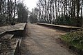
 Remains of Turton and Edgworth Railway Station (geograph 6881722).jpg 1,600 × 1,200; 795 KB
-
 Reservoir, cottage and tower (geograph 2434108).jpg 4,000 × 3,000; 4.97 MB
-
 Ripon Town Hall (geograph 4642364).jpg 1,024 × 642; 471 KB
-
 Roadworks in Knowsley Street (geograph 5816727).jpg 1,024 × 979; 222 KB
-
 Second Street, Barrow Bridge (geograph 4902801).jpg 1,280 × 919; 1.06 MB
-
 Settle Town Hall (geograph 3122971).jpg 2,816 × 2,112; 2.92 MB
-
 The Eagle and Child at Hurst Green - geograph.org.uk - 2394071.jpg 2,600 × 1,884; 1.83 MB
-
 The Lord Nelson - geograph.org.uk - 2544719.jpg 4,000 × 3,000; 5.14 MB
-
 War memorial and Hoghton Tower Drive (geograph 2568878).jpg 3,196 × 2,305; 2.65 MB
-
 Wildfire on Winter Hill (geograph 5822979).jpg 1,024 × 766; 59 KB
-
 Wildfire on Winter Hill (geograph 5828608).jpg 854 × 640; 324 KB
-
 Worsley Railway Station platforms (geograph 3403811).jpg 1,024 × 682; 705 KB
-
 York from Moor Lane - geograph.org.uk - 2544734.jpg 4,000 × 3,000; 6.45 MB
-
 York Terrace, Feniscowles - geograph.org.uk - 2455714.jpg 3,544 × 2,567; 3.28 MB
-
 York Village - geograph.org.uk - 2544750.jpg 640 × 463; 73 KB


.jpg)
.jpg)
.jpg)
.jpg)
.jpg)
.jpg)
.jpg)
.jpg)
.jpg)
.jpg)
.jpg)
.jpg)

.jpg)
.jpg)
.jpg)
.jpg)
.jpg)
.jpg)
.jpg)
.jpg)
.jpg)
.jpg)


.jpg)
.jpg)
.jpg)
.jpg)


