Category:Images by Philip Jeffrey
Jump to navigation
Jump to search

Media in category "Images by Philip Jeffrey"
The following 89 files are in this category, out of 89 total.
-
 A side door to St Marys (geograph 3637357).jpg 1,200 × 1,600; 692 KB
-
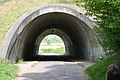
 Arch over a Great Ouse tributary (geograph 3200986).jpg 1,600 × 1,068; 680 KB
-
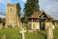
 Brafield-on-the-Green St Laurence from NW.jpg 1,244 × 1,272; 149 KB
-
 Bridge over the Grand Union (geograph 2821877).jpg 1,600 × 1,200; 441 KB
-
 Bridge under the A41 - geograph.org.uk - 653064.jpg 640 × 427; 78 KB
-
 Bridleway past the Hall (geograph 3543306).jpg 1,200 × 1,600; 764 KB
-
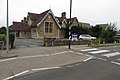 Bromham primary school - geograph.org.uk - 5524167.jpg 1,600 × 1,066; 396 KB
-
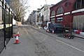 Building works on Melton Street for HS2 (geograph 6070447).jpg 1,600 × 1,066; 404 KB
-
 Castle Ashby in its parkland (geograph 6143643).jpg 1,600 × 1,066; 333 KB
-
 Cemetery at St Marys Old Linslade (geograph 3178638).jpg 1,600 × 1,067; 524 KB
-
 Chain Reaction sculpture in Campbell Park - geograph.org.uk - 5670470.jpg 1,600 × 1,066; 431 KB
-
 Compass Building on the Bath Road by Philip Jeffrey.jpg 1,600 × 1,065; 334 KB
-
 Damems Lane (geograph 2814640).jpg 640 × 480; 110 KB
-

-
 Drive to Coach Houses (geograph 3201026).jpg 1,600 × 1,068; 662 KB
-
 Drive to Thornton Park Farm (geograph 3201005).jpg 1,600 × 1,069; 762 KB
-
 Earls Court Exhibition centre (geograph 2871555).jpg 1,600 × 1,067; 512 KB
-
 Footpath across the field to Meadow House (geograph 7166021).jpg 1,600 × 1,066; 425 KB
-
 Footpath into Greens Norton (geograph 3544970).jpg 1,200 × 1,600; 693 KB
-
 Gatehouse to Manor Farm Tilsworth Geograph-3411443-by-Philip-Jeffrey.jpg 1,200 × 1,600; 567 KB
-
 Gayhurst House Geograph-2831357-by-Philip-Jeffrey.jpg 3,734 × 2,485; 1.87 MB
-
 Grafton Regis St Mary fr NE GeoUK B60,C36.jpg 1,716 × 1,204; 235 KB
-
 Hartwell St John the B from NW.jpg 1,134 × 882; 123 KB
-
 Hilton Hotel York - geograph.org.uk - 2939064.jpg 640 × 427; 82 KB
-
 Holy Cross Hoggeston Geograph-3554017-by-Philip-Jeffrey.jpg 1,600 × 1,067; 476 KB
-
 Holy Rood Church (geograph 3484191).jpg 1,600 × 1,067; 645 KB
-
 House in Upper Heyford, Northants - geograph-6502984.jpg 1,600 × 1,066; 356 KB
-
 Houses of Parliament (geograph 2872049).jpg 640 × 427; 72 KB
-
 Hovercraft racing at Claydon House - geograph.org.uk - 653058.jpg 640 × 427; 63 KB
-
 Howtown pier and ferry (geograph 2944180).jpg 640 × 480; 94 KB
-
 Inside Clifford's Tower - geograph.org.uk - 2939061.jpg 640 × 427; 87 KB
-

-
 Leighton Buzzard railway (geograph 3511760).jpg 1,600 × 1,067; 734 KB
-
 Lion Lodge Woburn Abbey Geograph-3079331-by-Philip-Jeffrey.jpg 1,600 × 1,068; 565 KB
-
 Loudoun monument in Ashby (geograph 3810956).jpg 1,200 × 1,600; 249 KB
-
 Lush grass field by Battens Green (geograph 3452432).jpg 1,600 × 1,068; 532 KB
-
 Market place and Town Hall (geograph 5704152).jpg 1,066 × 1,600; 296 KB
-
 Millennium milepost on Weasel Lane (geograph 6029200).jpg 1,600 × 1,067; 504 KB
-
 Milton Keynes Coachway - geograph.org.uk - 2930217.jpg 640 × 427; 60 KB
-
 NCN Millennium Milepost MP534 Mursley.jpeg 1,600 × 1,068; 682 KB
-
 NCN Millennium Milepost MP576 Shenley Brook End Milton Keynes.jpeg 3,913 × 2,442; 2.92 MB
-
 Bluebells in Holy Trinity churchyard, Normanton-le-Heath (geograph 3484196).jpg 1,200 × 1,600; 677 KB
-
 North Greenwich Station (geograph 5872950).jpg 1,600 × 1,200; 303 KB
-
 Office buildings in Sandridge Park - geograph.org.uk - 1275895.jpg 640 × 480; 64 KB
-
 Old station house (geograph 5555289).jpg 1,600 × 1,068; 343 KB
-
 Parish Church (geograph 2980002).jpg 1,600 × 1,065; 572 KB
-
 Parish Church by the Patna Road (geograph 3279106).jpg 1,200 × 1,600; 630 KB
-
 Path down to Knightley Way (geograph 3544975).jpg 1,600 × 1,067; 523 KB
-
 Church of St John the Baptist, Quinton, Northants (geograph 3533607).jpg 1,600 × 1,067; 537 KB
-
 Radstone St Lawrence eastw GeoUK 5917653.jpg 2,224 × 1,476; 266 KB
-
 Radstone St Lawrence fr east GeoUK 5917743.jpg 1,718 × 1,172; 259 KB
-
 Ragdale Hall (geograph 2938528).jpg 640 × 480; 67 KB
-
 Saint Peter and Saint Paul church (geograph 3525045).jpg 1,200 × 1,600; 574 KB
-
 Sales suite for the new build flats (geograph 5670452).jpg 1,600 × 1,076; 427 KB
-
 Salford Village Hall and bus shelter (geograph 3014706).jpg 1,600 × 1,067; 361 KB
-
 St Ethelredas Church, West Quantoxhead (geograph 4407442).jpg 1,600 × 1,066; 511 KB
-
 St Georges Circus and obelisk (geograph 4746789).jpg 1,600 × 1,066; 351 KB
-
 St John Whitchurch Geograph-3579630-by-Philip-Jeffrey.jpg 1,600 × 1,067; 438 KB
-
 St Leonards Church (geograph 5291933).jpg 1,600 × 1,066; 328 KB
-
 St Leonards Stagsden (geograph 4221672).jpg 1,600 × 1,067; 314 KB
-
 St Marys and churchyard (geograph 3637359).jpg 1,600 × 1,067; 422 KB
-
 St Marys Church Old Linslade (geograph 3178630).jpg 1,200 × 1,600; 597 KB
-
 St Marys Church Salford (geograph 3014721).jpg 1,600 × 1,067; 250 KB
-
 St Marys church Wooton (geograph 3637346).jpg 1,600 × 1,068; 429 KB
-
 St Michael and All Angels Church (geograph 3810226).jpg 1,600 × 1,067; 420 KB
-
 St Michaels church (geograph 4406737).jpg 1,600 × 1,066; 486 KB
-
 Stembridge Tower Mill (geograph 3452516).jpg 1,600 × 1,067; 495 KB
-
 Steps up to Clifford's Tower - geograph.org.uk - 2939058.jpg 427 × 640; 86 KB
-
 Church of St Mary the Virgin (geograph 3420383).jpg 1,600 × 1,067; 460 KB
-
 Tall shade in the pasture (geograph 3543348).jpg 1,200 × 1,600; 586 KB
-
 Thatched cottages on Thistley Lane - geograph.org.uk - 4424557.jpg 1,600 × 1,066; 422 KB
-
 The Edlesborough Ford (geograph 3827831).jpg 1,600 × 1,068; 521 KB
-
 The Great Ouse at Thornton (geograph 3200998).jpg 1,600 × 1,067; 598 KB
-
 The moated Denham Lodge, Quainton (geograph 3573430).jpg 1,600 × 1,068; 501 KB
-
 The Red Lion Salford (geograph 3014729).jpg 1,600 × 1,066; 437 KB
-
 Thornborough Ford, without water (geograph 3159831).jpg 1,600 × 1,067; 590 KB
-
 St Michael and all Saints church (geograph 4514377).jpg 1,600 × 1,066; 406 KB
-
 Trees by York Road - geograph.org.uk - 5748026.jpg 1,600 × 1,066; 622 KB
-
 Triple Star Head in the snow, Milton Keynes (geograph 2835934).jpg 1,600 × 1,200; 413 KB
-
 Turvey station.jpg 931 × 573; 391 KB
-
 Tyringham Bridge (geograph 3295576).jpg 1,600 × 1,067; 500 KB
-
 Wappenham Mary the Virgin fr ESE GeoUK.jpg 2,292 × 1,514; 311 KB
-
 Williams Conference Centre geograph-2998907-by-Philip-Jeffrey.jpg 1,600 × 1,200; 449 KB
-
 Wolverton Old Drill Hall (geograph 4111831).jpg 1,600 × 1,070; 387 KB
-
 York and Lancastrian banners on Ambion Hill - geograph.org.uk - 4659264.jpg 1,066 × 1,600; 311 KB
-
 York Castle Museum - geograph.org.uk - 2939025.jpg 640 × 427; 78 KB
-
 York Road with St Mary's church in the distance - geograph.org.uk - 5748028.jpg 1,600 × 1,066; 490 KB
-
 York Watergate - geograph.org.uk - 6070451.jpg 1,600 × 1,066; 485 KB
-
 York Way by Kings Cross Station - geograph.org.uk - 6255697.jpg 1,600 × 1,200; 485 KB
.jpg)
.jpg)

.jpg)

.jpg)

.jpg)
.jpg)
.jpg)


.jpg)
.jpg)
.jpg)
.jpg)
.jpg)
.jpg)
.jpg)


.jpg)

.jpg)

.jpg)

.jpg)
.jpg)

.jpg)
.jpg)
.jpg)
.jpg)


.jpg)
.jpg)

.jpg)
.jpg)
.jpg)
.jpg)
.jpg)


.jpg)
.jpg)
.jpg)
.jpg)
.jpg)
.jpg)

.jpg)
.jpg)
.jpg)
.jpg)
.jpg)
.jpg)
.jpg)
.jpg)
.jpg)

.jpg)
.jpg)

.jpg)
.jpg)
.jpg)
.jpg)
.jpg)
.jpg)

.jpg)

.jpg)


.jpg)


