Category:Images by Phil Platt
Jump to navigation
Jump to search

Media in category "Images by Phil Platt"
The following 50 files are in this category, out of 50 total.
-
 Bus arrives in Downham - geograph.org.uk - 2527500.jpg 4,000 × 3,000; 5 MB
-
 Castle Street, Clitheroe (geograph 2844845).jpg 3,980 × 2,603; 3.6 MB
-
 Chinese Gardens, Rivington-geograph-3984532-by-Phil-Platt.jpg 768 × 1,024; 715 KB
-
 Chinese Gardens, Rivington-geograph-3984536-by-Phil-Platt.jpg 768 × 1,024; 697 KB
-
 Cottages at Crow Trees (geograph 3034925).jpg 1,024 × 736; 782 KB
-
 Cottages in Roughlee (geograph 3035009).jpg 1,024 × 768; 620 KB
-
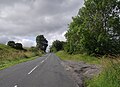
 Cox Green Road (geograph 3290204).jpg 1,024 × 682; 637 KB
-
 Cox Green Road, Egerton (geograph 4350861).jpg 2,669 × 1,998; 3.82 MB
-
 Cox Green Road, Egerton (geograph 4350864).jpg 640 × 477; 101 KB
-
 Cycleway at Bradley Fold (geograph 3331096).jpg 4,000 × 2,664; 5.52 MB
-
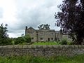
 Dearden Fold Farm-geograph.org.uk-2580023.jpg 3,250 × 2,000; 2.92 MB
-
 Derelict Mill (geograph 2356909).jpg 3,570 × 2,579; 3.83 MB
-
 Dinckley Brook.jpg 1,024 × 768; 827 KB
-
 Disused quarry and rocky outcrop (geograph 3290223).jpg 1,024 × 682; 533 KB
-

-
 Euxton Parish Church (geograph 2954367).jpg 4,000 × 3,000; 7.1 MB
-
 Immanuel Parish Church (geograph 3551719).jpg 1,024 × 768; 575 KB
-

-
 Footpath at Cox Green (geograph 3290199).jpg 1,024 × 682; 788 KB
-
 From the churchyard, Whittington (geograph 4177592).jpg 4,000 × 3,000; 5.91 MB
-
 Garden centre at Bradley Fold (geograph 3331104).jpg 1,024 × 682; 461 KB
-
 Hacking Hall Farm (geograph 2960648).jpg 3,760 × 2,206; 3.5 MB
-
 Hesketh End (geograph 4581138).jpg 1,024 × 768; 717 KB
-
 Higherford Old Bridge (geograph 4125343).jpg 1,280 × 960; 1.47 MB
-
 Hollin Farm, Roughlee (geograph 3034988).jpg 1,024 × 768; 538 KB
-
 Looking down to the Ribble (geograph 2630492).jpg 640 × 480; 115 KB
-
 Loud Mytham Bridge (geograph 2965194).jpg 4,000 × 3,000; 7.33 MB
-
 Monton Unitarian Church (geograph 3403817).jpg 1,024 × 682; 717 KB
-
 Osbaldeston Hall.jpg 4,000 × 3,000; 5.33 MB
-
 Path in the Chinese Gardens, Rivington-geograph-3984541-by-Phil-Platt.jpg 768 × 1,024; 763 KB
-
 Queen Victoria, Blackburn.jpg 640 × 480; 85 KB
-
 Radcliffe Tower (geograph 3730705).jpg 1,024 × 737; 480 KB
-
 Raw Riding Farm, Tatham (geograph 4189990).jpg 4,000 × 3,000; 5.34 MB
-
 Road into York (geograph 2544729).jpg 4,000 × 3,000; 4.8 MB
-
 Road out of York (geograph 2544724).jpg 2,831 × 2,049; 2.65 MB
-
 Seven Arched Bridge-geograph-3984556-by-Phil-Platt.jpg 768 × 1,024; 676 KB
-
 Spread Eagle at Eagley (geograph 2752930).jpg 4,000 × 3,000; 5.02 MB
-
 St Columba's Church, Warcop (2).jpg 1,280 × 959; 967 KB
-
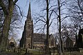
 St Mary's Church, Euxton.jpg 3,902 × 2,866; 4.83 MB
-
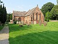
 St Michael's Church, Croston.jpg 1,024 × 768; 751 KB
-
 St. Georges Street, Chorley (geograph 2522985).jpg 4,000 × 3,000; 4.93 MB
-
 St. John the Baptist, Low Bentham (geograph 3113629).jpg 2,748 × 2,020; 1.86 MB
-
 St. Michael the Archangel, Whittington (geograph 4177589).jpg 4,000 × 3,000; 5.05 MB
-
 St. Oswalds church, Lower Peover (geograph 4474412).jpg 1,024 × 768; 718 KB
-
 Church of St. James the Less, Tatham (geograph 4189995).jpg 4,000 × 3,000; 5.66 MB
-
 The Buck, Paythorne (geograph 2630463).jpg 3,447 × 2,243; 7.85 MB
-
 The Square, Whalley.jpg 4,000 × 2,421; 3.78 MB
-
 Top of Quarlton Farmhouse.jpg 4,000 × 3,000; 5.53 MB
-
 Whittington from the churchyard (geograph 4177594).jpg 4,000 × 3,000; 6.76 MB
-
 Wigan Town Hall (geograph 3739878).jpg 1,024 × 722; 463 KB

.jpg)


.jpg)
.jpg)
.jpg)
.jpg)
.jpg)
.jpg)

.jpg)

.jpg)

.jpg)
.jpg)

.jpg)
.jpg)
.jpg)
.jpg)
.jpg)
.jpg)
.jpg)
.jpg)
.jpg)
.jpg)


.jpg)
.jpg)
.jpg)
.jpg)

.jpg)
.jpg)


.jpg)
.jpg)
.jpg)
.jpg)
.jpg)
.jpg)


.jpg)
.jpg)