Category:Images by Neil Theasby
Jump to navigation
Jump to search

Media in category "Images by Neil Theasby"
The following 200 files are in this category, out of 354 total.
(previous page) (next page)-
 "Moggie Thou" in Minting (geograph 4375155).jpg 3,745 × 4,995; 5.38 MB
-
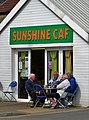 "Sunshine Caf" in Withernsea (geograph 4988004).jpg 3,170 × 4,275; 2.77 MB
-
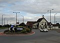 "The Bluebell Inn" and roundabout in Blaxton (geograph 5106310).jpg 4,953 × 3,566; 2.57 MB
-
 "The Coach and Horses" at Dunswell (geograph 4506539).jpg 4,435 × 3,558; 3.77 MB
-
 "The Cross Keys", Fletchergate, Nottingham (geograph 2239918).jpg 2,375 × 1,775; 1.55 MB
-
 "The Duke of York" at Pomeroy - geograph.org.uk - 3665029.jpg 3,551 × 2,537; 1.97 MB
-
 "The Hope and Anchor", Pontefract (geograph 4401637).jpg 4,754 × 3,610; 4.14 MB
-
 "The Liquorice Bush" public house, Pontefract (geograph 4401405).jpg 3,733 × 4,983; 4.49 MB
-
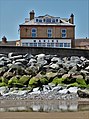 "The Marine Hotel", North Promenade, Withernsea (geograph 4986190).jpg 3,617 × 4,850; 4.17 MB
-
 "The Sebastopol" pub-restaurant, Minting (geograph 4375145).jpg 3,790 × 5,050; 5.26 MB
-
 "Tom Foolery" in Boston Spa (geograph 5883419).jpg 5,090 × 3,706; 3.92 MB
-
 "Where Have You Been?", River Witham, Lincoln (geograph 7002267).jpg 4,961 × 3,687; 3.76 MB
-
 -2016-01-30 Chadwick's Black Pudding Stall, Bury Market.jpg 5,064 × 3,888; 6.01 MB
-
 158 Squadron Memorial at Lissett (geograph 7206938).jpg 4,711 × 3,322; 3.38 MB
-
 A distant view of Beverley Minster (geograph 6196162).jpg 4,957 × 3,637; 4.63 MB
-
 A field drain - Asselby Marsh (geograph 3921816).jpg 1,944 × 2,592; 2.8 MB
-
 A glimpse of Hooton Pagnell Hall.jpg 3,561 × 4,638; 3.97 MB
-
 A view of Abdy Farm (geograph 3249891).jpg 4,473 × 2,684; 2.79 MB
-
 A view of Darlington Clock Tower (geograph 6221321).jpg 957 × 1,213; 275 KB
-
 Abington Church, County Limerick (geograph 2544670).jpg 1,952 × 2,608; 1.37 MB
-
 Agden Reservoir from Bailey Hill - geograph.org.uk - 1735724.jpg 2,608 × 1,952; 1.31 MB
-
 Albert Road, Goldthorpe (geograph 4588589).jpg 4,958 × 3,608; 4.51 MB
-
 All Saints Church, Kilnwick (geograph 7166883).jpg 5,089 × 3,670; 3.87 MB
-
 All Saints Church, Pontefract (geograph 4401653).jpg 5,053 × 3,716; 4.72 MB
-
 Allison Lane, Ulrome (geograph 7206948).jpg 5,035 × 3,623; 4.57 MB
-
 An old milestone by Houndkirk Road (geograph 6440396).jpg 3,597 × 4,838; 4.75 MB
-
 Anglesboro Village Hall (geograph 2544084).jpg 2,393 × 1,795; 939 KB
-
 Approaching Beverley Pastures - The Westwood (geograph 4322285).jpg 5,121 × 3,596; 4.4 MB
-
 At Agden Reservoir, Bradfield - geograph.org.uk - 1735694.jpg 2,608 × 1,952; 1.88 MB
-
 At Beverley Grammar School (geograph 3210604).jpg 4,311 × 2,587; 2.91 MB
-
 At Dowlow Limestone Works (geograph 3665073).jpg 3,648 × 2,736; 2.54 MB
-
 At Loftsome Bridge (geograph 3921798).jpg 2,509 × 1,882; 2.22 MB
-
 At the entrance of Moat Farm, Welwick (geograph 4987991).jpg 3,888 × 5,184; 5.79 MB
-
 At the Royal Station in Wolferton (geograph 5537742).jpg 3,652 × 5,082; 3.37 MB
-
 At Wolferton Station looking to St Peters Church (geograph 5545953).jpg 3,301 × 2,379; 1.69 MB
-
 Barkly News, Beeston, Leeds (geograph 5800784).jpg 3,791 × 4,497; 3.28 MB
-
 Barlborough Hall.jpg 640 × 427; 99 KB
-
 Barley Mow Kirk Ireton Geograph-3554037-by-Neil-Theasby.jpg 3,286 × 2,629; 1.61 MB
-
 Barley ripening on Ella Hill, Yorkshire Wolds (geograph 7227892).jpg 5,049 × 3,787; 4.81 MB
-
 Barlow Woodseats Geograph-2940205-by-Neil-Theasby.jpg 4,267 × 2,845; 2.56 MB
-
 Barncliff Stoop (geograph 6115536).jpg 3,560 × 4,776; 4.32 MB
-
 Barsalloch Fort (geograph 5833723).jpg 5,184 × 3,888; 5.81 MB
-
 Battersea Town Hall (clipped).jpg 4,409 × 2,558; 2.5 MB
-
 Battersea Town Hall - geograph-6170992.jpg 4,834 × 3,522; 3.39 MB
-

-
 Beck Road-Hartley Brook Road junction, Shiregreen (geograph 2662627).jpg 2,365 × 1,774; 940 KB
-
 Bennett's Cross, Dartmoor (geograph 4548087).jpg 3,888 × 5,184; 6.52 MB
-
 Beverley Grammar School (geograph 3210599).jpg 4,075 × 2,911; 2.67 MB
-
 Billy Bremner statue outside Leeds Uniteds stadium (geograph 5801013).jpg 4,805 × 3,623; 2.68 MB
-
 Blue house at New York - geograph.org.uk - 6607104.jpg 4,547 × 3,148; 2.63 MB
-
 Boulder clay cliffs at Highlands (geograph 7206984).jpg 5,129 × 3,540; 4.13 MB
-
 Bradbourne Brook - The Ford (geograph 4520412).jpg 3,888 × 5,184; 6.37 MB
-
 Branton Mill - seen across the M18 motorway (geograph 6823535).jpg 4,858 × 3,510; 3.33 MB
-
 Bridge over The River Tees (geograph 6272110).jpg 4,851 × 3,585; 4.35 MB
-
 Bridlington Road, Skipsea (geograph 7207221).jpg 4,835 × 3,549; 3.21 MB
-
 Brincliffe Towers in Chelsea Park, Sheffield (geograph 2873405).jpg 4,130 × 2,754; 2.44 MB
-
 Broadway - Not New York City - Brinsworth, Rotherham - geograph.org.uk - 2620609.jpg 1,952 × 2,608; 1.21 MB
-
 Bullock scratching itself - Hathersage Moor (geograph 5466353).jpg 4,662 × 3,458; 4.49 MB
-
 By Rainsbutt Road looking north (geograph 6936740).jpg 3,732 × 4,965; 4.98 MB
-
 By the Methodist Chapel in Brough Sowerby, Westmorland - geograph-5502709.jpg 4,932 × 3,587; 3.59 MB
-
 Caravan perched on the clifftop (geograph 7206969).jpg 5,026 × 3,522; 4.19 MB
-
 Cardiff International Athletics Stadium (geograph 3859170).jpg 5,055 × 3,371; 3.33 MB
-
 Carlton in Lindrick Parish Church (geograph 4615084).jpg 3,888 × 4,989; 5.53 MB
-
 Cattle on the earthworks of Skipsea Castle (geograph 7207082).jpg 4,828 × 3,462; 3.78 MB
-
 Cavendish coat of arms on western facade of Chatsworth House.jpg 3,888 × 4,750; 4.89 MB
-
 Chaloner Street, Guisborough (geograph 5429850).jpg 5,184 × 3,888; 7 MB
-
 Chapel Street, Longnor-geograph-2861017-by-Neil-Theasby.jpg 2,832 × 4,248; 2.73 MB
-
 Chesterfield Parish Church geograph-5215067-by-Neil-Theasby.jpg 3,569 × 4,692; 4.11 MB
-
 Christ Church in Stannington (geograph 4391795).jpg 4,828 × 3,649; 4.61 MB
-
 Christ Church, seen from the lychgate (geograph 6390515).jpg 3,655 × 4,813; 3 MB
-
 Church of Mary, Mother of God, Ballygarvan, County Cork (geograph 2566466).jpg 2,437 × 1,828; 868 KB
-
 Church of The Immaculate Conception, Spinkhill by Neil Theasby Geograph 3182878.jpg 4,282 × 2,855; 2.43 MB
-
 Church Path Cottage and St Johns Church, Kenn (geograph 1966382).jpg 2,608 × 1,952; 1.38 MB
-

-
 Clifford's Tower, York in 1959 - geograph.org.uk - 3219038.jpg 640 × 427; 64 KB
-
 Clifftop vegetation above Barmston Sands (geograph 7206998).jpg 5,012 × 3,519; 4.15 MB
-
 Coalpit Bridge over River Lathkill.jpg 2,608 × 1,952; 1.81 MB
-
 Come on England! (geograph 5800721).jpg 5,183 × 3,762; 4.94 MB
-
 Coronavirus closure notice (geograph 6428511).jpg 4,590 × 3,568; 2.48 MB
-
 Cottage garden in Midhopestones (geograph 3686807).jpg 3,506 × 2,505; 1.87 MB
-
 Cottage in the hamlet of Belph (geograph 5990414).jpg 4,957 × 3,483; 2.98 MB
-

-
 Cowburn Tunnel Air Shaft No 2 sign (geograph 4187773).jpg 2,592 × 1,944; 2.01 MB
-
 Cowburn Tunnel Air Shaft Number 2 (geograph 4187767).jpg 2,488 × 1,659; 579 KB
-
 Crosby Hall, Little Crosby (geograph 4072617).jpg 2,462 × 1,759; 1.35 MB
-
 Dale Dyke Reservoir from the south - geograph.org.uk - 1743850.jpg 2,608 × 1,952; 1.5 MB
-
 Deer Park Flats, Stannington (geograph 5259050).jpg 4,831 × 3,603; 3.46 MB
-
 Derelict church on Cork Road, Ballylanders (geograph 2544263).jpg 1,952 × 2,608; 1.12 MB
-
 Derwent Woodlands War Memorial (geograph 4741876).jpg 3,751 × 5,013; 5.86 MB
-
 Detail of the 158 Squadron Memorial at Lissett (geograph 7211044).jpg 2,539 × 3,349; 1.63 MB
-

-
 Distinctive milestone in Aldeburgh (geograph 5892991).jpg 4,886 × 3,655; 4.06 MB
-
 Drain west of Willingham by Stow - geograph.org.uk - 1701635.jpg 2,608 × 1,952; 1.44 MB
-
 Dunflat Road near Risby (geograph 7160673).jpg 4,921 × 3,465; 3.7 MB
-
 East of Graythorp Industrial Estate (geograph 5432358).jpg 4,914 × 3,742; 4.13 MB
-
 Eighteenth century milepost by Houndkirk Road (geograph 5993341).jpg 4,942 × 3,553; 5.45 MB
-
 Eighteenth century milestone by Houndkirk Road (geograph 5994529).jpg 3,742 × 5,038; 4.86 MB
-
 Eldon Hole, a Wonder of the Peak - geograph-3462326.jpg 2,636 × 3,514; 1.89 MB
-
 Elvington Village Green with Maypole - geograph.org.uk - 5850452.jpg 663 × 446; 119 KB
-
 Ely's "lantern". Interior view. - geograph.org.uk - 1709404.jpg 2,608 × 1,952; 1.44 MB
-
 Entrance of Robin Hood's Cave on Stanage Edge, Derbyshire - geograph-3466490.jpg 3,229 × 2,583; 1.82 MB
-
 Entrance to Peak Cavern, Castleton - geograph.org.uk - 1652866.jpg 640 × 479; 81 KB
-
 Evidence of old mine workings west of Middleton (geograph 4563276).jpg 3,888 × 5,184; 6.79 MB
-
 Fairfield Church - geograph.org.uk - 1484754.jpg 640 × 479; 49 KB
-
 Farm buildings north of Penistone Road, Bradfield - geograph.org.uk - 1735681.jpg 2,608 × 1,952; 1.13 MB
-
 Farm track on Asselby Marsh (geograph 3921808).jpg 2,592 × 1,944; 2.32 MB
-
 Farm track west of Littlewood Farm (geograph 7227910).jpg 3,888 × 5,184; 4.08 MB
-
 Farming land north of Clay Farm - geograph.org.uk - 1701622.jpg 2,608 × 1,952; 1.15 MB
-
 February in Roughton churchyard (geograph 4831128).jpg 3,888 × 5,184; 6.38 MB
-
 Fenny Bentley church south face GeoUK 4855067.jpg 991 × 877; 129 KB
-
 Fields south of Springthorpe Grange - geograph.org.uk - 1701647.jpg 2,608 × 1,952; 1.35 MB
-
 Fisherman In Repose (geograph 4267035).jpg 5,184 × 3,888; 6.36 MB
-
 Fisherman's Hut at Dungeness - geograph.org.uk - 1483767.jpg 640 × 479; 84 KB
-
 Footbridge over Barmston Main Drain (geograph 7207061).jpg 5,049 × 3,596; 5.83 MB
-
 Footpath sign with Lose Hill beyond it (geograph 6751996).jpg 5,002 × 3,694; 4.16 MB
-
 Forever Bury (geograph 4810541).jpg 4,950 × 3,104; 3.63 MB
-
 Formby railway station from the south (geograph 5115833).jpg 5,184 × 3,888; 6.68 MB
-
 Former coastguard cottages at Ulrome (geograph 7206965).jpg 5,184 × 3,888; 5.42 MB
-
 Former Methodist Church in New York - geograph.org.uk - 6608527.jpg 4,768 × 3,433; 2.86 MB
-
 Fountains Abbey from the East - geograph.org.uk - 1622330.jpg 640 × 479; 58 KB
-
-
 Gatehouse at Four Lane Ends, Sandbeck Park.jpg 5,027 × 3,714; 4.48 MB
-
 Gatepost (1672) in field south west of Rocher Edge - geograph.org.uk - 1735707.jpg 2,608 × 1,952; 2.17 MB
-
 Gatepost with box plant (geograph 5805060).jpg 3,782 × 4,908; 3.96 MB
-
 Gates to Kilnwick Old Hall (geograph 7166878).jpg 4,998 × 3,367; 4.08 MB
-
 Gateway to Ballylanders Gaelic A.A. playingfield (geograph 2544253).jpg 2,608 × 1,952; 916 KB
-
 Gisborough Hall east of Guisborough (geograph 5429857).jpg 5,053 × 3,699; 5.15 MB
-
 Goal kick at Gigg Lane (geograph 4810543).jpg 4,876 × 3,519; 3.4 MB
-

-
 The Church of St Michael and All Angels (geograph 4486359).jpg 640 × 480; 55 KB
-
 Grimethorpe Hall in September 2016 (geograph 5127290) (cropped).jpg 2,256 × 1,544; 1,009 KB
-
 Grimethorpe Hall in September 2016 (geograph 5127290).jpg 4,889 × 3,579; 4.45 MB
-

-
 Gritstone wall in Malcoff (geograph 3703840).jpg 3,570 × 4,997; 5.11 MB
-
 Groudle Station - Manx Electric Railway (geograph 4879874).jpg 4,204 × 3,309; 4.99 MB
-
 Guardian of the Path (geograph 6442559).jpg 4,956 × 3,545; 5.89 MB
-
 Has there been a flood? (geograph 6279837).jpg 4,900 × 3,278; 2.96 MB
-
 Hassop Hall Hotel (Geograph-3560912 by Neil Theasby).jpg 3,521 × 2,641; 1.8 MB
-
 Head of a suburban fox (geograph 4602920).jpg 4,335 × 3,691; 5.13 MB
-
 High Bradfield viewed from Agden Dam - geograph.org.uk - 1735711.jpg 2,608 × 1,952; 1.23 MB
-
 High Hazels House, High Hazels Park, Sheffield - geograph.org.uk - 2620538.jpg 2,413 × 1,810; 1.21 MB
-
 Hillsborough - the transport interchange (geograph 5239783).jpg 3,714 × 5,096; 3.72 MB
-
 Hillsborough Barracks (geograph 5239781).jpg 4,984 × 3,554; 2.52 MB
-
 Hodgson Tower Birmingham.jpg 2,316 × 3,165; 6.39 MB
-
 Hodgson Tower in Newtown, Birmingham (geograph 4685585).jpg 3,696 × 5,050; 5.23 MB
-
 Holmesfield - Church, Pub-Restaurant and Coronation Garden - geograph.org.uk - 1756617.jpg 1,952 × 2,608; 1.49 MB
-
 Holmgate House, Holmgate (geograph 3959706).jpg 2,322 × 1,858; 2.16 MB
-
 Horse riders on York Lane, Morthen (geograph 3487071).jpg 3,544 × 2,532; 2.1 MB
-
 House on Main Street, Ulrome (geograph 7206959).jpg 4,847 × 3,457; 3.32 MB
-
 Houses in the Broadgate development near Walkington (geograph 4266920).jpg 5,077 × 3,627; 4.05 MB
-
 Houses on Fore Street, Silverton (geograph 4549349).jpg 5,184 × 3,888; 7.03 MB
-
 Houses on Main Street, Asselby (geograph 3921825).jpg 2,590 × 1,850; 1.66 MB
-
 Humberston North Sea Lane Station - geograph.org.uk - 4224012.jpg 3,458 × 2,501; 1.8 MB
-
 Ilam Church from Ilam Hall-geograph-3542149-by-Neil-Theasby.jpg 3,322 × 2,658; 1.51 MB
-
-
 Inside John Smith's Stadium (geograph 4900417).jpg 5,011 × 3,498; 4.8 MB
-
 Inside St Mary's Church, Welwick (geograph 4987996).jpg 3,825 × 5,101; 4.57 MB
-
 Interior of St Annes Church Ellerker.jpg 4,402 × 2,935; 2.54 MB
-
 Kelso Town Hall (geograph 3632691).jpg 2,642 × 3,522; 1.92 MB
-
 Kilnwick Beck (geograph 7166881).jpg 5,184 × 3,888; 6.45 MB
-
 Knedlington Old Hall (Grade II* listed) (geograph 3921839).jpg 2,592 × 1,944; 2.34 MB
-
 Leader, High Bradfield - geograph.org.uk - 4059201.jpg 2,282 × 1,826; 2.02 MB
-
 Leeds 62 Miles (geograph 4238933).jpg 3,536 × 2,655; 2.29 MB
-
 Lewes seen from its eastern down - geograph.org.uk - 1656832.jpg 640 × 479; 87 KB
-
 Lincolnshire countryside south of Tiger Holt wood - geograph.org.uk - 1701614.jpg 2,608 × 1,952; 1.98 MB
-
 Littlewood Road (geograph 7227906).jpg 3,787 × 5,049; 4.12 MB
-
 Littlewood Road at a farm junction (geograph 7227915).jpg 5,108 × 3,860; 4.73 MB
-
-

-
 Low Field Lane (geograph 7157797).jpg 4,928 × 3,436; 3.96 MB
-
 Low to High Bradfield - geograph.org.uk - 4059203.jpg 1,942 × 2,428; 1.69 MB
-
 Lunchtime drinker in "The Old Red Cow" (geograph 4934786).jpg 4,504 × 3,587; 2.81 MB
-
 Lych Gate and Cemetery, Hooton Pagnell.jpg 4,962 × 3,593; 5.11 MB
-
 Main Tower - Fountains Abbey - geograph.org.uk - 1622324.jpg 479 × 640; 58 KB
-
 Megalithic Tomb, Duntryleague (geograph 2544297).jpg 1,753 × 2,337; 1,013 KB
-
 Memorial fountain on Welton Green (geograph 6279829).jpg 5,144 × 3,752; 5.04 MB
-
 Memorial Plaque, Beverley Grammar School (geograph 3210611).jpg 2,760 × 3,864; 2.9 MB
-
 Mersea Barrow, Mersea Island, Essex - geograph-4422803.jpg 5,184 × 3,888; 6.34 MB
-
 Mid summer vegetation by Thievesdale Wood (geograph 4616179).jpg 3,888 × 5,184; 6.82 MB
-
 Middlehowe Road near Walkington (geograph 7227904).jpg 3,888 × 5,184; 4.92 MB
-
 Milepost at Clough Green (geograph 5056762).jpg 3,279 × 4,591; 3.61 MB
-
 Milepost in High Ackworth (geograph 4408847).jpg 5,015 × 3,727; 5.29 MB
-
 Milepost north of High Bradfield (geograph 5664761).jpg 3,888 × 5,184; 4.98 MB
-
 Milestone at Bramhope near Leeds (geograph 2569298).jpg 2,608 × 1,952; 1.4 MB
-
 Milestone by Derby Road south of Wirksworth (geograph 6991948).jpg 5,184 × 3,758; 6.08 MB
-
 Milestone Number 5, Wyming Brook Farm (geograph 6115539).jpg 5,184 × 3,888; 5.53 MB
-
 Model aeroplane at Stanage (geograph 3819646).jpg 4,541 × 3,243; 2.65 MB
-
 Monk Bretton Priory - A view of The Gatehouse (geograph 4448005).jpg 3,596 × 4,960; 4.89 MB
-
 Mountain hare above Far Fork Grain (geograph 5822336).jpg 3,444 × 4,740; 2.83 MB
-
 Neglected iron milepost at Windy Knoll (geograph 7050096).jpg 3,888 × 5,184; 4.91 MB
-
 Neglected old wing at Bassetlaw Hospital (geograph 4821335).jpg 5,034 × 3,665; 4.95 MB
-
 New York Scrapyard, Rotherham - geograph.org.uk - 3084651.jpg 4,232 × 3,023; 2.73 MB
-
 Newark marketplace from the town hall (geograph 2589501).jpg 2,452 × 1,835; 994 KB
-
 North Field, Ulrome (geograph 7207045).jpg 5,067 × 3,801; 5.6 MB
-
 North gate to Renishaw Hall-geograph-3163501-by-Neil-Theasby.jpg 4,488 × 2,693; 3.39 MB
-
 North of Linacre Wood (geograph 5925947).jpg 5,023 × 3,692; 5.52 MB
-
 Noster View, Beeston (geograph 5800736).jpg 4,950 × 3,673; 3.39 MB
-
 Old Cragg Hall (geograph 5708914).jpg 4,992 × 3,667; 5.54 MB
-
 Old guide post at the head of Burnt Hill Lane (geograph 5914430).jpg 4,838 × 3,535; 4.37 MB
-
 Old guide post on Onesmoor Road (geograph 5914444).jpg 4,884 × 3,562; 4.85 MB
.jpg)
.jpg)
.jpg)
.jpg)
.jpg)

.jpg)
.jpg)
.jpg)
.jpg)
.jpg)
.jpg)

.jpg)
.jpg)
.jpg)

.jpg)
.jpg)
.jpg)

.jpg)
.jpg)
.jpg)
.jpg)
.jpg)
.jpg)
.jpg)

.jpg)
.jpg)
.jpg)
.jpg)
.jpg)
.jpg)
.jpg)


.jpg)

.jpg)
.jpg)
.jpg)


.jpg)
.jpg)
.jpg)
.jpg)

.jpg)
.jpg)
.jpg)
.jpg)
.jpg)
.jpg)

.jpg)
.jpg)

.jpg)
.jpg)
.jpg)
.jpg)

.jpg)


.jpg)
.jpg)
.jpg)

.jpg)


.jpg)

.jpg)
.jpg)
.jpg)
.jpg)

.jpg)
.jpg)
.jpg)

.jpg)
.jpg)
.jpg)
.jpg)

.jpg)

.jpg)
.jpg)
.jpg)
.jpg)


.jpg)


.jpg)
.jpg)

.jpg)


.jpg)

.jpg)
.jpg)
.jpg)
.jpg)
.jpg)


_in_field_south_west_of_Rocher_Edge_-_geograph.org.uk_-_1735707.jpg)
.jpg)
.jpg)
.jpg)
.jpg)
.jpg)

.jpg)
_(cropped).jpg)
.jpg)

.jpg)
.jpg)
.jpg)
.jpg)
.jpg)
.jpg)


.jpg)

.jpg)

.jpg)
.jpg)
.jpg)
.jpg)
.jpg)
.jpg)


.jpg)
.jpg)

.jpg)
.jpg)
_(geograph_3921839).jpg)

.jpg)


.jpg)
.jpg)


.jpg)

.jpg)


.jpg)
.jpg)
.jpg)

.jpg)
.jpg)
.jpg)
.jpg)
.jpg)
.jpg)
.jpg)
.jpg)
.jpg)
.jpg)
.jpg)
.jpg)
.jpg)

.jpg)
.jpg)

.jpg)
.jpg)
.jpg)
.jpg)
.jpg)
.jpg)