Category:Images by Mick Melvin
Jump to navigation
Jump to search

Media in category "Images by Mick Melvin"
The following 200 files are in this category, out of 266 total.
(previous page) (next page)-
 Air Shaft at Thornton Moor Denholme - geograph.org.uk - 40364.jpg 640 × 480; 105 KB
-
 Aire and Calder Navigation - geograph.org.uk - 39774.jpg 640 × 480; 65 KB
-
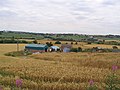
 Aire View Farm - geograph.org.uk - 40333.jpg 640 × 480; 92 KB
-
 Almscliff Crag North West Face - geograph.org.uk - 30317.jpg 640 × 480; 69 KB
-
 Almscliff Crags - geograph.org.uk - 30316.jpg 640 × 480; 69 KB
-
 Alverthorpe Wakefield - geograph.org.uk - 31072.jpg 640 × 541; 74 KB
-
 Angram Reservoir - geograph.org.uk - 21341.jpg 640 × 480; 89 KB
-
 Angram Reservoir - geograph.org.uk - 25968.jpg 640 × 480; 95 KB
-
 Angram Reservoir 21459.jpg 640 × 480; 60 KB
-
 Apperley Bridge - geograph.org.uk - 16216.jpg 640 × 480; 84 KB
-
 Approaching Whitendale Farm - geograph.org.uk - 39967.jpg 640 × 480; 128 KB
-
 Aqueduct East Budleigh - geograph.org.uk - 23425.jpg 640 × 480; 129 KB
-
 Askwith Community Primary School - geograph.org.uk - 27210.jpg 640 × 465; 80 KB
-
 Batley - geograph.org.uk - 31043.jpg 640 × 480; 79 KB
-
 Beatrix Farm Bowland - geograph.org.uk - 39947.jpg 640 × 480; 81 KB
-
 Beaver Dyke Reservoir - geograph.org.uk - 16488.jpg 640 × 480; 94 KB
-
 Black Hill Holme Moss - geograph.org.uk - 21329.jpg 640 × 480; 107 KB
-
 Bland Hill - geograph.org.uk - 17649.jpg 640 × 480; 116 KB
-
 Bottom Boat Wakefield - geograph.org.uk - 39758.jpg 640 × 443; 102 KB
-
 Brackenthwaite North Yorkshire - geograph.org.uk - 30321.jpg 640 × 480; 91 KB
-
 Bradford Cathedral.jpg 640 × 472; 101 KB
-
 Bradford City Centre - geograph.org.uk - 17036.jpg 640 × 525; 143 KB
-
 Brandy Head - geograph.org.uk - 23429.jpg 640 × 480; 84 KB
-
 Bridge over the River Skell - geograph.org.uk - 20280.jpg 640 × 480; 162 KB
-
 Budleigh Salterton - geograph.org.uk - 23417.jpg 640 × 480; 75 KB
-
 Burnsall Bridge - geograph.org.uk - 16736.jpg 640 × 480; 113 KB
-
 Car Park Chapel Cave Malham - geograph.org.uk - 21274.jpg 640 × 480; 125 KB
-
 Chapel at Brown Bank - geograph.org.uk - 16489.jpg 640 × 480; 79 KB
-
 Coach House St.Ives estate Bingley - geograph.org.uk - 40330.jpg 640 × 480; 75 KB
-
 Cockersdale - geograph.org.uk - 31826.jpg 640 × 480; 114 KB
-
 Cockersdale Village Gildersome - geograph.org.uk - 31829.jpg 640 × 482; 73 KB
-
 Countess Wear Bridge - geograph.org.uk - 23531.jpg 640 × 480; 89 KB
-
 Croasdale Bowland.jpg 640 × 480; 91 KB
-
 Dalesway - geograph.org.uk - 20700.jpg 640 × 480; 133 KB
-
 Darnbrook Cowside Beck - geograph.org.uk - 21323.jpg 640 × 480; 94 KB
-
 Devon Cliffs Holiday Park - geograph.org.uk - 23404.jpg 640 × 480; 64 KB
-
 Digley Reservoir - geograph.org.uk - 21212.jpg 640 × 480; 88 KB
-
 Dogloitch Wood - geograph.org.uk - 31059.jpg 640 × 480; 103 KB
-
 Duckett's crossing - geograph.org.uk - 25340.jpg 640 × 480; 78 KB
-
 Duke's Hill - geograph.org.uk - 29488.jpg 640 × 480; 86 KB
-
 Dunsop Head Bowland - geograph.org.uk - 39953.jpg 640 × 480; 93 KB
-
 Eavestone Lake - geograph.org.uk - 20288.jpg 640 × 480; 153 KB
-
 Eccup Reservoir Lodge - geograph.org.uk - 20705.jpg 640 × 480; 84 KB
-
 Exeter Canal Double locks - geograph.org.uk - 23527.jpg 640 × 480; 115 KB
-
 Fagley Wood - geograph.org.uk - 24925.jpg 640 × 480; 149 KB
-
 Fagley Wood - geograph.org.uk - 24927.jpg 640 × 480; 109 KB
-
 Falls Foot Ingleborough - geograph.org.uk - 21176.jpg 640 × 480; 129 KB
-
 Flappit Spring - geograph.org.uk - 40350.jpg 640 × 421; 69 KB
-
 Fleakingley Bridge - geograph.org.uk - 39785.jpg 640 × 480; 155 KB
-
 Ghaistrill's Strid Grassington - geograph.org.uk - 17112.jpg 640 × 480; 142 KB
-
 Gorpley Clough - geograph.org.uk - 17145.jpg 640 × 480; 180 KB
-
 Grimwith Reservoir - geograph.org.uk - 21422.jpg 640 × 480; 78 KB
-
 Hag Dyke Kettlewell - geograph.org.uk - 21339.jpg 640 × 480; 108 KB
-
 Hainworth Shaw Keighley - geograph.org.uk - 40331.jpg 640 × 527; 77 KB
-
 Hainworth Village - geograph.org.uk - 40339.jpg 640 × 517; 132 KB
-
 Halifax Road - geograph.org.uk - 16160.jpg 640 × 480; 131 KB
-
 Harewood House - geograph.org.uk - 20701.jpg 640 × 480; 100 KB
-
 Harter Fell Summit Cairn - geograph.org.uk - 35508.jpg 640 × 480; 91 KB
-
 Hazelwood Moor shooting hut - geograph.org.uk - 21410.jpg 640 × 480; 141 KB
-
 Hern Point Rock - geograph.org.uk - 23443.jpg 640 × 480; 99 KB
-
 Hey Beck, West Ardsley - geograph.org.uk - 31061.jpg 640 × 480; 171 KB
-
 High Grantley Village Hall - geograph.org.uk - 20287.jpg 640 × 480; 78 KB
-
 Hilltop Eavestone - geograph.org.uk - 20284.jpg 640 × 480; 168 KB
-
 Holdgate farm, Emmerdale Village - geograph.org.uk - 17124.jpg 640 × 480; 106 KB
-
 Howden Clough - geograph.org.uk - 31037.jpg 640 × 480; 174 KB
-
 Howley Hall - geograph.org.uk - 31041.jpg 640 × 480; 80 KB
-
 Ingleborough.jpg 640 × 480; 77 KB
-
 John O' Gaunt's Castle - geograph.org.uk - 16486.jpg 640 × 480; 88 KB
-

-
 Kentmere Pike.jpg 640 × 480; 87 KB
-
 Kilnsey Wharfedale - geograph.org.uk - 17108.jpg 640 × 480; 111 KB
-
 Ladram Bay - geograph.org.uk - 23438.jpg 640 × 480; 69 KB
-
 Ladram Rocks - geograph.org.uk - 23436.jpg 640 × 480; 82 KB
-
 Lady Blantyre's Rock St. Ives Bingley - geograph.org.uk - 40326.jpg 640 × 480; 155 KB
-
 Linton in Craven - geograph.org.uk - 16731.jpg 640 × 480; 141 KB
-
 Littleham Cove - geograph.org.uk - 23403.jpg 640 × 480; 88 KB
-
 Lord's Seat, Barden Fell - geograph.org.uk - 21413.jpg 640 × 480; 82 KB
-
 Low Dam near the River Washburn - geograph.org.uk - 28243.jpg 640 × 480; 142 KB
-
 Lower Park Farm - geograph.org.uk - 31063.jpg 640 × 566; 87 KB
-
 M1 Motorway West Yorkshire - geograph.org.uk - 31068.jpg 640 × 480; 70 KB
-
 M62 Motorway - geograph.org.uk - 39766.jpg 640 × 480; 81 KB
-
 Mannywells Cullingworth - geograph.org.uk - 40351.jpg 640 × 464; 78 KB
-
 Mardale Ill Bell Wild Horses - geograph.org.uk - 35512.jpg 640 × 480; 96 KB
-
 Markenfield Hall Gatehouse - geograph.org.uk - 16596.jpg 640 × 480; 99 KB
-
 Meregill Hole - geograph.org.uk - 21178.jpg 480 × 640; 174 KB
-
 Methley Lanes - geograph.org.uk - 39762.jpg 640 × 454; 58 KB
-
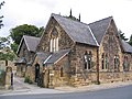
 Methodist Chapel Clifton Near Otley - geograph.org.uk - 27206.jpg 640 × 480; 128 KB
-
 Mossdale Caverns - geograph.org.uk - 16587.jpg 640 × 480; 107 KB
-
 Mossdale Memorial Plaque - geograph.org.uk - 16590.jpg 640 × 480; 76 KB
-
 Nape's Hill Stainburn - geograph.org.uk - 30310.jpg 640 × 480; 78 KB
-
 Norwood Social Hall Bland Hill - geograph.org.uk - 17597.jpg 640 × 480; 103 KB
-
 Oakworth Village - geograph.org.uk - 40342.jpg 640 × 480; 93 KB
-
 Otter Estuary - geograph.org.uk - 23428.jpg 640 × 480; 75 KB
-
 Otter Estuary Nature Reserve - geograph.org.uk - 23423.jpg 640 × 480; 91 KB
-
 Otterton East Devon - geograph.org.uk - 23427.jpg 640 × 480; 105 KB
-
 Picnic Place Scar House - geograph.org.uk - 21461.jpg 640 × 480; 88 KB
-
 Ploughed Footpath Moss Carr Farm - geograph.org.uk - 39769.jpg 640 × 480; 75 KB
-
 Pudsey Beck, Leeds.jpg 480 × 640; 123 KB
-
 Red Hall, Newton Hill Wakefield - geograph.org.uk - 31073.jpg 640 × 480; 102 KB
-
 Richard Dunn's sports centre - geograph.org.uk - 16164.jpg 640 × 480; 77 KB
-
 Riggs Moor - geograph.org.uk - 25961.jpg 640 × 480; 102 KB
-
 River Calder - geograph.org.uk - 39759.jpg 640 × 480; 112 KB
-
 Rocking Hall - geograph.org.uk - 28255.jpg 640 × 480; 91 KB
-
 Roman Road Croasdale - geograph.org.uk - 39959.jpg 640 × 480; 95 KB
-
 Salcombe Regis church - geograph.org.uk - 23542.jpg 640 × 480; 98 KB
-
 Scaly Hills Bankfoot - geograph.org.uk - 16165.jpg 640 × 480; 145 KB
-
 Scar House Moss - geograph.org.uk - 25899.jpg 640 × 480; 98 KB
-
 Scar House Reservoir - geograph.org.uk - 21457.jpg 640 × 480; 58 KB
-
 Scar House Reservoir Nidderdale - geograph.org.uk - 21455.jpg 640 × 480; 48 KB
-
 ScarHouseReservoir.jpg 640 × 480; 76 KB
-
 Scotland,Yorkshire - geograph.org.uk - 20878.jpg 640 × 480; 123 KB
-
 Sell Gill Hole Penyghent - geograph.org.uk - 21348.jpg 640 × 480; 160 KB
-
 Shiny Brook Clough - geograph.org.uk - 21215.jpg 640 × 480; 73 KB
-
 Shipley Glen Railway - geograph.org.uk - 17666.jpg 640 × 480; 178 KB
-
 Shooting Hut West Dyke - geograph.org.uk - 25911.jpg 640 × 480; 83 KB
-
 St Paul's C of E Church Wibsey - geograph.org.uk - 16157.jpg 640 × 480; 103 KB
-
 St Winefredes RC School Wibsey - geograph.org.uk - 16159.jpg 640 × 480; 82 KB
-
 St. Mary's Church Stainburn - geograph.org.uk - 30314.jpg 640 × 480; 72 KB
-
 St. Mary's Church, Conistone - geograph.org.uk - 17350.jpg 621 × 471; 250 KB
-
 Stanage Edge - geograph.org.uk - 20295.jpg 640 × 480; 87 KB
-
 Stanley Wakefield - geograph.org.uk - 39752.jpg 640 × 480; 105 KB
-
 Staples Brow Cullingworth - geograph.org.uk - 40345.jpg 640 × 504; 83 KB
-
 Statue of Thomas Chippendale - geograph.org.uk - 16460.jpg 640 × 480; 106 KB
-
 Stile at Near Comb Hill - geograph.org.uk - 29486.jpg 640 × 480; 59 KB
-
 Swinsty Reservoir - geograph.org.uk - 16463.jpg 640 × 480; 123 KB
-
 Swinsty Reservoir - geograph.org.uk - 16466.jpg 640 × 480; 70 KB
-
 Tatham Wife Hole - geograph.org.uk - 21172.jpg 640 × 480; 146 KB
-
 The Bridge Golden Acre Park - geograph.org.uk - 20718.jpg 640 × 480; 131 KB
-
 The Cairn on Harrisend Fell - geograph.org.uk - 15994.jpg 640 × 480; 73 KB
-
 The Coastal path Budleigh Salterton - geograph.org.uk - 23410.jpg 640 × 480; 95 KB
-

-
 The Floors - geograph.org.uk - 23406.jpg 640 × 480; 81 KB
-
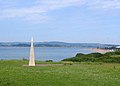 The Geoneedle at Orcombe Point Exmouth - geograph.org.uk - 23385.jpg 640 × 461; 60 KB
-
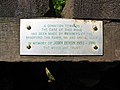 The John Dixon Plaque - geograph.org.uk - 17116.jpg 640 × 480; 95 KB
-
 The River Exe Estuary - geograph.org.uk - 23401.jpg 640 × 480; 49 KB
-
 The River Otter - geograph.org.uk - 23424.jpg 640 × 480; 130 KB
-
 The South West Coastal path - geograph.org.uk - 23402.jpg 640 × 480; 109 KB
-
 The Sun Inn - geograph.org.uk - 16471.jpg 640 × 480; 80 KB
-

-
 TheOldChurchSchoolSwillington(MickMelvin)Aug2005.jpg 640 × 480; 101 KB
-
 Thirlmere Aqueduct Whitendale.jpg 640 × 480; 128 KB
-
 Thorpe Edge Estate - geograph.org.uk - 16215.jpg 640 × 480; 124 KB
-
 Topsham Ferry - geograph.org.uk - 23536.jpg 640 × 480; 100 KB
-
 Trevor Briggs - geograph.org.uk - 20299.jpg 480 × 640; 97 KB
-
 Trough Bottom Cullingworth - geograph.org.uk - 40352.jpg 640 × 443; 78 KB
-
 Tufty Farm Gawthorpe - geograph.org.uk - 31066.jpg 640 × 480; 91 KB
-
 Twopennyloaf Rock - geograph.org.uk - 23432.jpg 640 × 480; 98 KB
-
 Upper Batley - geograph.org.uk - 31039.jpg 640 × 480; 82 KB
-
 Waterfall at Cow Close Gill - geograph.org.uk - 16710.jpg 480 × 640; 135 KB
-
 Waterfall Gill Beck - geograph.org.uk - 21343.jpg 640 × 480; 162 KB
-
 Weir on the River Washburn - geograph.org.uk - 29038.jpg 640 × 480; 155 KB
-
 West Ardsley - geograph.org.uk - 31058.jpg 640 × 539; 79 KB
-
 West Gill Dyke - geograph.org.uk - 25967.jpg 640 × 480; 153 KB
-
 Weston Church Otley - geograph.org.uk - 27190.jpg 640 × 480; 88 KB
-
 Wharfedale - geograph.org.uk - 21356.jpg 640 × 480; 106 KB
-
 Wibsey Park Lake - geograph.org.uk - 16131.jpg 640 × 480; 154 KB
-
 Wooded valley - geograph.org.uk - 23407.jpg 640 × 480; 164 KB
-
 Woodhall Road - geograph.org.uk - 24928.jpg 640 × 480; 123 KB
-
 Woodkirk - geograph.org.uk - 31044.jpg 640 × 480; 97 KB
-
 Wrigley's Cabin - geograph.org.uk - 21330.jpg 640 × 480; 58 KB
-
 Yeadon Town hall - geograph.org.uk - 16462.jpg 640 × 480; 80 KB
-
 York House - geograph.org.uk - 16214.jpg 640 × 480; 131 KB
-
 Alder Carr House Farm - geograph.org.uk - 30320.jpg 640 × 480; 142 KB
-
 Attermire Scar Settle - geograph.org.uk - 41249.jpg 640 × 480; 90 KB
-
 Bankhouse Bottom Pudsey - geograph.org.uk - 31821.jpg 640 × 480; 97 KB
-
 Beatrix Fell - geograph.org.uk - 39949.jpg 640 × 480; 94 KB
-
 Billberry Reservoir - geograph.org.uk - 21213.jpg 640 × 480; 60 KB
-
 Brandrith crags Blubberhouses - geograph.org.uk - 28268.jpg 640 × 480; 84 KB
-
 Brim Bray Pond - geograph.org.uk - 20283.jpg 640 × 480; 69 KB
-
 Brim Clough Whitendale - geograph.org.uk - 39963.jpg 640 × 480; 104 KB
-
 Briscoerigg Farm - geograph.org.uk - 30324.jpg 640 × 485; 66 KB
-
 Buckden Beck - geograph.org.uk - 16719.jpg 640 × 480; 102 KB
-
 Buckden Pike - geograph.org.uk - 16707.jpg 640 × 480; 94 KB
-
 Burn Fell Bowland - geograph.org.uk - 39950.jpg 640 × 480; 64 KB
-
 Capplestone Gate - geograph.org.uk - 21346.jpg 640 × 480; 75 KB
-
 Cat Steps Brighouse - geograph.org.uk - 17676.jpg 480 × 640; 114 KB
-
 Chew Valley - geograph.org.uk - 21331.jpg 640 × 480; 71 KB
-
 Clack Gill Beck - geograph.org.uk - 25907.jpg 640 × 480; 67 KB
-
 Cleckheaton - geograph.org.uk - 31028.jpg 640 × 480; 81 KB
-
 Cornfield Oulton Leeds - geograph.org.uk - 39772.jpg 640 × 480; 101 KB
-
 Cottage near Beckwithshaw Harrogate - geograph.org.uk - 30323.jpg 640 × 480; 83 KB
-
 Cow Close gill - geograph.org.uk - 16717.jpg 640 × 480; 63 KB
-
 Crags next to the footpath - geograph.org.uk - 15996.jpg 640 × 480; 168 KB
-
 Crows Chin Stanage - geograph.org.uk - 20296.jpg 640 × 480; 85 KB
-
 Darnbrook House - geograph.org.uk - 21278.jpg 640 × 480; 90 KB
-
 Dunsop Fell Bowland - geograph.org.uk - 39955.jpg 640 × 480; 78 KB
-
 Eccup Reservoir - geograph.org.uk - 20708.jpg 640 × 480; 68 KB
-
 Fewston Reservoir Wharfedale - geograph.org.uk - 16464.jpg 640 × 480; 73 KB
-
 Field near Pudsey Beck - geograph.org.uk - 31822.jpg 640 × 480; 42 KB
-
 Footbridge over River Washburn - geograph.org.uk - 29487.jpg 640 × 480; 155 KB
-
 Gas Holders Bayford Thrust - geograph.org.uk - 39775.jpg 640 × 496; 65 KB
-
 Goat Scar Kentmere - geograph.org.uk - 35505.jpg 640 × 480; 95 KB
-
 Great Whernside - geograph.org.uk - 21337.jpg 640 × 480; 70 KB
-
 Grimwith Reservoir - geograph.org.uk - 21421.jpg 640 × 480; 89 KB
-
 Grimwith Reservoir Northern bay - geograph.org.uk - 21452.jpg 640 × 480; 89 KB
-
 Grizedale Head - geograph.org.uk - 17662.jpg 640 × 480; 75 KB
-
 Harry Hallam's Moss - geograph.org.uk - 21168.jpg 640 × 480; 85 KB
-
 Harry's Dam - geograph.org.uk - 28248.jpg 640 × 480; 72 KB
-
 Hilltop Farm Stainburn - geograph.org.uk - 30311.jpg 640 × 480; 60 KB
-
 Home Farm Stainburn - geograph.org.uk - 30315.jpg 640 × 431; 52 KB


Aug2005.jpg)


