Category:Images by Mary and Angus Hogg
Jump to navigation
Jump to search

Subcategories
This category has only the following subcategory.
N
Media in category "Images by Mary and Angus Hogg"
The following 200 files are in this category, out of 5,371 total.
(previous page) (next page)-
 "The Maggie" Milestone - geograph.org.uk - 699216.jpg 450 × 600; 79 KB
-
 -2021-12-02 Crochet Kindness, Girvan, South Ayrshire.jpg 800 × 638; 173 KB
-
 -2021-12-02 Random act of Crochet Kindness, Girvan, South Ayrshire.jpg 496 × 800; 145 KB
-
 1 Mile to Wiston - geograph.org.uk - 489525.jpg 640 × 480; 65 KB
-
 2 Miles To Worcester Cross - geograph.org.uk - 989359.jpg 450 × 600; 75 KB
-
 A Beautiful Memorial - geograph.org.uk - 1020815.jpg 450 × 600; 85 KB
-
 A Bend In The Water Of Minnoch - geograph.org.uk - 1544465.jpg 640 × 452; 95 KB
-
 A Busy Time In Combie Street - geograph.org.uk - 1377490.jpg 640 × 476; 82 KB
-
 A Carpet Of Wild Garlic - geograph.org.uk - 421611.jpg 640 × 480; 237 KB
-
 A Chilly Day by the Water of Girvan - geograph.org.uk - 1653549.jpg 640 × 426; 123 KB
-

-
 A Choice Of Routes - geograph.org.uk - 912542.jpg 450 × 600; 107 KB
-
 A Cleit On St Kilda - geograph.org.uk - 1379478.jpg 640 × 426; 91 KB
-
 A Convenient Lay-By - geograph.org.uk - 1623335.jpg 640 × 480; 95 KB
-
 A Cross At Barnweil Church - geograph.org.uk - 1304138.jpg 426 × 640; 148 KB
-
 A February Farm Road - geograph.org.uk - 1705597.jpg 800 × 529; 181 KB
-
 A Few Sheep - geograph.org.uk - 354839.jpg 640 × 480; 113 KB
-
 A field on North Moor - geograph.org.uk - 6282683.jpg 640 × 420; 93 KB
-
 A Fine Carrick View - geograph.org.uk - 375052.jpg 640 × 469; 133 KB
-
 A Fine Headstone In Tarbolton Churchyard - geograph.org.uk - 1305041.jpg 426 × 640; 153 KB
-
 A Fine Set of Horns - geograph.org.uk - 456540.jpg 640 × 480; 124 KB
-
 A Fine View - geograph.org.uk - 771275.jpg 640 × 480; 100 KB
-
 A Fine View From Pulleen - geograph.org.uk - 457489.jpg 640 × 480; 93 KB
-
 A Fine View Point - geograph.org.uk - 578972.jpg 640 × 480; 131 KB
-
 A First Look At Turnberry Bay - geograph.org.uk - 912498.jpg 640 × 421; 106 KB
-

-
 A Galloway Forest Track - geograph.org.uk - 1531950.jpg 640 × 480; 106 KB
-
 A Glaury Field Entrance - geograph.org.uk - 1579318.jpg 640 × 463; 91 KB
-
 A Heap Of Road Stone - geograph.org.uk - 1544454.jpg 640 × 426; 97 KB
-
 A Hill Loch - geograph.org.uk - 820162.jpg 640 × 463; 82 KB
-
 A Kyle Farmland View - geograph.org.uk - 1303780.jpg 640 × 392; 86 KB
-
 A Line Of Spooky Trees - geograph.org.uk - 1579297.jpg 640 × 388; 81 KB
-
 A Line of Trees in Glen Tig - geograph.org.uk - 1717524.jpg 800 × 522; 167 KB
-
 A Lochan In Kirriereoch Forest - geograph.org.uk - 1540285.jpg 640 × 426; 82 KB
-
 A Log Stack In The Galloway Forest - geograph.org.uk - 1540039.jpg 640 × 426; 110 KB
-
 A Lonely Hawthorn - geograph.org.uk - 1717657.jpg 800 × 600; 175 KB
-
 A Long Queue - geograph.org.uk - 989745.jpg 640 × 430; 78 KB
-
 A Lovely Rotting Log - geograph.org.uk - 998345.jpg 640 × 426; 142 KB
-
 A Marshy Pool - geograph.org.uk - 1708685.jpg 800 × 532; 201 KB
-
 A Motte Near Douglas - geograph.org.uk - 1291492.jpg 640 × 426; 123 KB
-
 A New Forestry Road - geograph.org.uk - 1493960.jpg 640 × 480; 88 KB
-
 A Patch Of Bluebells - geograph.org.uk - 1463300.jpg 640 × 438; 143 KB
-
 A Pool on Ferntown Hill - geograph.org.uk - 1745891.jpg 800 × 600; 166 KB
-
 A Poor Cone Crop - geograph.org.uk - 618943.jpg 640 × 454; 97 KB
-
 A Quarry In Glentrool Forest - geograph.org.uk - 1544442.jpg 640 × 426; 115 KB
-
 A Rare Drop Of Snow - geograph.org.uk - 649376.jpg 640 × 475; 65 KB
-
 A Relic Population Of Bluebells - geograph.org.uk - 1313412.jpg 640 × 480; 196 KB
-
 A Restored Memorial In the Auld Kirkyard - geograph.org.uk - 1020830.jpg 640 × 426; 120 KB
-
 A Rock Beside The Track - geograph.org.uk - 1494053.jpg 640 × 438; 99 KB
-
 A Rocky Bay On The North Rhins Coast - geograph.org.uk - 1708836.jpg 1,024 × 575; 309 KB
-
 A Small Bay On Loch Moan - geograph.org.uk - 1542048.jpg 640 × 426; 77 KB
-
 A Small Stack - geograph.org.uk - 700330.jpg 449 × 600; 79 KB
-
 A Snowy B741 Near Rowanston Farm - geograph.org.uk - 1650168.jpg 640 × 426; 119 KB
-
 A Snowy Farm Track - geograph.org.uk - 1657453.jpg 640 × 426; 113 KB
-
 A South Carrick View - geograph.org.uk - 378903.jpg 640 × 480; 192 KB
-
 A Special Milepost - geograph.org.uk - 1539950.jpg 481 × 640; 99 KB
-
 A Spooky Old Wood Near Dogstone Hill - geograph.org.uk - 1708667.jpg 1,024 × 681; 431 KB
-
 A Sprinkle Of Snow - geograph.org.uk - 1063427.jpg 640 × 426; 117 KB
-
 A Sprinkling of Snow at Girvan - geograph.org.uk - 1655080.jpg 640 × 391; 95 KB
-
 A Standing Stone or a Big Boulder^ - geograph.org.uk - 1774569.jpg 426 × 640; 112 KB
-
 A stile on the Ebor Way - geograph.org.uk - 6282401.jpg 640 × 411; 133 KB
-

-

-
 A True Highlander - geograph.org.uk - 1774583.jpg 640 × 480; 126 KB
-
 A Vantage Point In The Galloway Forest - geograph.org.uk - 1337381.jpg 640 × 480; 121 KB
-
 A very wet field near Acaster Malbis - geograph.org.uk - 6282670.jpg 640 × 432; 89 KB
-
 A View From The Old Citadel - geograph.org.uk - 1195257.jpg 640 × 394; 86 KB
-
 A View In Glentrool Forest - geograph.org.uk - 1539877.jpg 640 × 480; 127 KB
-
 A Visit From The Mobile Library - geograph.org.uk - 840644.jpg 640 × 418; 79 KB
-
 A Wee Burn - geograph.org.uk - 519279.jpg 450 × 600; 86 KB
-
 A Wee Gap - geograph.org.uk - 421542.jpg 640 × 480; 173 KB
-
 A Wee Wet Bit - geograph.org.uk - 296162.jpg 640 × 480; 100 KB
-
 A Wide Footpath In The Galloway Forest - geograph.org.uk - 1337373.jpg 640 × 426; 107 KB
-
 A Winter View From Pulleen - geograph.org.uk - 457492.jpg 640 × 470; 66 KB
-
 A Wintry Tree on Dalhowan Farm - geograph.org.uk - 1627344.jpg 431 × 640; 110 KB
-
 A Zodiac In Oban Bay - geograph.org.uk - 1375063.jpg 640 × 374; 90 KB
-
 A1 River Tweed Bridge - geograph-5929246.jpg 640 × 338; 49 KB
-
 A23 road milestone at Horley, Surrey, England.jpg 450 × 600; 78 KB
-
 A70 Junction near Rigside - geograph.org.uk - 239116.jpg 640 × 480; 119 KB
-
 A73 at Chesterhall - geograph.org.uk - 519860.jpg 640 × 446; 106 KB
-
 Abbotshill Bridge (geograph 5864872).jpg 640 × 498; 131 KB
-
 Aberlady Bay - geograph.org.uk - 1431481.jpg 640 × 445; 92 KB
-
 Aberlady Bay At Low Tide - geograph.org.uk - 1431485.jpg 640 × 461; 101 KB
-
 Aberlady Market Cross - geograph.org.uk - 1431492.jpg 471 × 640; 90 KB
-
 Aberlady Village - geograph.org.uk - 1431495.jpg 640 × 429; 81 KB
-
 Abhainn a Mhuilinn - geograph.org.uk - 704085.jpg 473 × 600; 67 KB
-
 Above Auchensoul - geograph.org.uk - 1234367.jpg 640 × 426; 90 KB
-
 Above Currarie Glen - geograph.org.uk - 1269200.jpg 640 × 403; 132 KB
-
 Above Dobbingstone Burn - geograph.org.uk - 1291847.jpg 640 × 472; 145 KB
-
 Above Keirs Glen - geograph.org.uk - 791388.jpg 450 × 600; 77 KB
-
 Above Penwhapple Burn - geograph.org.uk - 848480.jpg 640 × 480; 101 KB
-
 Above Shallochwreck Burn - geograph.org.uk - 1269127.jpg 640 × 410; 121 KB
-
 Above The River Doon - geograph.org.uk - 1213308.jpg 399 × 600; 96 KB
-
 Above The Stinchar Valley - geograph.org.uk - 933598.jpg 640 × 436; 89 KB
-
 Acaster Bridge view - geograph.org.uk - 6282624.jpg 640 × 435; 121 KB
-
 Access Road - geograph.org.uk - 577511.jpg 640 × 462; 74 KB
-
 Across Bogton Loch - geograph.org.uk - 422244.jpg 455 × 600; 66 KB
-
 Across Broadlea Burn - geograph.org.uk - 1320307.jpg 640 × 396; 104 KB
-
 Across Kintra River Mouth - geograph.org.uk - 698467.jpg 640 × 462; 44 KB
-
 Across Loch Moan - geograph.org.uk - 1542017.jpg 640 × 418; 41 KB
-
 Across Loch Moan - geograph.org.uk - 1542058.jpg 640 × 426; 70 KB
-
 Across The Bridge - geograph.org.uk - 794024.jpg 450 × 600; 101 KB
-
 Across The Burn - geograph.org.uk - 791376.jpg 640 × 480; 90 KB
-
 Across The Estuary - geograph.org.uk - 953323.jpg 640 × 390; 78 KB
-
 Across The Farmland - geograph.org.uk - 931656.jpg 640 × 426; 58 KB
-
 Across The Gala Water Valley - geograph.org.uk - 1207295.jpg 640 × 417; 80 KB
-
 Across The Green - geograph.org.uk - 989387.jpg 640 × 430; 95 KB
-
 Across The Loch - geograph.org.uk - 933332.jpg 640 × 426; 72 KB
-
 Across The Moor - geograph.org.uk - 820053.jpg 640 × 480; 115 KB
-
 Across The Moorland - geograph.org.uk - 1166654.jpg 640 × 390; 90 KB
-
 Across The Raised Beach - geograph.org.uk - 911072.jpg 640 × 426; 90 KB
-
 Across The River Ayr - geograph.org.uk - 569699.jpg 640 × 480; 115 KB
-
 Across The River Leoig - geograph.org.uk - 1774590.jpg 640 × 426; 113 KB
-
 Across The Road - geograph.org.uk - 953332.jpg 640 × 426; 75 KB
-
 Across The Sound Of Islay - geograph.org.uk - 1162962.jpg 640 × 426; 113 KB
-
 Across The Sound Of Kerrera - geograph.org.uk - 1375228.jpg 640 × 409; 79 KB
-
 Across The Stinchar Valley - geograph.org.uk - 1234441.jpg 640 × 426; 67 KB
-
 Across The Water Of Girvan - geograph.org.uk - 1461648.jpg 640 × 466; 128 KB
-
 Across The Whitehaugh Water - geograph.org.uk - 569709.jpg 450 × 600; 78 KB
-
 Across Tunskeen Lane - geograph.org.uk - 904273.jpg 640 × 480; 89 KB
-
 Adamton Road South - geograph.org.uk - 683569.jpg 640 × 441; 51 KB
-
 Adder On The Track - geograph.org.uk - 421557.jpg 640 × 429; 245 KB
-
 After The Flood - geograph.org.uk - 1008192.jpg 640 × 474; 94 KB
-
 After The Rain - geograph.org.uk - 524503.jpg 640 × 480; 152 KB
-
 Ailsa Craig Cliffs - geograph.org.uk - 534691.jpg 458 × 600; 61 KB
-
 Ailsa Craig Cliffs.jpg 640 × 469; 79 KB
-
 Ailsa Craig Lighthouse - geograph.org.uk - 534700.jpg 640 × 404; 64 KB
-
 Ailsa Craig View - geograph.org.uk - 911045.jpg 640 × 426; 94 KB
-
 Ailsa Hospital - geograph.org.uk - 667811.jpg 640 × 480; 83 KB
-
 Ailsa Hospital - geograph.org.uk - 667812.jpg 640 × 453; 77 KB
-
 Ailsa Hospital Entrance - geograph.org.uk - 667810.jpg 640 × 462; 83 KB
-
 Aircraft Viewing Point - geograph.org.uk - 518150.jpg 640 × 466; 85 KB
-
 Aird Bridge Over The Ice - geograph.org.uk - 1657325.jpg 640 × 410; 75 KB
-
 Airds Moss - geograph.org.uk - 569691.jpg 640 × 451; 89 KB
-
 All that glistens is not silver - geograph.org.uk - 706089.jpg 450 × 600; 103 KB
-
 All That Glitters Is Not Gold - geograph.org.uk - 904289.jpg 640 × 480; 136 KB
-
 Allison Street, Ayr - geograph.org.uk - 649342.jpg 640 × 463; 87 KB
-
 Alloway Primary School - geograph.org.uk - 1314157.jpg 640 × 402; 94 KB
-
 Alloway Primary School - geograph.org.uk - 1314166.jpg 640 × 373; 88 KB
-
 Alloway Village Post Office - geograph.org.uk - 534714.jpg 640 × 480; 103 KB
-
 Along Fell Hill - geograph.org.uk - 1579362.jpg 640 × 426; 104 KB
-
 Along Temple Lane - geograph.org.uk - 6282694.jpg 640 × 418; 87 KB
-
 Along The Dalcairnie Road - geograph.org.uk - 422240.jpg 640 × 480; 90 KB
-
 Along The Dyke - geograph.org.uk - 824447.jpg 450 × 600; 77 KB
-
 Along The Dyke - geograph.org.uk - 932172.jpg 398 × 600; 81 KB
-
 Along The Fire Break - geograph.org.uk - 933340.jpg 640 × 426; 128 KB
-
 Along The Forest Track - geograph.org.uk - 904256.jpg 640 × 480; 105 KB
-
 Along The Raised Beach - geograph.org.uk - 911076.jpg 640 × 410; 90 KB
-
 Along The Road - geograph.org.uk - 1303750.jpg 640 × 426; 111 KB
-
 Along The Road - geograph.org.uk - 1579343.jpg 640 × 480; 97 KB
-
 Along The Shingle Bar - geograph.org.uk - 1163286.jpg 640 × 413; 107 KB
-
 Along The Track - geograph.org.uk - 1540312.jpg 640 × 426; 98 KB
-
 Along The Track - geograph.org.uk - 405857.jpg 640 × 480; 164 KB
-
 Along The Track - geograph.org.uk - 933382.jpg 640 × 426; 110 KB
-
 Am Fraoch Eilean - geograph.org.uk - 1164078.jpg 640 × 316; 70 KB
-
 Am Fraoch Eilean - geograph.org.uk - 706174.jpg 640 × 384; 37 KB
-
 Am Plastair - geograph.org.uk - 1371876.jpg 640 × 468; 89 KB
-
 Amlaird - geograph.org.uk - 276104.jpg 640 × 426; 97 KB
-
 An Ancient Stone - geograph.org.uk - 1212885.jpg 640 × 435; 121 KB
-
 An Assortment of Mosses and Lichens - geograph.org.uk - 619168.jpg 640 × 480; 172 KB
-
 An Doirlinn - geograph.org.uk - 700256.jpg 640 × 480; 94 KB
-
 An Icy Pool on the Water of Girvan - geograph.org.uk - 1657566.jpg 640 × 426; 113 KB
-
 An Icy Water of Girvan - 5 Days On - geograph.org.uk - 1653527.jpg 640 × 426; 115 KB
-
 An Icy Water of Girvan - geograph.org.uk - 1653572.jpg 640 × 426; 105 KB
-
 An Icy Water Of Girvan - geograph.org.uk - 1657358.jpg 640 × 426; 122 KB
-
 An Icy Water Of Girvan - geograph.org.uk - 1657516.jpg 640 × 426; 104 KB
-
 An Island In The River Tweed - geograph.org.uk - 1337760.jpg 640 × 414; 122 KB
-
 An Old Gate On The Moor - geograph.org.uk - 1775556.jpg 640 × 417; 103 KB
-
 An Old Track - geograph.org.uk - 771196.jpg 640 × 480; 81 KB
-
 An Old Well - geograph.org.uk - 1775610.jpg 480 × 640; 124 KB
-
 Ancient Alarm Signal - geograph.org.uk - 810213.jpg 640 × 370; 79 KB
-
 Ancient Folds - geograph.org.uk - 1163336.jpg 640 × 406; 121 KB
-
 Ancient Fort at Corsewall Point - geograph.org.uk - 1708556.jpg 1,024 × 676; 355 KB
-
 Ancient Fort Site at Strool Bay - geograph.org.uk - 1708726.jpg 1,024 × 755; 402 KB
-
 Ancient Railway Carriage - geograph.org.uk - 810208.jpg 640 × 480; 88 KB
-
 And This Little Pig.... - geograph.org.uk - 700530.jpg 640 × 480; 103 KB
-

-

-
 Approaching Ailsa Craig - geograph.org.uk - 534686.jpg 445 × 600; 61 KB
-
 Approaching Cloyntie Farm - geograph.org.uk - 1650101.jpg 640 × 426; 100 KB
-
 Approaching Craigdow Loch - geograph.org.uk - 1705986.jpg 1,024 × 730; 375 KB
-
 Approaching Dalmellington - geograph.org.uk - 375383.jpg 640 × 468; 188 KB
-
 Approaching Dhu Cottage - geograph.org.uk - 618909.jpg 450 × 600; 76 KB
-
 Approaching Eilean Mhic Ghoile - geograph.org.uk - 1165230.jpg 640 × 413; 132 KB
-
 Approaching Howe's Brae - geograph.org.uk - 1741653.jpg 800 × 542; 140 KB
-
 Approaching Kennacraig.jpg 640 × 480; 38 KB
-
 Approaching Lowood Bridge - geograph.org.uk - 1347265.jpg 640 × 422; 101 KB
-
 Approaching Luton Airport - geograph.org.uk - 1268083.jpg 640 × 480; 100 KB
-
 Approaching Oban - geograph.org.uk - 1375207.jpg 640 × 426; 113 KB
-
 Approaching Slouchnawen Bay - geograph.org.uk - 1705662.jpg 640 × 422; 92 KB
-
 Approaching The Roundabout - geograph.org.uk - 775946.jpg 640 × 453; 79 KB
-
 Approaching Threave - geograph.org.uk - 1627406.jpg 640 × 426; 100 KB
-
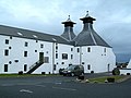 Ardbeg Distillery - geograph.org.uk - 1774928.jpg 640 × 480; 66 KB
-
 Ardgroom Leisure Village - geograph.org.uk - 456749.jpg 640 × 465; 95 KB
-
 Ardlochan Grove - geograph.org.uk - 918097.jpg 640 × 442; 82 KB
-
 Ardnahoe Loch - geograph.org.uk - 1165292.jpg 640 × 426; 118 KB
-
 Ardnahoe Loch View - geograph.org.uk - 1165296.jpg 640 × 423; 109 KB
-
 Ardnave Coast - geograph.org.uk - 349790.jpg 640 × 480; 102 KB
-
 Ardnave Coastal View - geograph.org.uk - 1779152.jpg 640 × 444; 86 KB
-
 Ardnave Farm Sign - geograph.org.uk - 705277.jpg 640 × 463; 81 KB


.jpg)


