Category:Images by M Walden
Jump to navigation
Jump to search

Media in category "Images by M Walden"
The following 114 files are in this category, out of 114 total.
-
 A Duck on Crawley Village Pond - geograph.org.uk - 1216021.jpg 640 × 427; 53 KB
-
 A9 Kessock Bridge - Inverness - geograph.org.uk - 1152353.jpg 640 × 404; 58 KB
-
 All Saints' Church, Farringdon - geograph.org.uk - 1137978.jpg 640 × 427; 97 KB
-
 Alton High Street - geograph.org.uk - 1138141.jpg 640 × 427; 98 KB
-
 Arqiva - Crawley Court - geograph.org.uk - 1148979.jpg 640 × 427; 63 KB
-
 Arqiva - Crawley Court - geograph.org.uk - 1148986.jpg 640 × 427; 115 KB
-
 Badshear Lane - Cheriton - geograph.org.uk - 1219629.jpg 640 × 427; 94 KB
-
 Black Isle Wildlife Park - geograph.org.uk - 1152315.jpg 640 × 480; 81 KB
-
 Brooks Centre Car Park Entrance - geograph.org.uk - 1194680.jpg 640 × 427; 94 KB
-
 Buildings in Cathedral Grounds - geograph.org.uk - 1194817.jpg 640 × 427; 102 KB
-
 Butties Alley to Market Street - geograph.org.uk - 1138133.jpg 640 × 427; 74 KB
-
 Carminowe Creek - Loe Pool - geograph.org.uk - 1138362.jpg 640 × 427; 118 KB
-
 Cathedral Close, Winchester - geograph.org.uk - 1138406.jpg 640 × 427; 142 KB
-
 Cheltenham High Street - geograph.org.uk - 1581522.jpg 640 × 427; 82 KB
-
-
 Colonial Style House - New Cheriton - geograph.org.uk - 1207225.jpg 640 × 480; 105 KB
-
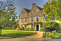
 Country Home - Crawley, Winchester - geograph.org.uk - 1215928.jpg 640 × 427; 140 KB
-
 Crawley Court - Winchester - geograph.org.uk - 1420589.jpg 640 × 449; 94 KB
-
 Degibna Methodist Prayer Chapel - geograph.org.uk - 1137981.jpg 640 × 427; 75 KB
-
 False Tree Mobile Phone Mast - geograph.org.uk - 1198864.jpg 480 × 640; 169 KB
-

-

-

-

-
 Field Opposite Dunsell's Lane - geograph.org.uk - 1137967.jpg 640 × 427; 72 KB
-
 Five Lanes Junction - Four Marks - geograph.org.uk - 1221806.jpg 640 × 480; 89 KB
-
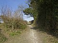
 Footpath at Cheriton Battlefield - geograph.org.uk - 1207273.jpg 640 × 480; 169 KB
-
 Fort George Chapel - geograph.org.uk - 1138008.jpg 640 × 480; 101 KB
-
 Four Marks Primary C of E School - geograph.org.uk - 1221776.jpg 640 × 480; 90 KB
-

-

-

-
 Goonhilly Earth Station - geograph.org.uk - 1138015.jpg 640 × 453; 86 KB
-
 Gosport Road - Lower Farringdon - geograph.org.uk - 1161734.jpg 640 × 427; 69 KB
-

-
 Holy Trinity - Wonston - geograph.org.uk - 1138125.jpg 640 × 427; 106 KB
-
 Holy Trinity Church - Wonston - geograph.org.uk - 1138121.jpg 640 × 427; 93 KB
-
 Horse at Higher Pentire - geograph.org.uk - 1138373.jpg 640 × 427; 90 KB
-

-
 IBM North Harbour - geograph.org.uk - 1161478.jpg 640 × 480; 78 KB
-

-
 Jewry Street Winchester - geograph.org.uk - 1568566.jpg 640 × 427; 87 KB
-

-
 Junction of Raebarn Close - B3046 - geograph.org.uk - 1198877.jpg 640 × 479; 99 KB
-

-
 Lakeside - North Harbour Portsmouth - geograph.org.uk - 1161471.jpg 640 × 480; 74 KB
-

-

-
 Little Minster Street - Winchester - geograph.org.uk - 1194737.jpg 640 × 427; 77 KB
-

-

-
 Lower Lamborough Lane - geograph.org.uk - 1207243.jpg 640 × 480; 122 KB
-
 Markall Close - New Cheriton - geograph.org.uk - 1207211.jpg 640 × 480; 78 KB
-
 Market Lane - Winchester - geograph.org.uk - 1194831.jpg 640 × 427; 78 KB
-
 Mason's Yard - geograph.org.uk - 1568496.jpg 640 × 434; 112 KB
-
 Middle Farm - Cheriton - geograph.org.uk - 1219550.jpg 640 × 427; 84 KB
-
 Middle Farm - Cheriton - geograph.org.uk - 1219595.jpg 640 × 427; 80 KB
-
 Mobile Phone Mast - geograph.org.uk - 1148788.jpg 427 × 640; 151 KB
-
 National Trust Signpost - geograph.org.uk - 1138380.jpg 640 × 427; 131 KB
-
 New Country Home at Crawley, Winchester - geograph.org.uk - 1216037.jpg 640 × 427; 116 KB
-

-
 Porthleven Harbour - geograph.org.uk - 1138029.jpg 640 × 480; 76 KB
-
 Radio Mast - Butser Hill - geograph.org.uk - 1149760.jpg 640 × 480; 61 KB
-
 Ropley Churchyard - geograph.org.uk - 1532658.jpg 640 × 480; 115 KB
-
 Ropley Cricket Pavilion - geograph.org.uk - 1137985.jpg 640 × 427; 74 KB
-
 Ropley Village Shop - geograph.org.uk - 1138197.jpg 640 × 427; 77 KB
-

-

-
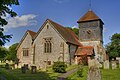
 St Peters Church Ropley - geograph.org.uk - 1138577.jpg 640 × 427; 87 KB
-

-
 St. Peters Church Grave Yard - geograph.org.uk - 1138192.jpg 640 × 480; 71 KB
-
 St.Peters Church, Ropley - geograph.org.uk - 1137973.jpg 640 × 427; 97 KB
-
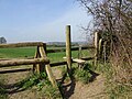 Stile at the top of Dark Lane - geograph.org.uk - 1207257.jpg 640 × 480; 137 KB
-

-

-
 Thatched Cottage - Crawley, Winchester - geograph.org.uk - 1215973.jpg 640 × 427; 113 KB
-
 Thatched Cottage - Crawley, Winchester - geograph.org.uk - 1215983.jpg 640 × 427; 103 KB
-

-
 Thatched Cottage - New Cheriton - geograph.org.uk - 1198825.jpg 640 × 496; 94 KB
-

-
 The Entrance To Cheriton - geograph.org.uk - 1219687.jpg 640 × 427; 102 KB
-
 The Royal Hampshire Regiment Museum - geograph.org.uk - 1568470.jpg 640 × 427; 82 KB
-
 The Square - Winchester - geograph.org.uk - 1194824.jpg 640 × 427; 94 KB
-
 The Windmill Pub - Four Marks - geograph.org.uk - 1230831.jpg 640 × 427; 66 KB
-
 Town Hall, Alton - geograph.org.uk - 1138089.jpg 640 × 427; 112 KB
-
 Truffles at Inadown Riding Centre - geograph.org.uk - 1137990.jpg 480 × 640; 118 KB
-
 Upper High Street - Winchester - geograph.org.uk - 1194708.jpg 640 × 427; 82 KB
-

-
 View Down Church Street - Ropley - geograph.org.uk - 1219704.jpg 640 × 427; 102 KB
-
 View Down Coinage Hall Street - geograph.org.uk - 1138208.jpg 640 × 427; 83 KB
-
 View Down Market Street - Alton - geograph.org.uk - 1138109.jpg 640 × 427; 94 KB
-
 View down North End Lane, Cheriton - geograph.org.uk - 1219586.jpg 640 × 427; 97 KB
-

-

-
 View in Market Street - Alton - geograph.org.uk - 1138116.jpg 640 × 427; 92 KB
-
 View Of Gate At Inadown - geograph.org.uk - 1161771.jpg 640 × 427; 88 KB
-

-
 View over Alum Chine Bay - geograph.org.uk - 1448175.jpg 640 × 427; 84 KB
-
 View over Alum Chine Beach - geograph.org.uk - 1448170.jpg 640 × 480; 105 KB
-
 View Over Countryside - geograph.org.uk - 1138038.jpg 640 × 480; 94 KB
-

-
 View over Kennels - geograph.org.uk - 1230844.jpg 640 × 427; 85 KB
-
 View towards Dark Lane on the B3046 - geograph.org.uk - 1207199.jpg 640 × 480; 134 KB
-

-
 View towards North Street Ropley - geograph.org.uk - 1448146.jpg 640 × 480; 100 KB
-
 View towards the A272 from the B3046 - geograph.org.uk - 1207290.jpg 640 × 480; 104 KB
-
 View up Alton Lane, Four Marks - geograph.org.uk - 1221785.jpg 640 × 480; 139 KB
-
 View up Lower Lamborough Lane, Cheriton - geograph.org.uk - 1207251.jpg 640 × 480; 134 KB
-

-
 White Horse Pub - Alton - geograph.org.uk - 1138134.jpg 640 × 427; 74 KB
-
 Winchester Cathedral - geograph.org.uk - 1137993.jpg 640 × 427; 104 KB
-
 Winchester Cathedral Shop - geograph.org.uk - 1194748.jpg 640 × 427; 101 KB
-
 Worthing Seaside Homes - geograph.org.uk - 1138528.jpg 640 × 427; 85 KB
-
 A House In Cheriton - geograph.org.uk - 1138513.jpg 640 × 427; 128 KB


