Category:Images by M Faherty
Jump to navigation
Jump to search

Media in category "Images by M Faherty"
The following 200 files are in this category, out of 490 total.
(previous page) (next page)-
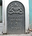
 Modern Mileplate by High Street, Marshfield (geograph 6071958).jpg 665 × 1,024; 171 KB
-

-
 Old Boundary Marker by Corn Street, Bristol (geograph 6037570).jpg 800 × 600; 113 KB
-

-

-
 Old Boundary Marker by The Grove, Hampstead (geograph 6094907).jpg 356 × 592; 99 KB
-

-
-
 Old Boundary Marker on Oxford Road bridge (geograph 6734524).jpg 800 × 600; 146 KB
-
 Old Boundary Markers by Lombard Court, City of London (geograph 6045378).jpg 2,355 × 1,489; 229 KB
-
 Old Boundary Markers by the A10, Gracechurch Street, London EC3 (geograph 6043572).jpg 3,074 × 2,304; 447 KB
-

-
 Old Boundary Markers on 41 Charterhouse Square, London EC1 (geograph 6043215).jpg 1,319 × 2,115; 220 KB
-
 Old Boundary Markers on Bell Lane, Bristol (geograph 6037337).jpg 800 × 600; 149 KB
-
 Old Boundary Markers on Cannon Street, EC4 (geograph 6037292).jpg 800 × 600; 72 KB
-
 Old Boundary Markers on Devereux Court WC2 (geograph 6034734).jpg 3,074 × 2,304; 399 KB
-
 Old Boundary Markers on Gracechurch Street EC3 (geograph 6048870).jpg 2,012 × 1,967; 260 KB
-
 Old Boundary Markers on Talbot Court EC3 (geograph 6733009).jpg 2,194 × 1,677; 261 KB
-
 Old Boundary Markers on Watling Street EC4 (geograph 6048479).jpg 2,999 × 2,197; 382 KB
-
 Old Milepost (geograph 6049856).jpg 479 × 640; 429 KB
-
 Old Milepost (geograph 6095947).jpg 1,462 × 1,704; 487 KB
-
 Old Milepost (geograph 6096053).jpg 1,411 × 1,704; 440 KB
-
 Old Milepost (geograph 6096095).jpg 1,440 × 1,704; 499 KB
-
 Old Milepost (geograph 6096097).jpg 1,350 × 1,704; 434 KB
-
 Old Milepost (geograph 6096318).jpg 1,092 × 1,704; 352 KB
-
 Old Milepost (geograph 6097756).jpg 600 × 800; 119 KB
-
 Old Milepost (geograph 6097794).jpg 1,605 × 1,449; 488 KB
-
 Old Milepost (geograph 6097997).jpg 1,252 × 1,704; 425 KB
-
 Old Milepost (geograph 6098055).jpg 1,507 × 1,704; 491 KB
-
 Old Milepost (geograph 6098143).jpg 1,175 × 1,704; 390 KB
-
 Old Milepost (geograph 6098835).jpg 1,221 × 1,704; 411 KB
-
 Old Milepost (geograph 6099036).jpg 1,369 × 1,704; 451 KB
-
 Old Milepost (geograph 6099175).jpg 759 × 1,704; 247 KB
-
 Old Milepost (geograph 6099239).jpg 1,183 × 1,704; 413 KB
-
 Old Milepost by Brooklands Road, Sale (geograph 5362246).jpg 1,301 × 1,704; 459 KB
-
 Old Milepost by Imber Road, Warminster parish (geograph 6050537).jpg 1,396 × 1,704; 436 KB
-
 Old Milepost by Shear Water reservoir, west of Crockerton (geograph 6035529).jpg 1,351 × 1,704; 470 KB
-
 Old Milepost by Southampton Road, Alderbury (geograph 6076634).jpg 1,126 × 1,704; 370 KB
-
 Old Milepost by the A30, Peckons Hill, Ludwell (geograph 6048344).jpg 1,333 × 1,704; 481 KB
-
 Old Milepost by the A338, Salisbury Road, Ringwood parish (geograph 6072282).jpg 1,190 × 1,787; 398 KB
-
 Old Milepost by the A350, Shaftesbury Road, Parsonage Down (geograph 6044982).jpg 1,147 × 1,704; 389 KB
-

-
 Old Milepost by the A36, Warminster Road, Codford Parish (geograph 6044031).jpg 1,459 × 1,602; 465 KB
-
 Old Milepost by the A36, Warminster Road, South Newton Parish (geograph 6044981).jpg 1,297 × 1,704; 436 KB
-
 Old Milepost by the A36, Warminster Road, Stapleford (geograph 6044315).jpg 1,447 × 1,704; 489 KB
-
 Old Milepost by the A36, west of Serrington, Stapleford Parish (geograph 6037805).jpg 1,234 × 1,704; 402 KB
-
 Old Milepost by the A361, Paxcroft, Hilperton Parish (geograph 6038101).jpg 2,272 × 1,704; 803 KB
-
 Old Milepost by the A40, Castle End Farm, Lea parish (geograph 6048563).jpg 1,251 × 1,704; 439 KB
-
 Old Milepost by the A40, Wilton, Bridstow parish (geograph 6050916).jpg 1,257 × 1,704; 430 KB
-
 Old Milepost by the A417, Maund Bryan, Bodenham parish (geograph 6048103).jpg 1,490 × 1,704; 500 KB
-
 Old Milepost by the A429, Fosse Way, Halford (geograph 6044040).jpg 1,227 × 1,704; 392 KB
-
 Old Milepost by the A438, White Cross Road, Hereford Parish (geograph 6044121).jpg 1,503 × 1,704; 480 KB
-
 Old Milepost by the A50 in Nether Knutsford (geograph 5622759).jpg 1,685 × 1,312; 448 KB
-

-
 Old Milepost by the A530, Nantwich Road, south west of Middlewich (geograph 5622835).jpg 1,285 × 2,022; 528 KB
-

-
 Old Milepost by the A662, Ashton New Road, Beswick (geograph 6069291).jpg 1,157 × 1,704; 436 KB
-
 Old Milepost by the A689, Hare Law (geograph 5624116).jpg 630 × 800; 194 KB
-
 Old Milepost by the B2026, Camp Hill, Hartfield Parish (geograph 6043996).jpg 1,158 × 1,704; 365 KB
-
 Old Milepost by the B4221, Gorsley, Linton Parish (geograph 6047585).jpg 668 × 768; 176 KB
-
 Old Milepost by the B4251, Three Ashes, Llangarron parish (geograph 6069144).jpg 1,313 × 1,704; 445 KB
-
 Old Milepost by the B4347 in Vowchurch (geograph 6102567).jpg 1,248 × 1,704; 435 KB
-

-
 Old Milepost by the B4348, Asper Wood, Dorstone Parish (geograph 6044067).jpg 1,421 × 1,704; 478 KB
-
 Old Milepost by the B4348, Dorstone (geograph 6036044).jpg 1,111 × 1,704; 381 KB
-
 Old Milepost by the B4348, Poston, Vowchurch parish (geograph 6051346).jpg 1,421 × 1,704; 467 KB
-
 Old Milepost by the B4348, south of Newton, Clifford parish (geograph 6061037).jpg 1,436 × 1,704; 519 KB
-
 Old Milepost by the B4349, (geograph 6045486).jpg 1,232 × 1,704; 419 KB
-
 Old Milepost by the B4349, by Clehonger Court, Clehonger Parish (geograph 6038306).jpg 1,167 × 1,704; 408 KB
-
 Old Milepost by the B4349, Coldwell, Kingstone Parish (geograph 6047763).jpg 1,330 × 1,704; 475 KB
-
 Old Milepost by the B4352 at Blakemere (geograph 6102188).jpg 1,308 × 1,704; 460 KB
-

-
 Old Milepost by the B4352, east of the Withies, Madley Parish (geograph 6044247).jpg 1,095 × 1,704; 397 KB
-
 Old Milepost by the B4352, near Showel Farm, Madley parish (geograph 6048281).jpg 1,261 × 1,704; 441 KB
-
 Old Milepost by the B4352, Woodyatt's Cross, Eaton Bishop parish (geograph 6050682).jpg 1,142 × 1,704; 405 KB
-
 Old Milepost by the B4355, Titley Court, Titley parish (geograph 6072848).jpg 1,402 × 1,704; 472 KB
-

-
-
 Old Milepost in Lower Bullingham parish (geograph 6037098).jpg 1,226 × 1,704; 417 KB
-
 Old Milepost near Lower Shutes Cottage, Horningsham parish (geograph 6049091).jpg 1,412 × 1,621; 485 KB
-
 Old Mileston by Cirencester Road, Rodborough Common (geograph 6072052).jpg 969 × 1,752; 327 KB
-
 Old Milestone (geograph 6094484).jpg 1,025 × 1,704; 322 KB
-
 Old Milestone (geograph 6095754).jpg 939 × 1,587; 289 KB
-
 Old Milestone (geograph 6095761).jpg 1,299 × 1,704; 451 KB
-
 Old Milestone (geograph 6095780).jpg 1,070 × 1,704; 362 KB
-
 Old Milestone (geograph 6095808).jpg 1,690 × 1,704; 585 KB
-
 Old Milestone (geograph 6095823).jpg 1,153 × 1,704; 389 KB
-
 Old Milestone (geograph 6095844).jpg 1,336 × 1,704; 451 KB
-
 Old Milestone (geograph 6095902).jpg 1,201 × 1,704; 416 KB
-
 Old Milestone (geograph 6095959).jpg 1,327 × 1,704; 479 KB
-
 Old Milestone (geograph 6095960).jpg 1,156 × 1,704; 407 KB
-
 Old Milestone (geograph 6096036).jpg 2,272 × 1,006; 460 KB
-
 Old Milestone (geograph 6096075).jpg 1,214 × 1,704; 434 KB
-
 Old Milestone (geograph 6096112).jpg 1,167 × 1,912; 450 KB
-
 Old Milestone (geograph 6096186).jpg 596 × 768; 161 KB
-
 Old Milestone (geograph 6096187).jpg 1,304 × 2,075; 486 KB
-
 Old Milestone (geograph 6096204).jpg 1,002 × 1,412; 267 KB
-
 Old Milestone (geograph 6097727).jpg 640 × 960; 153 KB
-
 Old Milestone (geograph 6097802).jpg 400 × 600; 313 KB
-
 Old Milestone (geograph 6097908).jpg 1,108 × 1,704; 407 KB
-
 Old Milestone (geograph 6097938).jpg 1,133 × 1,704; 358 KB
-
 Old Milestone (geograph 6097941).jpg 1,156 × 2,272; 551 KB
-
 Old Milestone (geograph 6097964).jpg 1,252 × 1,704; 435 KB
-
 Old Milestone (geograph 6097971).jpg 1,429 × 1,704; 513 KB
-
 Old Milestone (geograph 6097995).jpg 1,324 × 1,704; 504 KB
-
 Old Milestone (geograph 6098003).jpg 515 × 800; 169 KB
-
 Old Milestone (geograph 6098030).jpg 920 × 1,704; 320 KB
-
 Old Milestone (geograph 6098048).jpg 1,327 × 1,704; 418 KB
-
 Old Milestone (geograph 6098068).jpg 548 × 768; 154 KB
-
 Old Milestone (geograph 6098079).jpg 1,345 × 1,704; 437 KB
-
 Old Milestone (geograph 6098094).jpg 465 × 800; 146 KB
-
 Old Milestone (geograph 6098119).jpg 829 × 1,414; 319 KB
-
 Old Milestone (geograph 6098157).jpg 499 × 768; 162 KB
-
 Old Milestone (geograph 6098235).jpg 1,606 × 1,704; 547 KB
-
 Old Milestone (geograph 6098337).jpg 1,303 × 1,704; 467 KB
-
 Old Milestone (geograph 6098364).jpg 240 × 359; 83 KB
-
 Old Milestone (geograph 6098389).jpg 445 × 704; 151 KB
-
 Old Milestone (geograph 6098400).jpg 1,197 × 1,704; 443 KB
-
 Old Milestone (geograph 6098491).jpg 534 × 768; 118 KB
-
 Old Milestone (geograph 6098497).jpg 1,272 × 1,704; 428 KB
-
 Old Milestone (geograph 6098509).jpg 600 × 800; 235 KB
-
 Old Milestone (geograph 6098557).jpg 944 × 1,468; 247 KB
-
 Old Milestone (geograph 6098601).jpg 1,331 × 1,704; 424 KB
-
 Old Milestone (geograph 6098643).jpg 1,415 × 1,704; 520 KB
-
 Old Milestone (geograph 6098650).jpg 600 × 800; 172 KB
-
 Old Milestone (geograph 6098708).jpg 298 × 435; 124 KB
-
 Old Milestone (geograph 6098712).jpg 368 × 532; 103 KB
-
 Old Milestone (geograph 6098913).jpg 1,579 × 1,704; 543 KB
-
 Old Milestone (geograph 6098917).jpg 600 × 800; 128 KB
-
 Old Milestone (geograph 6098982).jpg 1,101 × 1,704; 378 KB
-
 Old Milestone (geograph 6098992).jpg 510 × 768; 91 KB
-
 Old Milestone (geograph 6099058).jpg 1,123 × 1,704; 350 KB
-
 Old Milestone (geograph 6099115).jpg 1,152 × 1,704; 382 KB
-
 Old Milestone (geograph 6099122).jpg 480 × 640; 334 KB
-
 Old Milestone (geograph 6099137).jpg 1,572 × 1,493; 489 KB
-
 Old Milestone (geograph 6099176).jpg 1,344 × 1,704; 490 KB
-
 Old Milestone (geograph 6099187).jpg 1,267 × 1,704; 444 KB
-
 Old Milestone by Akeman Street, Bibury Parish (geograph 6044188).jpg 1,095 × 1,477; 333 KB
-
 Old Milestone by Bells Lane, Stourton (geograph 6102258).jpg 1,318 × 1,704; 463 KB
-

-
 Old Milestone by Bodenham Moor (geograph 6047952).jpg 1,239 × 1,704; 422 KB
-
 Old Milestone by byway on Breach Hill, Chitterne (geograph 6045472).jpg 1,366 × 1,704; 451 KB
-
 Old Milestone by Carsons Road, Siston parish (geograph 6056255).jpg 1,138 × 1,704; 385 KB
-
 Old Milestone by Catswood Lane, north of Bisley (geograph 6072984).jpg 544 × 800; 218 KB
-
 Old Milestone by Church Street, Amesbury Parish (geograph 6037746).jpg 1,346 × 1,704; 461 KB
-
 Old Milestone by Cirencester Road, Minchinhampton Parish (geograph 6047584).jpg 1,301 × 1,704; 459 KB
-
 Old Milestone by Cirencester Road, Minchinhampton Parish (geograph 6049387).jpg 1,175 × 1,599; 402 KB
-
 Old Milestone by Cirencester Road, Minchinhampton parish (geograph 6049459).jpg 841 × 1,502; 281 KB
-
 Old Milestone by Clifton Down, Bristol parish (geograph 6072222).jpg 403 × 677; 137 KB
-
 Old Milestone by Coombe Lane, Newhouse Farm, Atworth parish (geograph 6049470).jpg 1,213 × 1,704; 420 KB
-
 Old Milestone by Corner Cottage, Halmore, Hamfallow parish (geograph 6072215).jpg 1,243 × 1,704; 456 KB
-
 Old Milestone by Cotham Brow, Bristol Parish (geograph 6044481).jpg 800 × 600; 150 KB
-
 Old Milestone by Deverill Road, Warminster parish (geograph 6050132).jpg 1,312 × 1,704; 390 KB
-
 Old Milestone by drove road on Crouch's Down (geograph 6045694).jpg 1,150 × 1,704; 376 KB
-
 Old Milestone by Dursley Road, Cambridge, Slimbridge (geograph 6047499).jpg 1,375 × 1,704; 427 KB
-
 Old Milestone by Ermine Street, Brockworth parish (geograph 6050209).jpg 1,246 × 1,704; 436 KB
-
 Old Milestone by Fearnhead Lane, Poulton with Fearnhead parish (geograph 6050612).jpg 1,401 × 1,704; 473 KB
-
 Old Milestone by Fowler's Hill Cemetery, Quenington (geograph 6068847).jpg 847 × 1,332; 242 KB
-

-
 Old Milestone by Hatherop Castle School entrance, Hatherop Parish (geograph 6044798).jpg 1,038 × 1,446; 313 KB
-
 Old Milestone by Hay Street, Marshfield (geograph 6102471).jpg 1,021 × 1,524; 267 KB
-
 Old Milestone by High Street, Hanham, Bristol (geograph 6056549).jpg 551 × 645; 153 KB
-
 Old Milestone by High Street, Maiden Bradley (geograph 6068745).jpg 1,245 × 1,704; 428 KB
-
 Old Milestone by High Street, Worton (geograph 6050691).jpg 1,324 × 1,704; 491 KB
-
 Old Milestone by Hindon Road, East Knoyle (geograph 6038139).jpg 1,309 × 1,704; 405 KB
-
 Old Milestone by Huntick Road, east of Lytchett Matravers (geograph 5623970).jpg 1,149 × 1,704; 408 KB
-
 Old Milestone by Leigh Road, Westbury Leigh (geograph 6035478).jpg 1,165 × 1,704; 376 KB
-
 Old Milestone by Lodge Road, Horningsham (geograph 6094455).jpg 1,186 × 1,704; 414 KB
-
 Old Milestone by Long Lane, Kilmington (geograph 6049013).jpg 1,549 × 1,704; 499 KB
-
 Old Milestone by Longcombe Drive, Longleat Park (geograph 6045519).jpg 1,165 × 1,704; 389 KB
-
 Old Milestone by Main Road, Bolton-le-Sands (geograph 6095911).jpg 621 × 800; 173 KB
-
 Old Milestone by Manchester Road, Hollins Green (geograph 6045138).jpg 1,377 × 1,704; 492 KB
-

-
 Old Milestone by Melksham Lane, near Broughton Gifford (geograph 6102579).jpg 1,237 × 1,704; 442 KB
-
 Old Milestone by Milestone House, Longtown (geograph 5362733).jpg 1,199 × 1,611; 342 KB
-
 Old Milestone by Mottram Old Road, Fern Bank (geograph 5622767).jpg 600 × 800; 214 KB
-

-
 Old Milestone by New Road, North Nibley (geograph 6096322).jpg 301 × 438; 114 KB
-
 Old Milestone by New Road, Zeals (geograph 6056606).jpg 1,198 × 1,704; 397 KB
-
 Old Milestone by Old Bridge Road, Broadbridge, Bosham parish (geograph 6049357).jpg 1,400 × 1,704; 492 KB
-
 Old Milestone by old road, Stapleford parish (geograph 6061103).jpg 1,339 × 1,704; 431 KB
-

-
 Old Milestone by Old Southampton Road, Cadnam, Bramshaw parish (geograph 6048889).jpg 1,362 × 1,704; 486 KB
-

-
 Old Milestone by Ox Drove near Groveley Hill (geograph 6072173).jpg 1,213 × 1,704; 368 KB
-
 Old Milestone by Ox Drove, Chilmark Down, Chilmark Parish (geograph 6038801).jpg 1,171 × 1,453; 277 KB
-
 Old Milestone by Ox Drove, north of Dinton, Teffont Parish (geograph 6050571).jpg 1,222 × 1,704; 435 KB
-
 Old Milestone by Ox Drove, Teffont Magna (geograph 6044968).jpg 1,375 × 1,704; 435 KB
-
 Old Milestone by Passage Road, Arlingham Parish (geograph 6044072).jpg 1,121 × 1,704; 388 KB
-
 Old Milestone by Red Lees Road, Southward Bottom, Cliviger Parish (geograph 6044165).jpg 1,122 × 1,704; 380 KB
-
 Old Milestone by Redland Road, Bristol (geograph 6102384).jpg 720 × 960; 187 KB
-
 Old Milestone by Rockbourne Road, near Little Toyd Farm (geograph 6056273).jpg 1,318 × 1,704; 475 KB
-
 Old Milestone by Rodway Hill Road, Kingsway parish (geograph 6048622).jpg 856 × 1,704; 279 KB
-
 Old Milestone by Seend Bridge, Bulkington parish (geograph 6061323).jpg 1,174 × 1,704; 412 KB
-
 Old Milestone by Springfield Road, Quenington parish (geograph 6049430).jpg 1,166 × 1,365; 326 KB
-
 Old Milestone by Station Road, Acton Turville (geograph 6044499).jpg 1,258 × 1,704; 450 KB
-
 Old Milestone by Station Road, Great Wishford (geograph 6043993).jpg 1,312 × 1,704; 468 KB
-
 Old Milestone by Stepping Stone Lane, Painswick Parish (geograph 6034792).jpg 1,162 × 1,574; 386 KB
-
 Old Milestone by Stockport Road, Amesbury (geograph 6102315).jpg 1,082 × 1,704; 399 KB
-
 Old Milestone by Stonehenge Road, Amesbury parish (geograph 6048499).jpg 1,310 × 1,704; 444 KB
.jpg)
.jpg)
.jpg)
.jpg)
.jpg)
.jpg)
.jpg)
.jpg)
.jpg)
.jpg)
.jpg)
.jpg)
.jpg)
.jpg)
.jpg)
.jpg)
.jpg)
.jpg)
.jpg)
.jpg)
.jpg)
.jpg)
.jpg)
.jpg)
.jpg)
.jpg)
.jpg)
.jpg)
.jpg)
.jpg)
.jpg)
.jpg)
.jpg)
.jpg)
.jpg)
.jpg)
.jpg)
.jpg)
.jpg)
.jpg)
.jpg)
.jpg)
.jpg)
.jpg)
.jpg)
.jpg)
.jpg)
.jpg)
.jpg)
.jpg)
.jpg)
.jpg)
.jpg)
.jpg)
.jpg)
.jpg)
.jpg)
.jpg)
.jpg)
.jpg)
.jpg)
.jpg)
.jpg)
.jpg)
.jpg)
.jpg)
.jpg)
.jpg)
.jpg)
.jpg)
.jpg)
.jpg)
.jpg)
.jpg)
.jpg)
.jpg)
.jpg)
.jpg)
.jpg)
.jpg)
.jpg)
.jpg)
.jpg)
.jpg)
.jpg)
.jpg)
.jpg)
.jpg)
.jpg)
.jpg)
.jpg)
.jpg)
.jpg)
.jpg)
.jpg)
.jpg)
.jpg)
.jpg)
.jpg)
.jpg)
.jpg)
.jpg)
.jpg)
.jpg)
.jpg)
.jpg)
.jpg)
.jpg)
.jpg)
.jpg)
.jpg)
.jpg)
.jpg)
.jpg)
.jpg)
.jpg)
.jpg)
.jpg)
.jpg)
.jpg)
.jpg)
.jpg)
.jpg)
.jpg)
.jpg)
.jpg)
.jpg)
.jpg)
.jpg)
.jpg)
.jpg)
.jpg)
.jpg)
.jpg)
.jpg)
.jpg)
.jpg)
.jpg)
.jpg)
.jpg)
.jpg)
.jpg)
.jpg)
.jpg)
.jpg)
.jpg)
.jpg)
.jpg)
.jpg)
.jpg)
.jpg)
.jpg)
.jpg)
.jpg)
.jpg)
.jpg)
.jpg)
.jpg)
.jpg)
.jpg)
.jpg)
.jpg)
.jpg)
.jpg)
.jpg)
.jpg)
.jpg)
.jpg)
.jpg)
.jpg)
.jpg)
.jpg)
.jpg)
.jpg)
.jpg)
.jpg)
.jpg)
.jpg)
.jpg)
.jpg)
.jpg)
.jpg)
.jpg)
.jpg)
.jpg)
.jpg)
.jpg)
.jpg)
.jpg)
.jpg)
.jpg)
.jpg)
.jpg)
.jpg)
.jpg)
.jpg)
.jpg)
.jpg)
.jpg)
.jpg)