Category:Images by Ken McCann
Jump to navigation
Jump to search

Media in category "Images by Ken McCann"
The following 45 files are in this category, out of 45 total.
-

-
 Barmby Ferry Road to Hemingbrough - geograph.org.uk - 655655.jpg 640 × 427; 66 KB
-
 Boardwalk through conservation area - geograph.org.uk - 652904.jpg 640 × 427; 84 KB
-

-
 Camping at the roadside - geograph.org.uk - 656197.jpg 427 × 640; 62 KB
-
 Carved snake in Hagg Lane Ponds - geograph.org.uk - 652891.jpg 640 × 427; 101 KB
-
 Crossroads on Osgodby Common - geograph.org.uk - 664906.jpg 640 × 427; 78 KB
-
 Farm track into arable land - geograph.org.uk - 660960.jpg 640 × 427; 54 KB
-
 FEMA - 18106 - Photograph by Jocelyn Augustino taken on 10-29-2005 in Florida.jpg 4,288 × 2,848; 7.24 MB
-
 FEMA - 18110 - Photograph by Jocelyn Augustino taken on 10-29-2005 in Florida.jpg 4,288 × 2,848; 6.26 MB
-
 Granny Darley's Field - geograph.org.uk - 654630.jpg 640 × 427; 112 KB
-
 Haddlesey Pump Station - geograph.org.uk - 686048.jpg 640 × 427; 62 KB
-
 Haymoors Wood - geograph.org.uk - 655896.jpg 640 × 427; 75 KB
-
 Finkle Street - geograph.org.uk - 655963.jpg 427 × 640; 49 KB
-
 Highway Board boundary marker - geograph.org.uk - 654949.jpg 427 × 640; 106 KB
-
 Junction with Barmby Ferry Road - geograph.org.uk - 656128.jpg 640 × 427; 53 KB
-
 Lighthouse across the South Bay - geograph.org.uk - 655978.jpg 640 × 427; 26 KB
-
 Marshy pond - geograph.org.uk - 685972.jpg 640 × 427; 48 KB
-
-
 Old course of River Derwent - geograph.org.uk - 655947.jpg 427 × 640; 66 KB
-
 Old Eye - geograph.org.uk - 686009.jpg 640 × 427; 37 KB
-
 Old Eye Pumping Station - geograph.org.uk - 685998.jpg 640 × 427; 64 KB
-
 Osgodby Common Pumping Station - geograph.org.uk - 660971.jpg 640 × 427; 68 KB
-
 Paper House Bridge - geograph.org.uk - 685876.jpg 640 × 427; 97 KB
-
 Paper House Pump from farm track - geograph.org.uk - 685850.jpg 640 × 427; 95 KB
-
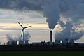 Power of different types - geograph.org.uk - 655935.jpg 640 × 427; 33 KB
-
 Public footpath^ - geograph.org.uk - 660977.jpg 640 × 427; 77 KB
-
 Pump station on stilts - geograph.org.uk - 686478.jpg 640 × 427; 64 KB
-
-
 River Aire - geograph.org.uk - 686443.jpg 640 × 427; 85 KB
-
 River Torne - geograph.org.uk - 673854.jpg 640 × 427; 70 KB
-
 Road from Haddlesey to Birkin - geograph.org.uk - 685935.jpg 640 × 427; 59 KB
-

-
 Student accommodation on UEA site - geograph.org.uk - 652933.jpg 640 × 427; 47 KB
-
 Temple Manor pumping station - geograph.org.uk - 685901.jpg 640 × 427; 87 KB
-
 USMC-101005-O-8119M-006.jpg 1,372 × 911; 387 KB
-
 USMC-101005-O-8119M-025.jpg 1,372 × 911; 467 KB
-
 USMC-101005-O-8119M-029.jpg 1,372 × 911; 462 KB
-

-
 Beech hedge 3-4 mile long - geograph.org.uk - 664947.jpg 640 × 427; 73 KB
-
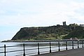
 Castle Cliff headland - geograph.org.uk - 685796.jpg 640 × 427; 52 KB
-
 Cold War Remains - geograph.org.uk - 673874.jpg 640 × 427; 78 KB
-
 Hill top trees in winter - geograph.org.uk - 664976.jpg 640 × 427; 50 KB
-
 Marine Drive North Bay - geograph.org.uk - 656271.jpg 640 × 427; 49 KB
-


