Category:Images by Ken Brown (27669)
Jump to navigation
Jump to search

Media in category "Images by Ken Brown (27669)"
The following 102 files are in this category, out of 102 total.
-
 Acacia Hall Weir - geograph.org.uk - 897189.jpg 640 × 481; 123 KB
-
 ASDA, Greenhithe, Kent - geograph.org.uk - 900792.jpg 640 × 481; 54 KB
-
 Barclays Bank, Dartford - geograph.org.uk - 902568.jpg 481 × 640; 94 KB
-
 Beach Huts at Bluewater - geograph.org.uk - 897878.jpg 640 × 481; 104 KB
-
 Bluewater Shopping Centre - geograph.org.uk - 894673.jpg 640 × 481; 91 KB
-
 Bluewater Shopping Centre - geograph.org.uk - 894676.jpg 640 × 481; 104 KB
-
 Bridge House - geograph.org.uk - 897028.jpg 640 × 461; 76 KB
-
 Broadstairs seafront - geograph.org.uk - 894738.jpg 427 × 640; 81 KB
-
 City Airport cargo area - geograph.org.uk - 896826.jpg 640 × 427; 49 KB
-
 City Airport Control Tower - geograph.org.uk - 896943.jpg 640 × 427; 65 KB
-
 City Airport Runway - geograph.org.uk - 896762.jpg 640 × 427; 54 KB
-
 City Hall - geograph.org.uk - 894840.jpg 640 × 427; 70 KB
-
 Clacton Pier and Lifeboat station - geograph.org.uk - 895684.jpg 640 × 427; 68 KB
-
 Clacton Pier Lifeboat Station - geograph.org.uk - 893925.jpg 427 × 640; 60 KB
-
 Clacton pier slipway - geograph.org.uk - 895826.jpg 640 × 427; 95 KB
-
 Crayford Clock Tower - geograph.org.uk - 894672.jpg 481 × 640; 73 KB
-
 Cutty Sark Stern - geograph.org.uk - 893509.jpg 427 × 640; 77 KB
-
 Danson Park Coot - geograph.org.uk - 898238.jpg 640 × 427; 61 KB
-
 Danson Park Ducks - geograph.org.uk - 899248.jpg 640 × 427; 116 KB
-
 Danson Park Lake - geograph.org.uk - 897764.jpg 427 × 640; 74 KB
-
 Dartford Bridge - geograph.org.uk - 897041.jpg 640 × 481; 106 KB
-
 Dartford County Court - geograph.org.uk - 908936.jpg 640 × 481; 99 KB
-
 Dartford Library - geograph.org.uk - 894662.jpg 640 × 481; 93 KB
-
 Dartford Market - geograph.org.uk - 894690.jpg 640 × 481; 84 KB
-
 Dartford War Memorial - geograph.org.uk - 894667.jpg 481 × 640; 67 KB
-
 Delphin Renaissance - geograph.org.uk - 895852.jpg 640 × 427; 65 KB
-
 Footbridge in Acacia Hall gardens - geograph.org.uk - 897186.jpg 640 × 481; 109 KB
-
 Fusion Apartments at Waterstone Park - geograph.org.uk - 900942.jpg 640 × 481; 73 KB
-
 Greenhithe Slipway - geograph.org.uk - 896941.jpg 640 × 481; 59 KB
-
 Greenhithe Station - geograph.org.uk - 918595.jpg 640 × 481; 72 KB
-
 Greenline Bus - geograph.org.uk - 896866.jpg 640 × 480; 72 KB
-
 Gypsy Horses - geograph.org.uk - 899271.jpg 640 × 480; 82 KB
-
 Hanau Bridge, Dartford - geograph.org.uk - 906213.jpg 640 × 481; 101 KB
-
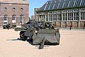
 HMS Grafton F80 Frigate - geograph.org.uk - 895892.jpg 640 × 427; 59 KB
-
 HMS Warrior - geograph.org.uk - 894749.jpg 640 × 427; 68 KB
-
 HMS Worcester pebble mosaic - geograph.org.uk - 897889.jpg 640 × 481; 107 KB
-
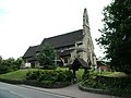
 Holy Trinity Church - geograph.org.uk - 894037.jpg 481 × 640; 95 KB
-
 Holy Trinity Church, Dartford - geograph.org.uk - 902534.jpg 640 × 481; 92 KB
-
 Ingress Abbey - geograph.org.uk - 893872.jpg 640 × 481; 81 KB
-
 King George V Dock - geograph.org.uk - 896815.jpg 640 × 427; 58 KB
-
 King George V Dock - geograph.org.uk - 896841.jpg 640 × 427; 59 KB
-
 Leap Fountain - geograph.org.uk - 894685.jpg 640 × 427; 89 KB
-
 London Road A226, Greenhithe - geograph.org.uk - 900314.jpg 481 × 640; 92 KB
-
 Maryon Park bridge - geograph.org.uk - 894677.jpg 640 × 427; 108 KB
-
 McDonalds Restaurant - geograph.org.uk - 906135.jpg 640 × 481; 78 KB
-

-
 McDonalds Roundabout, Greenhithe - geograph.org.uk - 906524.jpg 640 × 481; 80 KB
-
 Millennium Dome - geograph.org.uk - 893894.jpg 640 × 427; 50 KB
-
 My Allotment - geograph.org.uk - 896952.jpg 640 × 427; 91 KB
-
 National Service Parade - geograph.org.uk - 896747.jpg 427 × 640; 89 KB
-
 Navy War Memorial - geograph.org.uk - 893886.jpg 427 × 640; 59 KB
-
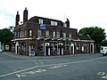
 North Kent Tavern - geograph.org.uk - 896587.jpg 511 × 640; 105 KB
-
 O'Dowds Public House - geograph.org.uk - 896547.jpg 640 × 427; 89 KB
-
 Old (unnamed) road to Stone Castle - geograph.org.uk - 898631.jpg 640 × 481; 108 KB
-
 Open Field at Horns Cross - geograph.org.uk - 900275.jpg 640 × 481; 75 KB
-
 Orchard Centre Clock Tower - geograph.org.uk - 894675.jpg 481 × 640; 64 KB
-
 Orchard Centre North Entrance - geograph.org.uk - 908926.jpg 640 × 481; 90 KB
-
 Plume Of Feathers Public House - geograph.org.uk - 896568.jpg 640 × 427; 67 KB
-
 Plume of Feathers Public House - geograph.org.uk - 897888.jpg 640 × 427; 80 KB
-
 Prince of Wales Pier - geograph.org.uk - 896901.jpg 640 × 427; 58 KB
-
 Priory Centre, Dartford - geograph.org.uk - 897155.jpg 640 × 481; 93 KB
-
 Priory Centre, Dartford - geograph.org.uk - 897157.jpg 640 × 481; 69 KB
-
 QE2 Bridge - geograph.org.uk - 893939.jpg 640 × 481; 60 KB
-
 Rapeseed in bloom - geograph.org.uk - 894687.jpg 640 × 481; 76 KB
-
 Ripley's Market - geograph.org.uk - 897162.jpg 640 × 481; 88 KB
-
 River Darent Ducks - geograph.org.uk - 899291.jpg 640 × 481; 103 KB
-
 River Thames at high tide - geograph.org.uk - 900925.jpg 427 × 640; 50 KB
-
 River Thames Swans - geograph.org.uk - 897871.jpg 481 × 640; 58 KB
-
 Riverside Steps - geograph.org.uk - 897868.jpg 640 × 481; 105 KB
-

-
 Saga Pearl cruise liner - geograph.org.uk - 895860.jpg 640 × 427; 73 KB
-
 Sails - geograph.org.uk - 892053.jpg 481 × 640; 73 KB
-
 Sails, detail - geograph.org.uk - 897890.jpg 482 × 640; 64 KB
-
 Sainsbury's, Dartford - geograph.org.uk - 897164.jpg 640 × 481; 66 KB
-
 Sea Promenade, Southsea - geograph.org.uk - 896948.jpg 640 × 427; 54 KB
-
 Sir Henry Johnson - geograph.org.uk - 894694.jpg 640 × 427; 74 KB
-
 South Parade Pier - geograph.org.uk - 894767.jpg 640 × 427; 55 KB
-
 St Mary's Church, Greenhithe, Kent - geograph.org.uk - 918591.jpg 640 × 481; 83 KB
-
 Stile, London Road - geograph.org.uk - 900262.jpg 481 × 640; 110 KB
-
 Stone Castle - geograph.org.uk - 893976.jpg 640 × 481; 84 KB
-
 Stone Park War Memorial - geograph.org.uk - 900354.jpg 640 × 481; 92 KB
-
 Stone Rise Development - geograph.org.uk - 908973.jpg 640 × 481; 83 KB
-
 Stone structure, Maryon Park - geograph.org.uk - 893508.jpg 640 × 427; 108 KB
-
 Thames and Pollo Rose at high water - geograph.org.uk - 896964.jpg 640 × 481; 66 KB
-
 Thames barrier at low tide - geograph.org.uk - 893511.jpg 640 × 427; 78 KB
-
 Thames Barrier under test - geograph.org.uk - 894834.jpg 640 × 427; 55 KB
-
 The Bull, Horns Cross - geograph.org.uk - 908957.jpg 640 × 481; 91 KB
-
 The Paper Moon - geograph.org.uk - 897177.jpg 640 × 481; 107 KB
-
 The Railway Hotel - geograph.org.uk - 919627.jpg 640 × 481; 83 KB
-
 The Two Brewers - geograph.org.uk - 897166.jpg 640 × 481; 78 KB
-
 The Wat Tyler - geograph.org.uk - 897173.jpg 481 × 640; 91 KB
-
 The Worrier - geograph.org.uk - 894674.jpg 481 × 640; 103 KB
-
 Tubby Isaacs Quality Seafoods - geograph.org.uk - 895837.jpg 640 × 427; 77 KB
-
 Tug Retainer on the Thames - geograph.org.uk - 906191.jpg 640 × 481; 62 KB
-
 Waterstone Park Oast House - geograph.org.uk - 898686.jpg 640 × 481; 76 KB
-
 Waterstone Park Playground - geograph.org.uk - 900329.jpg 640 × 481; 88 KB
-
 Waterstone Park, Emergency Access - geograph.org.uk - 900342.jpg 640 × 481; 78 KB
-
 Winston Close, Stone - geograph.org.uk - 900290.jpg 640 × 481; 72 KB
-

-
 Woolwich Arsenal Laboratory Square - geograph.org.uk - 895906.jpg 640 × 427; 90 KB
-
 Woolwich Arsenal Pier - geograph.org.uk - 893918.jpg 640 × 427; 53 KB
-
 YMCA Dartford - geograph.org.uk - 897194.jpg 640 × 481; 81 KB


.jpg)


_road_to_Stone_Castle_-_geograph.org.uk_-_898631.jpg)


