Category:Images by Johnny Durnan
Jump to navigation
Jump to search

Media in category "Images by Johnny Durnan"
The following 200 files are in this category, out of 1,505 total.
(previous page) (next page)-

-
 A816 approaching Oban from the south. - geograph.org.uk - 120760.jpg 640 × 480; 51 KB
-

-

-
 A82 north of Urquart Bay. - geograph.org.uk - 250768.jpg 640 × 480; 84 KB
-
 A82 roadsign south of Fort William - geograph.org.uk - 238964.jpg 640 × 480; 119 KB
-
 A82 south of Inverness near Brachla. - geograph.org.uk - 250765.jpg 640 × 480; 109 KB
-
 A82 with Stob Dearg to the left - geograph.org.uk - 1166212.jpg 640 × 480; 43 KB
-
-
 A83 Glen Croe - geograph.org.uk - 627395.jpg 640 × 480; 31 KB
-
 A83 north of Stonefield, Argyll. - geograph.org.uk - 134061.jpg 640 × 480; 89 KB
-
 A96 to Inverness near Seafield. - geograph.org.uk - 250758.jpg 640 × 480; 77 KB
-
 AA callbox at Brachla. - geograph.org.uk - 250766.jpg 640 × 480; 127 KB
-
 Abandoned boat West loch Tarbert. - geograph.org.uk - 674090.jpg 640 × 480; 32 KB
-
 Abbeyfield House Carradale - geograph.org.uk - 1334804.jpg 640 × 480; 61 KB
-

-
 Achadh nan Darach.jpg 640 × 480; 73 KB
-
-
 Ailsa Craig from HMS Campbeltown - geograph.org.uk - 988480.jpg 640 × 480; 51 KB
-
 Ailsa Craig from HMS Campbeltown - geograph.org.uk - 988485.jpg 640 × 480; 49 KB
-
 Ailsa Craig from HMS Campbeltown - geograph.org.uk - 988488.jpg 640 × 480; 50 KB
-
 Aircraft taxing at Glasgow Airport - geograph.org.uk - 646289.jpg 640 × 480; 32 KB
-
 Airds Castle, Carradale. - geograph.org.uk - 248934.jpg 640 × 480; 91 KB
-
 Airds Castle, site of remains. - geograph.org.uk - 248936.jpg 640 × 480; 83 KB
-
 Allt na Beiste. - geograph.org.uk - 383292.jpg 640 × 480; 61 KB
-
 Altnafeadh - geograph.org.uk - 1166270.jpg 640 × 480; 51 KB
-
 Altnafeadh - geograph.org.uk - 1166273.jpg 640 × 480; 49 KB
-
 An Cnap,Kyles of Bute. - geograph.org.uk - 550261.jpg 640 × 480; 31 KB
-
 An Griannan by the B8025. - geograph.org.uk - 133790.jpg 640 × 427; 72 KB
-
 Another angle of Llandudno Pier. - geograph.org.uk - 57921.jpg 640 × 480; 108 KB
-
 Ardminish Bay taken from Gigha ferry. - geograph.org.uk - 57424.jpg 640 × 480; 111 KB
-

-
 Argyll Hotel Southend. - geograph.org.uk - 130495.jpg 640 × 480; 72 KB
-

-
 Atlantic Ocean wildlife - geograph.org.uk - 671986.jpg 640 × 480; 22 KB
-
 Auchencorvie Memorial Plaque - geograph.org.uk - 622207.jpg 640 × 480; 63 KB
-
 Autumn Colours - geograph.org.uk - 606099.jpg 640 × 480; 73 KB
-
 Autumn Colours - geograph.org.uk - 606100.jpg 640 × 480; 38 KB
-
 Autumn Colours - geograph.org.uk - 606101.jpg 640 × 480; 38 KB
-
 Autumn colours. - geograph.org.uk - 263302.jpg 640 × 480; 104 KB
-
 Autumn harvest - geograph.org.uk - 572516.jpg 640 × 480; 90 KB
-
 Autumn view by Loch Tummel. - geograph.org.uk - 273473.jpg 640 × 480; 153 KB
-
-
 B842 near Grogport, Kintyre. - geograph.org.uk - 103848.jpg 640 × 480; 62 KB
-
 B842 view over moorland - geograph.org.uk - 563833.jpg 640 × 480; 46 KB
-
 Backs Water - geograph.org.uk - 1322468.jpg 640 × 480; 73 KB
-
 Balloch Castle - geograph.org.uk - 207054.jpg 640 × 480; 98 KB
-
 Balloch Castle and park - geograph.org.uk - 207052.jpg 640 × 480; 54 KB
-

-
 Balloch Castle. - geograph.org.uk - 207053.jpg 640 × 480; 66 KB
-
 Balnabraid Glen heading west - geograph.org.uk - 1088254.jpg 640 × 427; 75 KB
-
 Balnabraid Glen looking east - geograph.org.uk - 1088262.jpg 640 × 427; 60 KB
-
 Balquhain Farm - geograph.org.uk - 194140.jpg 640 × 480; 59 KB
-
 Barnabraid Glen aircraft crash site - geograph.org.uk - 1088269.jpg 640 × 427; 57 KB
-
 Barrowland - geograph.org.uk - 627429.jpg 640 × 480; 58 KB
-

-
 Beinn Chuirn from the A85 carpark - geograph.org.uk - 1166147.jpg 640 × 480; 47 KB
-
 Beinn Chuirn from the A85 Glen Lochy - geograph.org.uk - 1166152.jpg 640 × 480; 55 KB
-
-
 Beinn Dorain from the A82 - geograph.org.uk - 1166157.jpg 640 × 480; 43 KB
-
 Beinn Dorain from the A82 - geograph.org.uk - 1166171.jpg 640 × 480; 41 KB
-
 Bell Rock buoy off Whitby Harbour. - geograph.org.uk - 550730.jpg 640 × 480; 30 KB
-
 Bellanoch by the Crinan Canal, Argyll. - geograph.org.uk - 194254.jpg 640 × 480; 134 KB
-
 Ben Nevis footpath - geograph.org.uk - 992880.jpg 640 × 480; 51 KB
-
 Ben Nevis footpath near Auchintee - geograph.org.uk - 992872.jpg 640 × 480; 46 KB
-
 Ben Nevis from Corpach sea lock. - geograph.org.uk - 256874.jpg 640 × 480; 54 KB
-
 Ben Nevis Inn at Auchintee - geograph.org.uk - 992871.jpg 640 × 480; 67 KB
-
 Ben Nevis path from the Glen road. - geograph.org.uk - 233970.jpg 640 × 480; 106 KB
-
 Big House Saddell Bay - geograph.org.uk - 56511.jpg 640 × 480; 104 KB
-
 Big red chimney - geograph.org.uk - 563911.jpg 360 × 480; 32 KB
-
 Big tide at Waterfoot - geograph.org.uk - 1128213.jpg 640 × 480; 45 KB
-
 Big tide at Waterfoot,Carradale - geograph.org.uk - 1128205.jpg 640 × 480; 47 KB
-

-

-
 Blackmount carpark - geograph.org.uk - 1146977.jpg 640 × 480; 46 KB
-
 Blackmount carpark - geograph.org.uk - 1166178.jpg 640 × 480; 40 KB
-
 Blackmount carpark view - geograph.org.uk - 1166180.jpg 640 × 480; 48 KB
-
 Blackmount Carpark view - geograph.org.uk - 1166181.jpg 640 × 480; 52 KB
-
 Blackmount Carpark view - geograph.org.uk - 1166183.jpg 640 × 480; 68 KB
-

-
 Blairquhannan Farm livestock. - geograph.org.uk - 194133.jpg 640 × 480; 95 KB
-
 Boat mooring top of Loch na Cille. - geograph.org.uk - 133823.jpg 640 × 427; 69 KB
-

-
 Boats at mooring on Loch Etive. - geograph.org.uk - 195259.jpg 640 × 480; 95 KB
-

-

-
 Boturich Castle, by Balloch. - geograph.org.uk - 207055.jpg 640 × 480; 92 KB
-
 Brackley - geograph.org.uk - 563780.jpg 640 × 480; 43 KB
-
 Brackley Farm - geograph.org.uk - 639182.jpg 640 × 480; 47 KB
-

-
-
 Brander Pass the Awe Barrage. - geograph.org.uk - 195291.jpg 640 × 480; 141 KB
-
 Brander Pass, A85 Loch Awe. - geograph.org.uk - 195298.jpg 640 × 480; 109 KB
-
 Brander Pass, Cruachan. - geograph.org.uk - 195301.jpg 640 × 480; 84 KB
-
 Breakwater at Carradale Harbour - geograph.org.uk - 1347501.jpg 640 × 480; 34 KB
-
 Bridge at Loch Ba - geograph.org.uk - 1166184.jpg 640 × 480; 54 KB
-
 Brunerican Bay, Southend. - geograph.org.uk - 125046.jpg 640 × 480; 110 KB
-
 Buachaille Etive Mor - geograph.org.uk - 1166278.jpg 640 × 480; 47 KB
-

-
 Buachaille Etive Mor from the A82 - geograph.org.uk - 1166490.jpg 640 × 480; 58 KB
-
 Burnt Islands and the Kyles of Bute. - geograph.org.uk - 550150.jpg 640 × 480; 39 KB
-
 Cairgorm Funicular Railway. - geograph.org.uk - 61244.jpg 640 × 480; 122 KB
-
 Cairn at Blackmount carpark - geograph.org.uk - 1146979.jpg 640 × 480; 52 KB
-
 Cairn at Blackmount carpark - geograph.org.uk - 1146991.jpg 360 × 480; 38 KB
-
 Cal Mac ferry at Tarbert slipway. - geograph.org.uk - 559047.jpg 640 × 480; 36 KB
-

-
 Cameron House, Loch Lomond. - geograph.org.uk - 136382.jpg 640 × 480; 96 KB
-
 Campbeltown Airport Terminal. - geograph.org.uk - 117907.jpg 640 × 480; 88 KB
-
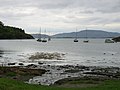
 Campbeltown Loch - geograph.org.uk - 61190.jpg 640 × 480; 59 KB
-
 Campbeltown Loch sunrise. - geograph.org.uk - 371809.jpg 640 × 480; 25 KB
-
 Canal basin - geograph.org.uk - 563880.jpg 640 × 480; 61 KB
-
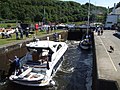
 Canal lock gates - geograph.org.uk - 563886.jpg 640 × 480; 70 KB
-

-
 Caol Scotnish narrows. - geograph.org.uk - 126775.jpg 640 × 480; 174 KB
-
 Caol Scotnish, Argyll. - geograph.org.uk - 126784.jpg 640 × 480; 120 KB
-
 Cara Island off Gigha - geograph.org.uk - 57423.jpg 640 × 480; 54 KB
-
 Carra Water at Waterfoot - geograph.org.uk - 1041973.jpg 640 × 480; 40 KB
-
 Carra Water reflections - geograph.org.uk - 1041976.jpg 640 × 480; 35 KB
-

-

-
 Carradale Estate - geograph.org.uk - 622226.jpg 640 × 480; 112 KB
-
 Carradale estate grounds - geograph.org.uk - 622224.jpg 640 × 480; 95 KB
-
 Carradale from above Rhonadale - geograph.org.uk - 1334812.jpg 640 × 480; 44 KB
-
 Carradale Harbour - geograph.org.uk - 1334781.jpg 640 × 480; 39 KB
-
 Carradale Harbour - geograph.org.uk - 1334786.jpg 640 × 480; 42 KB
-
 Carradale Harbour - geograph.org.uk - 1347491.jpg 640 × 480; 40 KB
-
 Carradale harbour shoreline - geograph.org.uk - 1347495.jpg 640 × 480; 59 KB
-
 Carradale House Estate, Kintyre. - geograph.org.uk - 107173.jpg 640 × 480; 162 KB
-
 Carradale War Memorial - geograph.org.uk - 610671.jpg 640 × 480; 90 KB
-
 Carradale-Approaching Dippen Bridge - geograph.org.uk - 1638379.jpg 640 × 480; 63 KB
-
 Carradale-Bridgend Houses - geograph.org.uk - 1638383.jpg 640 × 480; 70 KB
-
 Carradale-Fog Covered Glen - geograph.org.uk - 1638373.jpg 640 × 480; 39 KB
-
 Carradale-The Glen Bar - geograph.org.uk - 1638369.jpg 640 × 480; 72 KB
-

-
 Carskey Bay shoreline. - geograph.org.uk - 124994.jpg 640 × 480; 90 KB
-
 Carter Bar. - geograph.org.uk - 61124.jpg 640 × 480; 42 KB
-

-
 Castle Hotel, Ruthin town centre. - geograph.org.uk - 101304.jpg 640 × 480; 133 KB
-
 Castle Semple Loch, Lochwinnoch. - geograph.org.uk - 61069.jpg 640 × 480; 105 KB
-
 Castle Street Kirkcudbright - geograph.org.uk - 600158.jpg 640 × 480; 37 KB
-
-
 Chinese junk on River Ness. - geograph.org.uk - 250755.jpg 640 × 480; 87 KB
-

-
 Christmas joy at the Xscape, Braehead - geograph.org.uk - 627423.jpg 640 × 480; 63 KB
-
 Clachaig Inn Glencoe - geograph.org.uk - 1166538.jpg 640 × 480; 58 KB
-
 Claonaig - geograph.org.uk - 563855.jpg 640 × 480; 46 KB
-
 Climbing Ben Nevis footpath - geograph.org.uk - 992882.jpg 640 × 480; 52 KB
-
 Clyde Arc Glasgow - geograph.org.uk - 646327.jpg 640 × 480; 35 KB
-
 Clyde Arc Glasgow by day - geograph.org.uk - 572288.jpg 640 × 513; 48 KB
-
 Clyde Arc Glasgow by night - geograph.org.uk - 572290.jpg 640 × 480; 37 KB
-
 Clyde Arc, Glasgow - geograph.org.uk - 572273.jpg 640 × 480; 26 KB
-
 Clyde Arc, Glasgow - geograph.org.uk - 572293.jpg 640 × 480; 42 KB
-
 Clyde walkway - geograph.org.uk - 1347485.jpg 640 × 480; 51 KB
-
-

-
 Clydeport from Hunterston - geograph.org.uk - 645190.jpg 640 × 480; 45 KB
-

-
 Coastguard Station, Southend, Kintyre.jpg 640 × 480; 63 KB
-
 Coire Na Tulaich from Altnafeadh. - geograph.org.uk - 1147005.jpg 640 × 480; 56 KB
-
 Commando Memorial, Spean Bridge - geograph.org.uk - 107762.jpg 640 × 480; 99 KB
-
 Connel bridge - geograph.org.uk - 580745.jpg 640 × 480; 29 KB
-
 Connel Bridge - geograph.org.uk - 96848.jpg 640 × 480; 101 KB
-
 Connel Bridge. - geograph.org.uk - 96843.jpg 640 × 480; 113 KB
-
 Corpach Sea lock. - geograph.org.uk - 256872.jpg 640 × 480; 89 KB
-

-
-
 Country track near Blairhosh. - geograph.org.uk - 194126.jpg 640 × 480; 93 KB
-
 Country track to Dunain Park Hotel. - geograph.org.uk - 250749.jpg 640 × 480; 91 KB
-

-
-
-
 Countryside view from the Kinmel Arms - geograph.org.uk - 919718.jpg 640 × 480; 76 KB
-
 Cour Bay by Carradale, Kintyre. - geograph.org.uk - 63416.jpg 640 × 480; 101 KB
-
 Courtyard at Ardlamont Estate. - geograph.org.uk - 550290.jpg 640 × 480; 45 KB
-
 Creinch, small island on Loch Lomond. - geograph.org.uk - 206554.jpg 640 × 480; 63 KB
-
 Crinan Canal Basin - geograph.org.uk - 1409712.jpg 640 × 480; 80 KB
-
 Crinan Canal Basin - geograph.org.uk - 1409720.jpg 640 × 480; 73 KB
-
 Crinan canal basin - geograph.org.uk - 563883.jpg 640 × 480; 50 KB
-
 Crinan canal basin. - geograph.org.uk - 563892.jpg 640 × 480; 69 KB
-
 Crinan Canal lock gate at Ardrishaig. - geograph.org.uk - 198531.jpg 640 × 480; 103 KB
-
 Crinan Canal sea loch - geograph.org.uk - 563890.jpg 640 × 480; 60 KB
-
 Crinan canal sea loch office - geograph.org.uk - 563885.jpg 640 × 480; 59 KB
-
 Crinan Canal sea lock - geograph.org.uk - 1409714.jpg 640 × 480; 74 KB
-
 Crinan harbour - geograph.org.uk - 563908.jpg 640 × 480; 44 KB
-
 Crinan harbour - geograph.org.uk - 563909.jpg 640 × 480; 42 KB
-

-
 Crow Wood Path, Carradale. - geograph.org.uk - 107175.jpg 640 × 480; 156 KB
-
 Crow Wood Path, Carradale. - geograph.org.uk - 107176.jpg 640 × 480; 156 KB
-
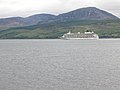 Cruise ship The World - geograph.org.uk - 58056.jpg 640 × 480; 102 KB
-
 Culag by Loch Lomond - geograph.org.uk - 627409.jpg 640 × 480; 58 KB
-
 Dalmeny Park Country House Hotel. - geograph.org.uk - 101298.jpg 640 × 480; 103 KB
-
 Dalmeny Park Country House Hotel. - geograph.org.uk - 101299.jpg 640 × 480; 97 KB
-

-
 Davaar Island from Ballimenach. - geograph.org.uk - 248121.jpg 640 × 480; 73 KB
-
-
 Davaar Island from the learside road. - geograph.org.uk - 248123.jpg 640 × 480; 54 KB
-
 Davaar Island lighthouse buildings - geograph.org.uk - 988493.jpg 640 × 480; 40 KB
-

-
 Davaar Island. - geograph.org.uk - 447726.jpg 640 × 480; 77 KB
-
 Dead tree Nevis Glen. - geograph.org.uk - 234010.jpg 640 × 480; 158 KB


