Category:Images by John Slater
Jump to navigation
Jump to search

Media in category "Images by John Slater"
The following 155 files are in this category, out of 155 total.
-
 Acaster Malbis Methodist Church - geograph.org.uk - 5458784.jpg 1,600 × 1,200; 680 KB
-
 Approaching Cheesecake Farm - geograph.org.uk - 6062426.jpg 1,600 × 1,200; 471 KB
-
 Approaching Chipchase Farm on Narrow Lane - geograph.org.uk - 5503157.jpg 1,600 × 1,200; 858 KB
-
 Approaching Lendal Bridge - geograph.org.uk - 3118969.jpg 2,048 × 1,536; 542 KB
-
 Approaching Naburn Lock - geograph.org.uk - 3119394.jpg 1,991 × 922; 241 KB
-
 Approaching New Farm - geograph.org.uk - 5450936.jpg 1,600 × 1,200; 735 KB
-
 Back Lane South, Wheldrake - geograph.org.uk - 6062440.jpg 1,600 × 1,200; 568 KB
-
 Beanland Lane, Stockton on the Forest - geograph.org.uk - 5775415.jpg 1,600 × 1,200; 671 KB
-
 Beck at Yapham Green (geograph 5717929).jpg 1,600 × 1,200; 958 KB
-
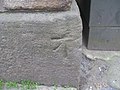 Benchmark at the junction of York Street and Campo Lane - geograph.org.uk - 3372424.jpg 2,048 × 1,536; 700 KB
-
 Benchmark on the Duke of York pub - geograph.org.uk - 3145883.jpg 2,048 × 1,536; 679 KB
-
 Bishopthorpe Crossing - geograph.org.uk - 3386544.jpg 2,048 × 1,536; 577 KB
-
 Bishopthorpe Palace - geograph.org.uk - 3119326.jpg 2,048 × 1,536; 640 KB
-
 Bridge carrying Melrosegate over the cycleway - geograph.org.uk - 5775996.jpg 1,600 × 1,200; 830 KB
-
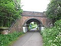 Bridge over the cycleway at Tang Hall Lane - geograph.org.uk - 5775992.jpg 1,600 × 1,200; 867 KB
-

-
 Bridge over the York ^ Selby Path near Mauds Ridding - geograph.org.uk - 5947330.jpg 1,600 × 1,200; 813 KB
-
 Bridges over the drain near Fir Tree Farm - geograph.org.uk - 4027316.jpg 1,600 × 1,200; 690 KB
-
 Bridleway beside the A64 - geograph.org.uk - 4028284.jpg 1,600 × 1,200; 500 KB
-
 Bridleway climbing to cross the A64 - geograph.org.uk - 4028885.jpg 1,600 × 1,200; 697 KB
-
 Bridleway south of Rufforth Hall - geograph.org.uk - 5450537.jpg 1,600 × 1,200; 604 KB
-
 Bridleway to Wheldrake - geograph.org.uk - 6062411.jpg 1,600 × 1,200; 708 KB
-
 Bridleway to York Hill - geograph.org.uk - 4903856.jpg 1,600 × 1,200; 419 KB
-
 Bridleway towards Langwith Lodge from Gipsey Corner - geograph.org.uk - 4027289.jpg 1,600 × 1,200; 391 KB
-
 Bridleway towards Rudcarr lane at Round Hills - geograph.org.uk - 5775405.jpg 1,600 × 1,200; 585 KB
-
 Broomfield Farm - geograph.org.uk - 4026789.jpg 1,600 × 1,200; 826 KB
-
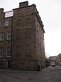 Building at the north end of York Street - geograph.org.uk - 3372429.jpg 1,536 × 2,048; 557 KB
-
 Packhorse bridge at Calva Hall - geograph.org.uk - 2778915.jpg 3,072 × 2,304; 1.34 MB
-
 Camping (and glamping) at Yapham Holds Farm (geograph 5717935).jpg 1,600 × 1,200; 641 KB
-
 Cool Oak Bridge, West Hendon - geograph.org.uk - 5428102.jpg 1,600 × 1,200; 769 KB
-
 Copmanthorpe Lane west of Bishopthorpe - geograph.org.uk - 3386538.jpg 2,048 × 1,536; 667 KB
-
 Course of the old railway near White Carr Farm - geograph.org.uk - 4026768.jpg 1,600 × 1,200; 672 KB
-
 Cruising into York along Clifton Long Reach - geograph.org.uk - 3118983.jpg 2,048 × 1,536; 588 KB
-
 Cycleway on the former railway, north of Osbaldwick - geograph.org.uk - 5775982.jpg 1,600 × 1,200; 778 KB
-
 Cycleway towards York - geograph.org.uk - 5775986.jpg 1,600 × 1,200; 607 KB
-
 Deadwater Station (geograph 4369480).jpg 1,760 × 1,104; 230 KB
-
 Drain south of Brownhills Farm - geograph.org.uk - 5775960.jpg 1,600 × 1,200; 662 KB
-
 Duke of York public house - geograph.org.uk - 3145882.jpg 1,793 × 1,407; 482 KB
-
 Duke of York, Stainland - geograph.org.uk - 3973550.jpg 1,600 × 1,200; 455 KB
-
 Earfit Lane towards Colton - geograph.org.uk - 3386562.jpg 2,048 × 1,536; 561 KB
-
 East Coast main line crosses the River Ouse - geograph.org.uk - 3115573.jpg 2,048 × 1,536; 549 KB
-
 End of the bridleway at Rufforth Moor - geograph.org.uk - 5450534.jpg 1,600 × 1,200; 894 KB
-
 Entrance to Belsom Farm (geograph 5717937).jpg 1,600 × 1,200; 570 KB
-
 Entrance to Fulford Cemetery - geograph.org.uk - 4028889.jpg 1,600 × 1,200; 692 KB
-
 Entrance to Manor Farm Buildings - geograph.org.uk - 5458456.jpg 1,600 × 1,200; 913 KB
-
 Entrance to Rufforth Hall - geograph.org.uk - 5450542.jpg 1,600 × 1,200; 655 KB
-
 Entrance to Willow Farm (geograph 5717626).jpg 1,600 × 1,200; 711 KB
-
 Fir Tree Farm - geograph.org.uk - 4027313.jpg 1,600 × 1,200; 571 KB
-
 Fisherman and his dog on Naburn Bridge - geograph.org.uk - 3119362.jpg 2,048 × 1,536; 606 KB
-
 Footbridge beside the River Foss north of Strensall - geograph.org.uk - 5372675.jpg 1,600 × 1,200; 644 KB
-
 Footbridge near Bolton House (geograph 5717904).jpg 1,600 × 1,200; 949 KB
-
 Footbridge on the Ebor Way west of Bishopthorpe - geograph.org.uk - 3386541.jpg 2,048 × 1,536; 520 KB
-
 Footbridge over the drain at the western end of Grimston Wood - geograph.org.uk - 4027294.jpg 1,600 × 1,200; 1,022 KB
-
 Footbridge over the drain north of Lockwood's Plantation - geograph.org.uk - 4027334.jpg 1,600 × 1,200; 882 KB
-

-

-
 Footpath at Middlethorpe Common - geograph.org.uk - 5458810.jpg 1,600 × 1,200; 667 KB
-
 Footpath beside Fulford Golf Course - geograph.org.uk - 4028273.jpg 1,600 × 1,200; 596 KB
-
 Footpath beside Lysander Cottage, Elvington - geograph.org.uk - 4027276.jpg 1,600 × 1,200; 578 KB
-
 Footpath from Meltonby Lane towards Yapham (geograph 5717934).jpg 1,600 × 1,200; 674 KB
-
 Footpath junction at the west side of Stub Wood - geograph.org.uk - 5458449.jpg 1,600 × 1,200; 531 KB
-
 Footpath off Carrbank Lane - geograph.org.uk - 5775402.jpg 1,600 × 1,200; 429 KB
-
 Footpath to Elvington - geograph.org.uk - 6062419.jpg 1,600 × 1,200; 659 KB
-
 Footpath to Elvington - geograph.org.uk - 6062429.jpg 1,600 × 1,200; 562 KB
-
 Footpath towards Bishopthorpe - geograph.org.uk - 5458800.jpg 1,600 × 1,200; 681 KB
-
 Former station at Crouch End (geograph 6039346).jpg 1,600 × 1,200; 456 KB
-
 Foss Walk near Mosswood House - geograph.org.uk - 5939180.jpg 1,600 × 1,200; 679 KB
-
 Foss Walk towards Crayke from Mosswood Lane - geograph.org.uk - 5939185.jpg 1,600 × 1,200; 539 KB
-
 Fulford Hall - geograph.org.uk - 3119318.jpg 2,048 × 1,536; 673 KB
-
 Garth Farm, Acaster Malbis - geograph.org.uk - 5458790.jpg 1,600 × 1,200; 548 KB
-
 Gated footbridge over Smawith Dike - geograph.org.uk - 5450548.jpg 1,600 × 1,200; 619 KB
-
 Goole railway station (geograph 5147173).jpg 1,600 × 1,200; 567 KB
-
 Grange Farm - geograph.org.uk - 4027282.jpg 1,600 × 1,200; 782 KB
-
 Hagg House Farm, north of Askham Bryan - geograph.org.uk - 5450512.jpg 1,600 × 1,200; 405 KB
-
 Hessay Methodist Church - geograph.org.uk - 5450552.jpg 1,600 × 1,200; 450 KB
-
 Holly Tree House - geograph.org.uk - 4026713.jpg 1,600 × 1,200; 758 KB
-
 Inn on the Green, Acomb (geograph 5453672).jpg 1,600 × 1,200; 549 KB
-
 Kexby Bridge - geograph.org.uk - 3928787.jpg 1,600 × 1,200; 688 KB
-
 Kexby Stray Farm - geograph.org.uk - 4026788.jpg 1,600 × 1,200; 449 KB
-
 Kirkham Abbey signal box and level crossing - geograph.org.uk - 3868947.jpg 1,600 × 1,200; 590 KB
-
 Knapton Lane, Acomb - geograph.org.uk - 5453655.jpg 1,600 × 1,200; 802 KB
-
 Lane towards Keys Plantation - geograph.org.uk - 4027305.jpg 1,600 × 1,200; 680 KB
-
 Lane towards Langwith House - geograph.org.uk - 4027309.jpg 1,600 × 1,200; 968 KB
-
 Lane towards Stock Hill - geograph.org.uk - 3854561.jpg 1,600 × 1,200; 964 KB
-
 Lock House, near Strensall - geograph.org.uk - 5372655.jpg 1,600 × 1,200; 488 KB
-
 Looking north from Pool Bridge - geograph.org.uk - 4027324.jpg 1,600 × 1,200; 797 KB
-
 Millennium Bridge - geograph.org.uk - 3118993.jpg 2,048 × 1,536; 554 KB
-
 Moor Lane Bridge - geograph.org.uk - 5947327.jpg 1,600 × 1,200; 802 KB
-
 Moor Lane towards the former level crossing - geograph.org.uk - 3386557.jpg 2,048 × 1,536; 599 KB
-
 Moor Lane, north of Knapton - geograph.org.uk - 5453647.jpg 1,600 × 1,200; 909 KB
-
 Naburn Bridge - geograph.org.uk - 3119352.jpg 2,048 × 1,340; 445 KB
-
 Narrow Lane, Wigginton Moor - geograph.org.uk - 5503153.jpg 1,600 × 1,200; 875 KB
-
 New York Lane - geograph.org.uk - 3395299.jpg 2,048 × 1,536; 536 KB
-
 Nostell station used to be here (geograph 2811772).jpg 3,072 × 2,304; 1.52 MB
-
 Nova Scotia Farm - geograph.org.uk - 5775420.jpg 1,600 × 1,200; 457 KB
-
 Old line of road east of Wilberfoss (geograph 5717624).jpg 1,600 × 1,200; 1,008 KB
-
 Path junction at the corner of Heslington Common - geograph.org.uk - 4028269.jpg 1,600 × 1,200; 667 KB
-
 Pond near Old Carlton Farm - geograph.org.uk - 5775384.jpg 1,600 × 1,200; 433 KB
-
 Pool Bridge Farm - geograph.org.uk - 4027326.jpg 1,600 × 1,200; 486 KB
-
 Poppleton railway station - geograph.org.uk - 5450948.jpg 1,600 × 1,200; 627 KB
-
 Primary School, Askham Richard - geograph.org.uk - 5450389.jpg 1,600 × 1,200; 549 KB
-
 Primrose Farm - geograph.org.uk - 5775950.jpg 1,600 × 1,200; 528 KB
-
 Redundant gate beside Kexby Stray - geograph.org.uk - 4026759.jpg 1,600 × 1,200; 835 KB
-
 River Foss between Piccadilly and Fossgate bridges - geograph.org.uk - 5776008.jpg 1,600 × 1,200; 750 KB
-
 River Foss near Strensall - geograph.org.uk - 5372663.jpg 1,600 × 1,200; 518 KB
-
 Rose Cottage Farm near Wigginton - geograph.org.uk - 5503162.jpg 1,600 × 1,200; 487 KB
-
 Rowland Hill Farm (geograph 5717927).jpg 1,600 × 1,200; 575 KB
-
 Scoreby Lane - geograph.org.uk - 4026709.jpg 1,600 × 1,200; 516 KB
-
 Scoreby Lodge - geograph.org.uk - 4026755.jpg 1,600 × 1,200; 803 KB
-
 Scoreby Manor House - geograph.org.uk - 4026748.jpg 1,600 × 1,200; 624 KB
-
 Sewage treatment works - geograph.org.uk - 3118960.jpg 2,048 × 1,536; 619 KB
-
 Sharp bend on Meltonby Lane (geograph 5717933).jpg 1,600 × 1,200; 868 KB
-
 Site of Dawley and Stirchley station (geograph 6305727).jpg 1,600 × 1,200; 968 KB
-
 Site of railway station (geograph 2970215).jpg 2,048 × 1,536; 536 KB
-
 Site of the former Moor Lane level crossing - geograph.org.uk - 3386555.jpg 2,048 × 1,536; 578 KB
-
 Skeldergate Bridge - geograph.org.uk - 3118989.jpg 2,048 × 1,536; 544 KB
-
 South Farm - geograph.org.uk - 4026751.jpg 1,600 × 1,200; 687 KB
-
 South Lodge (geograph 5717630).jpg 1,600 × 1,200; 690 KB
-
 Sports pitches at Rufforth - geograph.org.uk - 5450523.jpg 1,600 × 1,200; 367 KB
-
 St James's Church, Murton - geograph.org.uk - 5775973.jpg 1,600 × 1,200; 630 KB
-
 St Mary's Church, Welwick (geograph 5785654).jpg 1,600 × 1,200; 617 KB
-
 St Marys ^ St Nicholas Church, Wigginton - geograph.org.uk - 5503172.jpg 1,600 × 1,200; 559 KB
-
 St Nicholas Church, Askham Bryan - geograph.org.uk - 5450509.jpg 1,600 × 1,200; 413 KB
-
 St Oswald's Church, Fulford - geograph.org.uk - 4028899.jpg 1,600 × 1,200; 661 KB
-
 St Thomas's Church, Osbaldwick - geograph.org.uk - 5775978.jpg 1,600 × 1,200; 412 KB
-
 Strensall New Bridge - geograph.org.uk - 5372680.jpg 1,600 × 1,200; 458 KB
-
 Tadcaster Road at Dringhouses, towards York - geograph.org.uk - 5458817.jpg 1,600 × 1,200; 566 KB
-
 The Fox Inn, Stockton on the Forest - geograph.org.uk - 5775413.jpg 1,600 × 1,200; 399 KB
-
 The lane to Grey Leys Farm - geograph.org.uk - 4026798.jpg 1,600 × 1,200; 812 KB
-
 The Nags Head Inn, Askham Bryan - geograph.org.uk - 5450506.jpg 1,600 × 1,200; 484 KB
-
 The Old School Village Store and Tearoom, Rufforth - geograph.org.uk - 5450529.jpg 1,600 × 1,200; 390 KB
-
 The Red Lion at Knapton - geograph.org.uk - 5453651.jpg 1,600 × 1,200; 470 KB
-
 The Rose and Crown, Askham Richard - geograph.org.uk - 5450387.jpg 1,600 × 1,200; 409 KB
-
 The Ship at Strensall - geograph.org.uk - 5372667.jpg 1,600 × 1,200; 387 KB
-
 The White Horse, Upper Poppleton - geograph.org.uk - 5450943.jpg 1,600 × 1,200; 516 KB
-
 Towards Normans from York Road - geograph.org.uk - 5704930.jpg 1,600 × 1,200; 681 KB
-
 Track junction east of Lime Field Farm - geograph.org.uk - 4026717.jpg 1,600 × 1,200; 414 KB
-
 Track towards Bradley Grange - geograph.org.uk - 5450514.jpg 1,600 × 1,200; 563 KB
-
 Traffic calming , School Lane, Fulford - geograph.org.uk - 4028893.jpg 1,600 × 1,200; 726 KB
-
 Triangulation pillar on York Hill - geograph.org.uk - 4903976.jpg 1,600 × 1,200; 834 KB
-
 Trinity Methodist Church, Goole (geograph 5147177).jpg 1,600 × 1,200; 583 KB
-
 Urban footpath in Copmanthorpe - geograph.org.uk - 3386549.jpg 2,048 × 1,536; 518 KB
-
 Vale of York public house - geograph.org.uk - 3606064.jpg 1,600 × 1,200; 403 KB
-
 Water tower near Askham Bryan College - geograph.org.uk - 5704926.jpg 1,600 × 1,200; 425 KB
-
 Wenlock Arms, Wheldrake - geograph.org.uk - 6062436.jpg 1,600 × 1,200; 505 KB
-

-
 White House Farm - geograph.org.uk - 4027297.jpg 1,600 × 1,200; 412 KB
-
 White House Farm - geograph.org.uk - 4028880.jpg 1,600 × 1,200; 630 KB
-
 Wigginton Pond - geograph.org.uk - 5503165.jpg 1,600 × 1,200; 665 KB
-
 Woodhouse Farm - geograph.org.uk - 5450931.jpg 1,600 × 1,200; 610 KB
-
 York and Selby Path - geograph.org.uk - 3386536.jpg 2,048 × 1,536; 631 KB
-
 York City Football Club training ground - geograph.org.uk - 5503149.jpg 1,600 × 1,200; 441 KB
-
 York Gate Farm (aka The Cheerful Chilli) - geograph.org.uk - 3403520.jpg 2,048 × 1,536; 690 KB
-
 York Ring Road crosses the River Ouse - geograph.org.uk - 3115577.jpg 2,048 × 1,536; 545 KB
-
 York ^ Selby Path north of Riccall - geograph.org.uk - 5950356.jpg 1,600 × 1,200; 686 KB


.jpg)


_at_Yapham_Holds_Farm_(geograph_5717935).jpg)


.jpg)


.jpg)


.jpg)


.jpg)


.jpg)


.jpg)


.jpg)


.jpg)


.jpg)

.jpg)


.jpg)


.jpg)
.jpg)
.jpg)


.jpg)


.jpg)


.jpg)


_-_geograph.org.uk_-_6351626.jpg)


_-_geograph.org.uk_-_3403520.jpg)

