Category:Images by Graham Burnett
Jump to navigation
Jump to search

{{DEFAULTSORT:}Burnett, Graham}
Media in category "Images by Graham Burnett"
The following 111 files are in this category, out of 111 total.
-
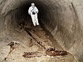 1880s Channel Tunnel Bore - geograph.org.uk - 254079.jpg 640 × 480; 100 KB
-
 A view from the Hub - geograph.org.uk - 253933.jpg 640 × 458; 80 KB
-
 All Saints, Dale - geograph.org.uk - 914501.jpg 640 × 480; 82 KB
-
 Ancient Tithe Barn - geograph.org.uk - 425869.jpg 640 × 480; 76 KB
-
 Ankerton House - geograph.org.uk - 275166.jpg 640 × 303; 57 KB
-
 Ashley Church - geograph.org.uk - 281173.jpg 640 × 480; 111 KB
-
 Astley Castle - geograph.org.uk - 480702.jpg 640 × 480; 101 KB
-
 Baden Hall - geograph.org.uk - 267718.jpg 640 × 480; 91 KB
-
 Baden Hall Fishery - geograph.org.uk - 267720.jpg 640 × 480; 86 KB
-
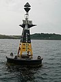 Black Rock Buoy - geograph.org.uk - 257795.jpg 480 × 640; 62 KB
-
 Bottesford Church - geograph.org.uk - 285056.jpg 640 × 475; 76 KB
-
 Brookside Business Park - geograph.org.uk - 267721.jpg 640 × 480; 75 KB
-
 Brown's Bridge - geograph.org.uk - 279078.jpg 640 × 480; 103 KB
-
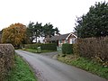 Bungalows and lane near Aspley - geograph.org.uk - 279082.jpg 640 × 480; 96 KB
-
 Bures St Mary - Chapel of St Stephen.jpg 640 × 480; 68 KB
-

-

-
 The Church of St Michael Chesterton - geograph.org.uk - 265404.jpg 640 × 480; 91 KB
-
 Chesterton Lodge - geograph.org.uk - 265408.jpg 640 × 480; 73 KB
-
 Coppice Farm and Buxtons A34 - geograph.org.uk - 271285.jpg 640 × 303; 80 KB
-
 Drake Hall Prison - geograph.org.uk - 272288.jpg 640 × 480; 90 KB
-
 Footpath to the White Horse Sibton - geograph.org.uk - 869467.jpg 640 × 480; 78 KB
-
 Grenville's Wood - geograph.org.uk - 271287.jpg 640 × 480; 53 KB
-
 Halangy Down BBC transmitter.jpg 640 × 480; 59 KB
-
 Hestercombegardens1.jpg 640 × 480; 127 KB
-
 Hilcote Hall - geograph.org.uk - 270804.jpg 640 × 480; 92 KB
-
 Holt Castle - geograph.org.uk - 570313.jpg 640 × 480; 83 KB
-
 Lane junction and house in Aspley - geograph.org.uk - 279086.jpg 640 × 480; 84 KB
-
 Little Ankerton Cats Hill - geograph.org.uk - 275165.jpg 640 × 480; 72 KB
-
 Lizard Point Tresco IOS - geograph.org.uk - 571003.jpg 640 × 480; 82 KB
-
 Longner Hall - geograph.org.uk - 425841.jpg 640 × 480; 89 KB
-
 Lydiard Tregoze Church - geograph.org.uk - 285029.jpg 640 × 480; 73 KB
-
 Lynch Lodge - geograph.org.uk - 265413.jpg 640 × 480; 86 KB
-
 Madresfield Court - geograph.org.uk - 292102.jpg 640 × 475; 69 KB
-
 Mausoleum at Knebworth House Herts - geograph.org.uk - 476189.jpg 640 × 480; 62 KB
-

-
 Merevale Our Lady Church - geograph.org.uk - 480715.jpg 640 × 480; 96 KB
-
 Middleton Hall 02.jpg 640 × 480; 114 KB
-
 Moel Lefn Summit Cairn - geograph.org.uk - 257690.jpg 640 × 480; 103 KB
-
 Morley St Matthews 744202 d54f0ee1.jpg 640 × 480; 69 KB
-
 New Dunwich Heathland - geograph.org.uk - 484167.jpg 640 × 480; 84 KB
-
 Norton Bridge - geograph.org.uk - 270813.jpg 640 × 480; 74 KB
-
 Old Hall Croscombe.jpg 640 × 480; 105 KB
-
 Old Smithy Norton Bridge - geograph.org.uk - 270818.jpg 640 × 480; 73 KB
-
 Oxleasows - geograph.org.uk - 270809.jpg 640 × 480; 62 KB
-
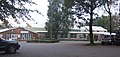
 Peasenhall Primary School - geograph.org.uk - 869455.jpg 640 × 480; 90 KB
-
 Polstead Hall - geograph.org.uk - 702663.jpg 640 × 480; 84 KB
-
 Pylons marching easterly - geograph.org.uk - 281160.jpg 640 × 480; 85 KB
-
 Rail Bridge and Tunnel Portal - geograph.org.uk - 278423.jpg 640 × 480; 117 KB
-
 Redheugh Bridge - geograph.org.uk - 253393.jpg 562 × 640; 72 KB
-
 Roundabout Hawks Green - geograph.org.uk - 278973.jpg 640 × 480; 51 KB
-
 Saint Felix School - geograph.org.uk - 270287 (sq cropped).jpg 384 × 384; 62 KB
-
 Saint Felix School - geograph.org.uk - 270287.jpg 640 × 480; 121 KB
-
 Rossetti Panels in St Martin's Church - geograph.org.uk - 1836350.jpg 1,600 × 1,200; 435 KB
-
 St Martins - geograph.org.uk - 1836338.jpg 800 × 600; 131 KB
-
 Sedgehill Church - geograph.org.uk - 285012.jpg 640 × 480; 68 KB
-
 St Bartholomews - geograph.org.uk - 425854.jpg 640 × 480; 86 KB
-
 St Margarets Church - geograph.org.uk - 292104.jpg 640 × 475; 54 KB
-
 St Marys RC Church - geograph.org.uk - 911595.jpg 640 × 480; 40 KB
-
 St Michael - geograph.org.uk - 869172.jpg 640 × 480; 94 KB
-
 St Peters Church Daylesford - geograph.org.uk - 1100644.jpg 640 × 480; 90 KB
-
 Crown Hotel Stamford - geograph.org.uk - 266703.jpg 640 × 480; 118 KB
-
 The Fox Inn Westbound A14 - geograph.org.uk - 277397.jpg 640 × 480; 65 KB
-
 The Hermitage, Depedale - geograph.org.uk - 914506.jpg 640 × 480; 112 KB
-
 The Street, Frostenden Corner - geograph.org.uk - 367517.jpg 640 × 480; 93 KB
-
 The World's Second Iron Bridge - geograph.org.uk - 789602.jpg 640 × 480; 94 KB
-
 Top Farm Wootton - geograph.org.uk - 277859.jpg 640 × 480; 53 KB
-
-
 Walled Garden Lindisfarne - geograph.org.uk - 253409.jpg 640 × 480; 63 KB
-
 Weir from the Nene - geograph.org.uk - 265409.jpg 640 × 480; 107 KB
-
 Yew Tree Farm - geograph.org.uk - 278405.jpg 640 × 480; 136 KB
-
 Across Chesterton hill - geograph.org.uk - 265420.jpg 640 × 480; 59 KB
-
 Boxbury Farm - geograph.org.uk - 302523.jpg 640 × 480; 90 KB
-
 Bridewell Cottage ,Wise Lane - geograph.org.uk - 285042.jpg 640 × 480; 86 KB
-
 Bryn Teg - geograph.org.uk - 252760.jpg 300 × 215; 18 KB
-

-
 Chedglow Manor Farm - geograph.org.uk - 281231.jpg 640 × 480; 93 KB
-
 Coterstock Lock River Nene - geograph.org.uk - 266701.jpg 640 × 480; 61 KB
-
 Farmland near Ladfordfield Ind Est - geograph.org.uk - 277860.jpg 640 × 480; 71 KB
-
 Field from Withy Bed - geograph.org.uk - 281196.jpg 640 × 480; 91 KB
-
 Formby Dunes - geograph.org.uk - 255473.jpg 640 × 480; 77 KB
-
 Formby with shale deposits - geograph.org.uk - 255470.jpg 640 × 480; 70 KB
-
 Fosse Gate - geograph.org.uk - 281181.jpg 640 × 480; 174 KB
-
 Friar Hayes Lane - geograph.org.uk - 284946.jpg 640 × 480; 92 KB
-
 Great Larkhill Farm - geograph.org.uk - 281145.jpg 640 × 480; 107 KB
-
 Hilcote Farm - geograph.org.uk - 270802.jpg 640 × 480; 78 KB
-

-
 Hop Spinney - geograph.org.uk - 265406.jpg 640 × 480; 68 KB
-

-
 Lane Junction Chebsey - geograph.org.uk - 270392.jpg 640 × 480; 133 KB
-
 Lane Junction Nr Clouds House East Knoyle - geograph.org.uk - 284927.jpg 640 × 480; 142 KB
-
 Monarch's Way - geograph.org.uk - 281244.jpg 640 × 480; 85 KB
-
 New House Farm - geograph.org.uk - 276121.jpg 640 × 480; 128 KB
-
 North along the Aberglaslyn Valley - geograph.org.uk - 257930.jpg 640 × 480; 124 KB
-
 Park Corner Farm - geograph.org.uk - 284900.jpg 640 × 480; 71 KB
-
 Pasture Field near Ash Bed - geograph.org.uk - 281206.jpg 640 × 480; 66 KB
-
 Play area and recreation ground - geograph.org.uk - 302539.jpg 640 × 480; 63 KB
-

-
 Quay Lane Reydon - geograph.org.uk - 270285.jpg 640 × 480; 83 KB
-
 Reydon Quay - geograph.org.uk - 270282.jpg 640 × 480; 74 KB
-
 Service Area Kettering A14 - geograph.org.uk - 277391.jpg 640 × 480; 62 KB
-
 Sheep Walk Farm - geograph.org.uk - 265405.jpg 640 × 480; 63 KB
-
 Sheep Walk Farm - geograph.org.uk - 266696.jpg 640 × 480; 92 KB
-
 Snaggs Farm. - geograph.org.uk - 284937.jpg 640 × 480; 96 KB
-
 Spring Fields Farm - geograph.org.uk - 276118.jpg 640 × 480; 74 KB
-
 Stukeley Roundabout - geograph.org.uk - 277362.jpg 640 × 480; 43 KB
-
 Sweetwell Farm - geograph.org.uk - 285016.jpg 640 × 480; 74 KB
-
 The Monarch's Way Long Newton - geograph.org.uk - 281221.jpg 640 × 480; 80 KB
-

-
 Water Newton Lodge - geograph.org.uk - 265407.jpg 640 × 480; 92 KB
-
 Winding Wheel Pub - geograph.org.uk - 278978.jpg 640 × 480; 78 KB


.jpg)


