Category:Images by David Purchase
Jump to navigation
Jump to search

Media in category "Images by David Purchase"
The following 200 files are in this category, out of 228 total.
(previous page) (next page)-
 A rather pointless sign! (geograph 5572713).jpg 2,592 × 1,944; 1.4 MB
-
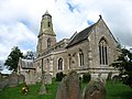
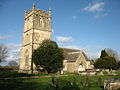
 Aghamore church (geograph 4058377).jpg 2,592 × 1,944; 1 MB
-
 Alderton village pond (geograph 2482259).jpg 2,592 × 1,944; 1.81 MB
-
 All Saints church, Aldwincle (geograph 3271603).jpg 2,592 × 1,944; 1.68 MB
-
 All Saints Church, Walton West - geograph.org.uk - 2558976.jpg 2,592 × 1,944; 1.66 MB
-
 All Saints' Church, Turkdean Geograph-2821694-by-David-Purchase.jpg 2,592 × 1,944; 1.66 MB
-
 Allerton church (geograph 2543565).jpg 2,592 × 1,944; 1.57 MB
-
 An unnamed tarn near Cleabarrow (geograph 3346219).jpg 2,592 × 1,944; 1.54 MB
-

-
 Approaching Cullen from the south (geograph 4949539) (cropped).jpg 2,298 × 1,331; 658 KB
-
 Approaching Cullen from the south (geograph 4949539).jpg 2,592 × 1,944; 1.49 MB
-
 Approaching the A838 (geograph 5044845).jpg 2,592 × 1,944; 1.93 MB
-
 Ardattin village (geograph 4073254).jpg 2,592 × 1,944; 1.51 MB
-
 Ardross church (geograph 5842941).jpg 2,592 × 1,944; 1.6 MB
-
 Ashridge Golf Course - the fifth hole.jpg 2,592 × 1,944; 2.05 MB
-
 Ashton Keynes church (geograph 5176856).jpg 2,199 × 1,536; 570 KB
-
 At the end of the track from Breanais (geograph 1961740).jpg 2,048 × 1,536; 1.18 MB
-
 Ballingarry church (geograph 4090332).jpg 2,592 × 1,944; 1.43 MB
-
 Bassenthwaite Lake under cloud-geograph-2699580-by-David-Purchase.jpg 2,592 × 1,944; 1.12 MB
-
 Beech Croft, Mockerkin (geograph 3096478).jpg 2,592 × 1,944; 1.56 MB
-
 Beinn Dubhain summit - geograph.org.uk - 1657197.jpg 640 × 480; 79 KB
-
 Benton Castle (geograph 2558966).jpg 1,944 × 2,592; 1.2 MB
-
 Benton Castle at sunset (geograph 2558939).jpg 2,592 × 1,944; 959 KB
-
 Biglands Nature Reserve (geograph 3493012).jpg 2,592 × 1,944; 1.78 MB
-
 Blockley Bowls Club-geograph-3517233-by-David-Purchase.jpg 2,592 × 1,944; 1.52 MB
-
 Blockley, Gloucestershire-Geograph-3517219-by-David-Purchase.jpg 2,592 × 1,944; 1.48 MB
-
 Boustead Hill (geograph 3492208).jpg 2,592 × 1,944; 1.23 MB
-
 Bowness Marsh and Bowness Wath - geograph.org.uk - 3492600.jpg 2,592 × 1,944; 1.72 MB
-
 Brick Road, Sunk Island - geograph.org.uk - 5784269.jpg 2,592 × 1,944; 1.37 MB
-
 Builth Road Wye Bridge.jpg 2,592 × 1,944; 2.02 MB
-
 Burra Voe pier (geograph 5023515).jpg 2,592 × 1,944; 1.13 MB
-
 St Lawrence's church, Bythorn-geograph.org.uk-3019407.jpg 2,592 × 1,944; 1.49 MB
-
 Camster Cairns - geograph.org.uk - 1657248.jpg 640 × 480; 85 KB
-
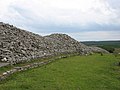 Camster Cairns - the Long Cairn - geograph.org.uk - 1657255.jpg 640 × 480; 80 KB
-
 Castle Calvay (geograph 2537186).jpg 2,048 × 1,536; 805 KB
-
 Castlehill harbour (geograph 4553369).jpg 2,592 × 1,944; 1.31 MB
-
 Castlehill harbour (geograph 4553386).jpg 2,592 × 1,944; 1.41 MB
-
 Clifton College Cricket Pavilion (geograph 2531939).jpg 2,592 × 1,944; 1.08 MB
-
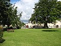 Clondulane village green (geograph 4085367).jpg 2,592 × 1,944; 2.13 MB
-
 Cnoc Craggie summit - geograph.org.uk - 1657100.jpg 640 × 480; 57 KB
-
 St Marys church, Collingbourne Kingston (geograph 3015572).jpg 2,592 × 1,944; 1.35 MB
-
 Compton House, Over Compton (geograph 2137308).jpg 2,592 × 1,944; 1.79 MB
-
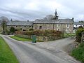 Cottages in Aughertree, Cumberland - geograph-2932388.jpg 2,592 × 1,944; 1.6 MB
-
 Culham Farm (geograph 4438557).jpg 2,427 × 1,838; 1.15 MB
-
 Disused church at Fasnakyle (geograph 5838257).jpg 2,592 × 1,944; 2.32 MB
-
 Drumburgh village - geograph.org.uk - 3492245.jpg 2,592 × 1,944; 1.57 MB
-
 Dunnet Head Lighthouse - geograph.org.uk - 1657054.jpg 640 × 480; 72 KB
-
 Easton Grey House-geograph-2486328.jpg 2,592 × 1,944; 1.84 MB
-
 Easton Grey-geograph-2486429.jpg 2,592 × 1,944; 1.56 MB
-
 Eglwys Sant Sior, Trefor (geograph 4622508).jpg 2,592 × 1,944; 1.68 MB
-
 All Saints Church, Ellington.jpg 1,944 × 2,592; 1.5 MB
-
 Ellonby village (geograph 3748604).jpg 2,592 × 1,944; 1.01 MB
-
 Entering Gamelsby (geograph 3493015).jpg 2,592 × 1,944; 1.63 MB
-
 Farmland near Newlands, Sunk Island (geograph 5784939).jpg 2,533 × 1,901; 1.1 MB
-
 Farmland near York Farm - geograph.org.uk - 4162918.jpg 2,592 × 1,944; 1.63 MB
-
 Fields at Crossgates (geograph 3096445).jpg 2,592 × 1,944; 997 KB
-
 Fields at Newtown Farm - geograph.org.uk - 3502862.jpg 2,592 × 1,944; 1.17 MB
-
 Fields at Unthank End (geograph 3093862).jpg 2,592 × 1,944; 1.81 MB
-
 Fields by the Solway Firth - geograph.org.uk - 3590916.jpg 2,592 × 1,944; 1.45 MB
-
 Fields east of Lamonby (geograph 2932492).jpg 2,592 × 1,944; 1.34 MB
-
 Fields south-east of Burtholme (geograph 3493991).jpg 2,592 × 1,944; 1.81 MB
-
 Fields west of Lamonby (geograph 2932487).jpg 2,592 × 1,944; 1.31 MB
-
 Footbridge over the River Wye (Afon Gwy) (geograph 2609434).jpg 2,592 × 1,944; 2.52 MB
-
 Former Baptist Chapel, Hillesley (geograph 3662562).jpg 2,592 × 1,944; 1.41 MB
-
 Foxley church (geograph 2482384).jpg 2,592 × 1,944; 1.42 MB
-
 Geograph 2665932 The entrance to Harptree Court.jpg 2,592 × 1,944; 1.93 MB
-
 Gilbert Place, Bloomsbury-geograph-3542678-by-David-Purchase.jpg 2,592 × 1,944; 1.33 MB
-
 Glyn Bridge Powys Wales.jpg 2,592 × 1,944; 2.72 MB
-
 Haverfordwest golf course (geograph 5899697).jpg 2,592 × 1,944; 1.23 MB
-
 Hillside west of Elsdonburn - geograph.org.uk - 2212997.jpg 2,592 × 1,944; 1.97 MB
-
 Holy Cross church, Hankerton (geograph 2842107).jpg 2,592 × 1,944; 1.5 MB
-
 Holy Trinity church, Meldreth (geograph 2828832).jpg 2,592 × 1,944; 1.19 MB
-
 Houses near Clonmore (geograph 4930755).jpg 2,592 × 1,944; 1.44 MB
-
 Hugh Town Battery (geograph 3443439).jpg 2,592 × 1,944; 1.47 MB
-
 In Alderton village (geograph 2482263).jpg 2,592 × 1,944; 1.65 MB
-
 Inverugie Bridge (geograph 4217716).jpg 2,592 × 1,944; 1.75 MB
-
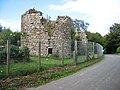 Inverugie Castle (geograph 4217732).jpg 2,592 × 1,944; 1.6 MB
-
 Isel Hall, and the bridge over Blumer Beck (geograph 3380818).jpg 2,592 × 1,944; 1.64 MB
-
 Kirkham Bridge (geograph 5784027).jpg 2,592 × 1,944; 1.93 MB
-
-
-

-
-

-
 Loch Ossian - geograph.org.uk - 1657316.jpg 640 × 480; 99 KB
-

-
 Lockerbie Town Hall and War Memorial (geograph 4767511).jpg 2,592 × 1,944; 931 KB
-
 Long Itchington Holy Trinity fr SW GeoUK 3940416.jpg 972 × 972; 192 KB
-
 St Marys church, Longdon (geograph 3819182).jpg 1,944 × 2,592; 1.91 MB
-

-
 Looking towards Coldsmouth Hill from Eccles Cairn - geograph.org.uk - 2212990.jpg 2,592 × 1,944; 1.37 MB
-
 Loughglinn church (geograph 4080029).jpg 2,592 × 1,944; 966 KB
-
 Loughglinn main street (geograph 4080267).jpg 2,592 × 1,944; 1.63 MB
-
 Lower Cabrach church (geograph 6214305).jpg 2,592 × 1,944; 1.36 MB
-
 Lybster Free Church (geograph 4550925).jpg 2,592 × 1,944; 1 MB
-
 Lybster Harbour - geograph.org.uk - 1657132.jpg 640 × 480; 93 KB
-
 Mapledurham Weir (geograph 4442433).jpg 2,592 × 1,944; 1.8 MB
-
 Marlborough House (geograph 3001974).jpg 2,592 × 1,944; 1.6 MB
-
 Matterdale church (geograph 3347535).jpg 2,592 × 1,944; 2.04 MB
-
 Mealisval from the west (geograph 1961761).jpg 2,048 × 1,536; 1.21 MB
-
 Mealisval summit cairn (geograph 1961720).jpg 2,048 × 1,536; 1,000 KB
-
 Memorial stone on Carlock Hill - geograph.org.uk - 1654876.jpg 640 × 480; 131 KB
-
 Meridian Marker beside the Thames (geograph 3333127).jpg 1,944 × 2,592; 1.36 MB
-

-
 Mockerkin village centre (geograph 3096472).jpg 2,592 × 1,944; 1.05 MB
-
 Modern housing in Linstock (geograph 3494056).jpg 2,592 × 1,944; 1.8 MB
-
 Morebattle Hill - geograph.org.uk - 2211486.jpg 2,592 × 1,944; 1.64 MB
-
 Church of the Holy Cross, Moreton Morrell (geograph 4021984).jpg 2,592 × 1,944; 1.82 MB
-
 MV Altaire in Voe of the Brig (geograph 5023462).jpg 2,592 × 1,944; 1.31 MB
-
 Nether Wasdale church (geograph 4701027).jpg 2,592 × 1,944; 1.56 MB
-
 Newlands Road and Farm, Sunk Island (geograph 5784935).jpg 2,592 × 1,944; 1.37 MB
-
 Old barns near Wilburton Manor House (geograph 5170538).jpg 2,194 × 1,576; 1.05 MB
-
 On Askham Fell (geograph 3003544).jpg 2,592 × 1,944; 1.74 MB
-
 Oulton Recreation Ground (geograph 3591039).jpg 2,592 × 1,944; 1.57 MB
-
 Peter's Rock - geograph.org.uk - 1657321.jpg 640 × 480; 135 KB
-
 Pinkney Court - geograph.org.uk - 2488943.jpg 2,592 × 1,944; 1.68 MB
-
 Pont Rhydgaled under repair (geograph 2609044).jpg 2,592 × 1,944; 1.76 MB
-
 River Duddon footbridge plaque - geograph.org.uk - 4699873.jpg 2,592 × 1,944; 1.92 MB
-
 Roadends sculpture verses (1) - geograph.org.uk - 2538598.jpg 2,048 × 1,536; 1.25 MB
-
 Roadends sculpture verses (2) - geograph.org.uk - 2538605.jpg 2,048 × 1,536; 1.39 MB
-
 Rough ground near Skelpick - geograph-5046122.jpg 2,592 × 1,944; 1.72 MB
-
 Sand Voe, near Isbister (geograph 5023501).jpg 2,592 × 1,944; 1.28 MB
-
 SS. Patrick & Oliver church, Glengoole (geograph 4089147).jpg 2,520 × 1,903; 885 KB
-
 St Andrew's Church, Hazleton Geograph-2821742-by-David-Purchase.jpg 2,592 × 1,944; 1.42 MB
-
 St Andrews church, Hyde Heath (geograph 4425134).jpg 2,592 × 1,944; 1.45 MB
-
 St Andrews church, Whitminster (geograph 5497417).jpg 2,592 × 1,944; 1.89 MB
-
 St Giles Barton, Hillesley (geograph 3662322).jpg 2,592 × 1,944; 1.2 MB
-
 St Giles Church, Alderton (geograph 2482270).jpg 2,592 × 1,944; 1.03 MB
-
 St Giles church, Stanton St Quintin (geograph 2505373).jpg 2,592 × 1,944; 1.8 MB
-
 St Giles church, Stanton St Quintin (geograph 2505420).jpg 2,592 × 1,944; 1.84 MB
-
 St Giles Church, Uley-geograph.org.uk-2748122.jpg 640 × 480; 141 KB
-
 St Helena Island - geograph.org.uk - 1654989.jpg 640 × 480; 127 KB
-
 St John the Evangelist church, New Pitsligo (geograph 6210249).jpg 2,592 × 1,944; 1.69 MB
-
 St John the Evangelist church, New Pitsligo (geograph 6210252).jpg 2,592 × 1,944; 1.72 MB
-
 St Johns Church, Inglesham (geograph 5079481).jpg 2,592 × 1,944; 1.68 MB
-
 St Margaret of Antioch church, Crick (geograph 2520640).jpg 2,592 × 1,944; 1.11 MB
-
 St Margarets church, Bagendon (geograph 5090987).jpg 2,592 × 1,944; 1.8 MB
-
 St Mary the Virgin church, Buckland St Mary (geograph 4558033).jpg 2,592 × 1,944; 1.55 MB
-
 St Mary the Virgin Church, Shepperdine (Geograh Image 3062012 b81b9659).jpg 2,592 × 1,944; 1.52 MB
-
 St Marys church, Chilton Foliat (geograph 2995948).jpg 2,592 × 1,944; 1.45 MB
-
 St Marys church, Creegh (geograph 4946595).jpg 2,592 × 1,944; 1.13 MB
-
 St Marys church, Kempsford (geograph 5084300).jpg 1,944 × 2,592; 1.56 MB
-
 St Marys church, Monnington (geograph 3723204).jpg 2,592 × 1,944; 1.32 MB
-
 St Marys church, Staunton on Wye (geograph 3723071).jpg 2,592 × 1,944; 1.16 MB
-
 St Marys church, Temple Guiting (geograph 3336360).jpg 2,592 × 1,944; 1.5 MB
-
 St Michael and All Angels church, Rowberrow (geograph 2636823).jpg 2,592 × 1,944; 1.74 MB
-
 St Michaels church, Great Cressingham (geograph 3719605).jpg 2,592 × 1,944; 1.61 MB
-
 St Nicholas Church, Sandford Orcas (geograph 2136820).jpg 2,592 × 1,944; 1.93 MB
-
 St Nicholas church, Willoughby - geograph.org.uk - 3767447.jpg 2,592 × 1,944; 1.51 MB
-
 St Ninian's Episcopal Church, Glen Urquhart (geograph 5838276).jpg 2,592 × 1,944; 1.52 MB
-
 St Peter's church, Little Barrington Geograph-2706630-by-David-Purchase.jpg 2,592 × 1,944; 1.77 MB
-
 St Peters church, Aldwincle (geograph 3271597).jpg 1,944 × 2,592; 1.14 MB
-
 St Peters church, Askham (geograph 3590530).jpg 2,592 × 1,944; 1.54 MB
-
 St Peters church, Farmington (geograph 2742781).jpg 2,592 × 1,944; 1 MB
-
 St Peters church, Windrush (geograph 2658906).jpg 2,592 × 1,944; 1.34 MB
-
 St Wddyn's church, Llanwddyn - geograph.org.uk - 2471169.jpg 2,592 × 1,944; 2.58 MB
-
 Stowey House (geograph 2665754).jpg 2,592 × 1,944; 1.82 MB
-
 Strathy Point Lighthouse - geograph.org.uk - 1657078.jpg 640 × 480; 59 KB
-
 Struy Bridge (geograph 5838242).jpg 2,592 × 1,944; 1.85 MB
-

-
 Tadpole Bridge (geograph 5074004).jpg 2,592 × 1,944; 1.85 MB
-
 Temple Bridge (geograph 4438398).jpg 2,592 × 1,944; 1.69 MB
-
 The 16th hole at Cally Golf Course (geograph 5978500).jpg 2,592 × 1,944; 1.43 MB
-
 The A40 in Trecastle (geograph 5900051).jpg 2,592 × 1,944; 1.7 MB
-
 The A40 in Trecastle (geograph 5900058).jpg 2,592 × 1,944; 1.36 MB
-
 The approach to St Mary the Virgin church, Thornthwaite (geograph 3379701).jpg 2,592 × 1,944; 1.36 MB
-
 The B996 through Glenfarg (geograph 6215110).jpg 2,592 × 1,944; 1.72 MB
-
 The Bridges of Newcastle (geograph 3495404).jpg 2,592 × 1,944; 1.6 MB
-
 The Bridges of Newcastle (geograph 3495411).jpg 2,592 × 1,944; 1.3 MB
-
 The centre of Knockananna (geograph 4090979).jpg 2,592 × 1,944; 1.45 MB
-
 The Cridford Inn, Trusham (geograph 3752169).jpg 2,592 × 1,944; 1.74 MB
-
 The Cumbria Way near Skiddaw House (geograph 2699379).jpg 2,592 × 1,944; 1.89 MB
-
 The drive to Dupton House (geograph 2932555).jpg 2,592 × 1,944; 2.36 MB
-
 The Dykesfield crossroads (geograph 3492141).jpg 2,592 × 1,944; 1.93 MB
-
 The East Window of St Ninian's church (geograph 5838289).jpg 2,592 × 1,944; 910 KB
-
 The end of the road at South Lochboisdale, South Uist - geograph.org.uk - 2538583.jpg 2,048 × 1,536; 980 KB
-
 The Formartine and Buchan Way at Udny Station (geograph 6213239).jpg 2,592 × 1,944; 1.55 MB
-
 The Hadrian's Wall Path above Crag Lough - geograph.org.uk - 3501150.jpg 2,592 × 1,944; 1.33 MB
-
 The Hadrian's Wall Path approaching Newtown - geograph.org.uk - 3502884.jpg 2,592 × 1,944; 1.48 MB
-
 The Hadrian's Wall Path follows a 'green lane' - geograph.org.uk - 3502888.jpg 2,592 × 1,944; 2.31 MB
-
 The Hadrian's Wall Path heads for Burgh by Sands - geograph.org.uk - 3492074.jpg 2,592 × 1,944; 2.03 MB
-
 The Hadrian's Wall Path leaving Newtown - geograph.org.uk - 3502873.jpg 2,592 × 1,944; 1.59 MB
-
 The Hadrian's Wall Path near Winshield Crags - geograph.org.uk - 3535341.jpg 2,592 × 1,944; 1.72 MB
-
 The Hadrian's Wall Path nearing Port Carlisle - geograph.org.uk - 3492568.jpg 2,592 × 1,944; 2.38 MB
-
 The Hill o' Many Stanes - geograph.org.uk - 1657209.jpg 640 × 480; 77 KB
-
 The Hill o' Many Stanes - geograph.org.uk - 1657222.jpg 640 × 480; 102 KB
-
 The Hill o' Many Stanes - geograph.org.uk - 1657229.jpg 480 × 640; 126 KB
-
 The Loch of Flugarth (geograph 5023495).jpg 2,592 × 1,944; 1.49 MB
-

-
 The main street in Whaddon (geograph 3273867).jpg 2,592 × 1,944; 1.36 MB
-
 The main street of Irishtown (geograph 4081220).jpg 2,592 × 1,944; 1.35 MB
-
 The Manor House, Little Missenden-geograph-4425168-by-David-Purchase.jpg 1,944 × 2,592; 1.29 MB
-
 The Maskelyne Plaque at Braes of Foss - geograph.org.uk - 1657281.jpg 480 × 640; 108 KB
-
 The New Drumossie Hotel (geograph 5837332).jpg 2,592 × 1,944; 1.46 MB
-

-
 The old Cambridgeshire County Hall (geograph 2137842).jpg 2,592 × 1,944; 1.23 MB
-
 The old chapel, Ponterwyd.jpg 2,592 × 1,944; 1.67 MB
-
 The old road bridge at Crailing (geograph 2211536).jpg 2,592 × 1,944; 2.23 MB
-
 The Oxford Canal (geograph 4867459).jpg 2,592 × 1,944; 1.81 MB
-

.jpg)
.jpg)
.jpg)
.jpg)


.jpg)
.jpg)

_(cropped).jpg)
.jpg)
.jpg)
.jpg)
.jpg)

.jpg)
.jpg)
.jpg)

.jpg)

.jpg)
.jpg)
.jpg)


.jpg)


.jpg)


.jpg)
.jpg)
.jpg)
.jpg)
.jpg)

.jpg)
.jpg)

.jpg)
.jpg)


.jpg)

.jpg)
.jpg)
.jpg)

.jpg)

.jpg)

.jpg)
.jpg)
.jpg)
_(geograph_2609434).jpg)
.jpg)
.jpg)


.jpg)

.jpg)
.jpg)
.jpg)
.jpg)
.jpg)
.jpg)
.jpg)
.jpg)
.jpg)


.jpg)

.jpg)


.jpg)
.jpg)
.jpg)
.jpg)

.jpg)
.jpg)
.jpg)
.jpg)
.jpg)

.jpg)

.jpg)
.jpg)

.jpg)
.jpg)
.jpg)
.jpg)
.jpg)
.jpg)
.jpg)


.jpg)

_-_geograph.org.uk_-_2538598.jpg)
_-_geograph.org.uk_-_2538605.jpg)

.jpg)
.jpg)

.jpg)
.jpg)
.jpg)
.jpg)
.jpg)
.jpg)


.jpg)
.jpg)
.jpg)
.jpg)
.jpg)
.jpg)
.jpg)
.jpg)
.jpg)
.jpg)
.jpg)
.jpg)
.jpg)
.jpg)
.jpg)
.jpg)

.jpg)

.jpg)
.jpg)
.jpg)
.jpg)

.jpg)

.jpg)

.jpg)
.jpg)
.jpg)
.jpg)
.jpg)
.jpg)
.jpg)
.jpg)
.jpg)
.jpg)
.jpg)
.jpg)
.jpg)
.jpg)
.jpg)

.jpg)


.jpg)

.jpg)
.jpg)


.jpg)

.jpg)

.jpg)
.jpg)
