Category:Images by David Lecore
Jump to navigation
Jump to search

Media in category "Images by David Lecore"
The following 95 files are in this category, out of 95 total.
-
 Badingair Burn - geograph.org.uk - 1163525.jpg 640 × 427; 35 KB
-
 Boundary cairn on Craiglea Hill - geograph.org.uk - 1199589.jpg 640 × 480; 85 KB
-
 Boundary Fence - geograph.org.uk - 1453658.jpg 640 × 427; 94 KB
-

-
 Boundary fence on The Buck - geograph.org.uk - 1425377.jpg 640 × 427; 84 KB
-

-
 Brux Hill summit cairn looking SE - geograph.org.uk - 1163746.jpg 640 × 427; 41 KB
-
 Brux Hill summit cairn looking SW - geograph.org.uk - 1163726.jpg 427 × 640; 36 KB
-
 Cairn and fence boundary - geograph.org.uk - 1195091.jpg 640 × 480; 72 KB
-
 Cairn of the flank of Ben Tirran - geograph.org.uk - 1727084.jpg 1,024 × 683; 78 KB
-

-
 Cock Hill - geograph.org.uk - 1453553.jpg 640 × 427; 68 KB
-
 Conifer plantation - geograph.org.uk - 1177689.jpg 640 × 480; 72 KB
-

-
 Correen Wood - geograph.org.uk - 1162413.jpg 640 × 427; 42 KB
-
 Craig of Greenburn - geograph.org.uk - 1453313.jpg 640 × 427; 72 KB
-
 Craiglea Hill - geograph.org.uk - 1198291.jpg 640 × 480; 88 KB
-
 Drainage ditch on flank of Brux Hill - geograph.org.uk - 1162393.jpg 640 × 427; 27 KB
-
 Eastern edge of Marchmar Wood - geograph.org.uk - 1162427.jpg 640 × 427; 25 KB
-
 Fairview - geograph.org.uk - 1176289.jpg 640 × 480; 59 KB
-

-
 Field with stream source and ruins - geograph.org.uk - 1194837.jpg 640 × 480; 107 KB
-

-
 Flank of Ben Tirran - geograph.org.uk - 1727046.jpg 1,024 × 683; 91 KB
-
 Flank of Ben Tirran - geograph.org.uk - 1727069.jpg 683 × 1,024; 90 KB
-
 Flank of Bonnyfleeces - geograph.org.uk - 1453605.jpg 640 × 427; 87 KB
-
 Flank of Brux Hill - geograph.org.uk - 1163676.jpg 640 × 427; 22 KB
-
 Flank of Craigangowan - geograph.org.uk - 1453719.jpg 640 × 427; 61 KB
-
 Foot bridge over Water of Dye - geograph.org.uk - 1214507.jpg 640 × 480; 124 KB
-
 Footbridge over Water of Dye - geograph.org.uk - 1214542.jpg 640 × 480; 112 KB
-

-
 Ford through Burn of Cockhill - geograph.org.uk - 1453579.jpg 640 × 427; 77 KB
-
 Forest Gateway - geograph.org.uk - 1176384.jpg 640 × 480; 87 KB
-
 Forest Track - geograph.org.uk - 1214443.jpg 640 × 480; 124 KB
-
 Forest track - geograph.org.uk - 1214652.jpg 480 × 640; 70 KB
-
 From the top of Bonnyfleeces - geograph.org.uk - 1453640.jpg 640 × 427; 73 KB
-

-
 Gordon Way - geograph.org.uk - 1177733.jpg 640 × 480; 88 KB
-
 GordonWayMarker.jpg 480 × 640; 101 KB
-
 Grouse Butt - geograph.org.uk - 1164108.jpg 640 × 427; 35 KB
-
 Grouse Butt - geograph.org.uk - 1164129.jpg 640 × 427; 34 KB
-

-
 Head of Blacklatch Burn - geograph.org.uk - 1162489.jpg 640 × 427; 19 KB
-
 Junction of forest tracks - geograph.org.uk - 1214634.jpg 640 × 480; 91 KB
-
 Lochnawean Hill - geograph.org.uk - 1453521.jpg 640 × 427; 83 KB
-
 Mount Battock from trig point - geograph.org.uk - 1457139.jpg 640 × 427; 61 KB
-
 Mount Battock summit Trig Point - geograph.org.uk - 1458346.jpg 640 × 427; 85 KB
-
 Murmannoch - geograph.org.uk - 1458309.jpg 640 × 427; 68 KB
-
 New drainage work - geograph.org.uk - 1176422.jpg 640 × 480; 78 KB
-
 New Forestry Track - geograph.org.uk - 1176414.jpg 640 × 480; 89 KB
-
 Old field boundaries - geograph.org.uk - 1214465.jpg 640 × 480; 100 KB
-
 Path leading to forest boundary - geograph.org.uk - 1194904.jpg 640 × 480; 108 KB
-
 Pressendye cairn and trig point - geograph.org.uk - 1198238.jpg 640 × 480; 98 KB
-
 Pressendye fence - geograph.org.uk - 1198209.jpg 640 × 480; 92 KB
-
 Recent tree damage - geograph.org.uk - 1199709.jpg 640 × 480; 91 KB
-
 Ruins of Hillside - geograph.org.uk - 1195076.jpg 640 × 480; 71 KB
-
 Ruins of Hillside - geograph.org.uk - 1199469.jpg 640 × 480; 77 KB
-
 Scar Hill FM radio mast - geograph.org.uk - 1197171.jpg 640 × 480; 81 KB
-
 Scar Hill FM radio mast - geograph.org.uk - 1199619.jpg 640 × 480; 55 KB
-
 Small lochan - geograph.org.uk - 1425541.jpg 640 × 427; 88 KB
-
 Socach Burn - geograph.org.uk - 1195054.jpg 640 × 480; 92 KB
-
 Stalkers hut - geograph.org.uk - 1195042.jpg 640 × 480; 103 KB
-
 Stalkers hut - geograph.org.uk - 1198320.jpg 640 × 480; 106 KB
-
 Stalkers hut in Correen Hills - geograph.org.uk - 1162089.jpg 640 × 427; 25 KB
-
 Stalkers hut in Correen Hills - geograph.org.uk - 1164165.jpg 640 × 427; 33 KB
-
 Still neglected and unloved - geograph.org.uk - 1176343.jpg 480 × 640; 95 KB
-
 Stream junction - geograph.org.uk - 1177676.jpg 640 × 480; 70 KB
-

-
 Summit of Brux Hill - geograph.org.uk - 1162504.jpg 427 × 640; 24 KB
-
 The Leggie - geograph.org.uk - 1453506.jpg 640 × 427; 64 KB
-
 Towards Cock Hill - geograph.org.uk - 1453672.jpg 640 × 427; 84 KB
-
 Track as it comes out of woodland - geograph.org.uk - 1214583.jpg 480 × 640; 101 KB
-
 Track as it enters woodland - geograph.org.uk - 1214603.jpg 480 × 640; 117 KB
-
 Track as it enters woodland - geograph.org.uk - 1214615.jpg 640 × 480; 101 KB
-
 Track coming down from Craigangowan - geograph.org.uk - 1453705.jpg 640 × 427; 81 KB
-
 Track following FC boundary - geograph.org.uk - 1195003.jpg 640 × 480; 107 KB
-
 Track leading to Cock Hill - geograph.org.uk - 1453484.jpg 640 × 427; 74 KB
-
 Track leading to Graystone Farm - geograph.org.uk - 1176254.jpg 640 × 480; 55 KB
-

-
 Track on Western flank of The Buck - geograph.org.uk - 1425481.jpg 640 × 427; 80 KB
-
 Trig Point - geograph.org.uk - 1453379.jpg 640 × 427; 62 KB
-
 Trig point on Ben Tirran (The Goet) - geograph.org.uk - 1727224.jpg 1,024 × 683; 88 KB
-
 Two buildings - geograph.org.uk - 1197180.jpg 640 × 480; 70 KB
-
 Wall with Caledonian Pines - geograph.org.uk - 1177765.jpg 640 × 480; 110 KB
-
 Watching me Geographing - geograph.org.uk - 1163711.jpg 640 × 455; 30 KB
-
 Water of Dye - geograph.org.uk - 1214414.jpg 640 × 480; 124 KB
-
 Wester Fingray - geograph.org.uk - 1453367.jpg 640 × 427; 84 KB
-
 Wolf Hill - geograph.org.uk - 1453620.jpg 640 × 427; 73 KB
-

-
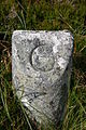 Boundary stone detail - geograph.org.uk - 1425434.jpg 427 × 640; 132 KB
-
 Burn Crossing - geograph.org.uk - 1453341.jpg 640 × 427; 88 KB
-
 Burn of Saughs - geograph.org.uk - 1453540.jpg 640 × 427; 74 KB
-
 Cairn on side of Stobie Hillock - geograph.org.uk - 1453443.jpg 640 × 427; 87 KB
-
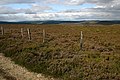 Converging fences - geograph.org.uk - 1425569.jpg 640 × 427; 95 KB
-
 Craigenscore Hill track - geograph.org.uk - 1425517.jpg 640 × 427; 93 KB


_-_geograph.org.uk_-_1727224.jpg)


