Category:Images by Christopher Hall
Jump to navigation
Jump to search

Media in category "Images by Christopher Hall"
The following 19 files are in this category, out of 19 total.
-
 Brunswick Pavilion, York Place, Scarborough - geograph.org.uk - 3838279.jpg 2,029 × 1,353; 547 KB
-
 Detail of paddle gear at former lock - geograph.org.uk - 3908735.jpg 2,166 × 3,032; 2.22 MB
-
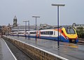 East Midlands train at Scarborough Station - geograph.org.uk - 4100772.jpg 2,581 × 1,844; 841 KB
-
 Former line of canal - geograph.org.uk - 3908754.jpg 3,262 × 2,330; 2.66 MB
-
 Former lock, Strensall - geograph.org.uk - 3908730.jpg 3,002 × 2,145; 2.25 MB
-
 Former lock, Strensall New Bridge - geograph.org.uk - 3908683.jpg 3,262 × 2,330; 2.82 MB
-
 Former locks on river Foss Navigation - geograph.org.uk - 3908748.jpg 2,944 × 2,103; 2.04 MB
-
 Horse Dale looking down to junction with Holm Dale (geograph 4150326).jpg 2,814 × 2,010; 1.05 MB
-
 Junction near Holm Dale (geograph 4150325).jpg 2,814 × 2,010; 1.05 MB
-
 Level crossing and former station, Strensall - geograph.org.uk - 3908716.jpg 3,160 × 2,257; 2.44 MB
-
 Notices on the Bath House - geograph.org.uk - 3999317.jpg 1,269 × 1,903; 443 KB
-
 Parish boundaries north of Lock House - geograph.org.uk - 3908765.jpg 2,979 × 2,128; 2.07 MB
-
 Remains of paddle gear on former lock - geograph.org.uk - 3908658.jpg 2,948 × 2,106; 2.12 MB
-
 River Foss north west of Huntington Road Bridge - geograph.org.uk - 3908651.jpg 2,948 × 2,106; 2.23 MB
-
 Strensall Bridge - geograph.org.uk - 3908700.jpg 3,039 × 2,171; 2.4 MB
-
 Strensall New Bridge - geograph.org.uk - 3908678.jpg 2,881 × 2,058; 1.93 MB
-
 Top of Holm Dale (geograph 4150323).jpg 2,814 × 2,010; 1.04 MB
-
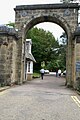 Victoria Lodge - geograph.org.uk - 3999737.jpg 1,369 × 2,053; 820 KB
-
 York Place, Scarborough - geograph.org.uk - 3838267.jpg 2,038 × 1,359; 504 KB


.jpg)
.jpg)


.jpg)

