Category:Images by Chris Reynolds
Jump to navigation
Jump to search

Media in category "Images by Chris Reynolds"
The following 200 files are in this category, out of 1,559 total.
(previous page) (next page)-
 "Alcyone" passes under Bridge No 131 - geograph.org.uk - 1468254.jpg 640 × 480; 65 KB
-
 "Coppice Way" in Wendover Woods - geograph.org.uk - 1202232.jpg 640 × 480; 198 KB
-
-
 2000 years of travel through the Gap - geograph.org.uk - 1284277.jpg 640 × 480; 157 KB
-
 A Bridleway is reached - geograph.org.uk - 1191375.jpg 640 × 480; 196 KB
-
 A Bridleway near Nashes Farm, Sandridge - geograph.org.uk - 1274098.jpg 640 × 480; 203 KB
-

-
 A circle of trees at Poulsden Lacey - geograph.org.uk - 1520491.jpg 640 × 480; 61 KB
-
 A Contented Lawn Mower - geograph.org.uk - 1226700.jpg 1,440 × 1,057; 917 KB
-

-
 A cycleway across Clapham Common - geograph.org.uk - 1325274.jpg 2,592 × 1,944; 2.48 MB
-

-
 A Damp Meadow backing onto the Canal - geograph.org.uk - 1283122.jpg 640 × 384; 112 KB
-

-
 A Distant View of Fairfolds Farm - geograph.org.uk - 1272146.jpg 640 × 480; 143 KB
-

-

-

-
-

-
 A Fallen Giant in Cobblers Pits - geograph.org.uk - 1311636.jpg 640 × 480; 300 KB
-
 A fallen tree blocks the way - geograph.org.uk - 1191343.jpg 640 × 480; 212 KB
-
 A Farm Shed at Lower Farm, Halton - geograph.org.uk - 1249912.jpg 640 × 480; 247 KB
-

-

-
 A Fine Stand of Fir Trees - geograph.org.uk - 1205384.jpg 640 × 480; 133 KB
-

-
 A Flooded Willow Tree - geograph.org.uk - 1233475.jpg 2,448 × 3,264; 5.71 MB
-
 A Forest of Foxgloves at Ashridge - geograph.org.uk - 1470453.jpg 480 × 640; 100 KB
-

-

-

-

-

-

-

-
-

-

-
 A Horse Rider using the Bridleway - geograph.org.uk - 1201337.jpg 640 × 480; 147 KB
-
-

-
 A Kinky Tree - geograph.org.uk - 1237187.jpg 480 × 640; 105 KB
-

-
 A large hay meadow at Aldbury - geograph.org.uk - 1210261.jpg 3,264 × 2,448; 4.76 MB
-
 A large unfenced hay meadow - geograph.org.uk - 1206672.jpg 640 × 480; 71 KB
-
-

-

-

-

-

-

-
 A meeting of the ways on Clapham Common - geograph.org.uk - 1325336.jpg 640 × 480; 137 KB
-

-

-

-

-
 A More Mature Hedgerow - geograph.org.uk - 1221763.jpg 640 × 480; 244 KB
-

-
 A Mowed Strip across a Giant Lawn - geograph.org.uk - 1310475.jpg 640 × 480; 218 KB
-

-

-

-

-

-

-

-
 A Path between the Ponds, Bookham Common - geograph.org.uk - 1237646.jpg 640 × 480; 252 KB
-

-

-

-
 A popular dog-walking spot near Aldbury - geograph.org.uk - 1206657.jpg 640 × 480; 110 KB
-

-

-

-

-
 A Round Woodland Pond at Ashridge - geograph.org.uk - 1193810.jpg 640 × 480; 139 KB
-

-
 A Row of Coppiced Stools - geograph.org.uk - 1205378.jpg 640 × 480; 201 KB
-

-

-

-

-

-

-

-
 A Sunny Autumn Afternoon at Ashridge - geograph.org.uk - 1568803.jpg 640 × 480; 128 KB
-
-

-
 A Trio of Large Trees on Clapham Common - geograph.org.uk - 1432886.jpg 3,264 × 2,448; 1.67 MB
-
 A Twisted Stump - geograph.org.uk - 1200220.jpg 640 × 480; 197 KB
-

-

-

-
 A Victorian style lamppost on Clapham Common - geograph.org.uk - 1325260.jpg 1,698 × 2,263; 568 KB
-

-

-

-
-
 A View of East Bank of College Lake from the Fitter Hide - geograph.org.uk - 1233490.jpg 3,264 × 2,448; 3.36 MB
-

-
 A View over Marsworth Reservoir - geograph.org.uk - 1221316.jpg 640 × 444; 124 KB
-

-

-

-

-

-
 A Woodland Pond in West Wood - geograph.org.uk - 1201309.jpg 640 × 480; 215 KB
-

-

-

-

-

-

-
-
 Aglais io, near Wilstone Reservoir - geograph.org.uk - 1440360.jpg 640 × 480; 51 KB
-
-

-
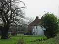
 Aldbury Vicarage - geograph.org.uk - 1364891.jpg 640 × 480; 74 KB
-
 All Ability Trail, Wendover Woods - geograph.org.uk - 1192384.jpg 480 × 640; 182 KB
-
 All Ability Trail, Wendover Woods - geograph.org.uk - 1192413.jpg 480 × 640; 182 KB
-

-
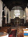
 All Saints Church, Buckland - geograph.org.uk - 1201448.jpg 2,272 × 1,704; 1.11 MB
-
 All Saints Church, Buckland - geograph.org.uk - 1201451.jpg 3,264 × 2,448; 2.4 MB
-
-

-
 All Saints Church, Long Marston - geograph.org.uk - 1203160.jpg 640 × 480; 153 KB
-
-

-
 All that remains of a once living tree - geograph.org.uk - 1221775.jpg 480 × 640; 273 KB
-
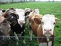 All we want is a friendly chat - geograph.org.uk - 1290916.jpg 640 × 480; 179 KB
-

-

-
 Along the Ridgeway path at Wigginton - geograph.org.uk - 1284117.jpg 480 × 640; 92 KB
-
 Alpaca at Norcott Court Farm - geograph.org.uk - 1243295.jpg 640 × 456; 170 KB
-

-

-

-

-
 An Old Orchard near Cholesbury Camp - geograph.org.uk - 1200200.jpg 480 × 640; 172 KB
-
-

-
 An Overcast Day on Bookham Common - geograph.org.uk - 1416492.jpg 640 × 480; 64 KB
-
 An unusual war memorial - geograph.org.uk - 1198302.jpg 480 × 640; 95 KB
-

-

-

-

-

-

-

-

-

-
 Arable Field South of the canal - geograph.org.uk - 1283119.jpg 640 × 480; 116 KB
-
 Are you lost^ - geograph.org.uk - 1327883.jpg 480 × 640; 178 KB
-

-

-
 Aston Hill Lodge, Aston Hill, Halton - geograph.org.uk - 1263091.jpg 640 × 480; 119 KB
-
 At the Heart of the Ashridge Estate - geograph.org.uk - 1181955.jpg 640 × 480; 175 KB
-

-

-
 Autumn on Clapham Common - geograph.org.uk - 1552863.jpg 640 × 480; 94 KB
-

-

-
 Avenue by Sports Field, RAF Halton - geograph.org.uk - 1259601.jpg 640 × 480; 91 KB
-
-

-

-

-
 Aylesbury Arm - Canal Bridge No 2 - Dixon's Gap Bridge - geograph.org.uk - 1235895.jpg 3,264 × 2,448; 2.78 MB
-

-
-
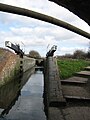
 Aylesbury Arm - Lock No 2 Bottom Gates - geograph.org.uk - 1228456.jpg 640 × 480; 111 KB
-

-
 Aylesbury Arm - Lock No 5 - Looking East - geograph.org.uk - 1229311.jpg 564 × 480; 101 KB
-

-
-

-

-

-
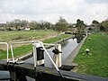
 Aylesbury Arm - Marsworth Lock (No 3) - geograph.org.uk - 1228864.jpg 480 × 640; 118 KB
-
-
-
 Aylesbury Arm - Skew Brickwork on Dixon's Gap Bridge - geograph.org.uk - 1235899.jpg 2,448 × 3,264; 2.82 MB
-
-
 Aylesbury Arm - Towpath beyond Lock No 3 - geograph.org.uk - 1228878.jpg 480 × 640; 118 KB
-

-

-
 Aylesbury Arm, Approaching Bridge 12 - geograph.org.uk - 1283093.jpg 640 × 480; 203 KB
-

-
 Aylesbury Arm, Bridge No 11 - geograph.org.uk - 1283053.jpg 640 × 480; 180 KB
-
-

-

-
 Aylesbury Arm, Fishing in the Canal - geograph.org.uk - 1269486.jpg 640 × 480; 162 KB
-

-

-
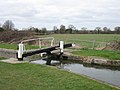
 Aylesbury Arm, Lock No 7 - geograph.org.uk - 1443001.jpg 640 × 480; 59 KB
-


_on_the_Wendover_Arm_of_the_Grand_Union_Canal_-_geograph.org.uk_-_1310492.jpg)


_and_Canal-side_House_-_geograph.org.uk_-_1228944.jpg)
_-_geograph.org.uk_-_1228949.jpg)


_at_Wilstone_-_geograph.org.uk_-_1608731.jpg)


_-_geograph.org.uk_-_1235889.jpg)
_-_geograph.org.uk_-_1228951.jpg)


_-_geograph.org.uk_-_1228864.jpg)
_looking_towards_Bridge_No_1_-_geograph.org.uk_-_1228874.jpg)


_-_geograph.org.uk_-_1235879.jpg)


_from_Bridge_No_2_looking_towards_Lock_No_5_-_geograph.org.uk_-_1235875.jpg)

_-_geograph.org.uk_-_1442993.jpg)
_-_geograph.org.uk_-_1442994.jpg)

