Category:Images by Chris Gunns
Jump to navigation
Jump to search

Media in category "Images by Chris Gunns"
The following 200 files are in this category, out of 5,416 total.
(previous page) (next page)-
 15inchgunsatImperialWarMuseumLondon.jpg 608 × 432; 106 KB
-
 A 27 , Sompting - geograph.org.uk - 1201676.jpg 640 × 480; 71 KB
-
 A 27 looking west - geograph.org.uk - 1201651.jpg 640 × 480; 64 KB
-
 A 286 at West Dean - geograph.org.uk - 1279431.jpg 640 × 480; 131 KB
-
 A 286 at West Dean - geograph.org.uk - 1279443.jpg 640 × 480; 130 KB
-
 A 354 Portland beach Road - geograph.org.uk - 1331789.jpg 640 × 480; 41 KB
-
 A 48 Aylburton - geograph.org.uk - 1723702.jpg 800 × 600; 127 KB
-
 A back lane in Middleham - geograph.org.uk - 442530.jpg 480 × 640; 103 KB
-
 A line of concrete on Chesil Beach - geograph.org.uk - 1329705.jpg 640 × 480; 169 KB
-
 A lot of groynes, Hayling - geograph.org.uk - 1291745.jpg 640 × 480; 92 KB
-
 A very sad sight - geograph.org.uk - 1322177.jpg 640 × 480; 100 KB
-
 A14 approaching Tholt-y-Will - geograph.org.uk - 788296.jpg 640 × 389; 70 KB
-
 A14 near Sulby Reservoir - geograph.org.uk - 788260.jpg 640 × 480; 74 KB
-
 A259 Bosham - geograph.org.uk - 1288304.jpg 640 × 480; 88 KB
-
 A259 Bosham - geograph.org.uk - 1288314.jpg 640 × 480; 93 KB
-
 A259 by the Bosham Inn - geograph.org.uk - 1288330.jpg 640 × 433; 116 KB
-
 A259 Fishbourne - geograph.org.uk - 1288266.jpg 640 × 480; 96 KB
-
 A259 Fishbourne - geograph.org.uk - 1288272.jpg 640 × 480; 95 KB
-
 A259 Fishbourne - geograph.org.uk - 1288295.jpg 640 × 480; 118 KB
-
 A259 Hermitage - geograph.org.uk - 1288354.jpg 640 × 480; 106 KB
-
 A259 Southbourne - geograph.org.uk - 1288337.jpg 640 × 480; 93 KB
-
 A27 and Mill Hill bridge - geograph.org.uk - 1201683.jpg 640 × 480; 65 KB
-
 A27 at Firle - geograph.org.uk - 1201730.jpg 640 × 480; 62 KB
-
 A27 Farlington - geograph.org.uk - 1182089.jpg 640 × 480; 75 KB
-
 A27 passing over Chichester canal - geograph.org.uk - 1287789.jpg 640 × 480; 122 KB
-
 A27 Southwick Hill Tunnel - geograph.org.uk - 1201665.jpg 640 × 480; 70 KB
-
 A285 Chichester to Petworth - geograph.org.uk - 1323308.jpg 640 × 459; 134 KB
-
 A285 Chichester to Petworth - geograph.org.uk - 1323612.jpg 640 × 480; 90 KB
-

-
 A286 at Lavant - geograph.org.uk - 1130485.jpg 640 × 482; 97 KB
-
 A286 Binderton - geograph.org.uk - 1130540.jpg 640 × 480; 76 KB
-

-
 A3 from Harrow Lane bridge - geograph.org.uk - 463254.jpg 640 × 480; 94 KB
-
 A3 southbound near Horndean - geograph.org.uk - 1098960.jpg 640 × 480; 52 KB
-
 A338 at the Cooper Dean roundabout - geograph.org.uk - 1326495.jpg 640 × 480; 64 KB
-
 A34 crossing the River Thames - geograph.org.uk - 1778619.jpg 800 × 600; 152 KB
-
 A342, A346 junction - geograph.org.uk - 1497048.jpg 640 × 480; 60 KB
-

-
 A352 at Worgret - geograph.org.uk - 1327752.jpg 640 × 480; 90 KB
-
 A354 Portland - geograph.org.uk - 1340231.jpg 640 × 480; 89 KB
-
 A354 Portland - geograph.org.uk - 1345622.jpg 640 × 425; 95 KB
-
 A354 Portland BeachRoad - geograph.org.uk - 1331820.jpg 640 × 453; 59 KB
-
 A354 Westwey Road - geograph.org.uk - 1329577.jpg 640 × 480; 81 KB
-
 A3M looking south - geograph.org.uk - 1239996.jpg 640 × 480; 59 KB
-
 A3M looking south - geograph.org.uk - 1240000.jpg 640 × 480; 56 KB
-
 A44 approaching Rhayader from the east - geograph.org.uk - 1526673.jpg 640 × 480; 103 KB
-
 A488 descending Colstey Bank - geograph.org.uk - 1563614.jpg 640 × 480; 117 KB
-
 A488 descending Colstey Bank - geograph.org.uk - 1563622.jpg 640 × 480; 84 KB
-
 A49 bridge over the B4361 - geograph.org.uk - 1498082.jpg 640 × 480; 94 KB
-
 A49 near Lee Brockhurst - geograph.org.uk - 1498679.jpg 640 × 480; 88 KB
-

-

-

-
 A505 Weston Hills Tunnel - geograph.org.uk - 1771232.jpg 640 × 480; 47 KB
-
 Abbey Mill and weir, Tewkesbury - geograph.org.uk - 1729202.jpg 800 × 600; 176 KB
-
 Abbey Mill, Tewkesbury - geograph.org.uk - 1729124.jpg 800 × 589; 138 KB
-
 Aber Glanhirin - geograph.org.uk - 1521652.jpg 640 × 480; 85 KB
-
 Abereiddy tower on Trwyncastell - geograph.org.uk - 543340.jpg 640 × 475; 125 KB
-
 Above Bar Street - geograph.org.uk - 1433929.jpg 640 × 480; 115 KB
-
 Above Bar Street - geograph.org.uk - 1434648.jpg 640 × 480; 93 KB
-

-
 Above Traeth y Mwnt - geograph.org.uk - 545765.jpg 640 × 480; 139 KB
-
 Accident black spot - geograph.org.uk - 1131248.jpg 640 × 480; 137 KB
-
 Accident Corner, Goodwood - geograph.org.uk - 812876.jpg 640 × 451; 92 KB
-
 Adam - geograph.org.uk - 1507310.jpg 522 × 640; 93 KB
-
 Adnams mash tun - geograph.org.uk - 421328.jpg 640 × 480; 99 KB
-
 Afon Elan and Abergwngu Farm - geograph.org.uk - 1521723.jpg 640 × 480; 94 KB
-
 Afon Elan just below Abergwngu - geograph.org.uk - 1521715.jpg 640 × 480; 103 KB
-
 Afon Nant Peris - geograph.org.uk - 403975.jpg 480 × 640; 73 KB
-
 Afon Ystwyth and Cwm Ystwyth - geograph.org.uk - 1524809.jpg 640 × 480; 128 KB
-
 Afon Ystwyth looking towards Cwm Ystwyth - geograph.org.uk - 1523727.jpg 640 × 480; 118 KB
-
 Afternoon sun Longleat House gardens - geograph.org.uk - 414492.jpg 640 × 480; 139 KB
-
 Afternoon sun Longleat House gardens - geograph.org.uk - 414494.jpg 640 × 480; 76 KB
-
 Alcester - geograph.org.uk - 421911.jpg 640 × 480; 96 KB
-
 St James Alderholt - geograph.org.uk - 1296589.jpg 640 × 543; 115 KB
-
 Aldershot High Street - geograph.org.uk - 1236405.jpg 640 × 481; 90 KB
-
 Aldershot post office - geograph.org.uk - 1236395.jpg 640 × 480; 85 KB
-
 Alexandra Warehouse, Gloucester Docks - geograph.org.uk - 1469276.jpg 640 × 480; 105 KB
-
 All Saints churchyard, East Meon - geograph.org.uk - 716852.jpg 640 × 480; 127 KB
-
 Allium ursinum in Glen Maye - geograph.org.uk - 773697.jpg 640 × 480; 203 KB
-
 Allotments beside the railway - geograph.org.uk - 1434985.jpg 640 × 405; 128 KB
-
 Alnwick Castle - geograph.org.uk - 919273.jpg 640 × 480; 102 KB
-
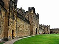 Alnwick Castle - geograph.org.uk - 919283.jpg 640 × 480; 106 KB
-
 Alnwick Castle - geograph.org.uk - 919305.jpg 480 × 640; 93 KB
-
 Alnwick Castle - geograph.org.uk - 919310.jpg 640 × 472; 100 KB
-
 Along the cliffs towards Beachy Head - geograph.org.uk - 426398.jpg 480 × 640; 79 KB
-
 Alongside Roman road near Bainbridge - geograph.org.uk - 399267.jpg 640 × 480; 74 KB
-

-
 Alton High Street - geograph.org.uk - 1454532.jpg 640 × 480; 99 KB
-
 Amazing shop in Lifford - geograph.org.uk - 431386.jpg 640 × 480; 206 KB
-
 Amazing shop in Lifford - geograph.org.uk - 431388.jpg 640 × 480; 213 KB
-
 Amberley Castle - geograph.org.uk - 1249991.jpg 640 × 427; 60 KB
-
 Ampney Crucis, Holy Rood Church (geograph 1696682).jpg 800 × 600; 196 KB
-
 Andreas churchyard - geograph.org.uk - 779089.jpg 640 × 480; 138 KB
-
 Andrews Park - geograph.org.uk - 1433955.jpg 640 × 531; 172 KB
-
 Andrews Park - geograph.org.uk - 1433975.jpg 640 × 480; 142 KB
-
 Andrews Park - geograph.org.uk - 1434001.jpg 640 × 480; 144 KB
-
 Ann's Hill Road, Gosport - geograph.org.uk - 1719047.jpg 800 × 600; 175 KB
-
 Apprentice House, Quarry Bank Mill - geograph.org.uk - 429541.jpg 640 × 480; 218 KB
-
 Apprentice House, Quarry Bank Mill - geograph.org.uk - 429554.jpg 480 × 640; 221 KB
-
 Approaching a cattle grid, near Squilver - geograph.org.uk - 1608507.jpg 640 × 480; 113 KB
-
 Approaching Bedstone - geograph.org.uk - 1540752.jpg 640 × 492; 149 KB
-
 Approaching Buriton Farm - geograph.org.uk - 1722432.jpg 1,024 × 768; 202 KB
-
 Approaching Clun on the B4368 - geograph.org.uk - 1540938.jpg 640 × 494; 89 KB
-
 Approaching Clun on the B4368 - geograph.org.uk - 1540951.jpg 640 × 480; 75 KB
-
 Approaching East Ashling - geograph.org.uk - 1129298.jpg 640 × 480; 63 KB
-
 Approaching Eynsham Lock - geograph.org.uk - 1777831.jpg 800 × 600; 121 KB
-
 Approaching Godstow Bridge - geograph.org.uk - 1778636.jpg 800 × 600; 208 KB
-
 Approaching Hirnant - geograph.org.uk - 1516963.jpg 640 × 480; 86 KB
-
 Approaching Hooksway - geograph.org.uk - 1722630.jpg 800 × 600; 119 KB
-
 Approaching junction with B4213 - geograph.org.uk - 1732904.jpg 800 × 600; 104 KB
-
 Approaching Smeafield level crossing - geograph.org.uk - 973201.jpg 640 × 480; 318 KB
-

-

-
 Approaching The Falkirk Wheel from above - geograph.org.uk - 415016.jpg 640 × 480; 186 KB
-

-

-
 Approaching Trumley - geograph.org.uk - 1206603.jpg 640 × 506; 108 KB
-
 Approaching Walford - geograph.org.uk - 1498636.jpg 640 × 480; 97 KB
-
 April , hillside near Hambledon - geograph.org.uk - 437536.jpg 480 × 640; 176 KB
-
 Area south of the Old Mill House - geograph.org.uk - 1182096.jpg 480 × 640; 145 KB
-
 Arthur's Seat, from The Hawse - geograph.org.uk - 1779860.jpg 800 × 600; 180 KB
-

-
 Arundel across the water meadows - geograph.org.uk - 1249939.jpg 640 × 531; 59 KB
-
 Ash Station - geograph.org.uk - 1236887.jpg 640 × 480; 90 KB
-
 Ashford Hanger - geograph.org.uk - 955754.jpg 640 × 480; 206 KB
-
 Auchentoshan distillery - geograph.org.uk - 416504.jpg 640 × 480; 218 KB
-
 Auchentoshan distillery-by-Chris-Gunns.jpg 640 × 480; 217 KB
-
 Avalanche Road, Portland - geograph.org.uk - 1342153.jpg 640 × 480; 76 KB
-
 Avebury - geograph.org.uk - 841088.jpg 640 × 480; 110 KB
-
 Avebury - geograph.org.uk - 841911.jpg 640 × 480; 74 KB
-
 Avebury - geograph.org.uk - 841924.jpg 640 × 480; 145 KB
-
 Avebury - geograph.org.uk - 841932.jpg 640 × 480; 121 KB
-
 Avebury - geograph.org.uk - 841939.jpg 640 × 480; 107 KB
-
 Avebury - geograph.org.uk - 841969.jpg 640 × 480; 121 KB
-
 Avebury cricket pavilion - geograph.org.uk - 841980.jpg 640 × 480; 102 KB
-
 Avebury Henge - geograph.org.uk - 429614.jpg 640 × 480; 213 KB
-
 Avebury Henge - geograph.org.uk - 429620.jpg 480 × 640; 219 KB
-
 Avebury Henge - geograph.org.uk - 429625.jpg 640 × 480; 212 KB
-
 Avebury Henge - geograph.org.uk - 429632.jpg 640 × 480; 212 KB
-
 Avebury Henge - geograph.org.uk - 429641.jpg 480 × 640; 215 KB
-
 Avebury Henge - geograph.org.uk - 429643.jpg 480 × 640; 209 KB
-
 Avebury Henge - geograph.org.uk - 429650.jpg 478 × 571; 313 KB
-
 Avebury Henge - geograph.org.uk - 841050.jpg 640 × 480; 106 KB
-
 Avebury Henge - geograph.org.uk - 841072.jpg 640 × 480; 125 KB
-
 Avebury Henge - geograph.org.uk - 841100.jpg 640 × 480; 114 KB
-
 Avebury Henge - geograph.org.uk - 841112.jpg 640 × 480; 144 KB
-
 Avebury Henge - geograph.org.uk - 841174.jpg 640 × 480; 141 KB
-
 Avebury Manor - geograph.org.uk - 429573.jpg 640 × 480; 213 KB
-
 Avebury Manor 02.jpg 640 × 480; 116 KB
-
 Avebury Manor 03.jpg 640 × 480; 153 KB
-
 Avebury Manor gate - geograph.org.uk - 395299.jpg 480 × 640; 215 KB
-
 Avebury stone - geograph.org.uk - 395276.jpg 640 × 480; 216 KB
-
 Avebury Stones - geograph.org.uk - 841065.jpg 524 × 640; 134 KB
-
 Avebury Stones - geograph.org.uk - 841181.jpg 640 × 480; 93 KB
-
 Avebury Stones - geograph.org.uk - 842019.jpg 640 × 398; 94 KB
-
 Avebury trees - geograph.org.uk - 841124.jpg 640 × 559; 110 KB
-
 Avenue of beech trees - geograph.org.uk - 685899.jpg 640 × 426; 173 KB
-
 Avenue of beech trees - geograph.org.uk - 685906.jpg 640 × 526; 181 KB
-
 Avenue of beech trees - geograph.org.uk - 685956.jpg 640 × 314; 113 KB
-
 Avenue on Hampstead Heath - geograph.org.uk - 1125633.jpg 640 × 480; 119 KB
-
 B1340 approaching Bamburgh - geograph.org.uk - 971233.jpg 640 × 480; 198 KB
-
 B1340 approaching Bamburgh - geograph.org.uk - 971241.jpg 640 × 480; 221 KB
-
 B1342 to Bamburgh - geograph.org.uk - 973334.jpg 633 × 466; 209 KB
-
 B1342 to Bamburgh near Galliheugh Bank - geograph.org.uk - 973327.jpg 627 × 471; 192 KB
-
 B2149 Havant - geograph.org.uk - 1057207.jpg 640 × 480; 106 KB
-
 B2149 Leigh Park - geograph.org.uk - 1057217.jpg 640 × 476; 100 KB
-

-
 B2150 approaching Brockbridge - geograph.org.uk - 1101908.jpg 640 × 480; 42 KB
-
 B2150 approaching Brockbridge - geograph.org.uk - 1101912.jpg 640 × 480; 43 KB
-
 B2150 approaching Brockbridge - geograph.org.uk - 457036.jpg 640 × 480; 132 KB
-
 B2150 Grenville Hill - geograph.org.uk - 1227551.jpg 640 × 480; 133 KB
-
 B2150 Grenville Hill - geograph.org.uk - 1227569.jpg 640 × 480; 85 KB
-
 B2150 near Bushy Down - geograph.org.uk - 1226571.jpg 640 × 480; 57 KB
-
 B2150 near Bushy Down - geograph.org.uk - 1226579.jpg 640 × 480; 59 KB
-
 B2150 north of Hambledon - geograph.org.uk - 456966.jpg 640 × 480; 91 KB
-
 B2150 South of Hambledon - geograph.org.uk - 1227628.jpg 640 × 470; 101 KB
-
 B2177 Southwick Road - geograph.org.uk - 1007439.jpg 598 × 640; 103 KB
-
 B2177 Southwick Road - geograph.org.uk - 1007443.jpg 640 × 480; 94 KB
-
 B3047 Alresford - geograph.org.uk - 1225828.jpg 640 × 480; 150 KB
-
 B3079 at Brook - geograph.org.uk - 1293904.jpg 640 × 480; 148 KB
-
 B3082 Blandford Road - geograph.org.uk - 1295149.jpg 640 × 474; 84 KB
-
 B3150 near Grenville Hall - geograph.org.uk - 456984.jpg 640 × 480; 91 KB
-
 B4213 junction with the A38 - geograph.org.uk - 1732920.jpg 800 × 496; 80 KB
-
 B4365 crossing Ludlow racecourse - geograph.org.uk - 1498061.jpg 640 × 480; 58 KB
-
 B4365 crossing Ludlow racecourse - geograph.org.uk - 1498068.jpg 640 × 480; 69 KB
-
 B4368 at Clunton - geograph.org.uk - 1540881.jpg 640 × 480; 75 KB
-
 B4368 at Clunton - geograph.org.uk - 1540909.jpg 640 × 480; 73 KB
-
 B4368 west of Clunton - geograph.org.uk - 1540924.jpg 640 × 480; 121 KB
-
 B6318 west from Harlow Hill - geograph.org.uk - 969234.jpg 640 × 480; 195 KB
-
 B6318 west from Walwick - geograph.org.uk - 969248.jpg 640 × 480; 240 KB
-
 Back Lane - geograph.org.uk - 1122257.jpg 640 × 480; 112 KB
-
 Ballards Brewery, Nyewood - geograph.org.uk - 1721668.jpg 800 × 600; 164 KB
-
 Ballaugh Old Church - geograph.org.uk - 787309.jpg 640 × 480; 199 KB
-
 Ballaugh Old Church - geograph.org.uk - 787313.jpg 480 × 640; 128 KB
-
 Ballaugh Old Church churchyard - geograph.org.uk - 787324.jpg 640 × 480; 145 KB
-
 Ballaugh Old Church gate posts - geograph.org.uk - 787321.jpg 480 × 640; 165 KB
-
 Ballymastocker Bay - geograph.org.uk - 396148.jpg 480 × 640; 218 KB
-
 Bamburgh - geograph.org.uk - 973353.jpg 627 × 437; 280 KB
-
 Bamburgh Castle - geograph.org.uk - 928605.jpg 640 × 455; 65 KB


.jpg)


