Category:Images by Cered
Jump to navigation
Jump to search

Media in category "Images by Cered"
The following 200 files are in this category, out of 213 total.
(previous page) (next page)-
 Aberaeron North beach - geograph.org.uk - 42412.jpg 640 × 383; 35 KB
-
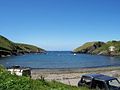 Abercastle Bay.jpg 640 × 480; 41 KB
-
 Aberporth Beach - geograph.org.uk - 54194.jpg 640 × 480; 49 KB
-
 Afon Gwaun - geograph.org.uk - 47715.jpg 640 × 436; 44 KB
-
 All Saints, Cellan - geograph.org.uk - 49752.jpg 640 × 435; 46 KB
-
 Allt Castellgeifr - geograph.org.uk - 41646.jpg 640 × 480; 68 KB
-
 Alltgoch Quarry - geograph.org.uk - 55699.jpg 640 × 480; 52 KB
-
 Banc Rhosgoch Fach - geograph.org.uk - 52317.jpg 640 × 480; 49 KB
-
 Banc-y-Warren - geograph.org.uk - 54234.jpg 640 × 436; 44 KB
-
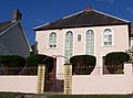
 Bancyfelin Chapel, Llangrannog - geograph.org.uk - 40154.jpg 572 × 451; 50 KB
-
 Bardsey View - geograph.org.uk - 55419.jpg 640 × 480; 29 KB
-
 Benton Castle - geograph.org.uk - 407464.jpg 640 × 480; 85 KB
-
 Betws Ifan Old Shop - geograph.org.uk - 58323.jpg 640 × 504; 49 KB
-
 Bleeding Yew Trees, Nevern - geograph.org.uk - 29469.jpg 640 × 480; 70 KB
-
 Bridge - geograph.org.uk - 110472.jpg 640 × 480; 146 KB
-
 Bridge - geograph.org.uk - 218723.jpg 640 × 480; 292 KB
-
 Bridge at Nevern - geograph.org.uk - 29466.jpg 640 × 480; 79 KB
-
 Bridge Over Afon Dulas - geograph.org.uk - 492217.jpg 640 × 479; 80 KB
-
 Bryncrug Church - geograph.org.uk - 148804.jpg 640 × 480; 102 KB
-
 Brynmair Chapel - geograph.org.uk - 50086.jpg 640 × 476; 40 KB
-
 Bwlch Nant Yr Arian - geograph.org.uk - 19769.jpg 640 × 480; 63 KB
-
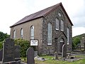
 Bwlchyfadfa Chapel - geograph.org.uk - 56957.jpg 640 × 480; 55 KB
-
 Capel Neuadd - geograph.org.uk - 54258.jpg 640 × 590; 68 KB
-
 Capel y Wig - geograph.org.uk - 54175.jpg 640 × 480; 54 KB
-
 Capel-y-Bryn - geograph.org.uk - 55716.jpg 640 × 480; 50 KB
-
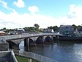 Cardigan Bridge - geograph.org.uk - 54239.jpg 640 × 480; 41 KB
-
 Cardigan Island - geograph.org.uk - 27332.jpg 640 × 480; 15 KB
-
 Carreg Cennen Castle - geograph.org.uk - 215123.jpg 640 × 480; 186 KB
-
 Carreg Cennen Castle - geograph.org.uk - 215125.jpg 640 × 480; 232 KB
-
 Cei Bach Lime Kiln - geograph.org.uk - 18107.jpg 480 × 640; 117 KB
-
 Church at Chalfont St.Peter - geograph.org.uk - 42866.jpg 622 × 422; 37 KB
-
 Chapel - geograph.org.uk - 50039.jpg 640 × 438; 45 KB
-
 Chapel - geograph.org.uk - 56972.jpg 586 × 480; 33 KB
-
 Church at Sarnau - geograph.org.uk - 50065.jpg 640 × 480; 73 KB
-
 Church Hall - geograph.org.uk - 54255.jpg 640 × 443; 29 KB
-
 Church of St. Brynach, Nevern - geograph.org.uk - 29467.jpg 640 × 480; 58 KB
-
 Cilgerran Castle - geograph.org.uk - 50320.jpg 640 × 494; 52 KB
-
 Coachman's Cautionary - geograph.org.uk - 218719.jpg 480 × 640; 135 KB
-
 Cofadail School - geograph.org.uk - 218730.jpg 640 × 480; 219 KB
-
 Corbalengi Stone - geograph.org.uk - 40156.jpg 480 × 640; 102 KB
-
 Craiglas Lime Kilns - geograph.org.uk - 31125.jpg 640 × 480; 59 KB
-
 Cribach Bay - geograph.org.uk - 54190.jpg 640 × 410; 24 KB
-
 Cwmtydu Beach - geograph.org.uk - 181013.jpg 640 × 480; 246 KB
-
 St. Vitalis Church - geograph.org.uk - 55455.jpg 640 × 480; 50 KB
-
 Dihewyd School - geograph.org.uk - 55442.jpg 640 × 480; 44 KB
-
 Disguised Mobile Phone Mast - geograph.org.uk - 211892.jpg 481 × 640; 50 KB
-
 Electrical Sub Station - geograph.org.uk - 50530.jpg 640 × 480; 56 KB
-
 Electricity Sub Station - geograph.org.uk - 50533.jpg 640 × 480; 33 KB
-
 Ellesborough Church - geograph.org.uk - 42820.jpg 640 × 421; 21 KB
-
 Falcondale Lake - geograph.org.uk - 311853.jpg 640 × 479; 52 KB
-
 Featherstone Road - geograph.org.uk - 43049.jpg 640 × 428; 37 KB
-
 Felin Bontbren - geograph.org.uk - 55500.jpg 640 × 480; 81 KB
-
 Felin Bontbren pond - geograph.org.uk - 56976.jpg 640 × 480; 86 KB
-
 Figures at Penuwch - geograph.org.uk - 27944.jpg 640 × 420; 50 KB
-
 Fishguard Breakwater - geograph.org.uk - 47699.jpg 640 × 480; 13 KB
-
 Fleet Review - geograph.org.uk - 58019.jpg 640 × 449; 110 KB
-
 Ford at Llanrhystyd - geograph.org.uk - 42178.jpg 640 × 465; 80 KB
-
 Forest track - geograph.org.uk - 215114.jpg 640 × 480; 255 KB
-
 Gilfach-yr-Halen - geograph.org.uk - 50089.jpg 640 × 480; 40 KB
-
 Glan-yr-Afon Arms - geograph.org.uk - 56961.jpg 640 × 480; 38 KB
-
 Go Cart Track - geograph.org.uk - 42815.jpg 640 × 480; 47 KB
-
 Gogerddan Arms - geograph.org.uk - 54252.jpg 640 × 483; 34 KB
-
 Goldhill Common - geograph.org.uk - 43127.jpg 640 × 421; 16 KB
-
 Groynes - geograph.org.uk - 148828.jpg 640 × 480; 75 KB
-
 Haddenham Church - geograph.org.uk - 42822.jpg 640 × 422; 32 KB
-
 HaverfordwestCastle - geograph.org.uk - 25363.jpg 640 × 480; 47 KB
-
 Hen Riw - geograph.org.uk - 54617.jpg 640 × 480; 27 KB
-
 St. Davids Church, Henfynyw - geograph.org.uk - 50054.jpg 640 × 459; 42 KB
-
 Hunting Lodge Hotel - geograph.org.uk - 51796.jpg 640 × 449; 93 KB
-
 Island and Headland at Castell Bach - geograph.org.uk - 180983.jpg 640 × 480; 233 KB
-
 Lampeter University - geograph.org.uk - 205525.jpg 640 × 480; 215 KB
-
 Lime Kiln - geograph.org.uk - 59707.jpg 640 × 480; 58 KB
-
 St Crannogs Church, Llangrannog - geograph.org.uk - 40153.jpg 640 × 438; 62 KB
-
 Llangrannog Dry Ski Slope - geograph.org.uk - 34326.jpg 640 × 480; 34 KB
-
 Llangranog Mill - geograph.org.uk - 40151.jpg 640 × 480; 91 KB
-
 Llanhowel Church - geograph.org.uk - 41381.jpg 640 × 480; 68 KB
-
 Llanina Arms - geograph.org.uk - 55411.jpg 640 × 444; 42 KB
-
 Llanina Church - geograph.org.uk - 16873.jpg 640 × 480; 80 KB
-
 Llanrhystyd Parish Church - geograph.org.uk - 42238.jpg 640 × 480; 55 KB
-
 Llansteffan Castle - geograph.org.uk - 59746.jpg 640 × 480; 24 KB
-
 St. Tysilio Church - geograph.org.uk - 54157.jpg 640 × 480; 52 KB
-
 Llechryd Bridge River Reifi Castell Malgwyn.jpg 640 × 480; 70 KB
-
 Llwyncelyn School - geograph.org.uk - 44430.jpg 640 × 453; 39 KB
-
 Maes Y Mynydd - geograph.org.uk - 47817.jpg 640 × 480; 49 KB
-
 Maiden Castle - geograph.org.uk - 25345.jpg 640 × 422; 24 KB
-

-
 Mast on Farm Land - geograph.org.uk - 59677.jpg 640 × 480; 39 KB
-
 Milestone - geograph.org.uk - 41154.jpg 640 × 480; 101 KB
-
 MOD-Qinetiq - geograph.org.uk - 59713.jpg 640 × 495; 46 KB
-
 Mwnt Church - geograph.org.uk - 59698.jpg 640 × 480; 31 KB
-
 Holy Trinity - geograph.org.uk - 55432.jpg 1,280 × 960; 285 KB
-
 Myfenydd Primary School , Llanrhystud - geograph.org.uk - 42194.jpg 640 × 389; 38 KB
-
 Mynydd Bach - geograph.org.uk - 41639.jpg 640 × 480; 30 KB
-
 Nanternis Chapel - geograph.org.uk - 56979.jpg 640 × 480; 55 KB
-
 Neuadd Coffa - geograph.org.uk - 56925.jpg 640 × 480; 35 KB
-
 New Quay Head - geograph.org.uk - 40144.jpg 640 × 407; 27 KB
-
 New Quay Lifeboat Station - geograph.org.uk - 40135.jpg 640 × 502; 41 KB
-
 New Quay Pier - geograph.org.uk - 40142.jpg 640 × 480; 45 KB
-
 Newport Castle - geograph.org.uk - 57254.jpg 640 × 515; 39 KB
-
 North Breakwater - geograph.org.uk - 47689.jpg 640 × 460; 19 KB
-
 Pantycrugiau Chapel - geograph.org.uk - 47871.jpg 640 × 480; 41 KB
-
 Parade Ground - geograph.org.uk - 58025.jpg 640 × 401; 41 KB
-
 Parc Aberporth - geograph.org.uk - 54220.jpg 640 × 436; 33 KB
-
 Pencae Chapel - geograph.org.uk - 55481.jpg 640 × 480; 47 KB
-
 Pencribach - geograph.org.uk - 40159.jpg 640 × 477; 32 KB
-
 Pendine Beach - geograph.org.uk - 43152.jpg 640 × 358; 15 KB
-
 Penmorfa Chapel, near Penbryn - geograph.org.uk - 25379.jpg 640 × 480; 63 KB
-
 Penmorfa Primary School - geograph.org.uk - 40155.jpg 640 × 480; 44 KB
-
 Plas Llansteffan - geograph.org.uk - 59747.jpg 640 × 480; 42 KB
-
 Pont Nanternis - geograph.org.uk - 56983.jpg 410 × 480; 43 KB
-
 Pontgarreg Primary School - geograph.org.uk - 40152.jpg 640 × 464; 42 KB
-

-
 Priory Bridge - geograph.org.uk - 54243.jpg 640 × 453; 37 KB
-
 Red Lion Inn - geograph.org.uk - 55706.jpg 640 × 480; 34 KB
-
 River Dysynni - geograph.org.uk - 148821.jpg 640 × 480; 55 KB
-
 River Leri - geograph.org.uk - 28944.jpg 640 × 480; 47 KB
-
 Siloam Chapel - geograph.org.uk - 59685.jpg 640 × 480; 41 KB
-
 St David's Head-by-Cered.jpg 640 × 466; 21 KB
-
 St Dogmael's Abbey - geograph.org.uk - 26809.jpg 640 × 420; 30 KB
-
 St Ishmael - geograph.org.uk - 59742.jpg 640 × 480; 23 KB
-
 St Llwchaiarn's - geograph.org.uk - 55488.jpg 640 × 480; 59 KB
-
 St Michael and All Angels Church - geograph.org.uk - 42818.jpg 640 × 423; 33 KB
-
 St Michaels Church, Penbryn - geograph.org.uk - 25376.jpg 640 × 480; 36 KB
-
 St Nons - geograph.org.uk - 55470.jpg 640 × 480; 69 KB
-
 St Peters Chapel - geograph.org.uk - 42833.jpg 640 × 401; 72 KB
-
 St Tysul Church, Llandysul - geograph.org.uk - 20639.jpg 640 × 480; 68 KB
-
 St. Dunstan Church, Monks Risborough - geograph.org.uk - 42852.jpg 640 × 448; 42 KB
-
 St. Mark's Church, Gwenlli, Ceredigion - geograph.org.uk - 47873.jpg 640 × 480; 51 KB
-
 St. Michael Church - geograph.org.uk - 54226.jpg 480 × 640; 83 KB
-
 St. Peter and St. Paul, Dinton - geograph.org.uk - 42862.jpg 429 × 640; 34 KB
-
 St.Mary, Princes Risborough - geograph.org.uk - 42859.jpg 468 × 640; 32 KB
-
 St.Marys Parish Church Ladykirk - geograph.org.uk - 50172.jpg 640 × 435; 29 KB
-
 St.Peters Church, Ilmer - geograph.org.uk - 42825.jpg 640 × 435; 72 KB
-
 Stockwell Lane - geograph.org.uk - 42830.jpg 640 × 432; 49 KB
-
 Stockwell Lane - geograph.org.uk - 58061.jpg 640 × 412; 37 KB
-
 Stone Circle - geograph.org.uk - 47841.jpg 640 × 480; 64 KB
-
 Swimming Pool - geograph.org.uk - 54249.jpg 640 × 480; 43 KB
-
 Synod Inn - geograph.org.uk - 56967.jpg 640 × 480; 64 KB
-
 Telecommunications Mast - geograph.org.uk - 56966.jpg 360 × 480; 23 KB
-
 Thatched Cottage - geograph.org.uk - 50232.jpg 640 × 432; 40 KB
-
 Tonfanau Quarry - geograph.org.uk - 148812.jpg 640 × 480; 61 KB
-
 Vitalinus stone, Nevern - geograph.org.uk - 29468.jpg 640 × 578; 115 KB
-
 Wallace Farm - geograph.org.uk - 43112.jpg 640 × 432; 33 KB
-
 War Memorial - geograph.org.uk - 49756.jpg 480 × 640; 54 KB
-
 Water Tap - geograph.org.uk - 50176.jpg 421 × 640; 39 KB
-
 Wern Independent Chapel - geograph.org.uk - 18636.jpg 640 × 480; 50 KB
-
 West Walk - geograph.org.uk - 43035.jpg 640 × 427; 29 KB
-
 Wind Turbine - geograph.org.uk - 59733.jpg 640 × 480; 18 KB
-
 Witches Cauldron - geograph.org.uk - 57226.jpg 640 × 480; 78 KB
-
 Wooden Bridge - geograph.org.uk - 311819.jpg 640 × 479; 48 KB
-
 Ynys Lochtyn - geograph.org.uk - 34325.jpg 640 × 480; 42 KB
-
 Ysgol Caerwedros - geograph.org.uk - 41157.jpg 611 × 453; 51 KB
-
 Ysgol Gyfun Aberaeron - geograph.org.uk - 41651.jpg 640 × 480; 37 KB
-
 Beach near Castell Bach - geograph.org.uk - 180997.jpg 640 × 480; 244 KB
-
 Bishop's Palace - geograph.org.uk - 41403.jpg 640 × 480; 62 KB
-
 Bridge - geograph.org.uk - 218705.jpg 640 × 480; 244 KB
-
 Bridge at Bryncrug - geograph.org.uk - 148781.jpg 640 × 480; 135 KB
-
 Bridge over Afon Drywi - geograph.org.uk - 183296.jpg 640 × 480; 278 KB
-
 Caersalem Chapel - geograph.org.uk - 57272.jpg 640 × 480; 21 KB
-
 Carn Llidi Bychan - geograph.org.uk - 41427.jpg 640 × 480; 50 KB
-
 Carn Trellwyd - geograph.org.uk - 47813.jpg 640 × 480; 22 KB
-
 Carnedd Meibion Owen - geograph.org.uk - 41610.jpg 640 × 480; 45 KB
-
 Carreg Walltog - geograph.org.uk - 27071.jpg 640 × 480; 77 KB
-
 Carreg-y-Ty - geograph.org.uk - 40157.jpg 640 × 491; 48 KB
-
 Castell Howell Cottages - geograph.org.uk - 56931.jpg 640 × 480; 55 KB
-
 Cenarth Bridge - geograph.org.uk - 59726.jpg 640 × 480; 67 KB
-
 Cleddau River - geograph.org.uk - 25325.jpg 640 × 480; 55 KB
-
 Coldstream Mains Farm - geograph.org.uk - 50211.jpg 640 × 414; 28 KB
-
 Colstream Mains Cottages - geograph.org.uk - 50206.jpg 640 × 420; 33 KB
-
 Country Lane - geograph.org.uk - 66264.jpg 640 × 480; 48 KB
-
 Craig Ddu - geograph.org.uk - 16862.jpg 640 × 480; 47 KB
-
 Disused Mineshaft - geograph.org.uk - 43944.jpg 480 × 640; 138 KB
-
 Farm Buildings - geograph.org.uk - 50035.jpg 640 × 400; 27 KB
-
 Footpath - geograph.org.uk - 29470.jpg 640 × 480; 87 KB
-
 Forest - geograph.org.uk - 20640.jpg 640 × 480; 55 KB
-
 Forest Clearing - geograph.org.uk - 49738.jpg 640 × 480; 44 KB
-
 Forest Entrance - geograph.org.uk - 49735.jpg 640 × 480; 69 KB
-
 Forest Lane - geograph.org.uk - 49743.jpg 640 × 480; 59 KB
-
 Gilfachreda Village - geograph.org.uk - 41628.jpg 640 × 512; 40 KB
-
 Groveland - geograph.org.uk - 58046.jpg 640 × 461; 21 KB
-
 Hengrofft Farm - geograph.org.uk - 215122.jpg 640 × 480; 302 KB
-
 Islands and arches - geograph.org.uk - 18604.jpg 640 × 480; 61 KB
-
 Leehouses - geograph.org.uk - 50196.jpg 640 × 423; 35 KB
-
 Llanborth - geograph.org.uk - 25371.jpg 640 × 480; 61 KB
-
 Llyn Y Gwaith - geograph.org.uk - 49721.jpg 640 × 480; 31 KB
-
 Lookout Shelter - geograph.org.uk - 27068.jpg 640 × 480; 26 KB
-
 Maenygroes Chapel - geograph.org.uk - 55494.jpg 640 × 480; 46 KB
-
 Mast - geograph.org.uk - 42220.jpg 640 × 471; 22 KB
-
 Mast - geograph.org.uk - 57292.jpg 538 × 393; 13 KB
-
 Moel Y Llyn - geograph.org.uk - 43543.jpg 640 × 480; 25 KB
-
 Mwdwl, Llwyncelyn - geograph.org.uk - 41653.jpg 480 × 640; 58 KB
-
 New Inn - geograph.org.uk - 50059.jpg 640 × 458; 45 KB
-
 New Ladykirk - geograph.org.uk - 50180.jpg 640 × 467; 36 KB
-
 Old Farm Cottage - geograph.org.uk - 41655.jpg 640 × 480; 42 KB
-
 Old Garage - geograph.org.uk - 55678.jpg 640 × 480; 65 KB
-
 Pembrey Road Racing - geograph.org.uk - 43141.jpg 640 × 426; 37 KB
-
 Pen Traeth-bach - geograph.org.uk - 54202.jpg 640 × 480; 48 KB
-
 Pen yr Hwbyn - geograph.org.uk - 59710.jpg 640 × 447; 25 KB
-
 Pond - geograph.org.uk - 66244.jpg 640 × 480; 74 KB
-
 Pont Clywedog - geograph.org.uk - 49749.jpg 640 × 480; 74 KB


_-_geograph.org.uk_-_18618.jpg)


