Category:Images by BJ Smur
Jump to navigation
Jump to search

Media in category "Images by BJ Smur"
The following 200 files are in this category, out of 673 total.
(previous page) (next page)-
 'Bailey' Bridge - geograph.org.uk - 1554584.jpg 640 × 480; 84 KB
-
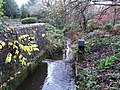
 15ft. Waterfall - geograph.org.uk - 1583026.jpg 640 × 480; 140 KB
-
 3 Transmitters - geograph.org.uk - 1461456.jpg 640 × 480; 40 KB
-
 A bonnie wee burn - geograph.org.uk - 1473145.jpg 600 × 453; 78 KB
-
 A different looking Antonine Wall - geograph.org.uk - 1523264.jpg 640 × 480; 102 KB
-
 A forlorn and forgotten phone box - geograph.org.uk - 1473178.jpg 453 × 600; 54 KB
-
 A Lost Bridge across the Luggie - geograph.org.uk - 1573543.jpg 640 × 480; 125 KB
-
 A Misty Carron Dam - geograph.org.uk - 1609363.jpg 640 × 480; 55 KB
-

-
 A Stand of Trees - geograph.org.uk - 1752393.jpg 1,024 × 768; 874 KB
-
 A73 Bridge - geograph.org.uk - 1546638.jpg 640 × 480; 133 KB
-
 A80 Upgrade Works - geograph.org.uk - 1470765.jpg 640 × 480; 92 KB
-
 A80 Upgrade Works - geograph.org.uk - 1498010.jpg 640 × 480; 57 KB
-
 Abandoned Plough - geograph.org.uk - 1764193.jpg 1,024 × 768; 805 KB
-
 Above the Gorse - geograph.org.uk - 1754241.jpg 1,024 × 768; 607 KB
-
 Across the high moor - geograph.org.uk - 1754295.jpg 1,024 × 768; 701 KB
-
 Adit above Luggie Water - geograph.org.uk - 1538128.jpg 1,024 × 768; 850 KB
-
 Agricultural drain - geograph.org.uk - 1716184.jpg 1,024 × 768; 649 KB
-
 Aitkenhead Bridge - geograph.org.uk - 1482482.jpg 640 × 480; 125 KB
-
 Aitkenhead Farm - geograph.org.uk - 1758532.jpg 1,024 × 768; 537 KB
-
 Almost a cave. - geograph.org.uk - 1582404.jpg 640 × 498; 155 KB
-
 An Auld Ricketty Bridge - geograph.org.uk - 1599524.jpg 640 × 480; 88 KB
-
 An Orderly Flock - geograph.org.uk - 1744985.jpg 1,024 × 768; 508 KB
-
 Ancient Cultivation Terraces - geograph.org.uk - 1608273.jpg 640 × 480; 84 KB
-
 Ancient Cultivation Terraces - geograph.org.uk - 1608416.jpg 640 × 480; 104 KB
-
 Ancient Dyke, Fannyside Muir - geograph.org.uk - 1618037.jpg 640 × 480; 99 KB
-
 Ancient Remains - geograph.org.uk - 1582468.jpg 640 × 480; 130 KB
-
 Angler's Bridge - geograph.org.uk - 1464102.jpg 640 × 480; 82 KB
-
 Antonine Wall near Westerwood - geograph.org.uk - 1523012.jpg 640 × 480; 127 KB
-
 Ardenrigg No.6 Colliery bing - geograph.org.uk - 1461454.jpg 640 × 480; 87 KB
-

-
 At North Third - geograph.org.uk - 1744971.jpg 1,024 × 768; 604 KB
-
 Auchenbowie Road - geograph.org.uk - 1760702.jpg 1,024 × 768; 535 KB
-
 Auchengeich Memorial - geograph.org.uk - 1514115.jpg 640 × 480; 74 KB
-
 Auchenkilns Holdings - geograph.org.uk - 1538441.jpg 640 × 480; 66 KB
-
 Auchincloch Burn - geograph.org.uk - 1764239.jpg 1,024 × 768; 821 KB
-
 Auchinstarry Basin and Beyond - geograph.org.uk - 1509647.jpg 640 × 480; 72 KB
-
 Auchinstarry Farm track - geograph.org.uk - 1526034.jpg 640 × 480; 127 KB
-
 Auchinstarry Marina iced in - geograph.org.uk - 1637860.jpg 640 × 480; 47 KB
-
 Auchinvalley - geograph.org.uk - 1768807.jpg 1,024 × 768; 658 KB
-

-
 Baillieston Interchange - geograph.org.uk - 1462740.jpg 640 × 480; 60 KB
-
 Baillieston Interchange - geograph.org.uk - 1557403.jpg 640 × 480; 62 KB
-
 Baillieston Victoriana - geograph.org.uk - 1658010.jpg 572 × 388; 55 KB
-
 Baillieston, Buchanan Gardens - geograph.org.uk - 1657979.jpg 640 × 483; 35 KB
-
 Baillieston, Church Street - geograph.org.uk - 1657969.jpg 640 × 483; 41 KB
-
 Baillieston, Dyke Street - geograph.org.uk - 1657989.jpg 640 × 483; 40 KB
-
 Baillieston, Main Street - geograph.org.uk - 1657999.jpg 640 × 483; 59 KB
-
 Banton - geograph.org.uk - 1715063.jpg 1,024 × 768; 552 KB
-
 Banton Bowling Club - geograph.org.uk - 1714973.jpg 1,024 × 768; 700 KB
-
 Banton gardens - geograph.org.uk - 1715055.jpg 1,024 × 768; 786 KB
-
 Banton Loch-Townhead Reservoir - geograph.org.uk - 1702439.jpg 1,024 × 768; 599 KB
-
 Banton Parish Church - geograph.org.uk - 1714974.jpg 1,024 × 768; 611 KB
-
 Banton's other burn - geograph.org.uk - 1716330.jpg 1,024 × 768; 933 KB
-
 Banton, the southern approaches - geograph.org.uk - 1716295.jpg 1,024 × 768; 576 KB
-
 Barbeth Moss and the new Motorway - geograph.org.uk - 1622171.jpg 640 × 480; 100 KB
-
 Bare hawthorn hedge - geograph.org.uk - 1715207.jpg 1,024 × 768; 680 KB
-
 Barge on the Forth and Clyde canal - geograph.org.uk - 1509686.jpg 640 × 480; 85 KB
-
-
 Bargeddie parish church, Bartonshill - geograph.org.uk - 991525.jpg 640 × 480; 50 KB
-
 Barrachnie - geograph.org.uk - 1657791.jpg 640 × 483; 59 KB
-
 Barrachnie, Church Army houses - geograph.org.uk - 1657807.jpg 640 × 483; 46 KB
-
 Battle of Stirling Bridge Stone - geograph.org.uk - 1519647.jpg 640 × 426; 113 KB
-
 Bellstane Clay Pit Adit - geograph.org.uk - 1556103.jpg 640 × 480; 117 KB
-
 Big Ditch, Whitehill - geograph.org.uk - 1764173.jpg 1,024 × 768; 811 KB
-
 Bing on the Moor, West Fannyside - geograph.org.uk - 1618065.jpg 640 × 480; 56 KB
-
 Bing Remains at Riskend - geograph.org.uk - 1769537.jpg 1,024 × 768; 798 KB
-
 Bingland - geograph.org.uk - 1716037.jpg 1,024 × 768; 625 KB
-
 Blackbog Road - geograph.org.uk - 1556085.jpg 640 × 480; 65 KB
-
 Blackbog Road at Mossywood - geograph.org.uk - 1555772.jpg 640 × 480; 70 KB
-
 Blackhill Transmitters - geograph.org.uk - 1464138.jpg 480 × 640; 43 KB
-
 Blackwood and the Campsies - geograph.org.uk - 1508089.jpg 640 × 480; 57 KB
-
 Blackwood and the Campsies - geograph.org.uk - 1615489.jpg 640 × 480; 38 KB
-
 Boat Ramp, Townhead Reservoir - geograph.org.uk - 1769542.jpg 1,024 × 768; 768 KB
-
 Bog and Bracken - geograph.org.uk - 1716119.jpg 1,024 × 768; 646 KB
-
 Bogfoot Sluice - geograph.org.uk - 1464075.jpg 640 × 480; 132 KB
-
 Boggy hollow, Nether Croy - geograph.org.uk - 1712238.jpg 1,024 × 768; 623 KB
-
 Bonnie Burn Cascade - geograph.org.uk - 1473149.jpg 600 × 453; 231 KB
-
 Bottomhead Farm Byre - geograph.org.uk - 1763731.jpg 1,024 × 768; 645 KB
-
 Bottomhead Farm Ruins - geograph.org.uk - 1764098.jpg 1,024 × 768; 634 KB
-
 Bottomhead Farmhouse - geograph.org.uk - 1763742.jpg 1,024 × 768; 583 KB
-
 Bottomhead Reservoir - geograph.org.uk - 1762867.jpg 1,024 × 768; 566 KB
-
 Bottomhead Reservoir - geograph.org.uk - 1762874.jpg 1,024 × 768; 620 KB
-
 Boulder field, northern slope of Croy Hill - geograph.org.uk - 1712254.jpg 1,024 × 768; 889 KB
-
 Boundary Track - geograph.org.uk - 1768795.jpg 1,024 × 768; 821 KB
-
 Bracco Road - geograph.org.uk - 1465923.jpg 640 × 480; 78 KB
-
 Brackenknowe Road on the Muir - geograph.org.uk - 1550110.jpg 480 × 640; 111 KB
-
 Brae at Wallstale - geograph.org.uk - 1744525.jpg 1,024 × 768; 690 KB
-
 Brae, Gain Road - geograph.org.uk - 1622212.jpg 480 × 640; 92 KB
-
 Breached Dam, Bottomhead Reservoir - geograph.org.uk - 1763010.jpg 1,024 × 768; 723 KB
-
 Break in the wall - geograph.org.uk - 1574056.jpg 640 × 480; 101 KB
-
 Bredisholm Track - geograph.org.uk - 1482930.jpg 480 × 640; 113 KB
-
 Bridge 17 - geograph.org.uk - 1462748.jpg 640 × 480; 121 KB
-
 Bridge in the glen - geograph.org.uk - 1582485.jpg 640 × 480; 150 KB
-

-

-
 Bridge No.18 - geograph.org.uk - 1473151.jpg 600 × 453; 54 KB
-
 Bridge on Chryston Road - geograph.org.uk - 1573523.jpg 640 × 480; 112 KB
-
 Bridge Over Bothlin Burn - geograph.org.uk - 1573451.jpg 640 × 480; 117 KB
-
 Bridge over Calder Water - geograph.org.uk - 1758548.jpg 1,024 × 768; 827 KB
-
 Bridge over Craigdouffie Burn - geograph.org.uk - 1753797.jpg 1,024 × 768; 873 KB
-
 Bridge over Craigdouffie Burn - geograph.org.uk - 1753802.jpg 1,024 × 768; 833 KB
-
 Bridge over old tramway, Kilsyth - geograph.org.uk - 1702386.jpg 1,024 × 768; 838 KB
-
 Bridge over the Auchincloch Burn - geograph.org.uk - 1752432.jpg 1,024 × 768; 917 KB
-
 Bridge over the Auchincloch Burn - geograph.org.uk - 1752446.jpg 1,024 × 768; 792 KB
-
 Bridge over the Avon Burn - geograph.org.uk - 1760714.jpg 945 × 656; 688 KB
-
 Bridge over the Cameron Burn - geograph.org.uk - 1550034.jpg 640 × 480; 148 KB
-
 Bridge over the Garrel at Alanfauld Farm - geograph.org.uk - 1586017.jpg 480 × 640; 147 KB
-
 Bridge over the Garrel Glen - geograph.org.uk - 1583050.jpg 640 × 480; 119 KB
-
 Bridge over the Shank Burn - geograph.org.uk - 1622235.jpg 480 × 640; 109 KB
-
 Bridgeway Road - geograph.org.uk - 1573460.jpg 640 × 465; 93 KB
-
 Broomhouse, Hamilton Road - geograph.org.uk - 1657893.jpg 640 × 483; 64 KB
-
 Broomhouse, Hamilton Road - geograph.org.uk - 1657899.jpg 640 × 483; 55 KB
-
 Broomhouse, Hamilton Road. - geograph.org.uk - 1657903.jpg 640 × 483; 58 KB
-
 Brown's Burn - geograph.org.uk - 1508204.jpg 640 × 480; 103 KB
-
 Brown's Burn below Stepends Road - geograph.org.uk - 1508216.jpg 640 × 480; 121 KB
-
 Buchanan Street - geograph.org.uk - 1463379.jpg 640 × 483; 56 KB
-
 Buchanan Street, Baillieston - geograph.org.uk - 1626219.jpg 640 × 483; 44 KB
-
 Buckie Burn Gorge - geograph.org.uk - 1608255.jpg 640 × 480; 92 KB
-
 Buckie Burn Gorge - geograph.org.uk - 1608448.jpg 640 × 480; 95 KB
-
 Buckie Burn Gorge - geograph.org.uk - 1609355.jpg 640 × 480; 59 KB
-
 Buckie Burn Spout - geograph.org.uk - 1608205.jpg 640 × 480; 160 KB
-
 Burn from Bottomhead Reservoir - geograph.org.uk - 1764058.jpg 1,024 × 768; 738 KB
-
 Burn from Fannyside Muir - geograph.org.uk - 1538058.jpg 640 × 480; 110 KB
-
 Burn going into Bottomhead Reservoir - geograph.org.uk - 1762882.jpg 1,024 × 768; 660 KB
-
 Burn heading west, Fannyside Muir - geograph.org.uk - 1618028.jpg 640 × 480; 92 KB
-
 Burn in the tussocks - geograph.org.uk - 1764129.jpg 1,024 × 768; 816 KB
-
 Burn on the moor, Palacerigg. - geograph.org.uk - 1618002.jpg 640 × 480; 90 KB
-
 Burngreen and the Garrel Burn, Kilsyth - geograph.org.uk - 1702513.jpg 1,024 × 768; 723 KB
-
 Burngreen to Market Street, Kilsyth - geograph.org.uk - 1593745.jpg 640 × 480; 82 KB
-
 Burnt slopes of Croy Hill - geograph.org.uk - 1712246.jpg 1,024 × 768; 707 KB
-
 Byre at Jawhills - geograph.org.uk - 1406988.jpg 640 × 480; 113 KB
-
 Calder Bridge - geograph.org.uk - 1472108.jpg 600 × 453; 65 KB
-
 Calder Miln remains - geograph.org.uk - 1589215.jpg 640 × 483; 168 KB
-
 Calder Viaduct - geograph.org.uk - 1482887.jpg 640 × 480; 111 KB
-
 Calderbank Avenue - geograph.org.uk - 1474622.jpg 640 × 480; 122 KB
-
 Calderbank Avenue 2008 - geograph.org.uk - 1474618.jpg 480 × 640; 77 KB
-
 Calderbank Grounds - geograph.org.uk - 1589228.jpg 640 × 347; 122 KB
-
 Cameron Road - geograph.org.uk - 1550027.jpg 640 × 480; 91 KB
-
 Canal Feeder - geograph.org.uk - 1593820.jpg 640 × 480; 148 KB
-
 Canal feeder and path, Kilsyth - geograph.org.uk - 1707035.jpg 1,024 × 768; 874 KB
-
 Canal feeder at Craigmarloch - geograph.org.uk - 1523318.jpg 477 × 640; 108 KB
-
 Canal feeder to Forth and Clyde Canal - geograph.org.uk - 1623016.jpg 640 × 480; 121 KB
-
 Carrickstone Trig - geograph.org.uk - 1477221.jpg 483 × 640; 72 KB
-
 Carron Bridge - geograph.org.uk - 1608442.jpg 640 × 480; 131 KB
-
 Carron Dam - geograph.org.uk - 1609368.jpg 640 × 480; 53 KB
-
 Carron Reservoir Dam - geograph.org.uk - 1464062.jpg 640 × 483; 61 KB
-
 Carronbridge Hotel - geograph.org.uk - 1608489.jpg 640 × 480; 67 KB
-
 Castle Hill - geograph.org.uk - 1449511.jpg 640 × 483; 254 KB
-
 Castle Hill Trig Pillar - geograph.org.uk - 1525953.jpg 640 × 480; 75 KB
-
 Chapelton Haugh - geograph.org.uk - 1538515.jpg 640 × 480; 82 KB
-
 Chappleton Road over the Luggie bridge - geograph.org.uk - 1538427.jpg 640 × 480; 111 KB
-
 Christmas Eve traffic on A80 - geograph.org.uk - 1637897.jpg 640 × 480; 59 KB
-
 Circular pond at Tomfyne - geograph.org.uk - 1752418.jpg 1,024 × 768; 823 KB
-
 Circular pond near Tomfyne - geograph.org.uk - 1764222.jpg 1,024 × 768; 706 KB
-
 Clay pit adit - geograph.org.uk - 1555829.jpg 640 × 480; 106 KB
-
 Clay Pit at Bellstane - geograph.org.uk - 1555810.jpg 640 × 480; 76 KB
-
 Clayslaps Road, Wester Blairlinn - geograph.org.uk - 1739421.jpg 1,024 × 768; 631 KB
-
 Colzium House, Kilsyth - geograph.org.uk - 1707021.jpg 1,024 × 768; 732 KB
-
 Condorrat works - geograph.org.uk - 1497996.jpg 640 × 480; 84 KB
-
 Confluence - geograph.org.uk - 1534714.jpg 640 × 480; 154 KB
-

-
 Confluence of Two Burns - geograph.org.uk - 1599531.jpg 640 × 480; 139 KB
-
 Contractor's access track - geograph.org.uk - 1758602.jpg 768 × 1,024; 637 KB
-
 Contractor's Compound - geograph.org.uk - 1497968.jpg 640 × 362; 61 KB
-
 Cool Graffiti - geograph.org.uk - 1546631.jpg 640 × 480; 86 KB
-
 Craig's Plantation - geograph.org.uk - 1764269.jpg 1,024 × 768; 886 KB
-
 Craigdouffie - geograph.org.uk - 1751671.jpg 1,024 × 768; 634 KB
-
 Craigdouffie - geograph.org.uk - 1751678.jpg 1,024 × 768; 581 KB
-
 Craigdouffie Burn - geograph.org.uk - 1715722.jpg 1,024 × 768; 872 KB
-
 Craigdouffie Burn falling off the hill - geograph.org.uk - 1754276.jpg 1,024 × 768; 780 KB
-
 Craigdouffie remains - geograph.org.uk - 1751655.jpg 1,024 × 768; 642 KB
-
 Craigend Lime Kilns - geograph.org.uk - 1744570.jpg 1,024 × 768; 837 KB
-
 Craighead Mill - geograph.org.uk - 1702409.jpg 1,024 × 1,365; 1.62 MB
-

-
 Culvert at Bredisholm - geograph.org.uk - 1463992.jpg 483 × 640; 124 KB
-
 Cumbernauld - geograph.org.uk - 1470717.jpg 640 × 480; 63 KB
-
 Cumbernauld Skyline - geograph.org.uk - 1495473.jpg 640 × 480; 30 KB
-
 Cumbernauld Sunset - geograph.org.uk - 1495478.jpg 480 × 640; 85 KB
-
 Cumbernauld's Dark Path - geograph.org.uk - 1495462.jpg 480 × 640; 138 KB
-
 Daldowie Estate cottage - geograph.org.uk - 1657953.jpg 640 × 483; 266 KB
-
 Daldowie Farm and hill - geograph.org.uk - 1519636.jpg 640 × 483; 240 KB
-
 David Place - geograph.org.uk - 1657877.jpg 640 × 483; 53 KB
-
 Demolition at South Myvot - geograph.org.uk - 1801540.jpg 800 × 600; 109 KB
-
 Demolition of North Road bridge - geograph.org.uk - 1528672.jpg 640 × 480; 93 KB
-
 Depression in the field - geograph.org.uk - 1613192.jpg 640 × 480; 90 KB
-
 Des Res at Carron Bridge - geograph.org.uk - 1599552.jpg 640 × 480; 57 KB
-
 Direction sign - geograph.org.uk - 1449543.jpg 640 × 480; 48 KB
-
 Douglas Glen - geograph.org.uk - 1556099.jpg 640 × 480; 60 KB
-
 Drumfin - geograph.org.uk - 1464168.jpg 640 × 480; 68 KB
-
 Drumfin and Lily Loch - geograph.org.uk - 1457254.jpg 640 × 480; 98 KB
-
 Drumlins at Milncroft - geograph.org.uk - 1622220.jpg 640 × 480; 91 KB
-
 Drumnessie - geograph.org.uk - 1722930.jpg 1,024 × 768; 791 KB
-
 Drumnessie - geograph.org.uk - 1723001.jpg 1,024 × 768; 659 KB
-
 Drumnessie Ruins - geograph.org.uk - 1608164.jpg 640 × 480; 55 KB
-
 Drumnessie Settlement - geograph.org.uk - 1722944.jpg 1,024 × 768; 779 KB
-
 Drumnessie Settlement - geograph.org.uk - 1722989.jpg 1,024 × 768; 778 KB
-
 Drumpeller Railway - geograph.org.uk - 1482389.jpg 640 × 480; 129 KB
-
 Dry Stane Dykes - geograph.org.uk - 1763016.jpg 1,024 × 768; 590 KB
-
 Drystane Barrier - geograph.org.uk - 1763015.jpg 1,024 × 768; 723 KB


