Category:Images by Andrew Huggett
Jump to navigation
Jump to search

Media in category "Images by Andrew Huggett"
The following 53 files are in this category, out of 53 total.
-
 'Druid's Circle' The Edge, Alderley Edge - geograph.org.uk - 43508.jpg 640 × 425; 221 KB
-
 Alfriston Village - geograph.org.uk - 44184.jpg 640 × 325; 116 KB
-
-
 Biddulph Grange Garden - geograph.org.uk - 48567.jpg 528 × 640; 188 KB
-
 Biddulph Grange Garden - geograph.org.uk - 48582.jpg 620 × 436; 157 KB
-
 Bircham Windmill, Great Bircham.jpg 640 × 454; 113 KB
-
 Bolton Town Centre - geograph.org.uk - 46664.jpg 640 × 346; 127 KB
-
 Bronte Waterfall - geograph.org.uk - 46683.jpg 512 × 640; 157 KB
-
 Chalk Farm and Willingdon church - geograph.org.uk - 46504.jpg 640 × 448; 115 KB
-
 Cliffe High Street, Lewes - geograph.org.uk - 43480.jpg 640 × 426; 143 KB
-
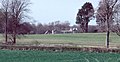
 Combe Hill - geograph.org.uk - 46656.jpg 640 × 448; 154 KB
-

-
 Cornmill Gardens, Wannock - geograph.org.uk - 46699.jpg 640 × 372; 123 KB
-
 Dunham Massey Hall - geograph.org.uk - 43482.jpg 640 × 406; 224 KB
-
 Eastbourne Town Hall - geograph.org.uk - 43450.jpg 426 × 640; 134 KB
-
 Folkington Manor - geograph.org.uk - 44784.jpg 640 × 330; 102 KB
-
 Gawsworth Church in August - geograph.org.uk - 46521.jpg 640 × 480; 210 KB
-
 Hailsham High Street - geograph.org.uk - 111346.jpg 640 × 427; 73 KB
-
 Hardraw Force Waterfall - geograph.org.uk - 44131.jpg 640 × 426; 227 KB
-
 Hardraw(AndrewHuggett)Sep2004.jpg 640 × 426; 149 KB
-
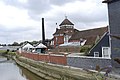 Harveys Brewery - geograph.org.uk - 43472.jpg 640 × 426; 102 KB
-
 Ingersley Clough Waterfall - geograph.org.uk - 44589.jpg 480 × 640; 184 KB
-
 Laburnum tree in Orford Road - geograph.org.uk - 53454.jpg 640 × 426; 147 KB
-

-
 Lower Willingdon from the Downs - geograph.org.uk - 44974.jpg 640 × 448; 138 KB
-
 Lymm Cross.jpg 640 × 312; 108 KB
-

-

-
 Prestwich Church - geograph.org.uk - 46671.jpg 535 × 640; 154 KB
-
 Sovereign Harbour Marina, Eastbourne - geograph.org.uk - 43970.jpg 640 × 419; 83 KB
-
 St Mary's Church, Hailsham - geograph.org.uk - 111354.jpg 640 × 432; 114 KB
-
 The Cedars, Hailsham - geograph.org.uk - 111340.jpg 640 × 426; 75 KB
-

-
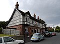 The Red Lion pub, Willingdon Village - geograph.org.uk - 43571.jpg 640 × 469; 116 KB
-
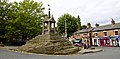
 The Village Pump, Willingdon - geograph.org.uk - 43527.jpg 515 × 640; 168 KB
-
 Towards Alfriston - geograph.org.uk - 47278.jpg 640 × 433; 167 KB
-
 Tram arrives at St Peter's Square - geograph.org.uk - 632870.jpg 640 × 435; 98 KB
-

-
 Wannock sign - geograph.org.uk - 46455.jpg 640 × 448; 105 KB
-
 White Nancy - geograph.org.uk - 43492.jpg 640 × 480; 71 KB
-
 Whitehead Clock Tower, Bury - geograph.org.uk - 44033.jpg 486 × 640; 127 KB
-
 Willingdon Village - geograph.org.uk - 43553.jpg 640 × 404; 123 KB
-
 Hampden Park, near Eastbourne - geograph.org.uk - 47132.jpg 640 × 448; 155 KB
-
 Martin Mere - geograph.org.uk - 48042.jpg 551 × 640; 129 KB
-
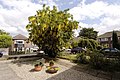
 Motcombe Gardens - geograph.org.uk - 44214.jpg 640 × 407; 186 KB
-
 Nine Ladies Stone Circle - geograph.org.uk - 109668.jpg 640 × 307; 128 KB
-
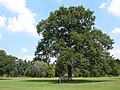 Queen Victoria's Oak Tree, Sandringham - geograph.org.uk - 44077.jpg 640 × 480; 164 KB
-
 Robin Hood's Stride at Sunset - geograph.org.uk - 109809.jpg 640 × 375; 95 KB
-
 Stapeley Water Gardens - geograph.org.uk - 52283.jpg 425 × 640; 135 KB
-
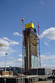
 The new Trafford Centre extension - geograph.org.uk - 632866.jpg 640 × 427; 33 KB
-

-
 View SW from Drusilla's Zoo Park - geograph.org.uk - 43605.jpg 640 × 304; 95 KB
-
 Wannock Glen - geograph.org.uk - 47197.jpg 640 × 442; 199 KB


Sep2004.jpg)


