Category:Images by Andrew Hackney
Jump to navigation
Jump to search

Subcategories
This category has only the following subcategory.
N
Media in category "Images by Andrew Hackney"
The following 200 files are in this category, out of 360 total.
(previous page) (next page)-
 "Hill 60" Quarry near Hollow Tor - geograph.org.uk - 1174624.jpg 640 × 494; 122 KB
-
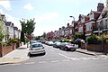
 4-6 Ealing Road, Northolt - geograph.org.uk - 1312145.jpg 640 × 480; 142 KB
-
 71 Hadfield Road, Hadfield - geograph.org.uk - 1188498.jpg 640 × 470; 126 KB
-
 A cottage in Allenby Road, Southall - geograph.org.uk - 1239579.jpg 640 × 426; 130 KB
-
 A cove in the Fleet at Herbury - geograph.org.uk - 1234334.jpg 640 × 477; 100 KB
-

-
 A Dartmoor letterbox on Laughter Tor - geograph.org.uk - 980028.jpg 640 × 426; 117 KB
-
 A40 at Northolt - geograph.org.uk - 1361849.jpg 640 × 424; 79 KB
-
 Abbey Road, Park Royal, NW10 - geograph.org.uk - 1320172.jpg 640 × 429; 62 KB
-

-
-

-
 Alperton Lane, Perivale - geograph.org.uk - 1314843.jpg 640 × 424; 83 KB
-
 Ash Road, Bishop's Green - geograph.org.uk - 1294169.jpg 640 × 426; 81 KB
-
 B3212 at Bellever Forest - geograph.org.uk - 1258861.jpg 640 × 426; 61 KB
-
 B3212 at the Warren House Inn - geograph.org.uk - 1559843.jpg 640 × 423; 62 KB
-
 B3387 at Haytor - geograph.org.uk - 1426104.jpg 640 × 424; 60 KB
-
 Bagwell Farm Touring Park - geograph.org.uk - 1234320.jpg 640 × 402; 95 KB
-
 Baldwyn Gardens, Acton, W3 - geograph.org.uk - 1179833.jpg 640 × 426; 83 KB
-
 Battle Abbey (1) - geograph.org.uk - 1230719.jpg 640 × 480; 123 KB
-
 Battle Abbey (2) - geograph.org.uk - 1230799.jpg 640 × 480; 107 KB
-
-
 Beech Road, Bishop's Green - geograph.org.uk - 1294160.jpg 640 × 426; 67 KB
-
 Bennett's Cross - geograph.org.uk - 1027533.jpg 640 × 480; 88 KB
-

-
 Blackgang Chine Gnome Garden.jpg 640 × 429; 124 KB
-
 Blackgang Chine maze.jpg 640 × 444; 207 KB
-
 Blackgang Chine Model Village 1.jpg 640 × 399; 133 KB
-
 Blackgang Chine Model Village 2.jpg 640 × 400; 119 KB
-
 Blackgang Chine Model Village 3.jpg 640 × 399; 130 KB
-
 Blackgang Chine, 1973 - geograph.org.uk - 1481093.jpg 640 × 423; 70 KB
-
 Blackgang Chine, cliff top paths - geograph.org.uk - 1485263.jpg 640 × 424; 107 KB
-

-
 Blue Pool, Furzebrook - geograph.org.uk - 1504305.jpg 640 × 412; 107 KB
-
 Bonehill Rocks - geograph.org.uk - 1562799.jpg 640 × 426; 78 KB
-
 Boscastle Harbour - geograph.org.uk - 1504598.jpg 640 × 409; 86 KB
-
 Bridge across leat - geograph.org.uk - 1259671.jpg 640 × 426; 92 KB
-

-
 Bridge over disused railway - geograph.org.uk - 1503672.jpg 640 × 407; 135 KB
-

-

-

-
 Buckland Abbey (1) - geograph.org.uk - 1714949.jpg 640 × 407; 79 KB
-
 Buckland Abbey (2) - geograph.org.uk - 1715877.jpg 640 × 417; 78 KB
-
 Budleigh Farm campsite - geograph.org.uk - 1188805.jpg 640 × 264; 73 KB
-

-
 Burrator Reservoir Boundary Stone - geograph.org.uk - 1174420.jpg 640 × 480; 121 KB
-

-
 Cadover Bridge (1) - geograph.org.uk - 1714547.jpg 640 × 424; 83 KB
-
 Cadover Bridge (2) - geograph.org.uk - 1715031.jpg 640 × 424; 71 KB
-
 Cairn on Water Hill - geograph.org.uk - 1560137.jpg 640 × 424; 76 KB
-
 Camping field at Home Farm - geograph.org.uk - 1239094.jpg 640 × 480; 127 KB
-

-
 Camping field at Kloofs Caravan Park (2) - geograph.org.uk - 1182443.jpg 640 × 480; 103 KB
-
 Campsite near Maes-y-Beran - geograph.org.uk - 1052267.jpg 640 × 480; 135 KB
-
 Castle Campbell - geograph.org.uk - 1044536.jpg 640 × 480; 89 KB
-
 Castle Park, Warwick - geograph.org.uk - 1503974.jpg 640 × 412; 108 KB
-
 Castlebar Hill roundabout - geograph.org.uk - 1297612.jpg 640 × 426; 92 KB
-
 Cathanger Rock (1) - geograph.org.uk - 1426285.jpg 640 × 480; 118 KB
-
 Cathanger Rock (2) - geograph.org.uk - 1426294.jpg 640 × 480; 150 KB
-
-
 Cave-Penny Cross near Corndon Tor - geograph.org.uk - 1426169.jpg 640 × 485; 115 KB
-
 Chepstow Castle, 1976 - geograph.org.uk - 1494278.jpg 640 × 420; 70 KB
-

-

-

-
 Clapper bridge at Oakery - geograph.org.uk - 1266522.jpg 640 × 502; 172 KB
-

-
 Combestone Tor (1) - geograph.org.uk - 1461020.jpg 640 × 424; 104 KB
-
 Combestone Tor (2) - geograph.org.uk - 1461395.jpg 640 × 424; 82 KB
-
 Corfe Castle before its destruction - geograph.org.uk - 1506230.jpg 640 × 405; 126 KB
-
 Cranford Park, Cranford - geograph.org.uk - 1013357.jpg 640 × 426; 108 KB
-
 Crossing of footpaths - geograph.org.uk - 1260309.jpg 640 × 426; 84 KB
-
 Deddington Arms Hotel, Deddington - geograph.org.uk - 1234210.jpg 640 × 462; 87 KB
-
 Derelict building at Cranford Park - geograph.org.uk - 1012710.jpg 640 × 426; 139 KB
-
 Derelict croft at Croftown - geograph.org.uk - 985616.jpg 640 × 480; 153 KB
-
 Derelict croft at Croftown - geograph.org.uk - 985618.jpg 640 × 480; 161 KB
-

-

-
-

-
-

-
 Disused sheds near Tottiford Reservoir - geograph.org.uk - 1259548.jpg 640 × 466; 171 KB
-
 Disused sheepfold at Leataidh (Leatty) - geograph.org.uk - 970068.jpg 640 × 480; 101 KB
-

-
 Dormers Wells High School - geograph.org.uk - 1239575.jpg 640 × 426; 127 KB
-
 Down Way, Northolt - geograph.org.uk - 1314822.jpg 640 × 424; 87 KB
-
 Duchy Square, Princetown - geograph.org.uk - 1103268.jpg 640 × 426; 61 KB
-
 Duchy Square, Princetown - geograph.org.uk - 1174359.jpg 640 × 480; 65 KB
-
 Dunna Bridge - geograph.org.uk - 974205.jpg 640 × 426; 63 KB
-
 Dunrobin Castle - geograph.org.uk - 1234249.jpg 640 × 529; 85 KB
-

-
-
 Edward Road, Northolt - geograph.org.uk - 1314813.jpg 640 × 424; 82 KB
-
 Engine 80104 at Swanage Station - geograph.org.uk - 1510002.jpg 640 × 406; 108 KB
-

-
 Entrance to King George's Field - geograph.org.uk - 1239652.jpg 640 × 426; 93 KB
-

-

-
 Farmland around Hexworthy - geograph.org.uk - 1559902.jpg 640 × 424; 105 KB
-
 Farmland near Grange of Cree - geograph.org.uk - 1040049.jpg 640 × 480; 92 KB
-
 Field at Herston Yards Campsite - geograph.org.uk - 1182261.jpg 640 × 480; 88 KB
-
 Fields at Down Barns Farm, Northolt - geograph.org.uk - 1314837.jpg 640 × 424; 84 KB
-
 Fields near Goatfield - geograph.org.uk - 1244023.jpg 591 × 640; 108 KB
-
 Fisherman's Cottage, Bossiney Road - geograph.org.uk - 1503771.jpg 640 × 408; 123 KB
-
 Holy Trinity, Fleet - geograph.org.uk - 979800.jpg 640 × 480; 138 KB
-

-
 Fortuneswell and Chiswell - geograph.org.uk - 1227065.jpg 640 × 480; 105 KB
-
 Fox Tor Cafe, Princetown - geograph.org.uk - 1102269.jpg 640 × 451; 60 KB
-
 Frozen Pond at Sharpitor Car Park - geograph.org.uk - 1102421.jpg 640 × 480; 71 KB
-
 Fuge's Post - geograph.org.uk - 973221.jpg 640 × 426; 72 KB
-
 Fuge's Post and Fur Tor - geograph.org.uk - 979912.jpg 426 × 640; 78 KB
-
 Fur Tor - Queen of the Moor - geograph.org.uk - 973680.jpg 640 × 426; 79 KB
-

-

-
 Gawler Newtake - geograph.org.uk - 1261457.jpg 640 × 426; 60 KB
-
 Gobbett Tin Mine ruins - geograph.org.uk - 1426348.jpg 640 × 424; 97 KB
-
 Gobbett Tunnel (1) - geograph.org.uk - 1426238.jpg 640 × 414; 126 KB
-
 Gobbett Tunnel (2) - geograph.org.uk - 1426242.jpg 640 × 417; 109 KB
-
 Goldfinch Lane, Bishop's Green - geograph.org.uk - 1293847.jpg 640 × 426; 88 KB
-
 Greenford Park Cemetery, Greenford - geograph.org.uk - 1261637.jpg 640 × 426; 151 KB
-
 Ha-ha in Cranford Park - geograph.org.uk - 1012673.jpg 640 × 426; 117 KB
-
 Hanger Lane, Ealing, W5 - geograph.org.uk - 1311526.jpg 640 × 424; 77 KB
-
 Hanwell Bridge, Hanwell, W7 - geograph.org.uk - 1316548.jpg 640 × 474; 130 KB
-
 Harman's Cross Station - geograph.org.uk - 1508568.jpg 640 × 403; 99 KB
-
 Hatfield House - the Old Palace - geograph.org.uk - 1839366.jpg 1,024 × 679; 300 KB
-
 Haytor Centre - geograph.org.uk - 1426100.jpg 640 × 423; 135 KB
-
 Haytor Granite Tramway - geograph.org.uk - 1714885.jpg 640 × 424; 96 KB
-
 Heligan House - geograph.org.uk - 1503355.jpg 640 × 409; 105 KB
-
 Hemsworthy Gate - geograph.org.uk - 1714234.jpg 640 × 427; 61 KB
-
 Hexworthy Cross - geograph.org.uk - 1027562.jpg 426 × 640; 79 KB
-
 High Sand Creek Campsite, Stiffkey - geograph.org.uk - 1235406.jpg 640 × 479; 110 KB
-
 High Street, Battle - geograph.org.uk - 1232675.jpg 640 × 480; 86 KB
-
 Holming Beam Car Park - geograph.org.uk - 1174587.jpg 640 × 426; 63 KB
-
 Horn Lane, Acton, W3 - geograph.org.uk - 1297594.jpg 640 × 426; 82 KB
-
 Horns Dam - geograph.org.uk - 1276273.jpg 640 × 480; 113 KB
-
 Horse Ford Cross - geograph.org.uk - 1460928.jpg 640 × 424; 93 KB
-
 Hound Tor - geograph.org.uk - 1505820.jpg 640 × 402; 114 KB
-
 Houses in Greenford Road, Greenford - geograph.org.uk - 1233688.jpg 640 × 436; 79 KB
-

-
 Houses in Lyndhurst Road, Greenford - geograph.org.uk - 975866.jpg 640 × 426; 108 KB
-
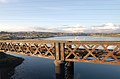
 Humber Bridge under construction - geograph.org.uk - 1479975.jpg 640 × 401; 70 KB
-

-

-

-
 Inveraray Castle - geograph.org.uk - 1226547.jpg 640 × 480; 125 KB
-
 Inverlael Bridge and River Lael - geograph.org.uk - 1224914.jpg 640 × 480; 69 KB
-

-
 Itchen Bridge under construction - geograph.org.uk - 1479998.jpg 640 × 422; 64 KB
-
 John Bishop's House (1) - geograph.org.uk - 1426315.jpg 640 × 416; 153 KB
-
 John Bishop's House (2) - geograph.org.uk - 1426317.jpg 640 × 424; 117 KB
-
 John Bishop's House (3) - geograph.org.uk - 1426325.jpg 640 × 424; 111 KB
-
-

-
-

-

-
-

-

-

-

-

-

-
-

-

-

-

-
 Kestrel Gardens, Bishop's Green - geograph.org.uk - 1293922.jpg 640 × 430; 92 KB
-
 King George's Field, Southall - geograph.org.uk - 1239644.jpg 640 × 426; 95 KB
-
 Laira Railway Bridge - geograph.org.uk - 1258529.jpg 640 × 421; 78 KB
-

-
 Lawson Road, Southall - geograph.org.uk - 1239621.jpg 640 × 411; 76 KB
-
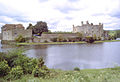 Leeds Castle, 1985 - geograph.org.uk - 1497889.jpg 640 × 436; 78 KB
-
 Leg O'Mutton Corner - geograph.org.uk - 1714852.jpg 640 × 424; 68 KB
-

-

-
 Llanthony Priory - geograph.org.uk - 1045530.jpg 640 × 470; 113 KB
-
 Loch an Fheoir - geograph.org.uk - 970883.jpg 640 × 480; 99 KB
-
 Loch Fleet (1) - geograph.org.uk - 1225099.jpg 640 × 480; 112 KB
-
 Loch Fleet (2) - geograph.org.uk - 1226119.jpg 640 × 480; 103 KB
-
 Lock's Gate Cross - geograph.org.uk - 1559591.jpg 640 × 424; 94 KB
-
 Low clouds over Loch Fyne - geograph.org.uk - 1182105.jpg 640 × 480; 56 KB
-
-
 Manor Farm Campsite, East Runton - geograph.org.uk - 1182167.jpg 640 × 480; 109 KB
-
 Market Place, Deddington - geograph.org.uk - 1228185.jpg 640 × 449; 82 KB
-
 Meadow above Hexworthy - geograph.org.uk - 980021.jpg 640 × 426; 94 KB
-
 Meadvale Road, Ealing, W5 - geograph.org.uk - 1295205.jpg 640 × 426; 102 KB
-
 Meldon Dam - geograph.org.uk - 1471082.jpg 640 × 419; 73 KB
-
 Meldon Reservoir - geograph.org.uk - 1471129.jpg 640 × 418; 79 KB
-
 Meldon Viaduct - geograph.org.uk - 1505881.jpg 640 × 409; 110 KB
-
 Mists clearing at Great Mis Tor - geograph.org.uk - 1027578.jpg 640 × 480; 63 KB
-
 MoD Hut at Holming Beam Car Park - geograph.org.uk - 1174316.jpg 640 × 426; 79 KB
-
 Moorland at Gawler Newtake (1) - geograph.org.uk - 1259042.jpg 640 × 426; 70 KB
-
 Moorland at Gawler Newtake (2) - geograph.org.uk - 1259108.jpg 640 × 426; 86 KB
-
 Moorland at Gawler Newtake (3) - geograph.org.uk - 1259179.jpg 640 × 426; 89 KB
-
 Moorland at Gawler Newtake (4) - geograph.org.uk - 1259190.jpg 640 × 426; 66 KB
-
 Moorland footpath - geograph.org.uk - 1426124.jpg 640 × 424; 66 KB


_-_geograph.org.uk_-_1246149.jpg)
_-_geograph.org.uk_-_1438339.jpg)


_-_geograph.org.uk_-_1230719.jpg)
_-_geograph.org.uk_-_1230799.jpg)


_-_geograph.org.uk_-_1714949.jpg)
_-_geograph.org.uk_-_1715877.jpg)

_-_geograph.org.uk_-_1297583.jpg)


_-_geograph.org.uk_-_1714547.jpg)
_-_geograph.org.uk_-_1715031.jpg)


_-_geograph.org.uk_-_1182500.jpg)
_-_geograph.org.uk_-_1182443.jpg)


_-_geograph.org.uk_-_1426285.jpg)
_-_geograph.org.uk_-_1426294.jpg)
_-_geograph.org.uk_-_1426182.jpg)


_-_geograph.org.uk_-_1297735.jpg)
_-_geograph.org.uk_-_1297739.jpg)


_-_geograph.org.uk_-_1461020.jpg)
_-_geograph.org.uk_-_1461395.jpg)


_-_geograph.org.uk_-_970068.jpg)
_-_geograph.org.uk_-_970957.jpg)


_-_geograph.org.uk_-_1426238.jpg)
_-_geograph.org.uk_-_1426242.jpg)


_-_geograph.org.uk_-_1426315.jpg)
_-_geograph.org.uk_-_1426317.jpg)
_-_geograph.org.uk_-_1426325.jpg)
_-_geograph.org.uk_-_1297303.jpg)
_-_geograph.org.uk_-_1297309.jpg)
_-_geograph.org.uk_-_1297318.jpg)
_-_geograph.org.uk_-_1297322.jpg)


_-_geograph.org.uk_-_1184037.jpg)
_-_geograph.org.uk_-_1184043.jpg)
,_Plymouth_-_geograph.org.uk_-_1259756.jpg)
,_Plymouth_-_geograph.org.uk_-_1259739.jpg)


_(1)_-_geograph.org.uk_-_970897.jpg)
_(2)_-_geograph.org.uk_-_1226580.jpg)


_-_geograph.org.uk_-_1225099.jpg)
_-_geograph.org.uk_-_1226119.jpg)


_-_geograph.org.uk_-_1259042.jpg)
_-_geograph.org.uk_-_1259108.jpg)
_-_geograph.org.uk_-_1259179.jpg)
_-_geograph.org.uk_-_1259190.jpg)
