Category:Illawarra
Jump to navigation
Jump to search
region in New South Wales, Australia | |||||
| Upload media | |||||
| Instance of | |||||
|---|---|---|---|---|---|
| Location | New South Wales, AUS | ||||
| Different from | |||||
 | |||||
Subcategories
This category has the following 17 subcategories, out of 17 total.
Media in category "Illawarra"
The following 154 files are in this category, out of 154 total.
-
 "Drum and Drumsticks" rock formation near Currarong (NSW) (7417189052).jpg 2,048 × 1,391; 810 KB
-
 1923 Wyndang House ~ Lake Illawarra.jpg 3,276 × 2,106; 3.24 MB
-
 A bit of the Illawarra Coast (2469696246).jpg 1,024 × 768; 416 KB
-
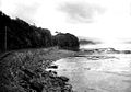 A bit of the Illawarra Coast from The Powerhouse Museum.jpg 986 × 689; 336 KB
-

-

-
 Austinmer from Sublime Point Wollongong 1926 (RAHS Photograph Collection) (27773707666).jpg 3,239 × 1,857; 1.64 MB
-
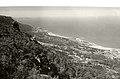
 Barren Grounds Illawarra lookout panorama 3.jpg 2,592 × 1,944; 1.21 MB
-

-
 Branding cattle at Illawarra.png 3,269 × 1,935; 3.34 MB
-

-
 Bulli Pass undated (RAHS Photograph Collection) (2) (27810836735).jpg 1,844 × 3,275; 1.51 MB
-
 Bulli Pass undated (RAHS Photograph Collection) (27808733095).jpg 1,861 × 3,197; 1.76 MB
-

-
 Bulli Pass undated RAHS (RAHS Photograph Collection) (27197273143).jpg 7,000 × 5,000; 4.77 MB
-
 Bulli Pass Woollongong in 1886.png 266 × 397; 179 KB
-
 Bulli Pass, NSW.jpg 870 × 1,050; 413 KB
-
 Bulli undated (RAHS-Osborne Photography Collection) (27733199561).jpg 2,502 × 1,854; 914 KB
-
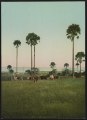
 Cabbage palms in the Illawarra District LCCN2017657727.jpg 5,220 × 7,208; 5.42 MB
-
 Cabbage palms in the Illawarra District LCCN2017657727.tif 5,220 × 7,208; 107.75 MB
-
 Cabbage palms, Illawarra (2414467181).jpg 1,024 × 775; 499 KB
-

-
 Cataract Road, Illawarra (2448016936).jpg 769 × 1,024; 533 KB
-
 Cathedral Rocks Kiama undated (RAHS Photograph Collection) (27808997165).jpg 2,966 × 1,722; 1.02 MB
-
 Chain baths, Wollongong undated (RAHS Photograph Collection) (27733486361).jpg 2,624 × 1,859; 732 KB
-
 Coaching in the Illawarra and South Coast area, New South Wales - 1905.jpg 1,524 × 1,003; 466 KB
-
 Coast at Broghton Parish(Gerringong, NSW).png 404 × 479; 167 KB
-
 Coast at Kiama Heights, Kiama Parish Camden County NSW 2.png 640 × 480; 186 KB
-
 Coast at Kiama Heights, Kiama Parish Camden County NSW.png 640 × 360; 171 KB
-
 Coolangatta Parish, Camden County (Berry NSW) looking south 2.png 640 × 480; 310 KB
-
 Coolangatta Parish, Camden County (Berry NSW) looking south.png 640 × 480; 217 KB
-
 Cordeaux Road, Illawarra (2469675610).jpg 1,024 × 756; 700 KB
-
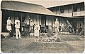
 Displays - Coronation Day Procession June 22nd 1911 (15274085322).jpg 760 × 600; 160 KB
-
 Drum and Drumstick Rocks at Currarong Bay (6218525807).jpg 591 × 441; 92 KB
-
 Fairy Meadow - panoramio (1).jpg 2,048 × 1,536; 491 KB
-
 Fairy Meadow - panoramio (2).jpg 2,048 × 1,536; 491 KB
-
 Fairy Meadow - panoramio (3).jpg 2,048 × 1,536; 485 KB
-
 Fairy Meadow - panoramio (4).jpg 2,048 × 1,536; 442 KB
-
 Fairy Meadow - panoramio.jpg 2,048 × 666; 308 KB
-
 Farming in the Shoalhaven (3008788347).jpg 791 × 600; 96 KB
-
 Flagstaff Hill Park - panoramio (1).jpg 2,048 × 1,536; 683 KB
-
 Flagstaff Hill Park - panoramio (2).jpg 2,048 × 624; 263 KB
-
 Flagstaff Hill Park - panoramio (3).jpg 2,048 × 1,536; 387 KB
-
 Flagstaff Hill Park - panoramio.jpg 2,048 × 1,536; 304 KB
-
 FMIB 36615 Map of the Illawarra Lake.jpeg 2,193 × 1,687; 441 KB
-
 Gerringong Station.png 640 × 480; 271 KB
-
 Gerringong township.png 640 × 480; 247 KB
-
 Hampden Bridge (2924807525).jpg 813 × 513; 94 KB
-
 Horseriders at Kangaroo River (3527203684).jpg 594 × 343; 67 KB
-
 Horseriding in the Kangaroo Valley (3126143901).jpg 621 × 436; 70 KB
-

-
-

-
 Illawarra colours.svg 117 × 117; 2 KB
-
 Illawarra Fly - panoramio (1).jpg 3,216 × 4,288; 2.64 MB
-
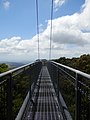
 Illawarra Fly Cantilever.jpg 2,842 × 3,640; 2.1 MB
-
 Illawarra region map.png 6,136 × 11,774; 3.04 MB
-
 Illawarra region map.svg 750 × 625; 3.18 MB
-

-
 Illawarra undated (RAHS Photograph Collection) (27727371392).jpg 1,213 × 1,832; 268 KB
-
 Investigator Tree Celtis paniculata Bass Point.jpg 4,767 × 3,574; 10.45 MB
-
 Jci3.jpg 700 × 500; 154 KB
-
 Kangaroo Valley (2924807831).jpg 1,015 × 438; 91 KB
-
 Kangaroo Valley (2925660492).jpg 617 × 436; 53 KB
-
 Kembla Pass, Illawarra (2414460663).jpg 708 × 1,024; 514 KB
-
 Lady Fuller Park - panoramio (1).jpg 2,048 × 1,536; 953 KB
-
 Lady Fuller Park - panoramio.jpg 1,536 × 2,048; 937 KB
-
 Loddon Falls Austinmer Wollongong undated (RAHS Photograph Collection) (2) (27733683351).jpg 3,195 × 1,863; 1.56 MB
-
 Loddon Falls Austinmer Wollongong undated (RAHS Photograph Collection) (27774512076).jpg 1,860 × 3,209; 1.52 MB
-
 Looking towards Bulli and Woonona 1926 (RAHS Photograph Collection) (27196931973).jpg 3,253 × 1,653; 1.18 MB
-

-
 National Park, Illawarra, NSW (2485132162).jpg 776 × 1,024; 726 KB
-
 North Wollongong - panoramio.jpg 2,048 × 850; 365 KB
-
 NSW Labor Opposition Leader John Robertson (6604877537).jpg 3,364 × 2,691; 1.88 MB
-
 Otford tunnel, view south from, undated (RAHS Photograph Collection) (27708364562).jpg 3,070 × 1,911; 2.79 MB
-
-
 Port Kembla 28 May 1937 RAHS (RAHS-Adastra Aerial Survey Collection) (27727570962).jpg 5,613 × 5,530; 12.03 MB
-

-
-

-
 Port Kembla steel works (3057429599) (2).jpg 441 × 598; 52 KB
-
-

-
 Puckey's Beach - panoramio.jpg 2,048 × 864; 270 KB
-
 Road to Wombeyan Caves (5454013713).jpg 892 × 746; 125 KB
-
 Rock Throne of Bombo (14464872530).jpg 4,558 × 2,721; 3.89 MB
-
 Rocks below the seacliff bridge.jpg 1,600 × 902; 182 KB
-
 Rural New South Wales (3058266840).jpg 621 × 436; 78 KB
-
 Scarborough - panoramio (6).jpg 2,048 × 1,536; 633 KB
-
 Scarborough - panoramio (7).jpg 2,048 × 791; 301 KB
-
 Scarborough sandstone Stanwell Park.jpg 1,067 × 1,600; 488 KB
-

-
 Sea Cliff Bridge - panoramio (4).jpg 2,048 × 1,536; 491 KB
-
 Sea Cliffs at Gerringong (Kiama Parish)NSW.png 640 × 480; 199 KB
-
 Sea cliffs at Gerringong NSW.png 640 × 480; 243 KB
-
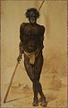 Selleny picture of aboriginal elder.jpg 358 × 564; 41 KB
-
 Seven Mile Beach, Gerringong (3596110863).jpg 626 × 441; 53 KB
-
 Stanwell Park (5556681179).jpg 571 × 416; 79 KB
-
 Stanwell Park Beach (2514729211).jpg 786 × 1,024; 503 KB
-

-
 Stanwell Tops - panoramio (1).jpg 2,048 × 1,536; 880 KB
-
 Stanwell Tops - panoramio.jpg 2,048 × 1,536; 769 KB
-
 Stuart Park, Wollongong undated (RAHS Photograph Collection) (27809543305).jpg 2,746 × 1,689; 1.42 MB
-
 Sublime Point - panoramio (1).jpg 2,048 × 1,536; 274 KB
-
 Sublime Point - panoramio.jpg 2,048 × 1,536; 400 KB
-
 Sublime Point Lookout Wollongong circa 1925 (RAHS Photograph Collection) (27734059711).jpg 3,010 × 1,695; 1.91 MB
-
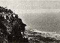 Sublime Point Lookout Wollongong RAHS undated (RAHS Photograph Collection) (27774851306).jpg 7,000 × 5,000; 4.99 MB
-

-
 Sublime point lookout, Illawarra, NSW.jpg 2,700 × 1,800; 979 KB
-

-
 Sublime Point Track - panoramio (1).jpg 1,536 × 2,048; 732 KB
-
 Sublime Point Track - panoramio (2).jpg 1,536 × 2,048; 882 KB
-
 Sublime Point Track - panoramio (3).jpg 2,048 × 1,536; 935 KB
-
 Sublime Point Track - panoramio.jpg 2,048 × 1,536; 567 KB
-
-
 Sunset lake illawarra.jpg 800 × 600; 51 KB
-
 SurfRace.jpg 1,261 × 934; 117 KB
-
 Swimming at the causeway (3057430057).jpg 598 × 450; 79 KB
-
 Syzygium paniculatum 88 cm trunk diameter.JPG 360 × 480; 97 KB
-
 The Illawarra Escarpment Track - panoramio (1).jpg 2,048 × 1,536; 1.18 MB
-
 The Illawarra Escarpment Track - panoramio (10).jpg 2,048 × 612; 395 KB
-
 The Illawarra Escarpment Track - panoramio (11).jpg 2,048 × 1,536; 837 KB
-
 The Illawarra Escarpment Track - panoramio (12).jpg 2,048 × 1,536; 684 KB
-
 The Illawarra Escarpment Track - panoramio (13).jpg 2,048 × 1,536; 495 KB
-
 The Illawarra Escarpment Track - panoramio (2).jpg 2,048 × 1,060; 358 KB
-
 The Illawarra Escarpment Track - panoramio (3).jpg 2,048 × 1,536; 1.11 MB
-
 The Illawarra Escarpment Track - panoramio (4).jpg 2,048 × 1,536; 1,018 KB
-
 The Illawarra Escarpment Track - panoramio (5).jpg 2,048 × 1,536; 544 KB
-
 The Illawarra Escarpment Track - panoramio (6).jpg 2,048 × 1,536; 470 KB
-
 The Illawarra Escarpment Track - panoramio (7).jpg 2,048 × 1,536; 362 KB
-
 The Illawarra Escarpment Track - panoramio (8).jpg 1,536 × 2,048; 778 KB
-
 The Illawarra Escarpment Track - panoramio (9).jpg 2,048 × 1,536; 431 KB
-
 The Illawarra Escarpment Track - panoramio.jpg 2,048 × 1,536; 851 KB
-
 The Woddi Woddi Track - panoramio (1).jpg 2,048 × 1,536; 1.04 MB
-
 The Woddi Woddi Track - panoramio (2).jpg 2,048 × 429; 286 KB
-
 The Woddi Woddi Track - panoramio.jpg 2,048 × 1,536; 685 KB
-
 Thirroul - panoramio (1).jpg 2,048 × 525; 261 KB
-
 Thirroul - panoramio.jpg 2,048 × 766; 429 KB
-
 Thirroul Beach from Sublime Point, undated (RAHS Photograph Collection) (27808371085).jpg 3,235 × 1,661; 1.48 MB
-
 Towradgi - panoramio.jpg 2,048 × 1,035; 407 KB
-
 Unanderra Station.png 640 × 480; 333 KB
-
 View at Austinmer (2514727199).jpg 1,024 × 778; 524 KB
-

-
 View of Stanwell Park (NSW) (6396890241).jpg 626 × 356; 79 KB
-
 Waterfalls at Bundanoon (2549703250).jpg 630 × 397; 72 KB
-
 Wollongong (5454014081).jpg 1,000 × 611; 228 KB
-
 Wollongong Tennis Club c. 1918 (RAHS Photograph Collection) (27216895163).jpg 2,356 × 1,793; 922 KB
-

-

-
 Women walking along Stanwell Park Beach (7539667724).jpg 516 × 379; 77 KB
-
 Woonona - panoramio (1).jpg 1,536 × 2,048; 505 KB
-
 Woonona - panoramio (2).jpg 2,048 × 835; 287 KB
-
 Woonona - panoramio (3).jpg 2,048 × 607; 262 KB
-
 Woonona - panoramio.jpg 2,048 × 665; 276 KB
_(7417189052).jpg)

.jpg)

_(27727371922).jpg)
_(27808377195).jpg)
_(27773707666).jpg)

_(27197370223).jpg)

_(27808734925).jpg)
_(2)_(27810836735).jpg)
_(27808733095).jpg)
_(3)_(27197282033).jpg)
_(27197273143).jpg)


_(27733199561).jpg)

.jpg)
_(27704715352).jpg)
.jpg)
_(27808997165).jpg)
_(27733486361).jpg)

.png)


_looking_south_2.png)
_looking_south.png)
.jpg)
.jpg)
.jpg)
.jpg)
.jpg)
.jpg)
.jpg)
.jpg)
.jpg)
.jpg)


.jpg)
.jpg)
.jpg)
_(27197065294).jpg)
_2_(27197064264).jpg)
_3_(27197064064).jpg)

.jpg)


_(27733697561).jpg)
_(27727371392).jpg)


.jpg)
.jpg)
.jpg)
.jpg)

_(2)_(27733683351).jpg)
_(27774512076).jpg)
_(27196931973).jpg)
_(27197449814).jpg)
.jpg)

.jpg)
_(27708364562).jpg)
_(27727369932).jpg)
_(27727570962).jpg)
_RAHS_(RAHS-Adastra_Aerial_Survey_Collection)_(27828817425).jpg)
_(27828787345).jpg)
_(27727438662).jpg)
_(2).jpg)
_(27794368036).jpg)
_(27708357642).jpg)

.jpg)
.jpg)

.jpg)
.jpg)

_(27708353102).jpg)
.jpg)
NSW.png)


.jpg)
.jpg)
.jpg)
_(27734066241).jpg)
.jpg)

_(27809543305).jpg)
.jpg)

_(27734059711).jpg)
_(27774851306).jpg)
_(27809523725).jpg)

_(27197402364).jpg)
.jpg)
.jpg)
.jpg)

_(27734020831).jpg)


.jpg)

.jpg)
.jpg)
.jpg)
.jpg)
.jpg)
.jpg)
.jpg)
.jpg)
.jpg)
.jpg)
.jpg)
.jpg)

.jpg)

_(27808371085).jpg)


.jpg)
_(27199009593).jpg)
_(6396890241).jpg)
.jpg)
.jpg)
_(27216895163).jpg)
_(27708200052).jpg)
_(27530867880).jpg)
.jpg)
.jpg)
.jpg)
.jpg)
.jpg)
.jpg)
.jpg)
.jpg)
.jpg)