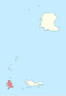
Category:Ilhéu de Fora (Selvagens)
Jump to navigation
Jump to search
English: Fora islet, the southernmost point of Portugal.
| Object location | | View all coordinates using: OpenStreetMap |
|---|
island in Portugal | |||||
| Upload media | |||||
| Instance of | |||||
|---|---|---|---|---|---|
| Part of | |||||
| Location | Madeira, Portugal | ||||
| Located in or next to body of water | |||||
| Area |
| ||||
| Elevation above sea level |
| ||||
 | |||||
Media in category "Ilhéu de Fora (Selvagens)"
The following 3 files are in this category, out of 3 total.
-
Ilhéu de Fora (Selvagens) location map.svg 998 × 1,455; 73 KB
-
Isole Selvagge dall'aereo - Isola di Fora.jpg 4,486 × 3,364; 7.54 MB
-
Southern Savage Islands, Atlantic Ocean.jpg 1,440 × 960; 331 KB


