Category:Ilgachuz Range
Jump to navigation
Jump to search
mountain range in British Columbia, Canada  | |||||
| Upload media | |||||
| Instance of | |||||
|---|---|---|---|---|---|
| Part of |
| ||||
| Made from material | |||||
| Location | British Columbia, Canada | ||||
| Width |
| ||||
| Length |
| ||||
| Highest point |
| ||||
| Elevation above sea level |
| ||||
 | |||||
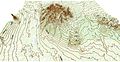
English: The Ilgachuz Range is a mountain range located entirely within Itcha Ilgachuz Provincial Park in British Columbia, Canada. It is part of the Anahim Volcanic Belt.
Subcategories
This category has only the following subcategory.
M
- Maps of Anahim Volcanic Belt (6 F)
Media in category "Ilgachuz Range"
The following 9 files are in this category, out of 9 total.
-
 Far Mountain 3D topo.jpg 4,080 × 2,121; 1.61 MB
-
 Far Mountain 3D.gif 618 × 434; 6.55 MB
-
 Far Mountain topo.jpg 1,484 × 2,004; 1.49 MB
-
 Ilgachuz Range east.jpg 940 × 371; 54 KB
-
 Ilgachuz Range northern.jpg 745 × 410; 35 KB
-
 Ilgachuz Range peaks.jpg 642 × 139; 12 KB
-
 Ilgachuz Range southern.jpg 775 × 395; 33 KB
-
 Ilgachuz Range.jpg 702 × 626; 143 KB
-
 RainbowIlgachuzItcha.jpg 510 × 207; 17 KB


