Category:Ilfracombe
Jump to navigation
Jump to search
town (seaside resort) and civil parish in Devon, England  Capella de Sant Nicolau d'Ilfracombe. | |||||
| Upload media | |||||
| Instance of | |||||
|---|---|---|---|---|---|
| Location | North Devon, Devon, South West England, England | ||||
| Inception |
| ||||
| Population |
| ||||
| Area |
| ||||
| Said to be the same as | Ilfracombe (Wikimedia duplicated page, civil parish) | ||||
| official website | |||||
 | |||||
English: Images relating to the town of Ilfracombe, Devon, England. For more information see the Wikipedia article Ilfracombe.
Subcategories
This category has the following 13 subcategories, out of 13 total.
Pages in category "Ilfracombe"
The following 2 pages are in this category, out of 2 total.
Media in category "Ilfracombe"
The following 200 files are in this category, out of 2,043 total.
(previous page) (next page)-

-
 28 The High Street, Ilfracombe - geograph.org.uk - 5361252.jpg 3,940 × 3,043; 5.12 MB
-
 35, 36 and 37 Oxford Grove, Ilfracombe - geograph.org.uk - 5765520.jpg 800 × 657; 146 KB
-
 4 ^ 5 St James Place, Ilfracombe EX34 9BH - geograph.org.uk - 5582497.jpg 1,282 × 1,795; 1.88 MB
-
 A Book of the West - Chapel Rock, Ilfracombe.png 1,983 × 1,392; 1.36 MB
-
-

-

-
 A Bull with a View - geograph.org.uk - 2032785.jpg 3,453 × 2,302; 3.26 MB
-
 A corner near Scamps yard - geograph.org.uk - 1500605.jpg 640 × 480; 110 KB
-
 A cottage at Damage Barton - geograph.org.uk - 1945828.jpg 1,024 × 680; 196 KB
-
 A country house on Warcombe lane - geograph.org.uk - 1946802.jpg 1,024 × 680; 248 KB
-
 A cove to the west of Brandy Cove - geograph.org.uk - 1987304.jpg 1,024 × 680; 256 KB
-

-

-

-
 A footpath across the field at Oakridge Farm - geograph.org.uk - 2150071.jpg 1,024 × 683; 115 KB
-
 A footpath approaching Higher Campscott - geograph.org.uk - 1967402.jpg 1,024 × 680; 311 KB
-
 A footpath from Damage Barton to Lee - geograph.org.uk - 1947390.jpg 1,024 × 680; 209 KB
-
 A footpath from Damage Barton to Warcombe Lane - geograph.org.uk - 1947393.jpg 1,024 × 683; 134 KB
-
 A footpath from Lee to Damage Barton - geograph.org.uk - 1947388.jpg 1,024 × 680; 219 KB
-

-

-

-

-
 A footpath opposite Shaftsborough Lane - geograph.org.uk - 1959494.jpg 1,024 × 680; 271 KB
-
 A footpath to Higher Campscott - geograph.org.uk - 1967429.jpg 1,024 × 680; 275 KB
-

-
-

-

-

-

-

-

-
 A gated track which leads to a small field - geograph.org.uk - 1967205.jpg 1,024 × 680; 278 KB
-
-

-

-
 A meteorological phenomenon in the Bristol Channel - geograph.org.uk - 3817393.jpg 1,600 × 1,200; 239 KB
-

-
 A new car park on the site of the old bus station - geograph.org.uk - 3969741.jpg 6,000 × 4,000; 4.69 MB
-

-
 A new parking meter on Wilder Road - geograph.org.uk - 2198420.jpg 680 × 1,024; 174 KB
-
 A pool of water at Little Shelfin Farm - geograph.org.uk - 1967054.jpg 1,024 × 680; 293 KB
-
 A pool of water near Lower Campscott - geograph.org.uk - 1959525.jpg 1,024 × 680; 241 KB
-
 A private road leading to Damage Barton - geograph.org.uk - 1945801.jpg 1,024 × 680; 213 KB
-
 A road junction in Lee. - geograph.org.uk - 1302670.jpg 640 × 480; 61 KB
-
 A rooftop garden with the Seven Hills as a backdrop - geograph.org.uk - 3510405.jpg 1,600 × 1,048; 464 KB
-
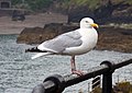 A seagull at Ilfracombe - geograph.org.uk - 1492740.jpg 640 × 456; 53 KB
-
 A secluded cove near Ilfracombe - geograph.org.uk - 1987365.jpg 680 × 1,024; 275 KB
-

-

-

-

-
-
-

-

-

-
 A sign appears for Mill Head - geograph.org.uk - 1444435.jpg 640 × 427; 72 KB
-
 A signpost on the South West Coast Path - geograph.org.uk - 1987150.jpg 1,024 × 680; 220 KB
-
 A single track country lane leaving the B3343 - geograph.org.uk - 1967176.jpg 1,024 × 680; 166 KB
-

-
 A snow flurry in Portland Street - geograph.org.uk - 5673960.jpg 4,000 × 3,000; 4.9 MB
-

-
 A stile a short distance from Warcombe Lane - geograph.org.uk - 1947379.jpg 1,024 × 680; 234 KB
-
 A stile at the top end of Combe Park. - geograph.org.uk - 951618.jpg 480 × 640; 140 KB
-
 A stile beneath a tree at Higher Campscott - geograph.org.uk - 1967490.jpg 1,024 × 680; 209 KB
-

-

-

-

-

-
 A track leading to Yarde Farm - geograph.org.uk - 1945716.jpg 1,024 × 768; 303 KB
-

-
 A Tree House in Crowness Cleave - geograph.org.uk - 1961373.jpg 1,024 × 731; 310 KB
-

-

-
 A view across Ilfracombe. - geograph.org.uk - 1228868.jpg 640 × 427; 110 KB
-
 A view of Hilly Mouth from Warcombe Lane - geograph.org.uk - 1947373.jpg 1,024 × 680; 211 KB
-

-
 A well at Higher Campscott - geograph.org.uk - 1967370.jpg 680 × 1,024; 176 KB
-
 A well at Higher Campscott - geograph.org.uk - 1967377.jpg 1,024 × 680; 298 KB
-
 A399 above Hele Bay and Rillage Point - geograph.org.uk - 3645502.jpg 1,536 × 768; 615 KB
-

-

-

-
 Across Freshwater Bay - geograph.org.uk - 1756965.jpg 640 × 480; 234 KB
-
 Admiral Collingwood, Ilfracombe - geograph.org.uk - 5455501.jpg 800 × 553; 83 KB
-
 Admiral Collingwood, Ilfracombe - geograph.org.uk - 5493765.jpg 800 × 691; 131 KB
-

-
 Ahead a mooring - Ilfracombe, North Devon - geograph.org.uk - 6092166.jpg 1,024 × 651; 126 KB
-

-
 Allotments on Crofts Lea Park. - geograph.org.uk - 951665.jpg 640 × 427; 85 KB
-
 Along the quay, Ilfracombe - geograph.org.uk - 1331198.jpg 473 × 640; 136 KB
-

-
 Ambulance Station - Marlborough Road - geograph.org.uk - 5393430.jpg 640 × 480; 61 KB
-
-

-
 An Entrance to Woolacombe Bay Holiday Village - geograph.org.uk - 1944099.jpg 1,024 × 680; 151 KB
-

-

-

-

-
-
 An OS Bench Mark - geograph.org.uk - 5695396.jpg 1,024 × 768; 248 KB
-

-
 Angel Restaurant, Ilfracombe - geograph.org.uk - 5448551.jpg 800 × 799; 152 KB
-
 Annie and the Flint, 126 The High Street, Ilfracombe - geograph.org.uk - 5361296.jpg 6,000 × 4,000; 3.87 MB
-

-

-

-

-

-

-
 Approaching Damage Barton - geograph.org.uk - 1945775.jpg 1,024 × 768; 234 KB
-
 Approaching Damage Barton - geograph.org.uk - 1945833.jpg 1,024 × 680; 218 KB
-
 Approaching Lee - geograph.org.uk - 1961458.jpg 1,024 × 680; 236 KB
-
 Approaching Lee from Higher Warcombe - geograph.org.uk - 1946400.jpg 1,024 × 680; 285 KB
-
 Approaching Lincombe - geograph.org.uk - 5382703.jpg 1,024 × 777; 176 KB
-

-
 Approaching Two Pots on the A3230 - geograph.org.uk - 1743884.jpg 1,024 × 768; 118 KB
-
 Approaching Yarde Farm - geograph.org.uk - 1945706.jpg 1,024 × 680; 239 KB
-
 Arcade Road - Wilder Road - geograph.org.uk - 5390120.jpg 640 × 480; 71 KB
-
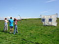 Archery lesson - Adventure Sports.JPG 2,816 × 2,112; 2.61 MB
-

-
 Ashton Accounting in Ilfracombe - geograph.org.uk - 5444349.jpg 758 × 800; 111 KB
-
 At anchor - geograph.org.uk - 1318347.jpg 640 × 480; 89 KB
-

-
 Atlantic Court, Ilfracombe - geograph.org.uk - 5498623.jpg 706 × 800; 121 KB
-
 Autumn moods on North Devon and distant Exmoor - geograph.org.uk - 2123636.jpg 1,024 × 683; 133 KB
-
 Avenue Street, Ilfracombe - geograph.org.uk - 3518613.jpg 1,600 × 1,325; 392 KB
-
 B3343 Mortehoe bridge 2021.jpg 4,032 × 3,024; 4.97 MB
-
 Back from Lundy - geograph.org.uk - 3437527.jpg 640 × 480; 52 KB
-
 Bahnstrecke Barnstaple–Ilfracombeg.svg 704 × 736; 2.08 MB
-

-
 Bandstand - panoramio (1).jpg 3,060 × 1,397; 2.64 MB
-
 Bandstand in Runnymede Gardens, Ilfracombe (1246).jpg 4,288 × 2,848; 5.73 MB
-
 Bandstand in Runnymede Gardens, Ilfracombe (1307).jpg 4,288 × 2,848; 5.73 MB
-
-

-

-
 Bargain Booze in Ilfracombe - geograph.org.uk - 5460357.jpg 647 × 800; 102 KB
-
 Barn conversion (holiday cottages) at Higher Warcombe - geograph.org.uk - 5316998.jpg 1,600 × 1,200; 743 KB
-
 Barn on Higher Slade Road - geograph.org.uk - 5382680.jpg 1,024 × 768; 143 KB
-
 Beach and promenade at Ilfracombe - geograph.org.uk - 6560675.jpg 6,000 × 4,000; 4.49 MB
-
 Beach at Hele Bay - geograph.org.uk - 2383952.jpg 640 × 476; 74 KB
-
 Beach at Ilfracombe - geograph.org.uk - 1430477.jpg 480 × 640; 94 KB
-
 Beara Farm - geograph.org.uk - 4005385.jpg 6,000 × 4,000; 4.66 MB
-
 Beara Farm - geograph.org.uk - 4134142.jpg 6,000 × 4,000; 4.96 MB
-
 Bedford, Ilfracombe - From Coronation Terrace.jpg 6,060 × 3,043; 17.07 MB
-
 Behind premises on Northfield Road and the High Street - geograph.org.uk - 3994785.jpg 3,648 × 2,736; 4.13 MB
-

-
 Belmont Road - Langleigh Road - geograph.org.uk - 5393599.jpg 640 × 480; 78 KB
-

-

-
 Belvedere Road - Springfield Road - geograph.org.uk - 5392422.jpg 640 × 480; 57 KB
-
 Bench and telescope, Capstone Point - geograph.org.uk - 1420705.jpg 640 × 480; 83 KB
-
 Bench at Capstone Point - geograph.org.uk - 4246207.jpg 854 × 1,280; 354 KB
-
 Bench on Capstone Parade - geograph.org.uk - 4247485.jpg 1,280 × 853; 1.27 MB
-
 Bend in High Street, Ilfracombe - geograph.org.uk - 5722687.jpg 753 × 800; 128 KB
-
 Bengal Spice in Ilfracombe - geograph.org.uk - 5441324.jpg 736 × 800; 167 KB
-
 Bennett's Mouth - geograph.org.uk - 1896541.jpg 1,024 × 768; 228 KB
-
 Benricks Skate Park, Ilfracombe - geograph.org.uk - 2281437.jpg 1,024 × 680; 225 KB
-
 Berkeley Place - Highfield Road - geograph.org.uk - 5393431.jpg 640 × 480; 69 KB
-
 Berrynarbor , Footpath - geograph.org.uk - 6767494.jpg 6,000 × 4,000; 4.93 MB
-

-
 Bicclescombe Park Road, Ilfracombe - geograph.org.uk - 5515027.jpg 800 × 493; 82 KB
-
 Bickenbridge - geograph.org.uk - 1967304.jpg 1,024 × 680; 212 KB
-
 Bickenbridge - geograph.org.uk - 1967314.jpg 1,024 × 680; 239 KB
-
 Big wave cheney.JPG 1,280 × 960; 325 KB
-
 Bird in hole rock - geograph.org.uk - 4476209.jpg 768 × 1,024; 196 KB
-
 Black Pit - geograph.org.uk - 880375.jpg 640 × 427; 100 KB
-

-
 Bluebells on Cairn - geograph.org.uk - 73909.jpg 640 × 480; 82 KB
-
 Boat House pub in Ilfracombe - geograph.org.uk - 5442422.jpg 800 × 730; 134 KB
-
 Body Aware Pilates studio in Ilfracombe - geograph.org.uk - 5766135.jpg 613 × 800; 101 KB
-

-

-
 Borough Cross on Mortehoe Station Road - geograph.org.uk - 1944090.jpg 1,024 × 680; 186 KB
-
 Braddicks and Sherborne, Ilfracombe - geograph.org.uk - 5515163.jpg 800 × 576; 118 KB
-

-
 Bradwell Road - Wilder Road - geograph.org.uk - 5393424.jpg 640 × 480; 71 KB
-

-
 Brandy Cove Point - geograph.org.uk - 1322977.jpg 640 × 480; 86 KB
-
 Brandy Cove Point - geograph.org.uk - 6561375.jpg 6,000 × 4,000; 4.1 MB
-
 Brewer Harding ^ Rowe in Ilfracombe - geograph.org.uk - 5545319.jpg 800 × 600; 90 KB
-

-
 Bridleway, Oakridge Cleave - geograph.org.uk - 82469.jpg 480 × 640; 59 KB
-
 Bristol.channel.ilfracombe.arp.750pix.jpg 750 × 536; 93 KB
-
 British Coffee House, Ilfracombe - geograph.org.uk - 5545322.jpg 794 × 800; 194 KB
-

-
 Brookdale Avenue - Church Road - geograph.org.uk - 5391433.jpg 640 × 480; 78 KB
-

-
 Building site, Fore Street, Ilfracombe - geograph.org.uk - 3644715.jpg 1,024 × 768; 123 KB
-
 Buildings around the junction of Mill Head ^ Gilbert Grove - geograph.org.uk - 5704449.jpg 2,272 × 1,704; 3.64 MB
-
 Buildings on Little Shelfin Farm - geograph.org.uk - 1967018.jpg 1,024 × 680; 168 KB
-
 Bullen's Rock - geograph.org.uk - 4475886.jpg 1,024 × 768; 200 KB
-
 Bunch of Grapes in Ilfracombe - geograph.org.uk - 5744243.jpg 600 × 800; 110 KB


.jpg)
.jpg)
.jpg)


_at_Higher_Warcombe_-_geograph.org.uk_-_5316998.jpg)


