Category:Igreja de Guide
Jump to navigation
Jump to search
| Object location | | View all coordinates using: OpenStreetMap |
|---|
church building in Mirandela, Bragança District, Portugal  | |||||
| Upload media | |||||
| Instance of | |||||
|---|---|---|---|---|---|
| Location | Torre de Dona Chama, Mirandela, Bragança, Portugal | ||||
| Diocese | |||||
| Heritage designation | |||||
 | |||||
|
This monument is classified as
Imóvel de Interesse Público .It is indexed in the IGESPAR database ( Instituto de Gestão do Património Arquitectónico e Arqueológico ), under the reference 72861.It is indexed in the SIPA database (Sistema de Informação para o Património Arquitectónico) under the reference 469. |
Media in category "Igreja de Guide"
The following 3 files are in this category, out of 3 total.
-
 Igreja de Guide.jpg 1,200 × 1,600; 368 KB
-
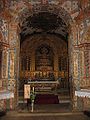 Interior da Igreja de Guide.jpg 384 × 512; 68 KB
-
 Interior da Igreja de Guide2.jpg 384 × 512; 44 KB

