Category:Iford, East Sussex
Jump to navigation
Jump to search
village and civil parish in East Sussex, UK  | |||||
| Upload media | |||||
| Instance of | |||||
|---|---|---|---|---|---|
| Location | Lewes, East Sussex, South East England, England | ||||
| Population |
| ||||
| Area |
| ||||
| Said to be the same as | Iford (Wikimedia duplicated page, civil parish) | ||||
 | |||||
Subcategories
This category has the following 3 subcategories, out of 3 total.
Media in category "Iford, East Sussex"
The following 200 files are in this category, out of 402 total.
(previous page) (next page)-
 A big steaming pile - geograph.org.uk - 4987565.jpg 640 × 426; 49 KB
-
 A coombe in the South Downs - geograph.org.uk - 4987517.jpg 640 × 426; 64 KB
-
 A line of bales - geograph.org.uk - 4987568.jpg 640 × 426; 75 KB
-
 A steaming pile - geograph.org.uk - 4987569.jpg 640 × 426; 53 KB
-
 A young crop of wheat - geograph.org.uk - 5022482.jpg 640 × 426; 42 KB
-
 Approaching Iford from the SE - geograph.org.uk - 1868658.jpg 1,600 × 1,200; 422 KB
-
 Approaching Swanborough Hill - geograph.org.uk - 4597735.jpg 1,306 × 979; 395 KB
-
 Arable land - geograph.org.uk - 4987583.jpg 640 × 426; 69 KB
-
 Bales, Iford Farm - geograph.org.uk - 5014994.jpg 640 × 426; 43 KB
-
 Balsdean Bottom - geograph.org.uk - 3144465.jpg 640 × 480; 71 KB
-
 Balsdean Bottom - geograph.org.uk - 3144466.jpg 640 × 495; 68 KB
-
 Balsdean Bottom heading south - geograph.org.uk - 1861353.jpg 1,600 × 1,200; 391 KB
-
 Barn at Iford Farm - geograph.org.uk - 2581833.jpg 640 × 427; 152 KB
-
 Barn at Pickers Hill - geograph.org.uk - 2126674.jpg 640 × 427; 74 KB
-
 Barn on Pickers Hill - geograph.org.uk - 454873.jpg 640 × 480; 62 KB
-
 Barn on South Downs - geograph.org.uk - 2138573.jpg 640 × 480; 90 KB
-
 Barn on South Downs - geograph.org.uk - 2138576.jpg 640 × 480; 86 KB
-
 Barn, Balsdean Bottom - geograph.org.uk - 3144456.jpg 640 × 480; 82 KB
-
 Barn, Iford Farm - geograph.org.uk - 5014982.jpg 640 × 393; 50 KB
-
 Barn, Iford Farm - geograph.org.uk - 5014991.jpg 640 × 448; 81 KB
-
 Barn, South Downs - geograph.org.uk - 4987546.jpg 640 × 370; 38 KB
-
 Barns in Iford - geograph.org.uk - 5014986.jpg 640 × 426; 59 KB
-
 Barns, Iford - geograph.org.uk - 5014995.jpg 640 × 426; 75 KB
-
 Barns, Swanborough Farm - geograph.org.uk - 3056588.jpg 640 × 480; 83 KB
-
 Bottom of the Breach Road - geograph.org.uk - 3925950.jpg 1,600 × 1,200; 551 KB
-
 Breach Road - geograph.org.uk - 3144407.jpg 480 × 640; 105 KB
-
 Bridleway junction - geograph.org.uk - 4987526.jpg 640 × 426; 54 KB
-
 Bridleway on South Downs - geograph.org.uk - 2126663.jpg 640 × 427; 90 KB
-
 Bridleway on top of Swanborough Hill - geograph.org.uk - 4922057.jpg 3,264 × 1,840; 1.51 MB
-
 Bridleway to Balsdean - geograph.org.uk - 3144452.jpg 640 × 480; 73 KB
-
 Bull in field in the centre of Iford - geograph.org.uk - 3055784.jpg 3,264 × 2,448; 5.25 MB
-
 Caburn Bottom - geograph.org.uk - 2632501.jpg 640 × 427; 67 KB
-
 Caburn Bottom - geograph.org.uk - 2632504.jpg 640 × 480; 72 KB
-
 Calf on The South Downs - geograph.org.uk - 2135307.jpg 427 × 640; 83 KB
-
 Calves and lambs at Iford Farm - geograph.org.uk - 3924836.jpg 1,600 × 1,200; 524 KB
-
 Calves on Swanborough Hill - geograph.org.uk - 2126499.jpg 640 × 480; 94 KB
-
 Calves on Swanborough Hill - geograph.org.uk - 2126502.jpg 480 × 640; 102 KB
-
 Calves on Swanborough Hill - geograph.org.uk - 2135319.jpg 640 × 480; 104 KB
-

-
 Cattle grazing in Stump Bottom - geograph.org.uk - 1861139.jpg 1,600 × 1,200; 370 KB
-
 Cattle grazing on the South Downs - geograph.org.uk - 4987542.jpg 640 × 426; 59 KB
-
 Cattle grazing, The Brooks - geograph.org.uk - 2468661.jpg 640 × 430; 56 KB
-
 Cattlegate, Swanborough - geograph.org.uk - 3056611.jpg 640 × 480; 92 KB
-
 Chalk grassland, Castle Hill - geograph.org.uk - 6145842.jpg 1,024 × 768; 665 KB
-
 Chalky flint field - geograph.org.uk - 5022486.jpg 640 × 426; 61 KB
-
 Chalky flint field - geograph.org.uk - 5022487.jpg 640 × 426; 56 KB
-
 Church Cottages - geograph.org.uk - 3059277.jpg 480 × 640; 89 KB
-
 Coming off Swanborough Hill - geograph.org.uk - 4597741.jpg 1,306 × 979; 405 KB
-
 Concrete Road, Front Hill - geograph.org.uk - 3076623.jpg 640 × 480; 87 KB
-
 Concrete Road, Iford Hill - geograph.org.uk - 3076614.jpg 480 × 640; 80 KB
-
 Concrete Track leading up Front Hill - geograph.org.uk - 2959850.jpg 4,320 × 3,240; 3.97 MB
-
 Cottage on the edge of Iford - geograph.org.uk - 5022472.jpg 640 × 426; 86 KB
-
 Cottages, Iford - geograph.org.uk - 5015003.jpg 640 × 426; 81 KB
-
 Cow on the South Downs - geograph.org.uk - 2126520.jpg 640 × 480; 86 KB
-
 Cow with a good view - geograph.org.uk - 4987507.jpg 640 × 407; 50 KB
-
 Cow's Placenta - geograph.org.uk - 3059238.jpg 640 × 480; 175 KB
-
 Cows on South Downs - geograph.org.uk - 2135171.jpg 640 × 427; 82 KB
-
 Cows on South Downs - geograph.org.uk - 2135179.jpg 640 × 427; 70 KB
-
 Cows on South Downs - geograph.org.uk - 2135185.jpg 640 × 480; 90 KB
-
 Cows on South Downs - geograph.org.uk - 2135194.jpg 640 × 480; 92 KB
-
 Cows on South Downs - geograph.org.uk - 2138566.jpg 640 × 480; 75 KB
-
 Crop field at Rise Farm - geograph.org.uk - 2625589.jpg 640 × 480; 110 KB
-
 Cyclist on South Downs Way - geograph.org.uk - 2126514.jpg 640 × 427; 69 KB
-
 Dencher Rd - geograph.org.uk - 4987529.jpg 640 × 426; 73 KB
-
 Dencher Road - geograph.org.uk - 2959826.jpg 4,320 × 3,240; 4.89 MB
-
 Dencher Road - geograph.org.uk - 3056646.jpg 448 × 640; 90 KB
-
 Dencher Road - geograph.org.uk - 3117211.jpg 1,600 × 1,064; 405 KB
-

-
 Dencher Road, Swanborough Hill - geograph.org.uk - 1143781.jpg 640 × 357; 79 KB
-
 Dencher Road, Swanbrough Hill - geograph.org.uk - 1143779.jpg 640 × 384; 77 KB
-
 Disused Chalk Pit - geograph.org.uk - 3056663.jpg 640 × 480; 85 KB
-
 Disused fencing - geograph.org.uk - 2624549.jpg 640 × 480; 89 KB
-
 Downland farmland - geograph.org.uk - 4987580.jpg 640 × 408; 72 KB
-
 Downland Scenery - geograph.org.uk - 4987559.jpg 640 × 426; 60 KB
-
 Downland scenery - geograph.org.uk - 4987576.jpg 640 × 426; 65 KB
-
 Drainage channel by the River Ouse - geograph.org.uk - 2630989.jpg 640 × 480; 105 KB
-
 Drainage channel by the River Ouse - geograph.org.uk - 2630991.jpg 640 × 480; 112 KB
-

-

-
-

-
 Drive to Iford Manor - geograph.org.uk - 3144375.jpg 640 × 506; 116 KB
-
 Early Spider Orchid - geograph.org.uk - 6145834.jpg 1,024 × 1,024; 332 KB
-
 Earthwork, Swanborough Hill - geograph.org.uk - 3144422.jpg 640 × 480; 86 KB
-
 Eighteen Acres - geograph.org.uk - 3056614.jpg 640 × 480; 107 KB
-
 Eighteen Acres and Rail Field - geograph.org.uk - 3059307.jpg 640 × 453; 89 KB
-
 Electricity Pylon, The Brooks - geograph.org.uk - 972983.jpg 479 × 640; 69 KB
-
 Farm buildings in Balsdean Bottom - geograph.org.uk - 1861129.jpg 1,600 × 1,200; 432 KB
-
 Farm gate on The Rise - geograph.org.uk - 2624103.jpg 640 × 480; 104 KB
-
 Farm machinery, Iford - geograph.org.uk - 5015001.jpg 640 × 426; 79 KB
-
 Farm near Iford - geograph.org.uk - 3923910.jpg 1,600 × 1,200; 441 KB
-
 Farm track by the River Ouse - geograph.org.uk - 2632483.jpg 640 × 480; 79 KB
-
 Farm track on The Brooks - geograph.org.uk - 2631004.jpg 640 × 480; 112 KB
-
 Farmhouse, Swanborough Farm - geograph.org.uk - 3923890.jpg 1,600 × 1,200; 424 KB
-
 Farmland near Rise Farm - geograph.org.uk - 2624096.jpg 640 × 480; 116 KB
-
 Farmland on top of the South Downs - geograph.org.uk - 4987549.jpg 640 × 426; 61 KB
-
 Farmland on top of the South Downs - geograph.org.uk - 4987573.jpg 640 × 426; 73 KB
-
 Fencing by the River Ouse - geograph.org.uk - 2625596.jpg 640 × 480; 70 KB
-
 Field near Iford - geograph.org.uk - 973963.jpg 640 × 479; 99 KB
-
 Field on The Brooks - geograph.org.uk - 2631154.jpg 640 × 480; 96 KB
-
 Fields on the South Downs - geograph.org.uk - 2135262.jpg 9,609 × 2,267; 6.19 MB
-
 Flint cottages, Iford - geograph.org.uk - 5015005.jpg 640 × 426; 90 KB
-
 Flint-built barn at Iford Farm - geograph.org.uk - 6294754.jpg 889 × 1,024; 215 KB
-
 Flinty field, Swanborough Hill - geograph.org.uk - 4987532.jpg 640 × 426; 76 KB
-
 Flinty field, Swanborough Hill - geograph.org.uk - 4987534.jpg 640 × 426; 80 KB
-
 Flinty field, Swanborough Hill - geograph.org.uk - 4987537.jpg 640 × 426; 81 KB
-
 Flood plain of the River Ouse - geograph.org.uk - 2468690.jpg 640 × 430; 41 KB
-
 Footpath - geograph.org.uk - 5022483.jpg 640 × 426; 70 KB
-
 Footpath across farmland towards Northease - geograph.org.uk - 6294143.jpg 768 × 1,024; 208 KB
-
 Footpath across field - geograph.org.uk - 5009141.jpg 640 × 426; 81 KB
-
 Footpath along field boundary - geograph.org.uk - 5014975.jpg 640 × 426; 93 KB
-
 Footpath crossing a field - geograph.org.uk - 5022708.jpg 640 × 426; 69 KB
-
 Footpath heading north - geograph.org.uk - 5022484.jpg 640 × 426; 62 KB
-
 Footpath heading north - geograph.org.uk - 5022488.jpg 640 × 426; 63 KB
-
 Footpath junction - geograph.org.uk - 5022494.jpg 640 × 426; 69 KB
-
 Footpath leaves the field - geograph.org.uk - 5022710.jpg 640 × 426; 88 KB
-
 Footpath north from Iford - geograph.org.uk - 5022701.jpg 640 × 426; 47 KB
-
 Footpath out of Iford - geograph.org.uk - 5022474.jpg 640 × 426; 81 KB
-
 Footpath to Iford - geograph.org.uk - 5009138.jpg 640 × 426; 64 KB
-
 Footpath to Iford - geograph.org.uk - 5014972.jpg 640 × 426; 79 KB
-
 Footpath to Iford - geograph.org.uk - 973385.jpg 640 × 479; 126 KB
-
 Footpath to Swanborough Manor - geograph.org.uk - 5022495.jpg 640 × 426; 61 KB
-
 Former Village Street - geograph.org.uk - 973898.jpg 640 × 479; 89 KB
-
 Forty Acres - geograph.org.uk - 3144411.jpg 640 × 480; 62 KB
-
 Fourteen Acres - geograph.org.uk - 3058233.jpg 640 × 480; 79 KB
-
 Front Hill - geograph.org.uk - 3076630.jpg 640 × 480; 101 KB
-
-
 Gate on South Downs - geograph.org.uk - 2135551.jpg 640 × 427; 91 KB
-
 Gates to Iford Grange - geograph.org.uk - 5022696.jpg 640 × 426; 94 KB
-
 Grange Cottage - geograph.org.uk - 5022465.jpg 640 × 470; 77 KB
-
 Great Laine (1) - geograph.org.uk - 3056631.jpg 640 × 480; 76 KB
-
 Great Laine (2) - geograph.org.uk - 3056641.jpg 640 × 480; 76 KB
-
 Great Laine (3) - geograph.org.uk - 3097899.jpg 640 × 480; 60 KB
-
 Great Laine (4) - geograph.org.uk - 3144364.jpg 640 × 480; 61 KB
-
 Greenwich Meridian at Iford Manor - geograph.org.uk - 2272723.jpg 1,600 × 1,067; 769 KB
-
 Greenwich Meridian at Swanborough airstrip - geograph.org.uk - 2282859.jpg 1,600 × 1,067; 861 KB
-
 Greenwich Meridian at Swanborough fishing lakes - geograph.org.uk - 2272727.jpg 1,600 × 1,067; 584 KB
-
 Greenwich meridian at Swanborough fishing lakes - geograph.org.uk - 2282902.jpg 3,072 × 2,048; 2.19 MB
-
 Greenwich Meridian clipping Swanborough fishing lakes - geograph.org.uk - 2269276.jpg 1,600 × 1,067; 491 KB
-
 Greenwich meridian crossing Swanborough airstrip - geograph.org.uk - 2282865.jpg 1,600 × 1,067; 655 KB
-
 Greenwich Meridian from the road from Rodmell to Lewes - geograph.org.uk - 2269260.jpg 1,600 × 1,067; 480 KB
-
 Greenwich Meridian in Iford - geograph.org.uk - 2269268.jpg 1,600 × 1,067; 706 KB
-
 Greenwich meridian in Iford - geograph.org.uk - 2286382.jpg 1,600 × 1,053; 669 KB
-
 Greenwich meridian in Iford - geograph.org.uk - 2304462.jpg 1,600 × 1,067; 533 KB
-
 Greenwich Meridian just north of Iford - geograph.org.uk - 2286394.jpg 1,600 × 1,067; 607 KB
-

-

-
 Greenwich Meridian just south of Iford - geograph.org.uk - 2272726.jpg 3,072 × 2,048; 4.48 MB
-
 Greenwich Meridian north of Iford - geograph.org.uk - 2286407.jpg 1,600 × 1,103; 749 KB
-
 Greenwich Meridian reaching the Rodmell to Lewes road - geograph.org.uk - 2269257.jpg 1,600 × 1,067; 450 KB
-
 Greenwich Meridian south of Iford. - geograph.org.uk - 2269263.jpg 1,600 × 1,067; 590 KB
-
 Greenwich Meridian south of Swanborough airstrip - geograph.org.uk - 2282873.jpg 1,600 × 1,067; 594 KB
-
 Greenwich Meridian south of Swanborough lakes - geograph.org.uk - 2269762.jpg 1,600 × 1,067; 266 KB
-
 Greenwich Meridian tree in Iford - geograph.org.uk - 2304448.jpg 3,072 × 2,048; 4.32 MB
-
 Greenwich Meridian tree in Iford - geograph.org.uk - 2304474.jpg 1,600 × 1,067; 585 KB
-
 Greenwich meridian wall plaque in Iford - geograph.org.uk - 2304472.jpg 3,000 × 1,981; 2.03 MB
-
 Group of pines, Iford - geograph.org.uk - 3500507.jpg 640 × 480; 89 KB
-
 Hatch Furlong (1) - geograph.org.uk - 3059232.jpg 640 × 480; 79 KB
-
 Hatch Furlong (2) - geograph.org.uk - 3059241.jpg 640 × 478; 87 KB
-
 Hawthorn bush, Home Bottom - geograph.org.uk - 1822101.jpg 640 × 428; 136 KB
-
 Hay Bales by South Downs Way - geograph.org.uk - 3925880.jpg 1,600 × 1,200; 386 KB
-
 Heathy Brow - geograph.org.uk - 4987593.jpg 640 × 426; 43 KB
-
 Hilltop reservoir (and trees) - geograph.org.uk - 5022476.jpg 640 × 426; 31 KB
-
 Hog Brook - geograph.org.uk - 3082929.jpg 640 × 452; 90 KB
-
 Hopper, Iford Farm - geograph.org.uk - 5014984.jpg 640 × 426; 65 KB
-
 Horse Brook - geograph.org.uk - 3082927.jpg 640 × 480; 103 KB
-
 House in Iford - geograph.org.uk - 5015040.jpg 640 × 426; 70 KB
-
 House in Iford - geograph.org.uk - 5022469.jpg 640 × 426; 66 KB
-
 House near Swanborough Manor - geograph.org.uk - 5022703.jpg 640 × 426; 58 KB
-
 House near the church, Iford - geograph.org.uk - 5015028.jpg 640 × 426; 96 KB
-
 Houses, Swanborough Hollow - geograph.org.uk - 5022478.jpg 640 × 426; 43 KB
-
 Houses, Swanborough Hollow - geograph.org.uk - 5022481.jpg 640 × 426; 47 KB
-
 Ifold Hill - geograph.org.uk - 3056649.jpg 640 × 480; 100 KB
-
 Iford - geograph.org.uk - 5014985.jpg 640 × 426; 58 KB
-
 Iford - geograph.org.uk - 5015006.jpg 640 × 426; 62 KB
-
 Iford - geograph.org.uk - 5015044.jpg 640 × 426; 78 KB
-
 Iford Court - geograph.org.uk - 973920.jpg 479 × 640; 111 KB
-
 Iford Farm - geograph.org.uk - 5009120.jpg 640 × 426; 44 KB
-
 Iford Farm - geograph.org.uk - 5009131.jpg 640 × 426; 49 KB
-
 Iford Farm - geograph.org.uk - 5009134.jpg 640 × 426; 57 KB
-
 Iford Farm - geograph.org.uk - 5014969.jpg 640 × 426; 51 KB
-
 Iford Farm - geograph.org.uk - 5014980.jpg 640 × 426; 98 KB
-
 Iford Farm - geograph.org.uk - 5014992.jpg 640 × 426; 68 KB
-
 Iford Farm - geograph.org.uk - 5015032.jpg 640 × 426; 85 KB
-
 Iford Farm - geograph.org.uk - 5022461.jpg 640 × 426; 60 KB
-
 Iford Farm - geograph.org.uk - 5022466.jpg 640 × 426; 82 KB
-
 Iford Farm - geograph.org.uk - 973888.jpg 640 × 479; 60 KB
-
 Iford Farm - geograph.org.uk - 973904.jpg 479 × 640; 95 KB
-
 Iford Farm - geograph.org.uk - 973913.jpg 640 × 488; 88 KB
-
 Iford Farms - geograph.org.uk - 5015052.jpg 640 × 426; 91 KB
-
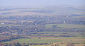 Iford from Itford Hill - geograph.org.uk - 1118867.jpg 640 × 347; 53 KB
-
 Iford Hill from Swanborough Hill - geograph.org.uk - 1143782.jpg 640 × 381; 83 KB
-
 Iford Lane - geograph.org.uk - 3923936.jpg 1,600 × 1,200; 639 KB
-
 Iford Manor - geograph.org.uk - 5015002.jpg 640 × 426; 94 KB
-
 Iford Meridian Marker - geograph.org.uk - 3059286.jpg 640 × 480; 100 KB
-

-
 Iford Reading Room - geograph.org.uk - 5015054.jpg 640 × 426; 71 KB
-
 Iford Village Hall - geograph.org.uk - 973932.jpg 640 × 479; 84 KB
-
 Iford Village Hall.jpg 1,024 × 683; 232 KB
-
 Iford village lane joining the Lewes to Newhaven road - geograph.org.uk - 3055796.jpg 3,264 × 2,448; 3.76 MB


_-_geograph.org.uk_-_3056631.jpg)
_-_geograph.org.uk_-_3056641.jpg)
_-_geograph.org.uk_-_3097899.jpg)
_-_geograph.org.uk_-_3144364.jpg)


_-_geograph.org.uk_-_3059232.jpg)
_-_geograph.org.uk_-_3059241.jpg)


_-_geograph.org.uk_-_5022476.jpg)


