Category:Iden, East Sussex
Jump to navigation
Jump to search
village in United Kingdom .jpg) | |||||
| Upload media | |||||
| Instance of | |||||
|---|---|---|---|---|---|
| Location | Rother, East Sussex, South East England, England | ||||
| Population |
| ||||
| Area |
| ||||
| Said to be the same as | Iden (Wikimedia duplicated page, civil parish) | ||||
 | |||||
English: Iden is a village and civil parish in the Rother District of East Sussex, England. The village is located two miles (3.2 km) north of Rye.
Subcategories
This category has the following 8 subcategories, out of 8 total.
I
- Iden Lock (12 F)
- Iden Methodist Church (7 F)
- Iden War Memorial (1 F)
O
- Oasts in Iden (14 F)
- Old Tudor, Iden (3 F)
- Oxenbridge Farm (3 F)
Media in category "Iden, East Sussex"
The following 200 files are in this category, out of 590 total.
(previous page) (next page)-
 1-2, Grove Lane, Iden - geograph.org.uk - 6195053.jpg 640 × 476; 73 KB
-
 A variety of footpath signs - geograph.org.uk - 3095628.jpg 640 × 486; 80 KB
-
 A wet day on Walland Marsh - geograph.org.uk - 4142044.jpg 4,000 × 3,000; 4.06 MB
-
 Access road to Readers Farm - geograph.org.uk - 2493578.jpg 3,072 × 2,304; 2.08 MB
-
 Aglais io - geograph.org.uk - 1994812.jpg 3,072 × 2,304; 1.57 MB
-
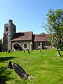 All Saints Church, Iden - geograph.org.uk - 6195038.jpg 480 × 640; 96 KB
-
 All Saints, Iden, churchyard (a) - geograph.org.uk - 6210601.jpg 640 × 480; 78 KB
-
 All Saints, Iden, churchyard (b) - geograph.org.uk - 6210602.jpg 640 × 480; 104 KB
-
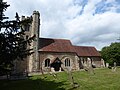
 All Saints, Iden, early July 2019 - geograph.org.uk - 6206208.jpg 480 × 640; 67 KB
-
 All Saints, Iden, font - geograph.org.uk - 6210618.jpg 480 × 640; 67 KB
-
 All Saints, Iden, incumbency board - geograph.org.uk - 6210615.jpg 480 × 640; 56 KB
-
 All Saints, Iden, memorial - geograph.org.uk - 6210606.jpg 640 × 480; 51 KB
-
 All Saints, Iden, pulpit - geograph.org.uk - 6210619.jpg 640 × 480; 64 KB
-

-

-
 Ash Field - geograph.org.uk - 6190871.jpg 640 × 480; 67 KB
-
 Ash Field - geograph.org.uk - 6214092.jpg 640 × 480; 53 KB
-
 B2082 Wittersham Road - geograph.org.uk - 6084779.jpg 1,024 × 684; 380 KB
-
 B2082, Iden - geograph.org.uk - 6084767.jpg 1,024 × 684; 230 KB
-
 Banks of the River Rother - geograph.org.uk - 1753060.jpg 640 × 430; 77 KB
-
 Barn at Baron's Grange - geograph.org.uk - 6640021.jpg 6,000 × 4,000; 4.42 MB
-
 Barn Field - geograph.org.uk - 6189780.jpg 640 × 480; 69 KB
-
 Barn Field - geograph.org.uk - 6191965.jpg 640 × 480; 83 KB
-
 Barn Field - geograph.org.uk - 6211215.jpg 640 × 480; 52 KB
-
 Barn Field - geograph.org.uk - 6218361.jpg 640 × 480; 79 KB
-
 Barn near Iden Lock - geograph.org.uk - 1901990.jpg 1,024 × 483; 191 KB
-
 Barn near Moat Farmhouse - geograph.org.uk - 6640017.jpg 6,000 × 4,000; 3.75 MB
-

-
 Barons Grange, Readers Lane, Iden - geograph.org.uk - 300472.jpg 479 × 640; 130 KB
-
 Bat box - geograph.org.uk - 3032104.jpg 640 × 430; 70 KB
-
 Bell Corner Field - geograph.org.uk - 6195055.jpg 640 × 480; 65 KB
-
 Bell Corner Field - geograph.org.uk - 6195057.jpg 640 × 480; 115 KB
-
 Bend in the Five Watering Sewer - geograph.org.uk - 1749657.jpg 640 × 430; 78 KB
-
 Beside the Royal Military Canal - geograph.org.uk - 3455301.jpg 4,320 × 3,240; 5.23 MB
-
 Bides-Middle Gill Field - geograph.org.uk - 6196126.jpg 640 × 480; 47 KB
-
 Black Tailed Skimmer - geograph.org.uk - 6195078.jpg 640 × 465; 114 KB
-
 Boat on the River Rother - geograph.org.uk - 2540281.jpg 2,256 × 1,496; 1.62 MB
-
 Boats by the path - geograph.org.uk - 3098025.jpg 640 × 407; 51 KB
-
 Boats Moored - geograph.org.uk - 3038296.jpg 640 × 430; 73 KB
-
 Boats Moored on the Rother - geograph.org.uk - 3038301.jpg 640 × 430; 67 KB
-
 Boonshill Bridge - geograph.org.uk - 1753224.jpg 640 × 430; 83 KB
-
 Boonshill Bridge - geograph.org.uk - 1753298.jpg 640 × 430; 74 KB
-
 Boonshill Bridge - geograph.org.uk - 3098035.jpg 640 × 430; 57 KB
-
 Boonshill Bridge - geograph.org.uk - 6190948.jpg 640 × 480; 80 KB
-
 Boonshill Bridge, over River Rother - geograph.org.uk - 2441872.jpg 2,256 × 1,496; 937 KB
-
 Boonshill Farm - geograph.org.uk - 6190927.jpg 640 × 480; 75 KB
-
 Boonshill Petty Sewer - geograph.org.uk - 6190947.jpg 480 × 640; 79 KB
-
 Boonshill Petty Sewer - geograph.org.uk - 6190956.jpg 480 × 640; 86 KB
-
 Boonshill Pumping Station - geograph.org.uk - 6196088.jpg 640 × 480; 58 KB
-
 Bosney Barn Field - geograph.org.uk - 6196129.jpg 640 × 480; 79 KB
-
 Bowlers Town - geograph.org.uk - 300250.jpg 640 × 501; 156 KB
-
 Brabands Wood - geograph.org.uk - 6195018.jpg 640 × 480; 45 KB
-
 Brabands Wood, Coldharbour Lane - geograph.org.uk - 2359770.jpg 1,600 × 1,061; 265 KB
-
 Breaches (1) - geograph.org.uk - 6196119.jpg 640 × 480; 63 KB
-
 Breaches (2) - geograph.org.uk - 6196120.jpg 640 × 472; 54 KB
-
 Breaches Shaw - geograph.org.uk - 6196112.jpg 640 × 464; 87 KB
-
 Bridge Marsh - geograph.org.uk - 6195073.jpg 640 × 480; 65 KB
-
 Bridge Marsh - geograph.org.uk - 6195076.jpg 640 × 508; 77 KB
-
 Bridge over Five Watering Sewer - geograph.org.uk - 1899338.jpg 1,024 × 768; 270 KB
-
 Bridge over the Five Watering Sewer - geograph.org.uk - 1749661.jpg 640 × 430; 133 KB
-
 Bridge over the River Rother - geograph.org.uk - 1752892.jpg 640 × 430; 124 KB
-
 Bridge Piece - geograph.org.uk - 6196012.jpg 640 × 480; 68 KB
-
 Bridge, Military Rd - geograph.org.uk - 3095645.jpg 640 × 430; 72 KB
-
 Bridleway beside the River Rother - geograph.org.uk - 1993884.jpg 3,072 × 2,304; 1.48 MB
-
 Bridleway to Iden Park - geograph.org.uk - 2482621.jpg 3,072 × 2,304; 2.57 MB
-
 Burntoak Barn Field - geograph.org.uk - 6190916.jpg 640 × 480; 65 KB
-
 By way Iden Wood - geograph.org.uk - 4010025.jpg 2,814 × 2,010; 1.03 MB
-
 Byway into Kings Wood - geograph.org.uk - 2482590.jpg 3,072 × 2,304; 2.53 MB
-
 Cabbage Field near Bowlers Town - geograph.org.uk - 300254.jpg 640 × 479; 166 KB
-
 Canalized River Rother - geograph.org.uk - 1753032.jpg 640 × 430; 114 KB
-
 Channel Marsh - geograph.org.uk - 6196026.jpg 640 × 480; 69 KB
-
 Channel Marsh - geograph.org.uk - 6196095.jpg 640 × 480; 82 KB
-
 Channel Marsh - geograph.org.uk - 6218388.jpg 640 × 480; 54 KB
-
 Church Field - geograph.org.uk - 6219659.jpg 640 × 480; 75 KB
-

-
 Church Lane, Iden - geograph.org.uk - 6195045.jpg 640 × 480; 71 KB
-
 Cliff - geograph.org.uk - 6196109.jpg 640 × 480; 80 KB
-
 Coldharbour Lane - geograph.org.uk - 6194989.jpg 640 × 480; 85 KB
-
 Coldharbour Lane - geograph.org.uk - 6219690.jpg 640 × 480; 101 KB
-

-
 Coney Banks-Willow Bed - geograph.org.uk - 6219717.jpg 640 × 480; 61 KB
-

-
 Corkwood House, Readers Lane - geograph.org.uk - 6218403.jpg 640 × 480; 87 KB
-
 Corner Field - geograph.org.uk - 6196133.jpg 640 × 480; 81 KB
-
 Corner Field-Thistly Field - geograph.org.uk - 6190902.jpg 640 × 480; 69 KB
-
 Cottage Garden Field - geograph.org.uk - 6214103.jpg 640 × 480; 53 KB
-
 Cottage in Church Lane - geograph.org.uk - 6210597.jpg 640 × 480; 94 KB
-
 County boundary stone - geograph.org.uk - 3837208.jpg 4,000 × 3,000; 4.32 MB
-
 County boundary stone - geograph.org.uk - 3837213.jpg 4,000 × 3,000; 4.43 MB
-
 Cowl of Moat Farm Oast - geograph.org.uk - 6636471.jpg 5,334 × 4,000; 2.42 MB
-
 Craven Pumping Station - geograph.org.uk - 3042336.jpg 640 × 430; 120 KB
-
 Craven Pumping Station and Sluice - geograph.org.uk - 6196063.jpg 640 × 480; 91 KB
-
 Crockets and Reader - geograph.org.uk - 6218409.jpg 640 × 480; 81 KB
-
 Crop Field on Kent and East Sussex Border - geograph.org.uk - 1899321.jpg 1,024 × 768; 205 KB
-
 Cropfield near Five Watering Sewer - geograph.org.uk - 1539178.jpg 640 × 427; 128 KB
-
 DCV Graveyard, Tyson Marsh - geograph.org.uk - 6196015.jpg 640 × 343; 107 KB
-
 Dead Tree, Leasams Hill - geograph.org.uk - 300235.jpg 640 × 479; 137 KB
-
 Delf Field - geograph.org.uk - 6211188.jpg 640 × 480; 87 KB
-
 Derelict Barn near Iden Lock - geograph.org.uk - 6191960.jpg 640 × 480; 92 KB
-

-
 Derelict building beside the River Rother - geograph.org.uk - 4674981.jpg 3,264 × 2,448; 3.82 MB
-
 Derelict Building by River Rother - geograph.org.uk - 2540307.jpg 2,256 × 1,496; 920 KB
-
 Derelict building, Rother Levels - geograph.org.uk - 3038331.jpg 640 × 430; 73 KB
-
 Derelict caravans by the River Rother - geograph.org.uk - 1753123.jpg 640 × 430; 114 KB
-
 Dilapidated Barn, Tyson Marsh - geograph.org.uk - 6196025.jpg 640 × 480; 75 KB
-
 Ditch beside Military Road - geograph.org.uk - 4002294.jpg 640 × 480; 139 KB
-
 Ditch by the Sussex Border Path - geograph.org.uk - 3095625.jpg 640 × 430; 97 KB
-

-
-
 Drainage channel heading south - geograph.org.uk - 1749738.jpg 640 × 430; 140 KB
-
 Drainage channel near Breaches Shaw - geograph.org.uk - 2493679.jpg 3,072 × 2,304; 2.58 MB
-
 Drainage ditch alongside Military Road - geograph.org.uk - 4147730.jpg 4,000 × 3,000; 4.23 MB
-
 Drive, Iden Park - geograph.org.uk - 6219686.jpg 480 × 640; 130 KB
-
 Drummers Old Field - geograph.org.uk - 6196121.jpg 640 × 480; 64 KB
-
 Eccles Turf - geograph.org.uk - 3035428.jpg 640 × 430; 120 KB
-
 Eight Acre Marsh - geograph.org.uk - 6218396.jpg 640 × 480; 68 KB
-

-

-

-

-
 Elmfield, Grove Lane, Iden - geograph.org.uk - 6197454.jpg 640 × 480; 67 KB
-
 Farm Buildings and Track - geograph.org.uk - 1224234.jpg 640 × 427; 86 KB
-
 Farm track and footpath - geograph.org.uk - 3027805.jpg 2,256 × 1,496; 881 KB
-
 Farmhouse, Thornsdale Farm - geograph.org.uk - 3040484.jpg 640 × 430; 89 KB
-
 Farmland by the Royal Military Canal - geograph.org.uk - 3098017.jpg 640 × 430; 75 KB
-
 Farmland near Boonshill bridge - geograph.org.uk - 3098031.jpg 640 × 383; 54 KB
-
-
 Farmland, Rother Levels - geograph.org.uk - 3033971.jpg 640 × 430; 76 KB
-
 Farmland, Rother Levels - geograph.org.uk - 3038291.jpg 640 × 430; 76 KB
-
 Farmland, Rother Levels - geograph.org.uk - 3042293.jpg 640 × 430; 53 KB
-
 Farmland, Rother Levels - geograph.org.uk - 3042339.jpg 640 × 430; 70 KB
-
 Field Number 255 - geograph.org.uk - 6195061.jpg 640 × 480; 77 KB
-
 Field Number 32 - geograph.org.uk - 6196041.jpg 640 × 480; 72 KB
-
 Field Number 33 - geograph.org.uk - 6196037.jpg 640 × 480; 63 KB
-
 Field Number 37 - geograph.org.uk - 6196046.jpg 640 × 480; 73 KB
-
 Field Number 392 - geograph.org.uk - 6214014.jpg 640 × 480; 74 KB
-
 Field Number 406 - geograph.org.uk - 6214005.jpg 640 × 464; 75 KB
-
 Field Number 407 - geograph.org.uk - 6214010.jpg 640 × 480; 83 KB
-
 Field Number 48 - geograph.org.uk - 6196075.jpg 640 × 480; 75 KB
-
 First Brook - geograph.org.uk - 6195069.jpg 640 × 480; 68 KB
-
 Fishermen on the River Rother - geograph.org.uk - 1979492.jpg 1,600 × 1,061; 311 KB
-
 Fishermen on the River Rother - geograph.org.uk - 1994801.jpg 3,072 × 2,304; 1.56 MB
-
 Five Watering Sewer - geograph.org.uk - 1749354.jpg 640 × 430; 139 KB
-
 Five Watering Sewer - geograph.org.uk - 1749670.jpg 640 × 430; 137 KB
-
 Five Watering Sewer - geograph.org.uk - 1994989.jpg 3,072 × 2,304; 1.84 MB
-
 Five Watering Sewer - geograph.org.uk - 3026808.jpg 2,256 × 1,496; 902 KB
-
 Flat farmland - geograph.org.uk - 5202769.jpg 640 × 322; 36 KB
-
 Flat farmland near Kent Ditch - geograph.org.uk - 5202768.jpg 640 × 420; 57 KB
-
 Fly (16922039288).jpg 480 × 383; 42 KB
-
 Footpath and bridleway junction near Iden Park - geograph.org.uk - 2482723.jpg 3,072 × 2,304; 2.99 MB
-
 Footpath by the River Rother - geograph.org.uk - 3033819.jpg 640 × 430; 71 KB
-
 Footpath marker, River Rother - geograph.org.uk - 1752997.jpg 640 × 430; 128 KB
-
 Footpath near Bosney Farm - geograph.org.uk - 2493659.jpg 3,072 × 1,728; 1.24 MB
-
 Footpath through a potato field - geograph.org.uk - 1994982.jpg 3,072 × 2,304; 2.11 MB
-
 Footpath through an orchard, near Baron's Grange - geograph.org.uk - 2493468.jpg 3,072 × 2,304; 2.5 MB
-
 Footpath through Crop Field - geograph.org.uk - 3026817.jpg 2,256 × 1,496; 899 KB
-
 Footpath to Five Watering Sewer - geograph.org.uk - 2495441.jpg 3,072 × 2,304; 1.93 MB
-
 Footpath towards Hurst Farm - geograph.org.uk - 1994792.jpg 3,072 × 2,304; 1.69 MB
-

-
 Footpath, Coldharbour - geograph.org.uk - 4010035.jpg 2,812 × 2,008; 869 KB
-
 Footpath, Lower Penstock - geograph.org.uk - 6219707.jpg 480 × 640; 91 KB
-
 Footway Field - geograph.org.uk - 6190886.jpg 640 × 480; 96 KB
-
-
 Forstals Farm - geograph.org.uk - 2594182.jpg 2,256 × 1,496; 878 KB
-
 Forstals Farm - geograph.org.uk - 6219729.jpg 640 × 551; 92 KB
-
 Forstals Farmhouse - geograph.org.uk - 6640014.jpg 6,000 × 4,000; 3.44 MB
-
 Four Acres - geograph.org.uk - 6211174.jpg 640 × 480; 60 KB
-
 Four Acres - geograph.org.uk - 6219667.jpg 640 × 480; 61 KB
-
 Fox Earth - geograph.org.uk - 6218359.jpg 640 × 480; 70 KB
-
 Frozen River Rother - geograph.org.uk - 413555.jpg 640 × 431; 100 KB
-
 Further Field - geograph.org.uk - 6194965.jpg 640 × 502; 103 KB
-
 Further Four Acres - geograph.org.uk - 6190961.jpg 640 × 480; 74 KB
-
 Further Nine Acres - geograph.org.uk - 6190958.jpg 640 × 480; 77 KB
-
 Gardener's Hill - geograph.org.uk - 6195062.jpg 480 × 640; 135 KB
-
 Gate beside the River Rother - geograph.org.uk - 1994821.jpg 3,072 × 2,304; 1.89 MB
-
 Gate Field - geograph.org.uk - 6214042.jpg 640 × 480; 53 KB
-
 Gate House Field - geograph.org.uk - 6219695.jpg 640 × 480; 66 KB
-
 Gate on the Sussex Border Path - geograph.org.uk - 1994797.jpg 3,072 × 2,304; 1.27 MB
-
 Gate on the Sussex Border Path - geograph.org.uk - 1994815.jpg 3,072 × 2,304; 1.22 MB
-
-
 Gate, Sussex Border Path - geograph.org.uk - 3033888.jpg 640 × 430; 84 KB
-
 Gate, Sussex Border Path - geograph.org.uk - 3038299.jpg 640 × 430; 68 KB
-
 Gate, Sussex Border Path - geograph.org.uk - 3038336.jpg 640 × 430; 65 KB
-
 Gate, Sussex Border Path - geograph.org.uk - 3040469.jpg 640 × 430; 82 KB
-
 Gates beside the River Rother - geograph.org.uk - 1994769.jpg 3,072 × 2,304; 1.23 MB
-
 Grove Farmhouse, Grove Lane, Iden - geograph.org.uk - 6214108.jpg 640 × 480; 68 KB
-
 Grove Farmhouse, Iden - geograph.org.uk - 2493647.jpg 3,072 × 2,304; 2.26 MB
-
 Grove Lane - geograph.org.uk - 6190900.jpg 480 × 640; 75 KB
-
 Grove Lane, Iden - geograph.org.uk - 6214110.jpg 640 × 519; 81 KB
-
 Groves - geograph.org.uk - 6218368.jpg 640 × 480; 63 KB
-
 Hay Bales - geograph.org.uk - 1224223.jpg 640 × 427; 75 KB
-
 Highknock Channel - geograph.org.uk - 1749768.jpg 640 × 430; 116 KB
-
 Hither Field - geograph.org.uk - 6194979.jpg 640 × 480; 101 KB
-
 Hither Nine Acres - geograph.org.uk - 6190954.jpg 640 × 480; 74 KB
-
 Hop Garden - geograph.org.uk - 6195008.jpg 640 × 480; 70 KB
-
 Horse Lodge Field - geograph.org.uk - 6196127.jpg 640 × 480; 85 KB
-
 House Field - geograph.org.uk - 6211199.jpg 640 × 480; 79 KB
-
 House Field - geograph.org.uk - 6214058.jpg 640 × 480; 76 KB
-
 House Field - geograph.org.uk - 6214065.jpg 640 × 480; 58 KB
-
 House Field - geograph.org.uk - 6214102.jpg 640 × 480; 66 KB


_-_geograph.org.uk_-_6210601.jpg)
_-_geograph.org.uk_-_6210602.jpg)


_-_geograph.org.uk_-_6196119.jpg)
_-_geograph.org.uk_-_6196120.jpg)


.jpg)


