Category:Ide, Devon
Jump to navigation
Jump to search
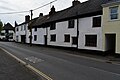
English: Ide is a village in Devon, England situated less than a mile to the southwest of Exeter. The village church (rebuilt in 1834) is dedicated to the German Saint Ida of Herzfeld. The village is home to two pubs: the Poacher's Arms and Huntsman Inn. A long ford (some argue the second longest in Europe) crosses a lane on the edge of the village. Above Ide on a hilltop at SX8888 is the site of a Roman fortlet or signal station.
village in Devon, United Kingdom  Eglwys y Santes Ida, Ide | |||||
| Upload media | |||||
| Instance of | |||||
|---|---|---|---|---|---|
| Location | Teignbridge, Devon, South West England, England | ||||
| Population |
| ||||
 | |||||
Subcategories
This category has the following 7 subcategories, out of 7 total.
D
- Drakes Farm, Ide (4 F)
F
- Ford at Ide, Devon (7 F)
H
- The Huntsman Inn, Ide (3 F)
I
- Ide War Memorial (3 F)
P
- Poachers Inn, Ide (3 F)
T
- Thatched cottages in Ide (21 F)
Media in category "Ide, Devon"
The following 200 files are in this category, out of 201 total.
(previous page) (next page)-
 A seat with a view over Exeter - geograph.org.uk - 2434414.jpg 800 × 600; 340 KB
-
 A tributary of the Alphin Brook - geograph.org.uk - 3181222.jpg 1,024 × 768; 261 KB
-
 A30 Approaching Exeter - geograph.org.uk - 4427173.jpg 3,786 × 2,294; 3.66 MB
-
 A30 Bridge - geograph.org.uk - 5254272.jpg 640 × 426; 61 KB
-
 A30 crossed by footbridge from Ide Bridge - geograph.org.uk - 3226189.jpg 3,057 × 1,886; 1.24 MB
-
 A30 crossed by Shillingford Road - geograph.org.uk - 3226201.jpg 3,215 × 1,941; 1,015 KB
-
 A30 exit for A377 at Alphington - geograph.org.uk - 3649370.jpg 1,854 × 1,180; 1.13 MB
-
 A30 heading north west - geograph.org.uk - 3649481.jpg 1,935 × 1,147; 1.28 MB
-
 A30 near Alphington - geograph.org.uk - 5564898.jpg 2,048 × 1,536; 257 KB
-
 A30 near Ide - geograph.org.uk - 3649467.jpg 1,989 × 1,260; 1.35 MB
-
 A30 north of Ide - geograph.org.uk - 3226185.jpg 3,648 × 2,048; 1.19 MB
-
 A30 to the far west - geograph.org.uk - 6263167.jpg 1,024 × 684; 259 KB
-
 Alphington junction, A30 - geograph.org.uk - 5254258.jpg 640 × 426; 48 KB
-
 An apparently peaceful path near Ide - geograph.org.uk - 5074195.jpg 4,896 × 3,672; 3.01 MB
-

-
 Barn and pylon, Darnaford - geograph.org.uk - 5919866.jpg 2,848 × 4,288; 1.52 MB
-
 Barn, Cuckoo Green - geograph.org.uk - 5923829.jpg 4,288 × 2,848; 1.3 MB
-
 Beans by Polehouse Lane - geograph.org.uk - 4997903.jpg 2,986 × 1,934; 1.27 MB
-
 Beware of horses sign on road to Ide - geograph.org.uk - 6436830.jpg 1,600 × 1,200; 985 KB
-
 Bridge in Crabb Lane - geograph.org.uk - 1890515.jpg 480 × 640; 82 KB
-
 Bridge over dismantled railway near Ide - geograph.org.uk - 5599464.jpg 1,200 × 1,600; 843 KB
-
 Bridge over dismantled railway near West Town Farm, Ide - geograph.org.uk - 5599466.jpg 1,200 × 1,600; 852 KB
-
 Building construction south of Ide - geograph.org.uk - 6263311.jpg 1,024 × 768; 244 KB
-
 Cattle by Polehouse Lane - geograph.org.uk - 4997099.jpg 1,920 × 1,098; 778 KB
-
 Coldharbour Wood - geograph.org.uk - 5924127.jpg 4,182 × 2,327; 1.21 MB
-
 College Lane - geograph.org.uk - 1081191.jpg 640 × 480; 100 KB
-
 Combes Head - geograph.org.uk - 1964970.jpg 1,024 × 768; 168 KB
-
 Congregational Church, Ide - geograph.org.uk - 1081213.jpg 640 × 480; 85 KB
-
 Country Lane, near Idestone Cross - geograph.org.uk - 1875419.jpg 1,024 × 768; 223 KB
-
 Cows near Markham Lane, Ide - geograph.org.uk - 6631448.jpg 1,600 × 1,200; 790 KB
-
 Dismantled railway between Ide and Longdown - geograph.org.uk - 5599447.jpg 1,200 × 1,600; 840 KB
-
 Dismantled railway leading to Ide - geograph.org.uk - 5599460.jpg 1,600 × 1,200; 829 KB
-
 Down beside the A30 - geograph.org.uk - 3396055.jpg 800 × 362; 177 KB
-
 Entrance to garden equipment business, Ide - geograph.org.uk - 6437002.jpg 1,600 × 1,200; 1.09 MB
-
 Exeter , A30 turn off - geograph.org.uk - 2490763.jpg 4,288 × 2,848; 4.67 MB
-
 Exeter , The A30 Dual Carriageway - geograph.org.uk - 2490764.jpg 4,278 × 2,832; 4.63 MB
-
 Farm entrance, on Markham Lane - geograph.org.uk - 1964958.jpg 1,024 × 768; 119 KB
-
 Farm gate with a view to Exeter - geograph.org.uk - 2434434.jpg 800 × 600; 492 KB
-
 Farm on Markham Lane - geograph.org.uk - 2434389.jpg 800 × 600; 315 KB
-
 Farmland near Marshall Farm - geograph.org.uk - 5923128.jpg 3,049 × 2,181; 954 KB
-
 Farmland near Whiddon Farm - geograph.org.uk - 5919216.jpg 4,230 × 2,711; 1.73 MB
-
 Field above Marshall Farm - geograph.org.uk - 5923765.jpg 4,052 × 2,375; 1.49 MB
-
 Field and farm track south of Markham Lane, Ide - geograph.org.uk - 6631463.jpg 1,600 × 1,200; 892 KB
-

-
 Field at Marshall Farm - geograph.org.uk - 1577899.jpg 640 × 480; 156 KB
-
 Field at Marshall Farm, looking west - geograph.org.uk - 1577897.jpg 640 × 480; 177 KB
-
 Field by Polehouse Lane - geograph.org.uk - 4997962.jpg 1,920 × 1,190; 696 KB
-
 Field gateway west of Ide - geograph.org.uk - 2006323.jpg 640 × 480; 96 KB
-
 Field near Markham Cross - geograph.org.uk - 5923123.jpg 4,288 × 2,402; 1.2 MB
-
 Field south of Fordland Brook - geograph.org.uk - 5599409.jpg 1,600 × 1,200; 872 KB
-
 Field southeast of Whiddon Farm - geograph.org.uk - 5919253.jpg 4,288 × 2,848; 2.03 MB
-
 Foot and cycle bridge from Ide to the Twisted Oak - geograph.org.uk - 5599720.jpg 1,600 × 1,200; 770 KB
-
 Footbridge - geograph.org.uk - 5254270.jpg 640 × 426; 90 KB
-
 Footbridge at Ide - geograph.org.uk - 2280844.jpg 640 × 480; 102 KB
-
 Footbridge at Ide - geograph.org.uk - 2280845.jpg 640 × 480; 112 KB
-
 Footbridge over the A30 - geograph.org.uk - 4436690.jpg 2,989 × 1,544; 1.96 MB
-
 Footpath from Polehouse Lane - geograph.org.uk - 4997979.jpg 2,880 × 1,840; 1.2 MB
-
 Footpath to Markham Cross - geograph.org.uk - 2434416.jpg 800 × 600; 395 KB
-
 Fordland Bottom and stream by the road - geograph.org.uk - 5599406.jpg 1,600 × 1,200; 840 KB
-
 Fordland Bottom Road - geograph.org.uk - 2537119.jpg 600 × 800; 555 KB
-

-
 Fordland Brook running in a roadside ditch - geograph.org.uk - 5599665.jpg 1,200 × 1,600; 788 KB
-
 Fore Street Ide - geograph.org.uk - 1890504.jpg 640 × 480; 68 KB
-
 Fore Street, Ide - geograph.org.uk - 1080551.jpg 640 × 480; 56 KB
-
 Gates by Polehouse Lane - geograph.org.uk - 4997919.jpg 1,920 × 1,057; 674 KB
-
 Green lane at Markham Cross - geograph.org.uk - 1577872.jpg 640 × 480; 172 KB
-
 Green trees and bushes and entrance to field, near Ide - geograph.org.uk - 6436998.jpg 1,600 × 1,200; 1.02 MB
-
 Halscombe - geograph.org.uk - 160154.jpg 640 × 480; 95 KB
-
 Halscombe Brake - geograph.org.uk - 5924144.jpg 2,848 × 4,288; 2.46 MB
-
 Harvested field south of Ide - geograph.org.uk - 6263321.jpg 1,024 × 684; 215 KB
-
 Heading north through Ide - geograph.org.uk - 1577904.jpg 640 × 480; 157 KB
-
 Heading south through Ide - geograph.org.uk - 1577902.jpg 640 × 480; 146 KB
-
 Higgledy-piggledy cottage at Ide - geograph.org.uk - 473749.jpg 640 × 429; 62 KB
-
 High Street, Ide - geograph.org.uk - 1739980.jpg 566 × 640; 77 KB
-
 High Street, Ide - geograph.org.uk - 2192093.jpg 480 × 640; 200 KB
-
 House in Ide - geograph.org.uk - 2192090.jpg 640 × 480; 228 KB
-
 Houses in High Street, Ide - geograph.org.uk - 6437474.jpg 1,600 × 1,200; 829 KB
-
 Ide (2021-07-26) 02.jpg 5,568 × 3,712; 17.92 MB
-
 Ide (2021-07-26) 05.jpg 5,568 × 3,712; 17.74 MB
-
 Ide (2021-07-26) 06.jpg 5,568 × 3,712; 16.44 MB
-
 Ide (2021-07-26) 08.jpg 5,568 × 3,712; 18.26 MB
-
 Ide (2021-07-26) 09.jpg 3,712 × 5,568; 15.29 MB
-
 Ide (2021-07-26) 10.jpg 5,568 × 3,712; 17.36 MB
-
 Ide (2021-07-26) 13.jpg 5,568 × 3,712; 14.99 MB
-
 Ide (2021-07-26) 29.jpg 5,568 × 3,712; 15.29 MB
-
 Ide (2021-07-26) 33.jpg 3,712 × 5,568; 14.53 MB
-
 Ide (2021-07-26) 34.jpg 5,568 × 3,712; 17.29 MB
-
 Ide (2021-07-26) 38.jpg 5,568 × 3,712; 17.38 MB
-
 Ide (2021-07-26) 41.jpg 5,568 × 3,712; 15.09 MB
-
 Ide (2021-07-26) 42.jpg 5,418 × 3,612; 12.38 MB
-
 Ide (2021-07-26) 47.jpg 5,568 × 3,712; 16.95 MB
-
 Ide (2021-07-26) 48.jpg 5,568 × 3,712; 16.36 MB
-
 Ide (2021-07-26) 49.jpg 5,568 × 3,712; 16.62 MB
-
 Ide - geograph.org.uk - 16752.jpg 640 × 425; 78 KB
-
 Ide community hall, shop and post office - geograph.org.uk - 6437005.jpg 1,600 × 1,200; 651 KB
-
 Ide Ford - geograph.org.uk - 4194331.jpg 3,872 × 2,592; 4.44 MB
-
 Ide High Street - geograph.org.uk - 6263185.jpg 1,024 × 684; 253 KB
-
 Ide Junction - geograph.org.uk - 3171287.jpg 1,024 × 768; 242 KB
-
 Ide Primary School - geograph.org.uk - 1081207.jpg 640 × 480; 112 KB
-
 Ide village shop and Post Office - geograph.org.uk - 3181208.jpg 1,024 × 768; 216 KB
-
 Lane above Marshall Farm - geograph.org.uk - 5923742.jpg 2,946 × 1,858; 1.13 MB
-
 Lane above Marshall Farm - geograph.org.uk - 5923749.jpg 4,199 × 2,540; 1.81 MB
-

-
 Lane approaching Darnaford - geograph.org.uk - 5924218.jpg 3,936 × 2,456; 1.76 MB
-
 Lane from Ide to Dunchideock - geograph.org.uk - 6263328.jpg 1,024 × 684; 303 KB
-

-
 Lane heading south east - geograph.org.uk - 3562344.jpg 640 × 480; 102 KB
-

-
 Markham Cross - geograph.org.uk - 5923085.jpg 4,042 × 2,473; 1.35 MB
-

-
 Markham Lane looking west - geograph.org.uk - 2434391.jpg 800 × 600; 355 KB
-
 Markham Lane, Ide - geograph.org.uk - 6631453.jpg 1,600 × 1,200; 994 KB
-
 Marshy ground and railway embankment, Ide - geograph.org.uk - 5599662.jpg 1,600 × 1,200; 777 KB
-

-
 Minor road junction, south of Ide - geograph.org.uk - 1964977.jpg 1,024 × 768; 250 KB
-
 Minor road through Knowle Plantation - geograph.org.uk - 1875373.jpg 1,600 × 1,200; 539 KB
-
 New Buildings Farm, College Lane - geograph.org.uk - 1081188.jpg 640 × 480; 116 KB
-

-
 Old and new bridges on the edge of Ide - geograph.org.uk - 5599723.jpg 1,600 × 1,200; 807 KB
-
 Old Bridge Marker by Bell Farm Road, Ide Parish (geograph 6038156).jpg 527 × 800; 294 KB
-
 Old Ide Lane footbridge - geograph.org.uk - 3171272.jpg 1,024 × 768; 314 KB
-

-

-
 Path from Polehouse Lane - geograph.org.uk - 4997971.jpg 1,920 × 1,280; 715 KB
-
 Permissive footpath into Fordland Bottom - geograph.org.uk - 5599412.jpg 1,600 × 1,200; 852 KB
-

-
 Poachers Inn, Ide - geograph.org.uk - 2459074.jpg 640 × 466; 76 KB
-
 Polehouse Lane - geograph.org.uk - 2434396.jpg 800 × 600; 424 KB
-
 Polehouse Lane, Ide - geograph.org.uk - 6631454.jpg 1,200 × 1,600; 902 KB
-
 Post Office at Ide, Devon (2288404289) (2).jpg 1,280 × 960; 199 KB
-
 Private road to Fordland Farm - geograph.org.uk - 5598801.jpg 1,200 × 1,600; 901 KB
-
 Private road to Halscombe - geograph.org.uk - 2434464.jpg 800 × 600; 429 KB
-

-
 Railway bridge over Halscombe Lane - geograph.org.uk - 5599653.jpg 1,600 × 1,200; 777 KB
-
 Road approaching Knowle Plantation - geograph.org.uk - 2434461.jpg 800 × 600; 377 KB
-
 Road by the A30 - geograph.org.uk - 5254266.jpg 640 × 426; 75 KB
-
 Road leading east from Idestone Cross - geograph.org.uk - 2434431.jpg 800 × 600; 461 KB
-
 Road near Markham Cross - geograph.org.uk - 3100633.jpg 640 × 448; 76 KB
-
 Road near Westbury - geograph.org.uk - 4997993.jpg 2,048 × 3,072; 1.26 MB
-

-
 Road passing Parson's Pot Brake - geograph.org.uk - 2434454.jpg 800 × 600; 395 KB
-

-
 Road past Marshall Farm - geograph.org.uk - 4997102.jpg 1,920 × 1,335; 926 KB
-
 Road to Dunchideock - geograph.org.uk - 1577901.jpg 640 × 480; 172 KB
-
 Road to Ide - geograph.org.uk - 6263176.jpg 1,024 × 684; 295 KB
-
 Road to Ide at Markham Cross - geograph.org.uk - 1577883.jpg 640 × 480; 176 KB
-
 Road to Ide from A377-A30 roundabout - geograph.org.uk - 6436828.jpg 1,600 × 1,200; 740 KB
-

-
 Rock Close Copse and Saltmarsh Copse - geograph.org.uk - 160179.jpg 640 × 480; 84 KB
-
 Saltmarsh Copse - geograph.org.uk - 5919606.jpg 3,612 × 2,241; 913 KB
-
 Saltmarsh Copse - geograph.org.uk - 5924039.jpg 4,103 × 2,470; 1.55 MB
-

-
 Sheep near Whiddon Farm - geograph.org.uk - 5923113.jpg 4,103 × 2,667; 1.9 MB
-
 Site (estimated) of Ide station, 2000 (geograph 5434509).jpg 2,319 × 1,347; 2.67 MB
-
 Southern slip road - Exeter - geograph.org.uk - 75217.jpg 640 × 480; 97 KB
-
 St Ida's church, Ide - geograph.org.uk - 6437015.jpg 1,600 × 1,200; 921 KB
-
 Steep road from Fordland Bottom towards Longdown - geograph.org.uk - 5599402.jpg 1,600 × 1,200; 853 KB
-
 Teignbridge , The A30 - geograph.org.uk - 3381270.jpg 4,236 × 2,768; 2.75 MB
-
 Teignbridge , The A30 - geograph.org.uk - 3861408.jpg 4,288 × 2,848; 4.4 MB
-
 Terraced houses in High Street, Ide - geograph.org.uk - 6437492.jpg 1,600 × 1,200; 672 KB
-
 Thatched house in High Street, Ide - geograph.org.uk - 6437504.jpg 1,600 × 1,200; 872 KB
-
 Thatched house on a slope, Ide - geograph.org.uk - 5599673.jpg 1,600 × 1,200; 888 KB
-
 The A30 at Ide - geograph.org.uk - 3171315.jpg 1,024 × 768; 191 KB
-
 The A30 heading - geograph.org.uk - 4148580.jpg 4,000 × 2,664; 2.54 MB
-
 The A30 westbound near Ide - geograph.org.uk - 3498141.jpg 800 × 600; 151 KB
-
 The A30 westbound near Ide - geograph.org.uk - 3498144.jpg 800 × 600; 152 KB
-
 The A30, near Alphington - geograph.org.uk - 1348138.jpg 640 × 480; 97 KB
-
 The A377 joins the A30 westbound - geograph.org.uk - 3498137.jpg 800 × 600; 135 KB
-
 The College, Ide - geograph.org.uk - 1739960.jpg 640 × 430; 75 KB
-
 The College, Ide - geograph.org.uk - 5599693.jpg 4,528 × 3,231; 4.6 MB
-
 The extension of Markham Lane at Markham Cross - geograph.org.uk - 6631467.jpg 1,200 × 1,600; 1.09 MB
-
 The Poachers Inn, Ide - geograph.org.uk - 6437472.jpg 1,600 × 1,200; 784 KB
-
 The southern end of Ide main street - geograph.org.uk - 3663511.jpg 640 × 480; 74 KB
-
 The stone tower of St Ida's church, Ide - geograph.org.uk - 6437018.jpg 1,200 × 1,600; 1.08 MB
-
 The strange hill south of Halscombe Lane, Ide - geograph.org.uk - 5599646.jpg 1,600 × 1,200; 813 KB
-
 The turning for Ide - geograph.org.uk - 1080545.jpg 640 × 480; 66 KB
-
 Towards Knowle Plantation - geograph.org.uk - 5923949.jpg 4,288 × 2,848; 2.22 MB
-
 Track into Brockham Plantation - geograph.org.uk - 5924151.jpg 4,288 × 2,848; 2.46 MB
-
 Track through Brockham Plantation - geograph.org.uk - 5924440.jpg 2,848 × 4,288; 2.66 MB
-
 Track to Markham Cross - geograph.org.uk - 1964973.jpg 1,024 × 768; 249 KB
-
 Track to Marshall Farm - geograph.org.uk - 1577889.jpg 640 × 480; 176 KB
-
 Track, to Marshall Farm - geograph.org.uk - 1458020.jpg 640 × 480; 102 KB
-
 Track, to Marshall Farm - geograph.org.uk - 1458023.jpg 640 × 480; 98 KB
-
 Under the A30 at roundabout near Ide - geograph.org.uk - 4035453.jpg 640 × 414; 52 KB
-
 Valley above Ide - geograph.org.uk - 3100682.jpg 640 × 435; 61 KB
-
 Valley of Fordland Brook - geograph.org.uk - 5598797.jpg 1,600 × 1,200; 863 KB
-
 View across Halscombe - geograph.org.uk - 1964972.jpg 1,600 × 1,200; 423 KB
-
 View from Knowle Hill - geograph.org.uk - 5923996.jpg 4,130 × 2,628; 1.73 MB
-
 View from Knowle Hill - geograph.org.uk - 5924003.jpg 4,260 × 2,545; 1.78 MB
-
 View over Marshall Farm - geograph.org.uk - 160182.jpg 640 × 480; 84 KB
-
 View over Marshall Farm - geograph.org.uk - 5919350.jpg 4,288 × 2,848; 2.47 MB
-
 Wall with cut benchmark, Station Road, Ide - geograph.org.uk - 6631491.jpg 1,600 × 1,200; 1.08 MB
-
 Warning signs on the entry to Ide - geograph.org.uk - 2537140.jpg 800 × 600; 530 KB
-
 West Town Farm (geograph 2537133).jpg 600 × 800; 489 KB
-
 West Town Farm, Ide - geograph.org.uk - 1081201.jpg 640 × 480; 79 KB
-
 Whiddon Farm - geograph.org.uk - 1964963.jpg 1,600 × 1,200; 409 KB
-
 Whiddon Farm - geograph.org.uk - 2434419.jpg 800 × 600; 423 KB
-
 Whiddon Lane looking east - geograph.org.uk - 3548180.jpg 640 × 480; 111 KB
-
 Whiddon Lane looking east - geograph.org.uk - 3548206.jpg 640 × 480; 96 KB
-
 Whiddon Lane looking west - geograph.org.uk - 3548183.jpg 640 × 480; 126 KB


_02.jpg)
_05.jpg)
_06.jpg)
_08.jpg)
_09.jpg)
_10.jpg)
_13.jpg)
_29.jpg)
_33.jpg)
_34.jpg)
_38.jpg)
_41.jpg)
_42.jpg)
_47.jpg)
_48.jpg)
_49.jpg)


.jpg)

.jpg)


_(2).jpg)


_-_geograph.org.uk_-_2434703.jpg)


_of_Ide_station,_2000_(geograph_5434509).jpg)


.jpg)


