Category:Idaho State Highway 51
Jump to navigation
Jump to search
 | number: | (fifty-one) |
|---|---|---|
| State highways in Idaho: | 31 · 32 · 33 · 34 · 36 · 37 · 38 · 39 · 40 · 41 · 43 · 44 · 45 · 46 · 47 · 48 · 50 · 51 · 52 · 53 · 54 · 55 · 57 · 58 · 60 · 61 · 62 · 64 · 66 · 67 · 69 · 71 |
state highway in Owyhee and Elmore counties in Idaho, United States  | |||||
| Upload media | |||||
| Instance of | |||||
|---|---|---|---|---|---|
| Location |
| ||||
| Transport network | |||||
| Connects with | |||||
| Owned by | |||||
| Maintained by | |||||
| Inception |
| ||||
| Length |
| ||||
| Terminus | |||||
| Partially coincident with | |||||
 | |||||
English: Media related to Idaho State Highway 51, a 93.598 miles (150.631 km) state highway in Owyhee and Elmore counties in southwestern Idaho, United States, that connects Nevada State Route 225 at the Nevada border (north-northwest of Owyhee, Nevada) with Interstate 84 Business in Mountain Home.
Subcategories
This category has only the following subcategory.
Media in category "Idaho State Highway 51"
The following 10 files are in this category, out of 10 total.
-
 Idaho 51.svg 601 × 601; 2 KB
-

-
 2014-08-19 14 36 43 Welcome to Idaho sign at the south end of Idaho State Highway 51.JPG 3,264 × 2,448; 3.37 MB
-

-

-
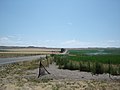
 Highway 51 Bruneau Idaho - panoramio - Chanilim714.jpg 2,304 × 1,728; 1.81 MB
-
 Highway 51 Bruneau Idaho - panoramio.jpg 2,304 × 1,728; 1.64 MB
-
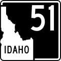 ID-51.svg 600 × 600; 32 KB
-
 State Route 51 in Southern Idaho.JPG 2,736 × 3,648; 2.53 MB
-
 Turner House.jpg 2,048 × 1,536; 1.49 MB
_and_the_south_end_of_Idaho_State_Highway_51_in_Owyhee,_Nevada.JPG)

_near_Owyhee,_Nevada.JPG)


