Category:ICE network maps
Jump to navigation
Jump to search
Media in category "ICE network maps"
The following 22 files are in this category, out of 22 total.
-
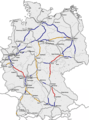
 Germany - ICE line network, train frequencies and top speeds.svg 1,073 × 1,272; 2.4 MB
-
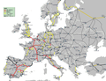
 High Speed Railroad Map Europe 2008.gif 1,992 × 1,463; 299 KB
-
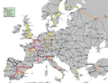
 High Speed Railroad Map Europe 2009-2011-15-05.png 1,793 × 1,370; 287 KB
-
 High Speed Railroad Map Europe 2009.gif 1,793 × 1,316; 271 KB
-
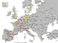
 High Speed Railroad Map Europe 2011.png 1,793 × 1,370; 294 KB
-
 High Speed Railroad Map Europe 2011.svg 800 × 600; 932 KB
-
 High Speed Railroad Map of Europe 2011.svg 800 × 600; 809 KB
-
 High Speed Railroad Map of Europe 2013.svg 800 × 600; 684 KB
-
 High Speed Railroad Map of Europe 2014.svg 800 × 600; 685 KB
-
 High Speed Railroad Map of Europe 2015.svg 800 × 600; 688 KB
-
 High Speed Railroad Map of Europe 2016.svg 800 × 600; 749 KB
-
 High Speed Railroad Map of Europe.svg 1,038 × 834; 1.68 MB
-
 HSL network around the Netherlands (June 2020).png 1,019 × 720; 265 KB
-
 HSR network around the Netherlands (March 2012).jpg 683 × 473; 190 KB
-
 ICE International-2011.svg 842 × 595; 156 KB
-
 ICE International.svg 842 × 595; 156 KB
-
 ICE Network.png 1,200 × 1,620; 582 KB
-
 ICE-Linien in Österreich.png 2,066 × 1,158; 292 KB
-
 ICE-Streckennetz.png 1,136 × 1,514; 539 KB
-
 ICEtracks.png 1,052 × 1,441; 458 KB
-
 Karte IC-, EC- und ICE-Strecken Deutschland.png 2,383 × 2,969; 1.26 MB
-
 LGV Europa FR 2.svg 792 × 864; 642 KB


.png)
.jpg)


