Category:Hydrology of Montana
Jump to navigation
Jump to search
Subcategories
This category has the following 5 subcategories, out of 5 total.
B
D
L
R
Media in category "Hydrology of Montana"
The following 33 files are in this category, out of 33 total.
-
 Big Spring Creek Lewistown Montana 16.JPG 3,264 × 2,448; 3.17 MB
-
 Federal-State cooperative snow surveys and water supply forecasts for Montana and northern Wyoming (IA CAT31294806002).pdf 1,195 × 1,614, 28 pages; 1,002 KB
-

-
 Federal-State cooperative snow surveys and water supply forecasts for Montana and northern Wyoming (IA CAT31294806055).pdf 1,127 × 1,577, 14 pages; 434 KB
-
 Federal-State-Private cooperative snow surveys and water supply forecasts for Montana and northern Wyoming (IA CAT31294813010).pdf 1,216 × 1,689, 48 pages; 2.71 MB
-
 Federal-State-Private cooperative snow surveys and water supply forecasts for Montana and northern Wyoming (IA CAT31294813011).pdf 1,354 × 1,752, 30 pages; 2.04 MB
-

-
 Federal-State-Private cooperative snow surveys and water supply forecasts for Montana and northern Wyoming (IA CAT31294813017).pdf 1,216 × 1,600, 32 pages; 1.17 MB
-

-
 Federal-State-Private cooperative snow surveys and water supply forecasts for Montana and northern Wyoming (IA CAT31294813022).pdf 1,391 × 1,764, 22 pages; 1.21 MB
-
 Water supply outlook and Federal-State-Private cooperative snow surveys for Montana & northern Wyoming (IA CAT31294827001).pdf 1,027 × 1,581, 24 pages; 938 KB
-
 Water supply outlook and Federal-State-Private cooperative snow surveys for Montana & northern Wyoming (IA CAT31294827002).pdf 1,008 × 1,533, 28 pages; 902 KB
-
 Water supply outlook and Federal-State-Private cooperative snow surveys for Montana & northern Wyoming (IA CAT31294827004).pdf 1,218 × 1,602, 46 pages; 1.6 MB
-
 Water supply outlook and Federal-State-Private cooperative snow surveys for Montana & northern Wyoming (IA CAT31294827005).pdf 1,237 × 1,629, 44 pages; 1.49 MB
-
 Water supply outlook and Federal-State-Private cooperative snow surveys for Montana & northern Wyoming (IA CAT31294827007).pdf 1,252 × 1,627, 34 pages; 1.1 MB
-
 Water supply outlook for Montana and federal-state-private cooperative snow surveys (IA CAT31294856079).pdf 1,195 × 1,672, 8 pages; 593 KB
-
 Water supply outlook for Montana and federal-state-private cooperative snow surveys (IA CAT31294856089).pdf 1,095 × 1,637, 12 pages; 907 KB
-
 Water supply outlook for Montana and federal-state-private cooperative snow surveys (IA CAT31294856107).pdf 1,008 × 1,422, 10 pages; 732 KB
-
 Water supply outlook for Montana and federal-state-private cooperative snow surveys (IA CAT31294856111).pdf 1,185 × 1,700, 8 pages; 598 KB
-
 Watershed work plan, city of Browning watershed, Glacier County, Montana (IA CAT75432211).pdf 1,116 × 1,566, 116 pages; 4.97 MB
-
 Watershed work plan- Baker Lake watershed, Fallon County, Montana (IA CAT75432218).pdf 1,054 × 1,527, 92 pages; 4.16 MB
-
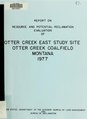
 Report of Sand Coulee Creek and upper tributaries flood hazard analyses, Cascade County, Montana (IA CAT75653253).pdf 1,241 × 1,629, 210 pages; 10.7 MB
-

-
 Fig 12 Map showing preglacial river system of northern Montana.jpg 1,050 × 827; 113 KB
-
 Fig 14 Map showing drainage of part of northern Montana at early Wisc stage.jpg 1,057 × 769; 124 KB
-
 Fig 15 Map showing post glacial drainage system of part of northern Montana.jpg 1,076 × 844; 158 KB
-
 Fig 16 Map showing pre-Glacial river system.jpg 1,438 × 1,085; 171 KB
-
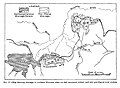 Fig 17 Map showing drainage of no Montana.jpg 1,448 × 1,066; 203 KB
-
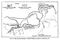 Fig 18 May showing drainage of Northern Montana.jpg 1,449 × 998; 175 KB
-
 Fig 19 Map showing post-Glacial drainage system.jpg 1,407 × 1,048; 208 KB
-
 Hydrologic data from the Bull Mountains area, south-central Montana (IA hydrologicdatafr00riou 0).pdf 1,652 × 2,179, 168 pages; 47.52 MB
-
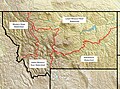 Montana Water Court divisions.jpg 2,689 × 2,000; 2.68 MB
-